Map size in jpg-format: 23.312MiB
Click to open in high resolution (open in new tab).
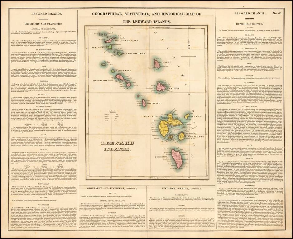
Nice example of this detailed map of the Leeward Islands, from the first edition of Carey & Lea's Atlas.
One of the most detailed maps of the region to appear in an early American Atlas. Lengthy narrative text below includes details about the islands, climates, towns, soils, government and history of each. Colored coded by possessions Increasingly rare on the market. Carey & Lea's Atlas is highly prized not only for its cartographic information but the marvelous information about each of the states and territories which is included. The atlas was issued in 6 editions in English, French & German between 1822 and 1827.
Henry Charles Carey (1793-1879) was an American geography publisher and businessman. He was the son of Mathew Carey and carried on the family publishing company in partnership with his brother-in-law, Isaac Lea. Henry worked in his father’s business from a young age. At twelve, he managed a store selling his father’s publications. At fifteen, he was the firm’s financial manager. In 1817, he became a junior partner, which changed the company’s name to Carey & Son.
In 1822, Mathew Carey brought in a new junior partner, Isaac Lea, who had married Henry’s sister, Frances Anne. In the same year, Mathew Carey left the business, with Henry buying out his father’s share. His younger brother briefly joined the business, but left by 1829, when the firm was named Carey & Lea. William A. Blanchard joined the firm in 1833, causing another name change to Carey, Lea & Blanchard. Henry retired in 1835, leaving the firm as Lea & Blanchard.
Henry had outside interests, including political economy. He published Principles of Political Economy in 1837. He also wrote Past, Present, and Future (1848), Principles of Social Science (1858-1860), and The Unity of Law (1872). In the 1850s, he was very active in organizing the nascent Republican Party. He died in 1879.
If you are a student, write to us in telegram: @antiquemaps and indicate what material you need and for what work you need a map in high detail. We are ready to provide material on special terms. For students only!


![[Wall Map] West-Indische Paskaert waer in de graden der breedde over weder zyden vande middelyn wassende so vergrooten dat die geproportioneert syn tegen hunne nevenstaende graden de lengde.](/map/small/60169.jpg)