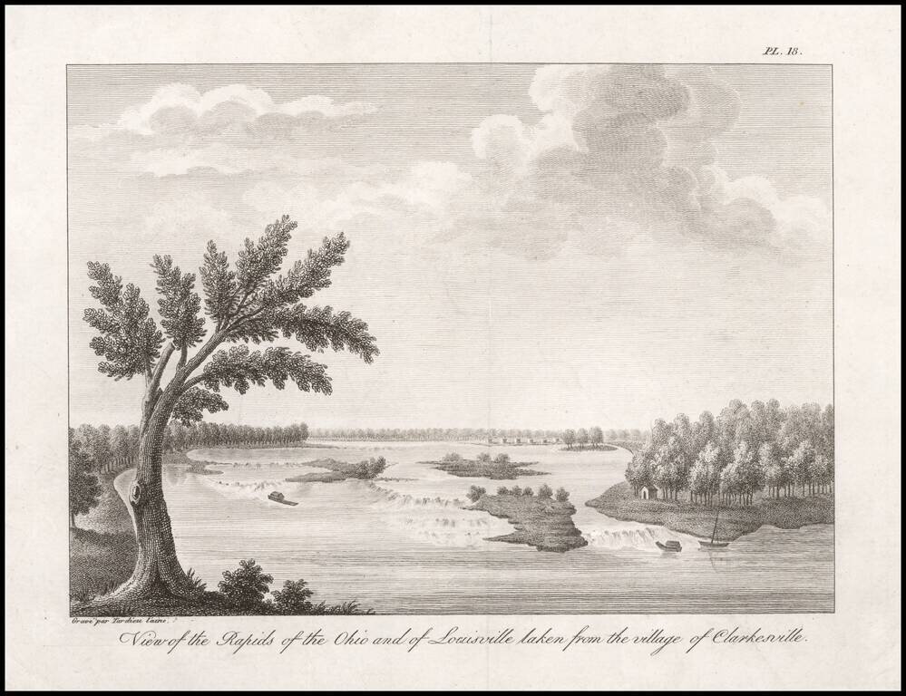
One of the Earliest Views of Louisville, Made Shortly After It Was Founded by Col. George Rogers Clark. An 18th century French Spy's View of the Rapids of the Ohio. Fine engraved view of the Rapids of the Ohio River, taken from "Clarkesville" (now...
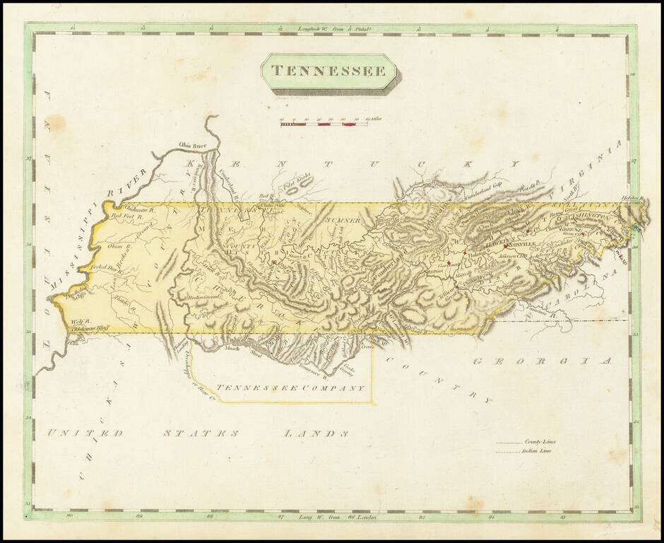
Early map of Tennessee, shortly after statehood. Includes counties, towns, rivers, and other features. Washington District still shown. South of the state are the United States Lands and Tennessee Company.
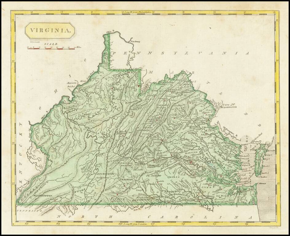
Early engraved map of Virginia, published in Philadelphia in 1804. The map shows towns, early roads and distances, early counties, mountains, rivers and other details.
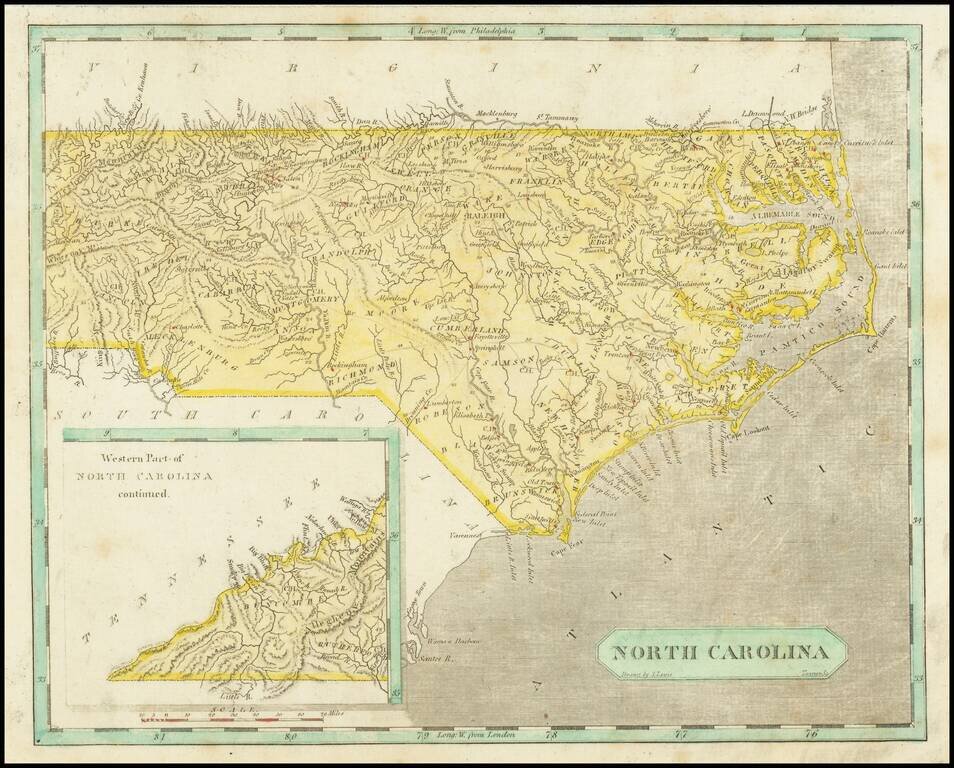
Early map of North Carolina. Early county names and configurations are shown. "Western Part of North Carolina continued." is shown in an inset map in the lower-left corner.
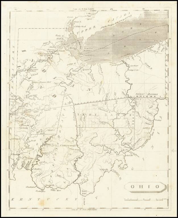
One of the First Printed Maps of Ohio -- Published Just Months After Ohio Statehood Important early map of Ohio from Arrowsmith & Lewis' New and Elegant General Atlas. The map appeared only months after Ohio became a state on March 1, 1803. The...
![[Educational Map] North America](/map/small/68773.jpg)
Fascinating educational map of North America, bearing the engraver's signature of Neele, Strand (London). The map presents a remarkable look at North America at about the time Lewis & Clark set out on their expedition to find a practicable route...
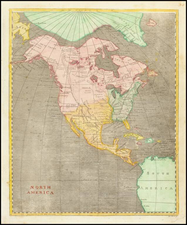
A Fascinating Pre-Louisiana Purchase Map of North America Scarce early map of North America, shortly before the Louisiana Purchase. An interesting time period, immediately preceding the reports of Alexander von Humboldt and Zebulon Pike, in the year...
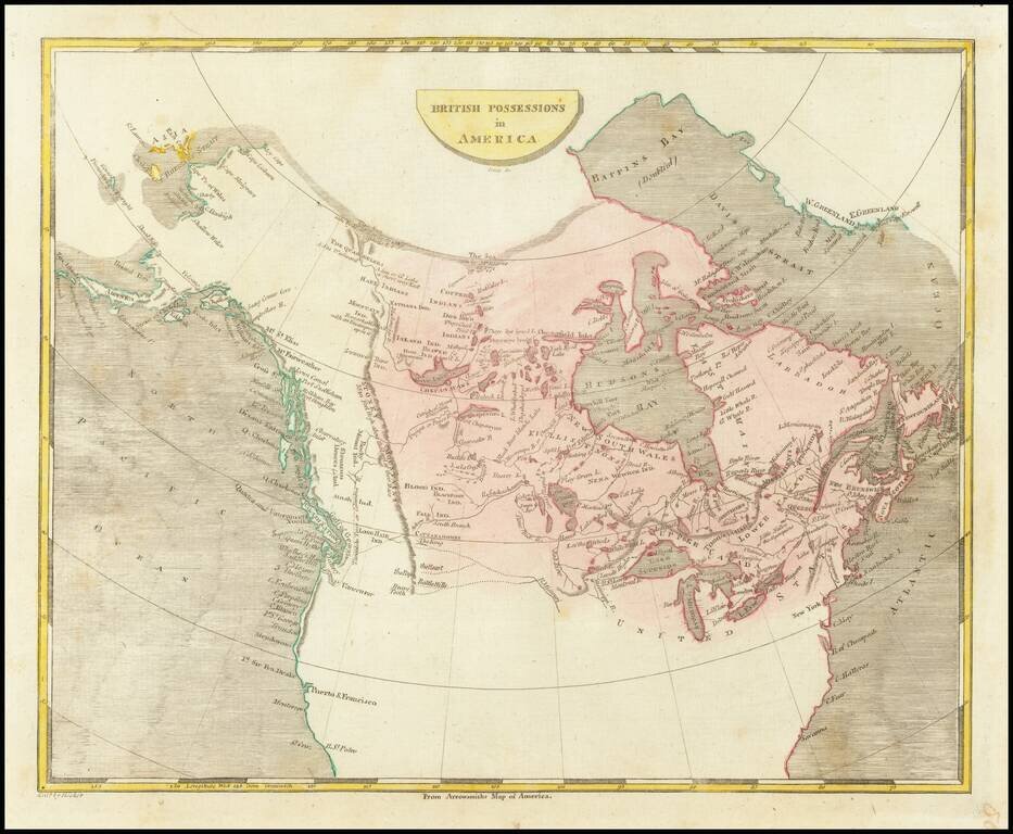
Scarce engraved map of Canada, published in Philadelphia in 1804. Shows a potential land bridge from Russia to Alaska. Speculates about the existence of the Northwest Passage.
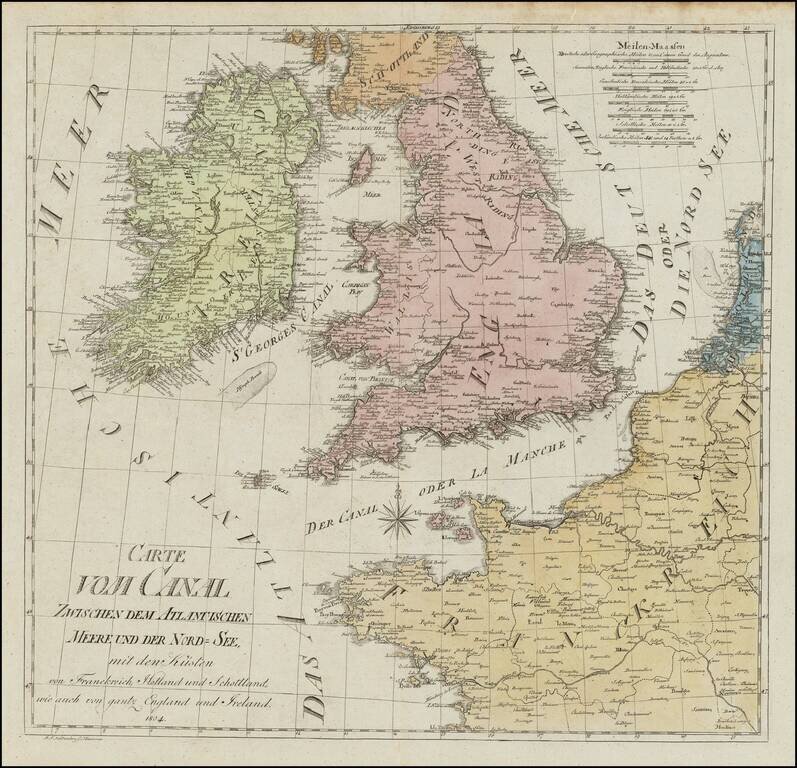
Rare chart of the British Isles, published in Hannover in 1804. The map exhibits a unique cartographic style.
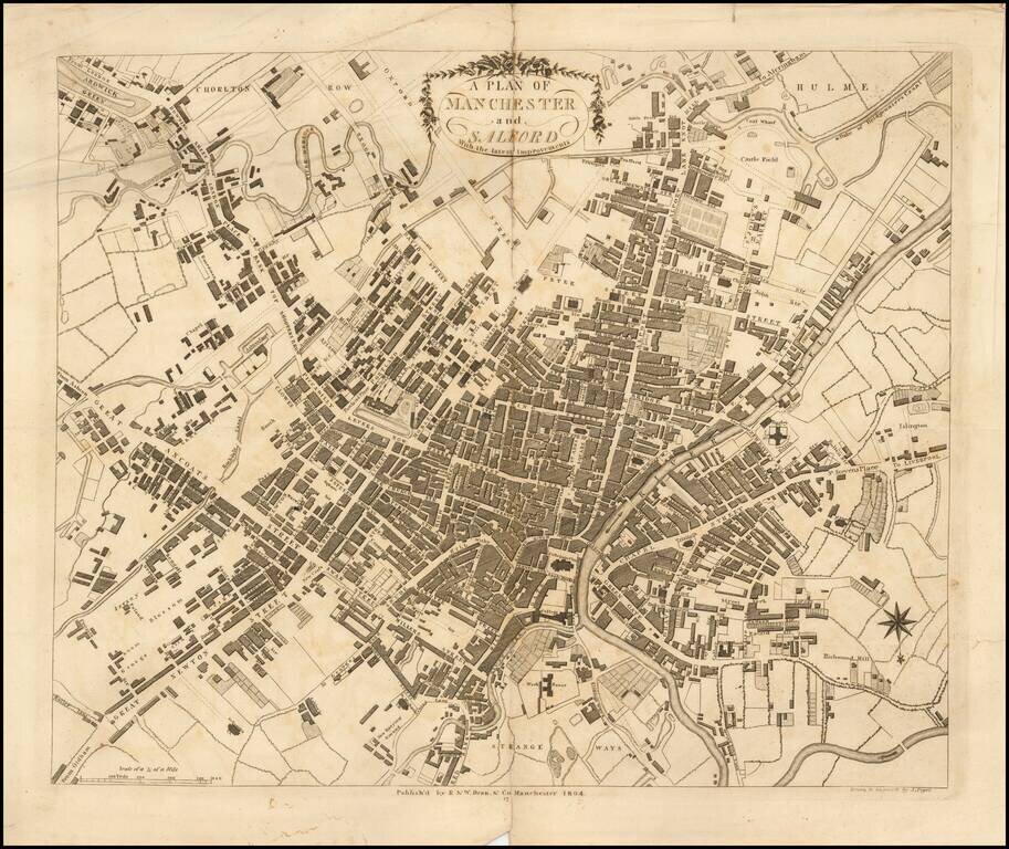
Detailed map of Manchester, pubilshed in Dean & Co.'s Manchester and Salford Directory: or alphabetical list of the merchants, manufacturers, and inhabitants in general, . . . The map is on a scale of about eight inches to the mile; is "drawn and...
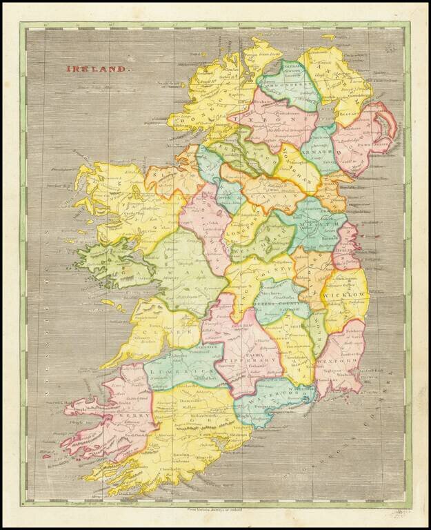
Early American-published engraved map of Ireland, part of the joint effort at atlas publishing between Arron Arrowsmith and Samuel Lewis.
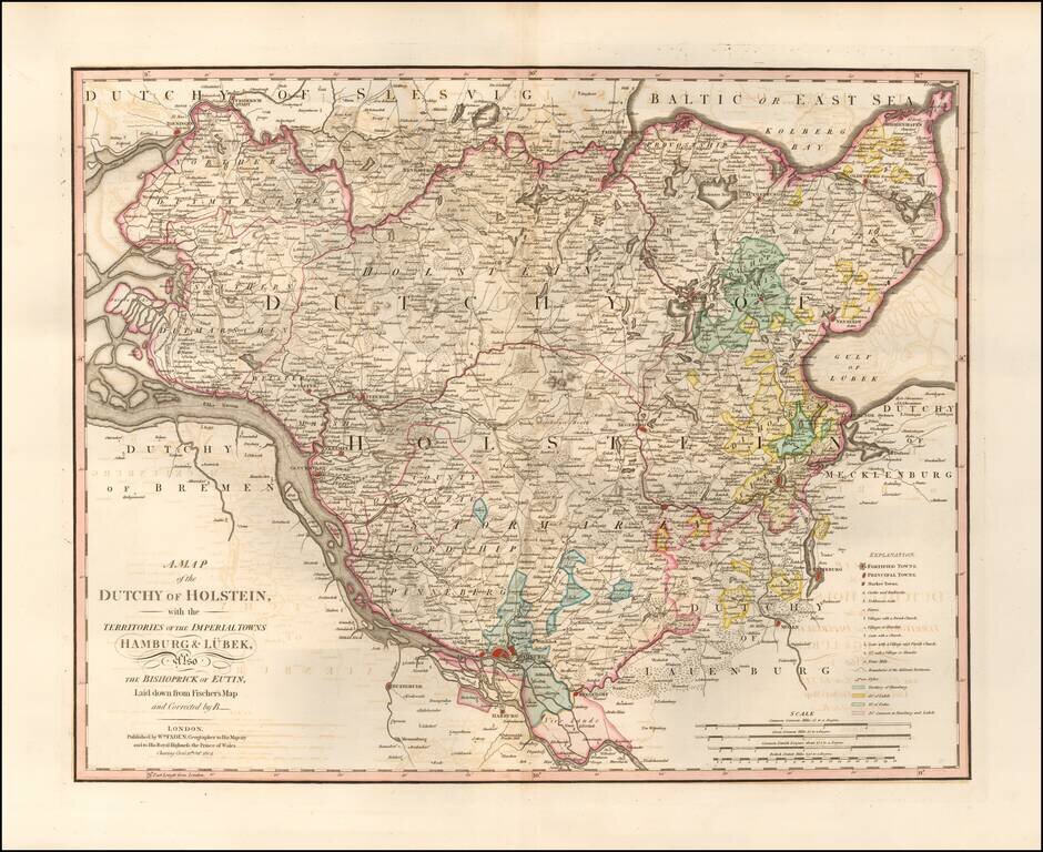
Highly detailed map of northern Germany, published by William Faden, one of England's leading mapmakers in the late 18th Century. The map provides an exceptionally detailed image of the region, including roads, towns, rivers, islands, lakes, etc.
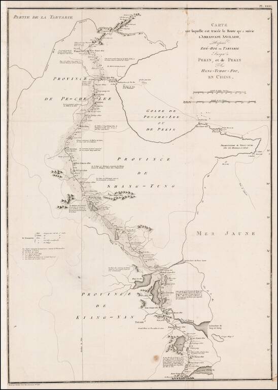
Detailed map of the Macartney's Route across China during his Embassy of 1792-1794. The Macartney Embassy, also called the Macartney Mission, was a British embassy to China in 1793. The Mission ran from 1792-94 . It is named for the first envoy of...
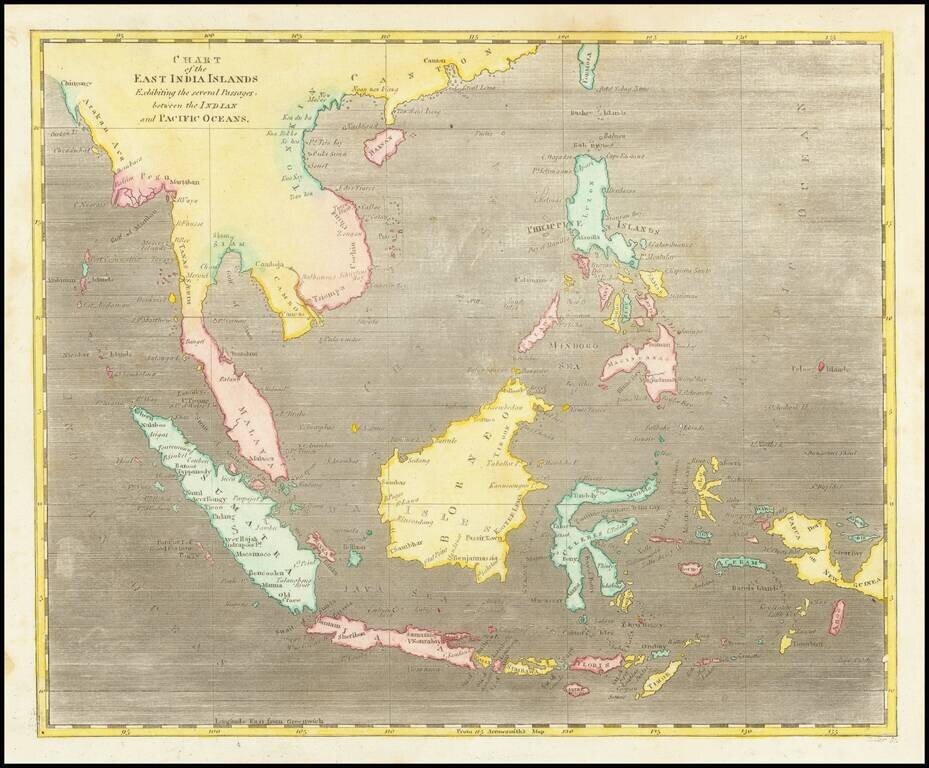
Early map of Southeast Asia. A nice example, from Arrowsmith & Lewis's New & Elegant Atlas, an early collaboration between American mapmaker Samuel Lewis and British mapmaker Aaron Arrowsmith.
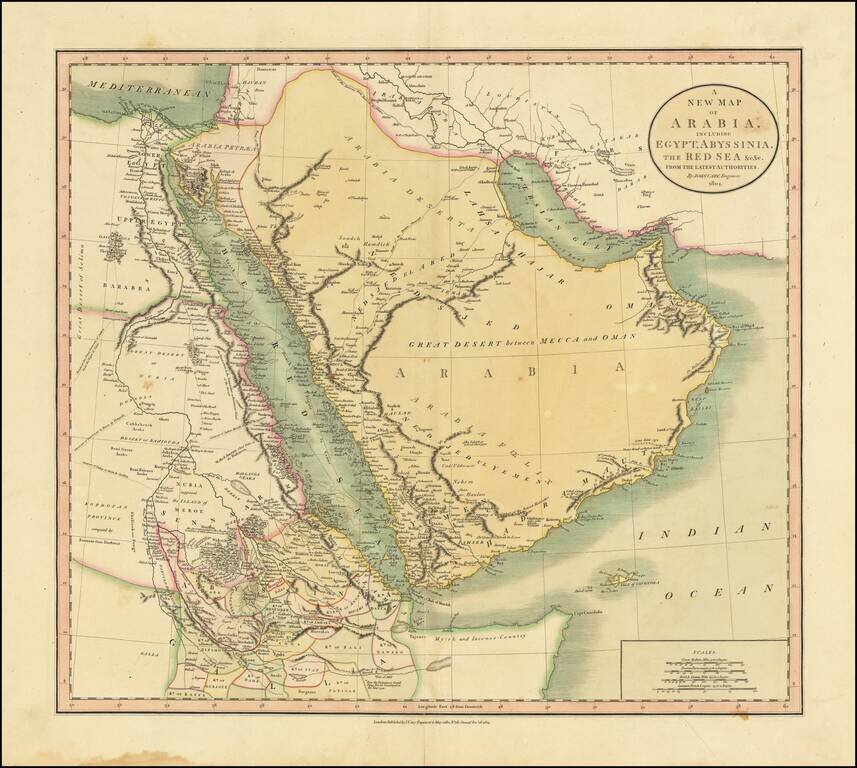
Includes The Caravan Routes To Mecca Large detailed map of the region, centered on the Saudi peninsula and the Red Sea. In the Arabian Peninsula, the map notes the Route of the Indian Caravans from Katif (El Qatif) to Mecca and the Route of the...
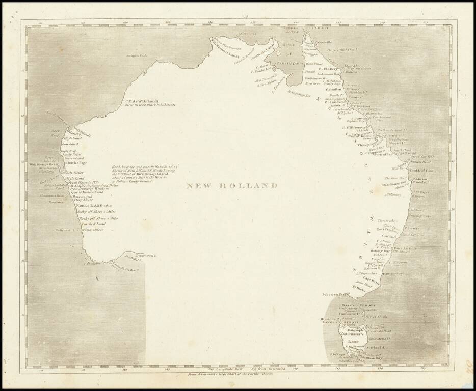
Engraved map of Australia featuring a curious interpretation of the southern coastline. This simple map shows Van Diemen's Land as an Island, reflecting the knowledge after Flinders, but is completely devoid of coastal features in the south and...