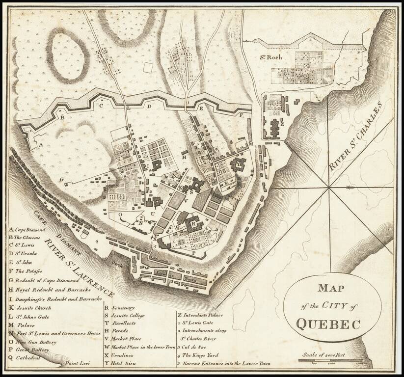
Rare Revolutionary War battle plan of Quebec City, from Charles Smith's Monthly Military Repository, the first map of Quebec printed in the United States. This rare engraving from Charles Smith's Monthly Military Repository is the first detailed plan...
![[Manuscript Map of Part of Morelos]](/map/small/49429ba.jpg)
Manuscript pictographic map of Morelos showing area now partially underwater This is a road and boundary map with pictographic symbols showing area in the modern state of Morelos. At least some of the area is now underwater, inundated by the man-made...
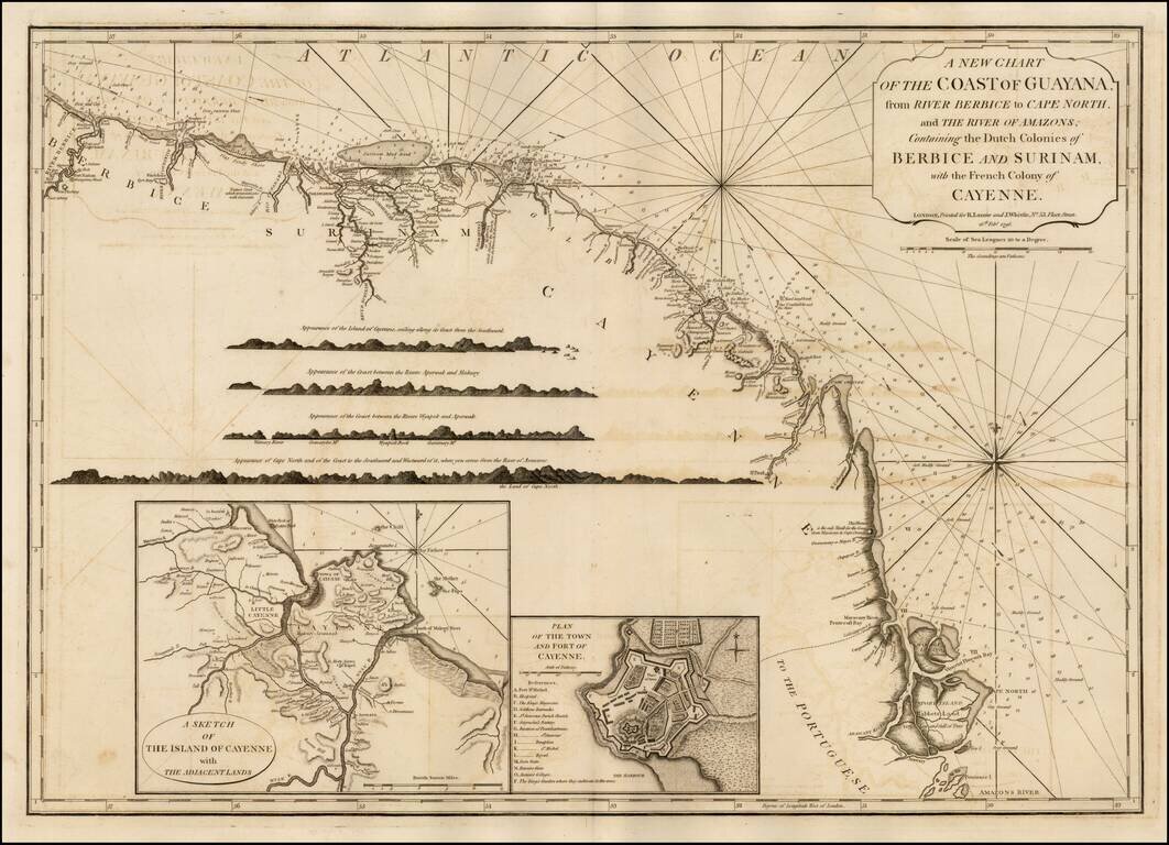
Significantly revised and updated version Laurie & Whittle's chart of the Dutch and French Colonies in Guayana, from Jeffery's West India Atlas.
![[Monastery Ter Apel] Petite carte des environs de Klooster ter apel et de Rooswinkel . . . 1796](/map/small/60565.jpg)
Finely executed manuscript map of the area around the Monastery Ter Apel in the Groningen area. Ter Apel Monastery Ter Apel Monastery was a monastery in the village of Ter Apel in the northeastern Dutch province of Groningen. It is the only monastery...
![[Monastery Ter Apel] Plan des digues de retenues nommees Leijdijken, derriere le Village de Klooster ter Apel, avec le project d' une Redoute sur l'alignement de la digue de traverse nommee, Korten ??? ??? dam, pour la defence de cet acces: paasage unique](/map/small/60585.jpg)
Finely executed manuscript map of the area around the Monastery Ter Apel in the Groningen area. The full title and translation are: [Monastery Ter Apel] Plan des digues de retenues nommees Leijdijken, derriere le Village de Klooster ter Apel, avec...
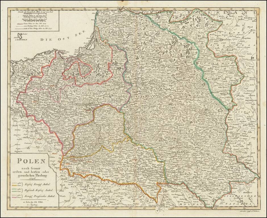
Detailed map of Poland, published in Augsburg by Johann Walch. The map shows Poland after the 3 dismemberments. The color coding shows the areas taken by the various European powers.
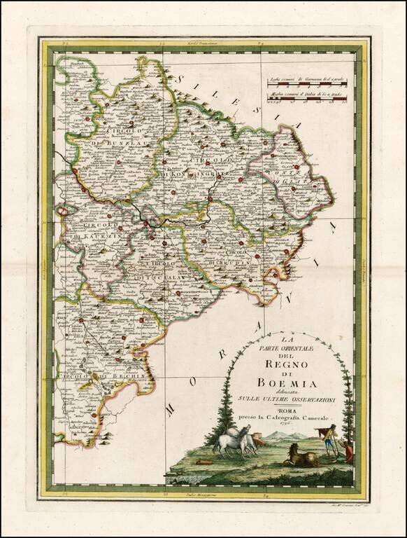
Rare and highly decorative regional map of the Eastern part of Bohemia. The map shows Prague in the west and extends to the Moravian and Silesian borders. Includes an ornate cartouche.
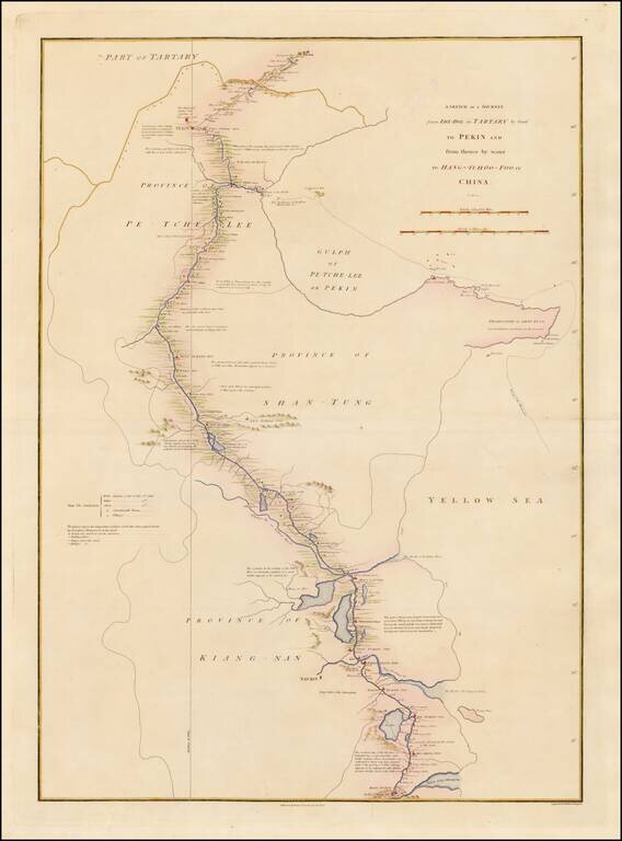
Detailed map showing the route taken from Zhe-Hol in Tartary to Beijing and then on to Hang-Tchoo Foo, from Staunton's An Authentic Account of an Embassy from the King of Great Britain to the Emperor of China. The map details George Macartney's...
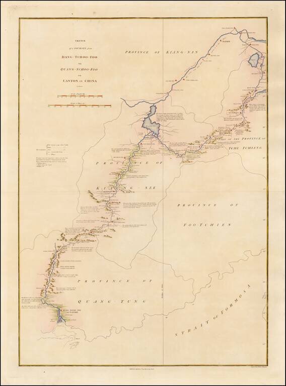
Detailed map showing the route taken from Hang-Tchoo Foo to Quang-Tchoo-Foo (Canton), from Staunton's An Authentic Account of an Embassy from the King of Great Britain to the Emperor of China. The map details Geroge Macartney's Embassy to China, the...
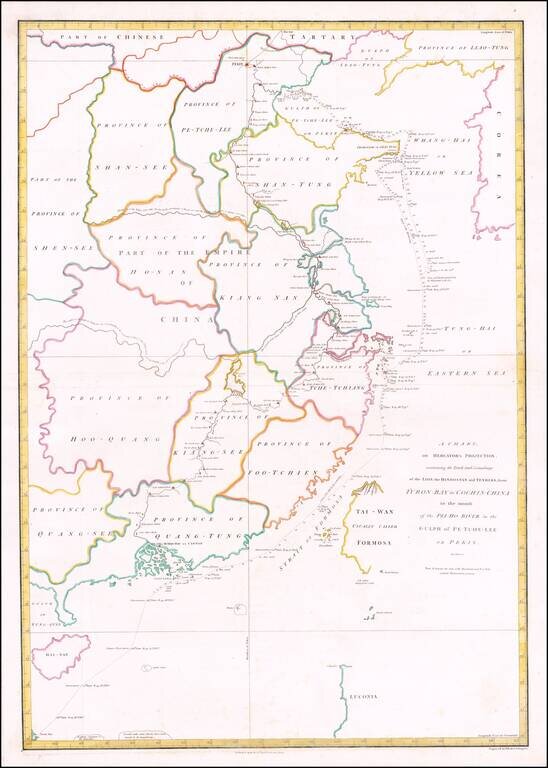
Detailed chart of the coast of China from Staunton's An Authentic Account of an Embassy from the King of Great Britain to the Emperor of China, showing the tracks of the vessels carrying the Earl of Macartney's Embassy along the coast of China with a...
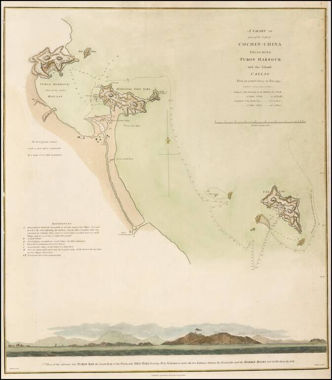
Detailed map of the Vietnamese Coast, centered on Turon Harbor (Da Nang area). Staunton's An Authentic Account of an Embassy from the King of Great Britain to the Emperor of China. Includes a profile view, at bottom, showing Turon Bay.
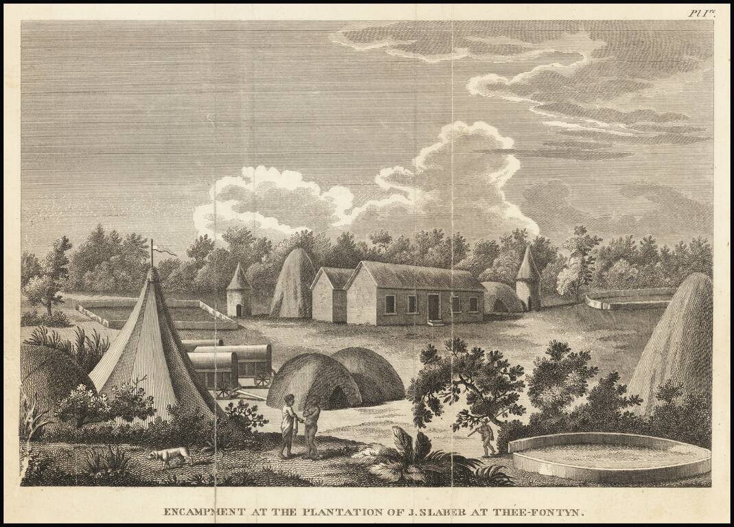
Copper plate engraved image of a plantation in South Africa, from New travels into the interior parts of Africa, by the way of the Cape of Good Hope, in the years 1783, 84 and 85. . . . by Francois Valliant. François Levaillant was a French author,...
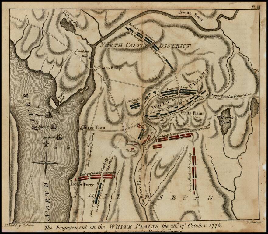
Rare Revolutionary War battle plan of White Plains, from Charles Smith's Monthly Military Repository, the first detailed plan of the battle of White Plains to be printed in the United States. Following decisive victories in Brooklyn and Manhattan,...