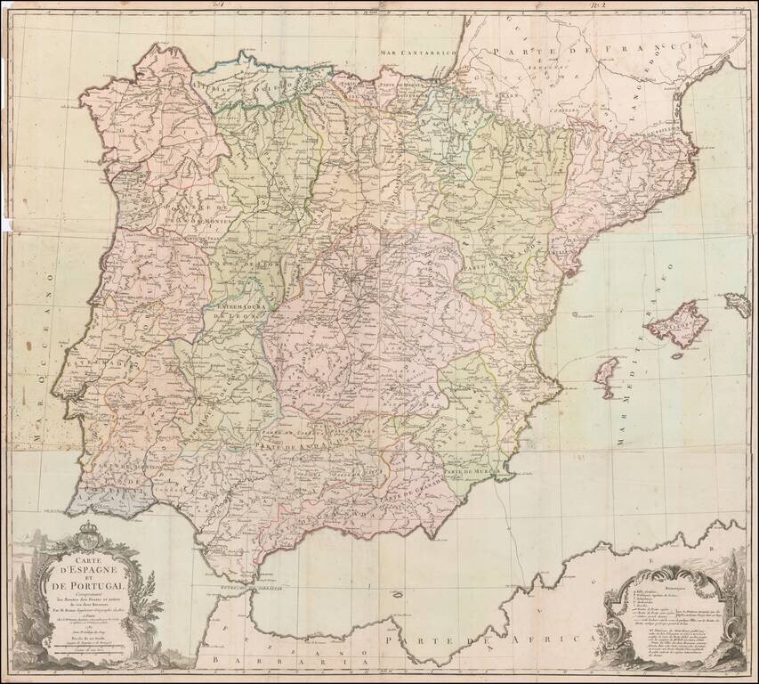
Rare Six-Sheet Postal Map of Spain and Portugal Finely executed map of the Iberian Peninsula, focusing on the postal routes throughout the region. The key at the bottom right identifies the various types of cities, towns and regions, along with...
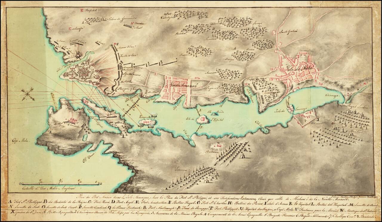
Plan of the Siege of Fort St. Philip Signed By A Future US Consul Finely executed manuscript map showing the Second Siege of Minorca. The map is oriented with southwest at the top, showing the bombardment of the British held Fort St. Philip from...
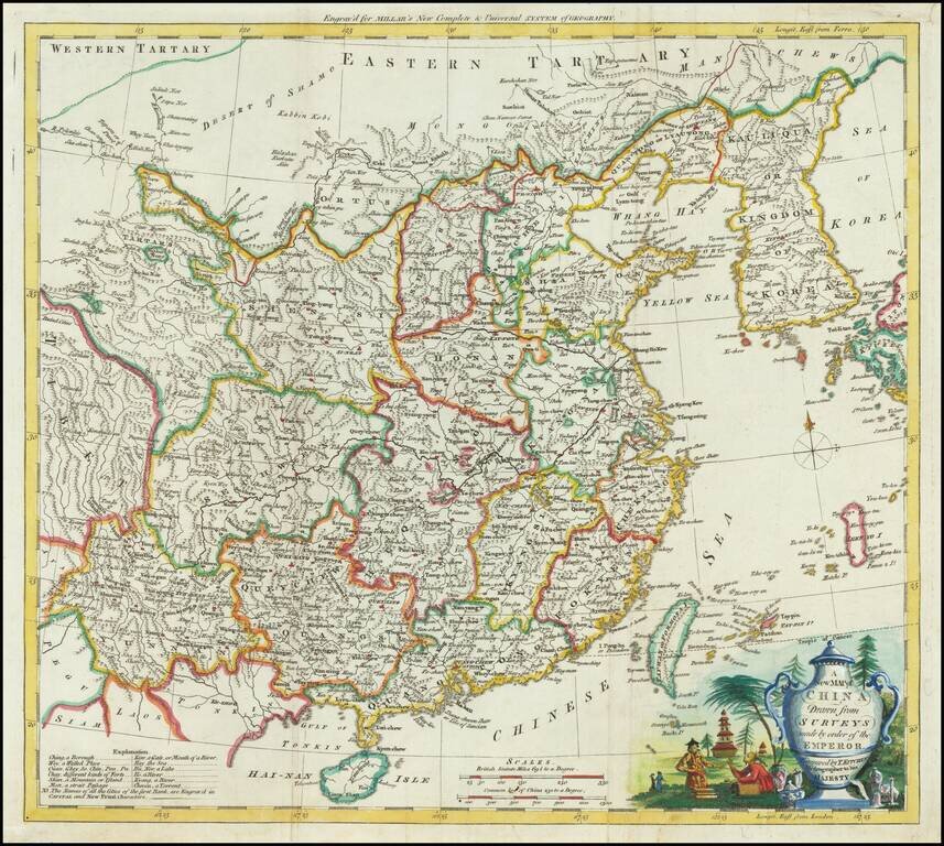
Attractive engraved map of China, produced by Thomas Kitchin for George Henry Millar's New Complete & Universal System of Geography. The map was published in London circa 1782. The cartouche is particularly attractive on this map, featuring a...
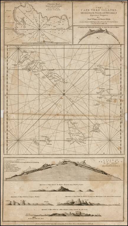
Detailed chart of the Cape Verde Islands off the Coast of Africa, with inset maps of Praya Bay, A View of the English Road, A View of Praya Bay and a group of recognition views.