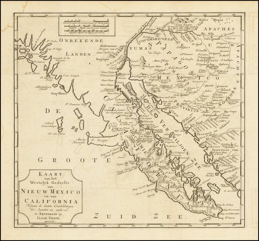
One of the Earliest Obtainable Maps of Southern California and Baja California Fine old color example of this early map of Baja California and parts of Alta California, Arizona and Sonora. Isaac Tirion's map of Baja California is one of the best...
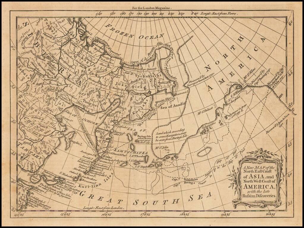
Interesting map of the Northern Pacific, showing the tracks of Captains Behring and Tschirkows Voyages of Exploration on the St. Peter and St. Paul, from Kamtschatka to the NW Coast of America and into the North East Passage, from 1728 to 1741. Vitus...
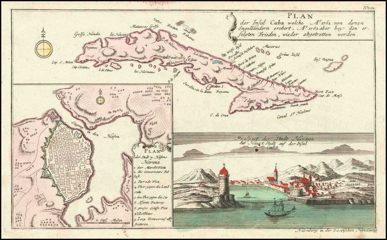
Striking map of Cuba, along with a detailed plan of Havana, and a view of the city and the entrance to its harbor, which appeared in Raspe's Shauplatz des gegenwaertigen Krieg. The plan is highly detailed with a numbered key to the city's major...
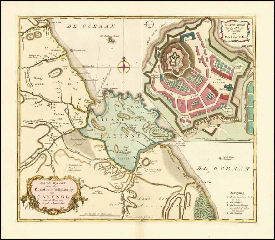
Fine old color example of Tirion's map of French Guiana, with a large inset map of Cayenne. Includes a meticulous depiction of the Plantations in the region.
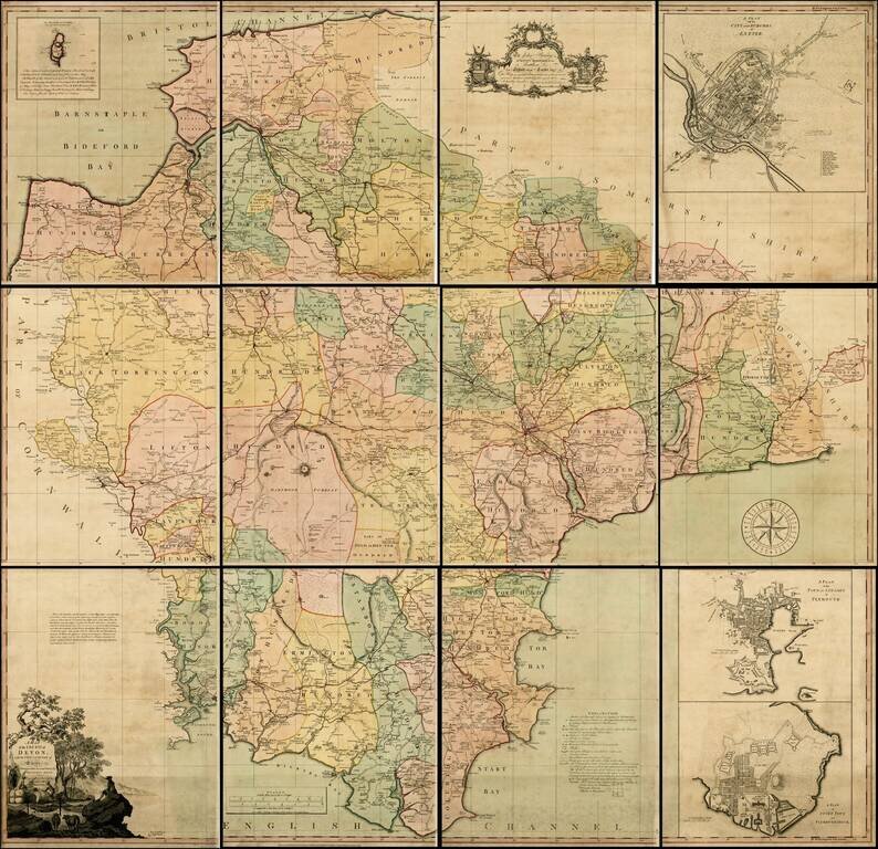
Fine example of Benjamin Donn's 12-sheet map of Devon, the first map to win the Royal Society of Arts award for the best 1 inch to a mile survey of an English county, and the first large-scale printed map of Devon. Engraved and published by Thomas...
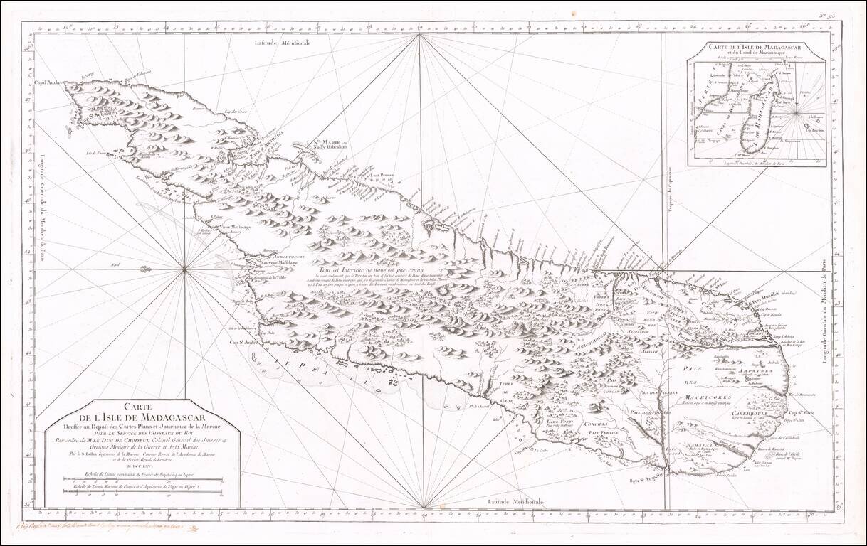
Fine early sea chart of the Madagascar, published by the French Hydrographical Department. This chart was produced by Jacques-Nicolas Bellin (1703-1772), France's preeminent maritime cartographer and the Premier Ingénieur of the Depot de la Marine...