Map size in jpg-format: 1.30196MiB
Click to open in high resolution (open in new tab).
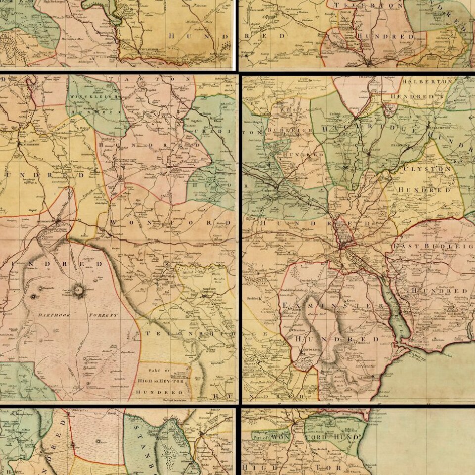
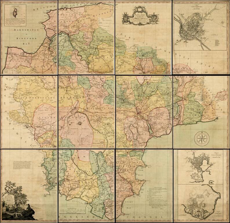
Fine example of Benjamin Donn's 12-sheet map of Devon, the first map to win the Royal Society of Arts award for the best 1 inch to a mile survey of an English county, and the first large-scale printed map of Devon.
Engraved and published by Thomas Jefferys, Benjamin Donn's map of Devon represents a high-point in 18th Century English County maps, combining the new science of surveying, with the artistry of copper engraving to create this fine map. Executed on 12-sheets, this map covers the entirety of Devonshire or Devon from the English Channel to Barnstaple (Bideford) Bay and from Cornwall to Somerset at a scale of 1 inch to 1 mile. Donn also incorporates large insets of Exeter (showing the college), Plymouth, Plymouth Dock, Stoke Town, and the Isle of Lundy. The map is finished with a decorative title cartouche.
In 1759, the Society for the Encouragement of the Arts, Manufacturers, and Commerce (the Royal Society for the Arts, beginning in 1847), began offering a £100 award for a large scale one inch to the mile map of any English county, at the suggestion of the Cornish antiquarian William Borlase,. Benjamin Donn was the first to win the award, with this finely executed 12 sheet map. Although Donn estimated the cost of preparing the map at £2000, the prestige of issuing the first large scale British county map assured the success of his work.
Donn dedicated his map to John Baring of Mount-Radford and Matthew Lee of Ebford, local notables who may have helped Donn finance his survey work. Most examples of this map appear bound in atlas format with a single fold, and are generally found either uncolored or in outline color. Donn charged 2 extra shillings for binding and 5 extra for coloring. The present example appears to have been laid on linen and bound in plano, assuring its survival in such fine condition.
If you are a student, write to us in telegram: @antiquemaps and indicate what material you need and for what work you need a map in high detail. We are ready to provide material on special terms. For students only!