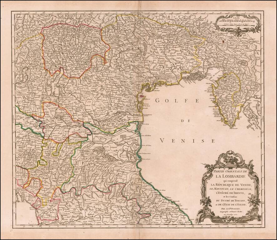
Highly detailed map of the Eastern part of the Lombardy region, from DeVaugondy's Atlas Universel. Includes towns, mountains, rivers, lakes and a host of other details. Decorative Cartouche. De Vaugondy's atlas was one of the most successful and...
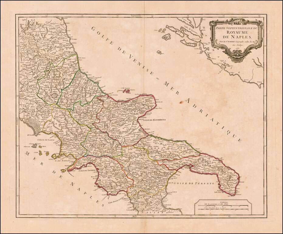
Striking map of the northern portion of the Kingdom of Naples, from an early edition of De Vaugondy's Atlas Universel. Includes towns, mountains, rivers, lakes and a host of other details. De Vaugondy's atlas was one of the most successful and...
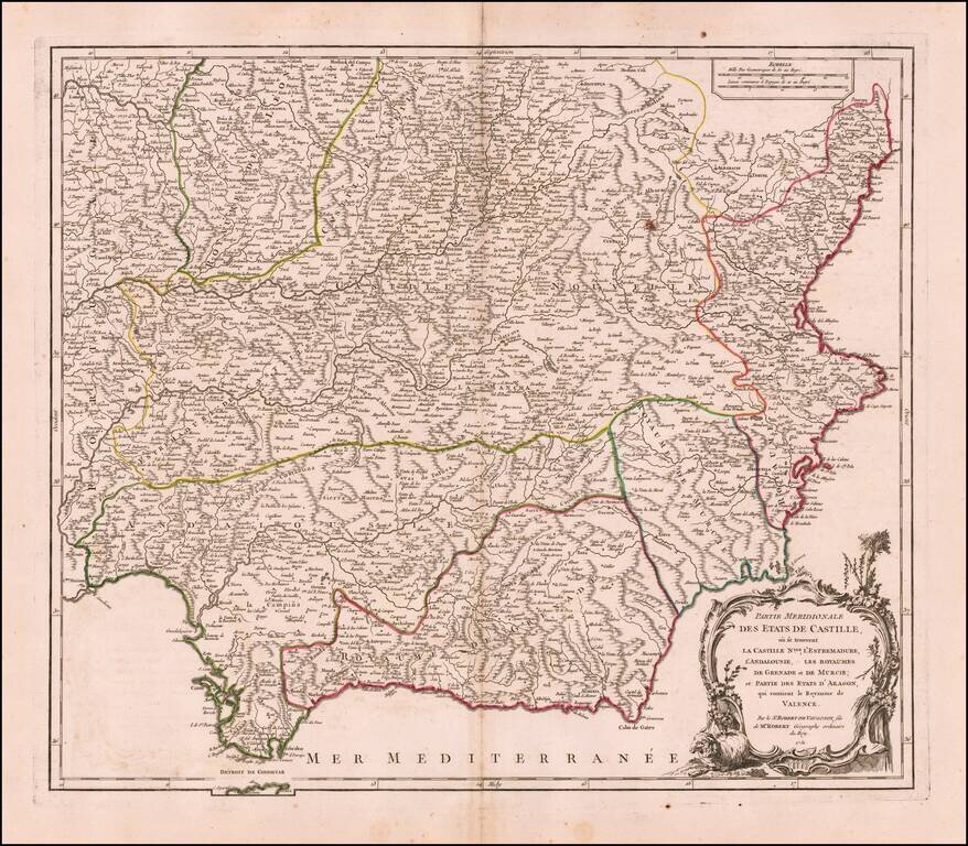
Decorative and highly detailed map of Southwestern Spain and including a decorative cartouche.
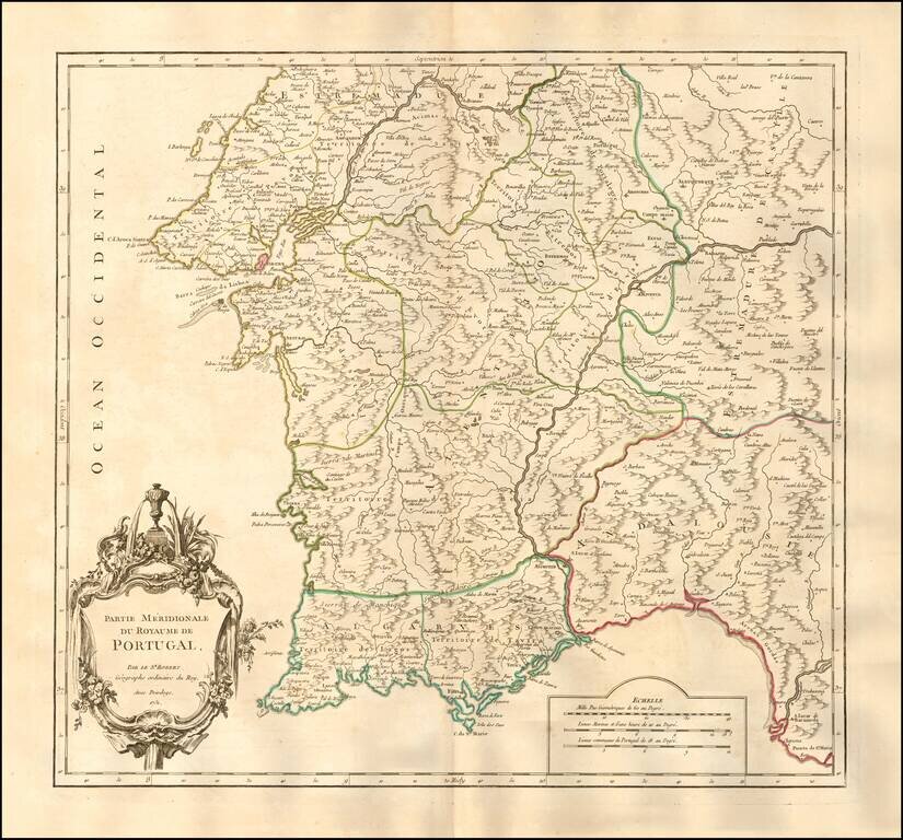
Nice example of the first edition of De Vaugondy's map of the southern part of Portugal. Lisbon and the Barra da Lisboa are prominently featured. Several hundred towns are shown. Decorative cartouche. An excellent large format map from the middle of...
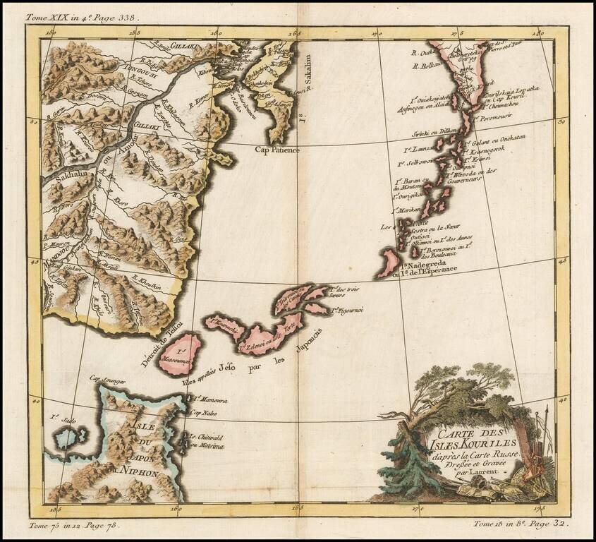
A striking map of Northern Japan and the contiguous islands and coastline. Very detailed and interesting.
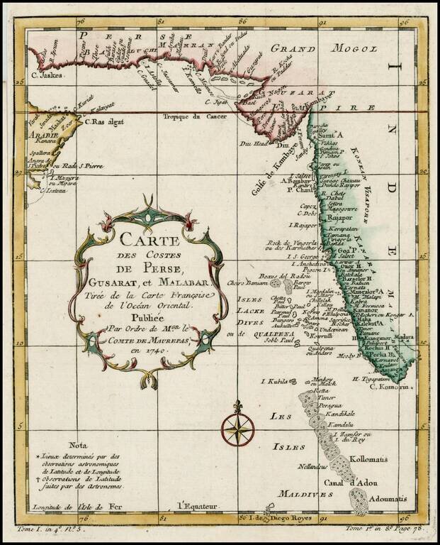
Detailed map of the region from the mouth of the Persian Gulf to the Maldives. Includes large decorative cartouche and compass rose.
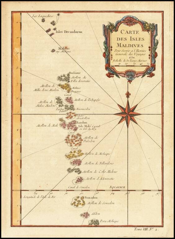
Detailed map of the Maldives, with rhumblines and a large compass rose. Includes a decorative title cartouche. One of the maps produced by Nichlas Bellin for Prevost d'Exiles influential travel book, L'Histoire Generale des Voyages.
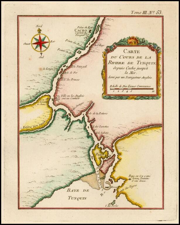
Detailed map of the Tunquin River and Bay, extending north to Cacho, the capital city. One of the maps produced by Nichlas Bellin for Prevost d'Exiles influential travel book, L'Histoire Generale des Voyages.
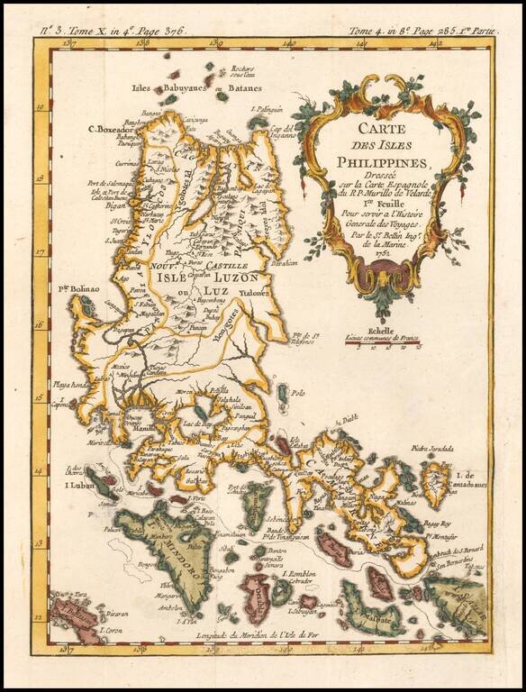
Detailed map of the Northern portion of the Philippines, extending from Batanes and Babuyans to Mindoro and Masbate, and centered on Luzon. One of the most detailed maps of the period. Includes a large decorative title cartouche. One of the maps...
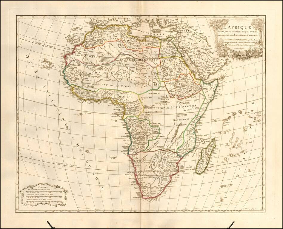
Detailed map of Africa, published in Paris by De Vaugondy in his Atlas Universal. The map reflects the limited knowledge among Europeans in the interior parts of the continent.
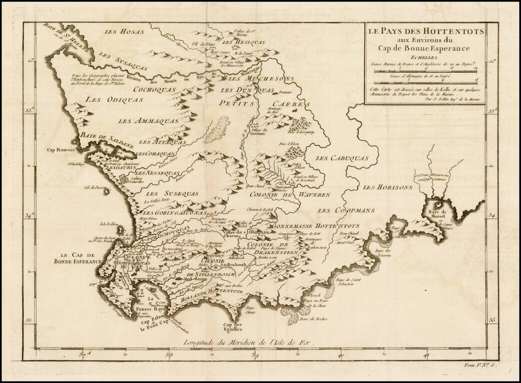
Detailed map of a portion of South Africa, from Baye de St. Helen and Baye Saldane in the West, to Baye de Musssel in the East, centered on the Dutch Hottentot regions and Petit Cafres. Shows tribes, rivers, towns, mountains, lakes, bays, capes, and a...
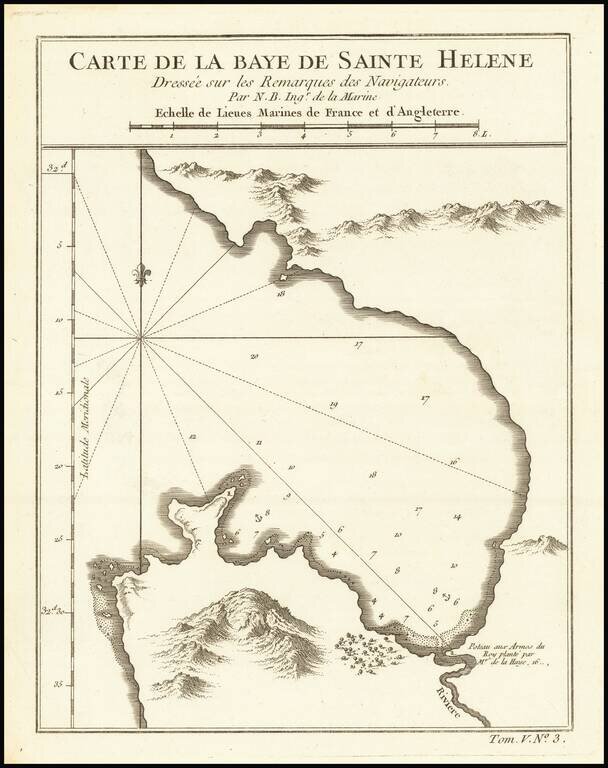
Detailed plan of St. Helena Bay, northwest of Capetown, South Africa.
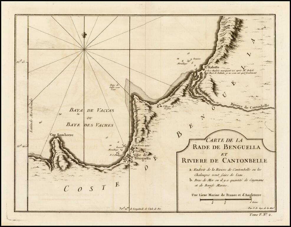
Detailed regional map of the region between Benguela, Angola and the Cantonbelle (Catumbela) River, from J.N. Bellin, the map maker to the King of France. The map includes Fort. Kabuto, which Bellin notes as having been identifed by the English and De...
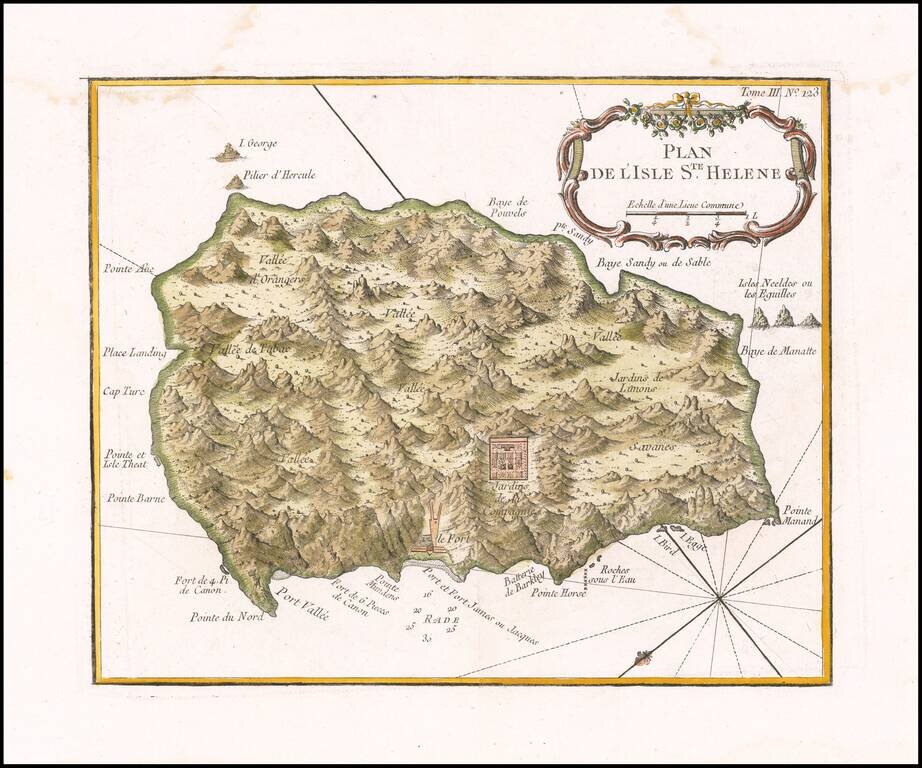
Fine early map of the St. Helene. Bellin's map Plan de l'Isle Ste Helene is largely is derived from the maps of Seller and Moll. The outline of the island essentially is that portrayed by Seller, with, for example, the very pronounced 'finger' of...
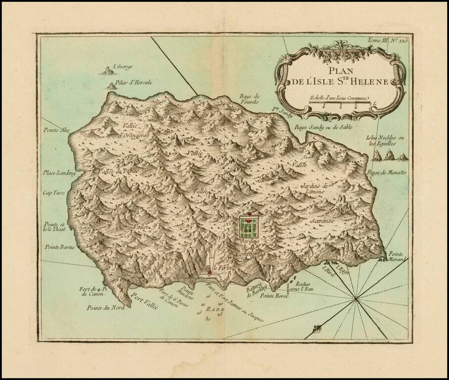
Fine early map of the St. Helene. Bellin's map Plan de l'Isle Ste Helene is largely is derived from the maps of Seller and Moll. The outline of the island essentially is that portrayed by Seller, with, for example, the very pronounced 'finger' of...