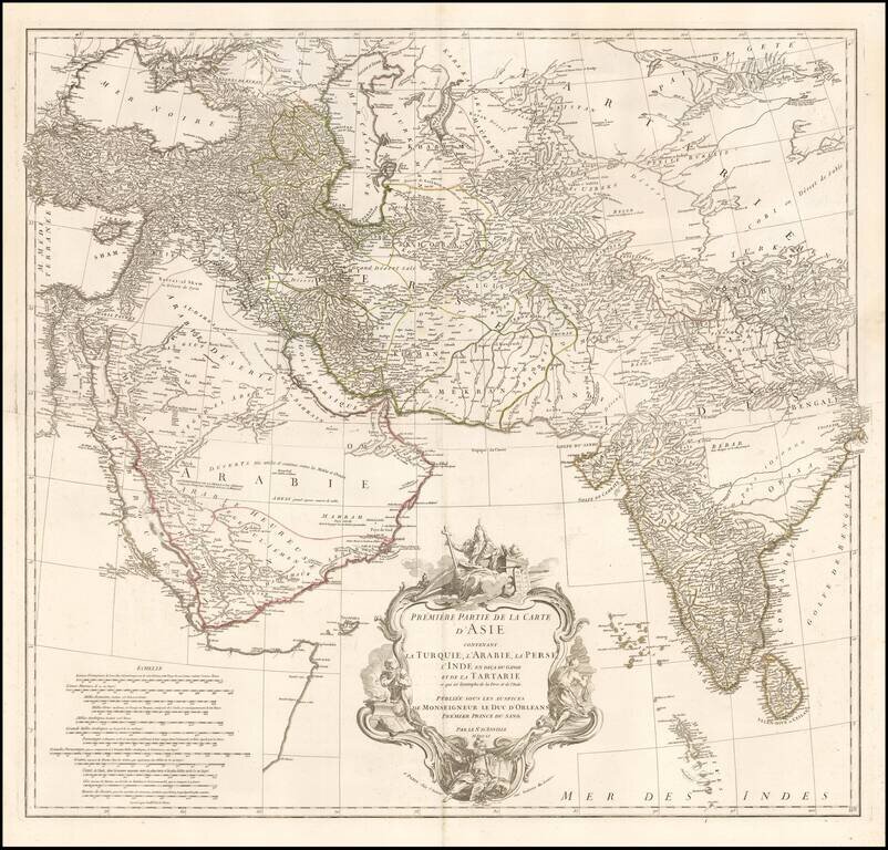
Striking 2-sheet map of the western half of Asia, published by D'Anville. Includes details from Turkey through the Black and Caspian Seas to Tibet and south to include the Arabian peninsula and all of India. Fine detail throughout including the Maldive...
![[Tycho Brahe Celestial Model & Time Clock]](/map/small/33354.jpg)
A Celestial / Scientific Rarity Fascinating illustration showing a model of the Solar System, based upon Tycho Brahe's theories on the face of a clock, engraved in Prague in 1751. The image consists of an astronomical clock depicting a Tychonic solar...
![[Governor of Virginia] The Right Honble William Anne, Keppel, Earl of Albermarle, Viscount Bury, Baron of Ashford, Groom of the Stole, Governour & Captn General of Virginia, Colonel of the Coldstream Regiment of Fort, Lt. General of His Majesty's Forces,](/map/small/60432.jpg)
William Anne, Governor of Virginia Rare mezzotint portrait of William Anne Keppel, Second Earl of Albermarle and Governor of Virginia. Lieutenant-General Willem Anne van Keppel, 2nd Earl of Albemarle KG KB PC (1702 – 1754) was a British diplomat...
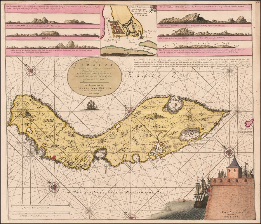
Fine Original Color Example Rare Dutch sea chart of Curaçao, published by the Van Keulen family in the middle of the 18th Century. The chart includes several coastal insets and an inset of Fort Amsterdam and the Bay of St. Anna. Van Keulen's chart...
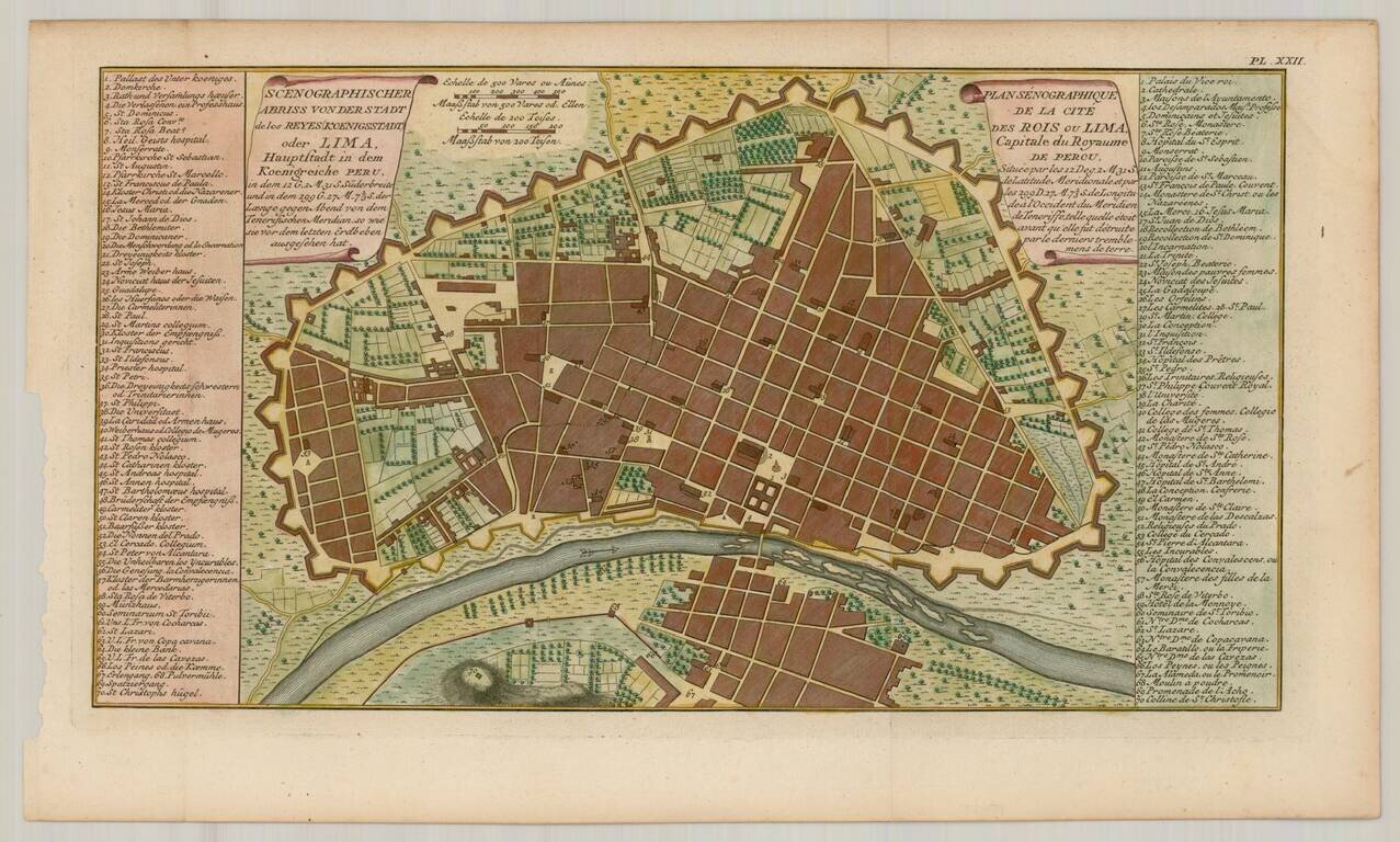
Nice example of Ulloa's plan of Lima, capital of Peru, from the 1751 German edition of the official account of Ulloa's expedition. Antonio de Ulloa (1716-1795) was a Spanish general, explorer, author, astronomer, colonial administrator and the first...
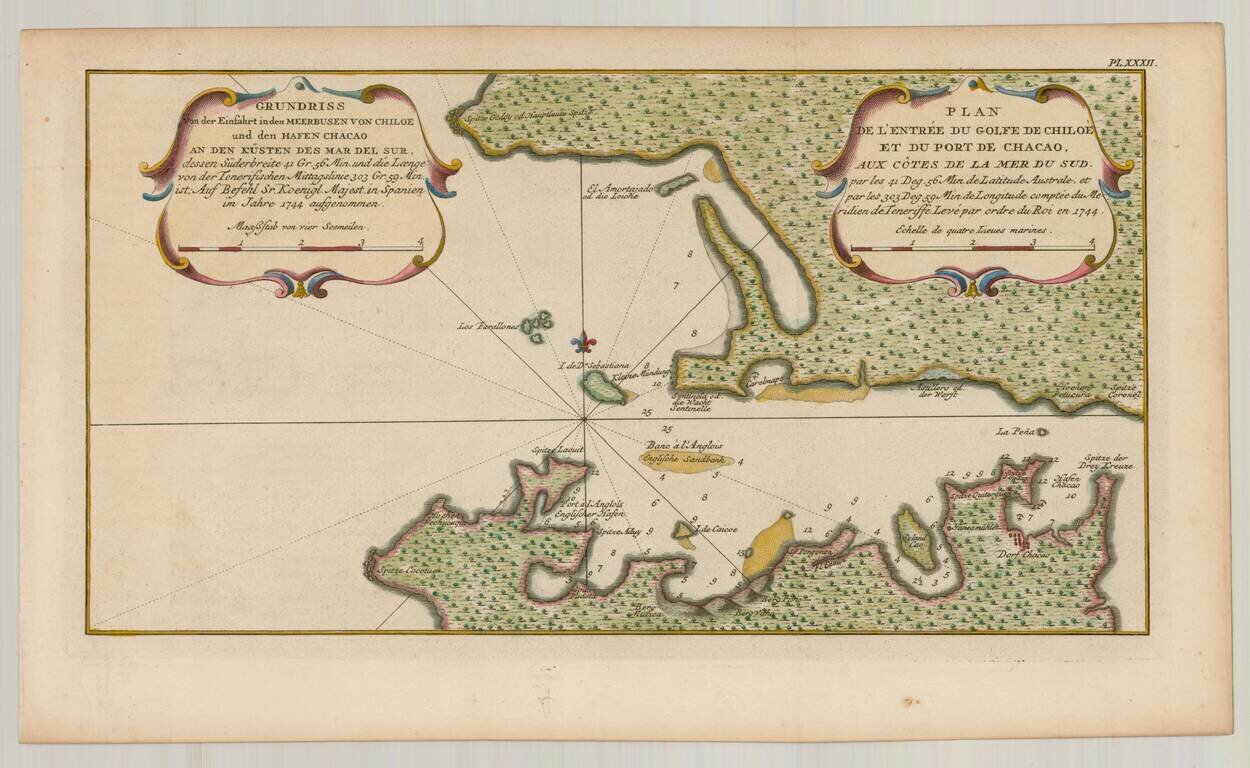
Detailed plan of the Harbor at Chiloe, from the 1751 German edition of the official account of Ulloa's expedition. Antonio de Ulloa (1716-1795) was a Spanish general, explorer, author, astronomer, colonial administrator and the first Spanish governor...
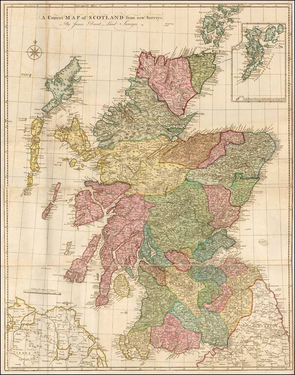
Finely executed map of Scotland, based upon James Dorret's General Map of Scotland . . . , issued in 1750. Dorret's map of Scotland was the standard depiction of Scotland for the next 40 years, used by the likes of Thomas Kitchin, Marcus Armstrong,...
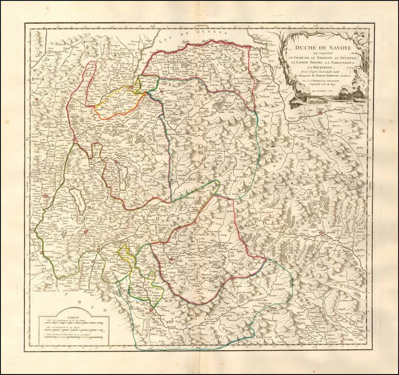
Detailed map of the Duchy of Savoy. Includes cities, villages, rivers, mountain ranges, castles, etc.
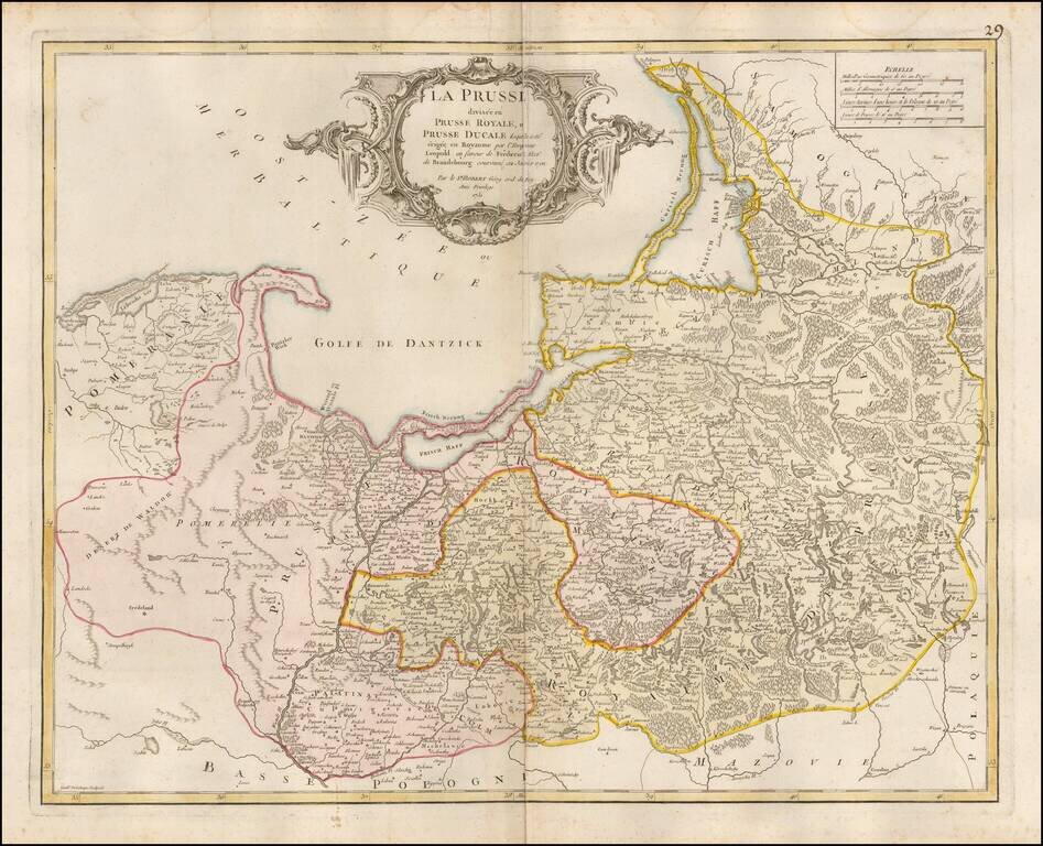
Detailed map of Prussia, including much of Poland and the Baltic Countries, published by De Vaugondy in Paris.
![[Wroclaw] Carte du Diocese de Breslau, avec ses IV. Archidiaconats, subdivses en ses Cercles Archiprebyteriales desineee sous la Directiondu bien reverend Sieur Felbiger . . . MDCCLI](/map/small/59627.jpg)
From The First Official Survey of Silesia Detailed regional map of the Diocese of Breslau (Wroclaw), published in Nuremberg. The map was originally published separately in about 1736 and was later issued in the Homann Heirs Atlas Silesiae Id Est...
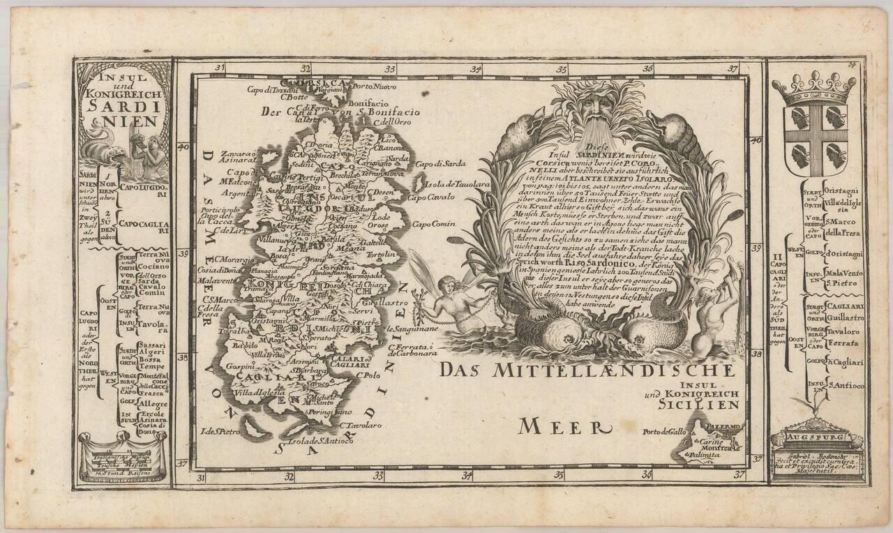
Detailed map of Sardinia, with an elaborate cartouche and coats of arms. The Bodenehr family of engravers and publishers of Augsburg began with Johannes Georg Bodenehr (1631 - 1704), a publisher of atlases and geographical books. His son Gabriel...
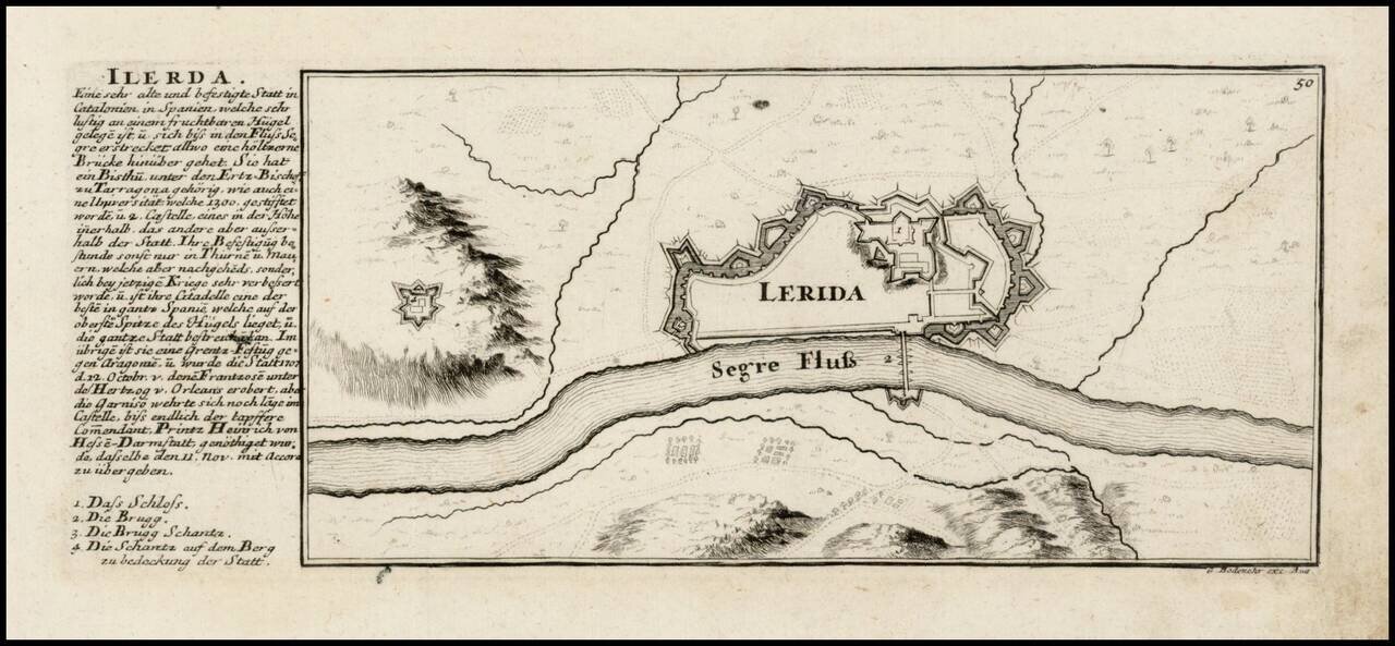
Plan of the fortifications of Lerida on the Serge River, with text at the left side with a text about the city and a legend, published in Bodenehr's Curioses Staats und Kriegs Theatrum. The Bodenehr family of engravers and publishers of Augsburg began...
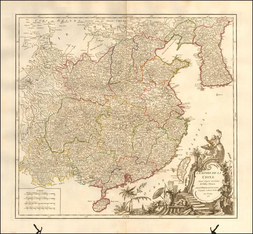
Striking large format map of China & Korea, from De Vaugondy's Atlas Universel. Includes a large and detailed Formosa. Beautifully colored by province, with a striking full-color cartouche. Includes the Island of Taiwan or Formosa.
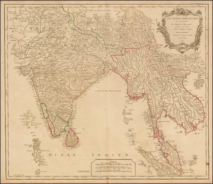
Nice example of Robert De Vaugondy's map of India & Southeast Asia, from his Atlas Universel. Publisher's outline hand-color.
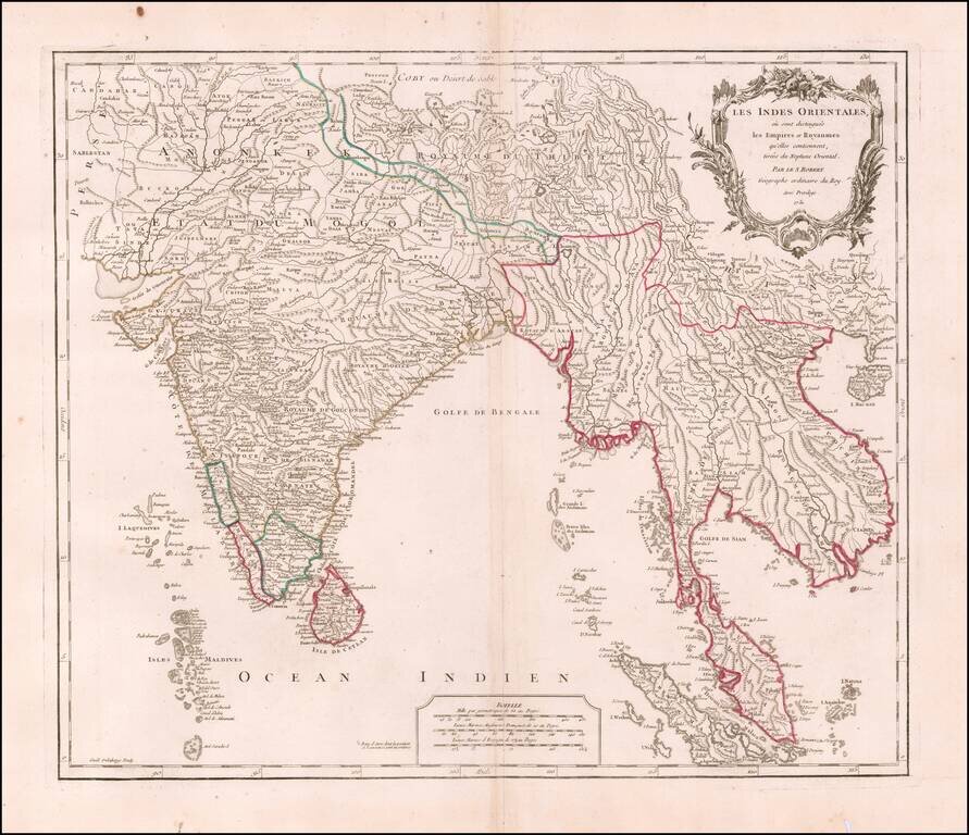
Interesting regional map extending from India, the Ganges and the Maldive Islands to Hai-nan, Cochinchina, the Straits of Malacca and Sumatra, from DeVaugondy's Atlas Universel. Includes islands, towns, mountains, rivers, lakes and a host of other...