![[Solar Eclipse of July 25, 1748] Die versinsterte Erdkugel d. i. Geographische Vorstellung der Sonnen od Erd-Finsternis den 25ten. Iulii Ao. 1748 . . . | le Monde Eclipse ou Representation Geographique de L'Eclipse de la Terre ou du Soleil qui arrivera](/map/small/69214.jpg)
Fascinating set of maps and projections illustrating the predicted path of a solar eclipse on July 25, 1748, based on calculations by Leonhard Euler, a renowned mathematician and astronomer. The map sheet includes three hemisphere projections...
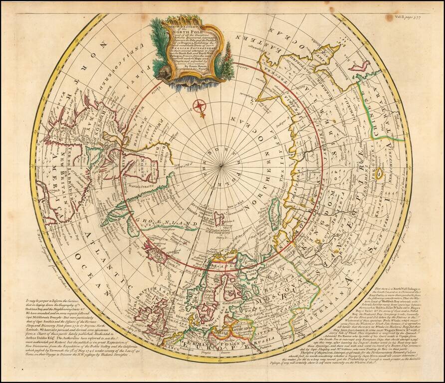
Second edition of Bowen's spectacular Arctic and sub-Arctic map, showing excellent detail around Hudson Bay, Greenland, Spitzbergen & NE Coast of Europe & Asia. The second edition has been revised to include the tracks of a number of early...
![Representation du Cours ordinaire des Vents de Traverse qui regnent les Cotes dans la grande Mer Du Sud [California as an Island]](/map/small/54744.jpg)
Interesting map charging the course of the trade winds in the Pacific Ocean, published by Bellin in the Histoire Generale de Voyages, based upon the obseravations of Dampier. California is shown as an island. An odd piece of the southern hemisphere...
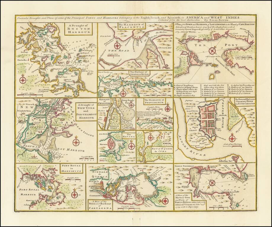
Nice set of harbor and town plans, showing the major trading cities and ports in North America and the Caribbean. The maps include: Boston New York Charleston Martinico Placentia Anapolis St. Augustine Havana St. Jago (San Juan) Providence...
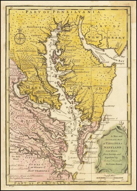
Scarce map of the Chesapeake region, based upon Augustine Hermann's map of 1673 and Henry Popple's map of 1733. The map includes a number of interesting annotations and place names, including Indian House and Plantations, English Plantations, Black...
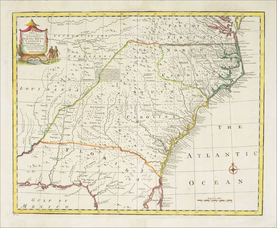
Striking example of Bowen's detailed map of the Carolinas, Georgia and most of Florida, extending west to the Country of the Cherokees and French Louisiana. The map is highly detailed and show many towns, forts, Indian Tribes, mountains, rivers,...
![A New & Accurate Map of Mexico or New Spain together with California New Mexico &c. [Inset map of the Galapagos Islands]](/map/small/70276.jpg)
Striking map of the Southwestern and Southeastern United States, Baja California, Mexico, Central America and the Gulf Coast region, centered on Texas. Includes nice annotations throughout the map, including annotations describing Kino's expedition to...
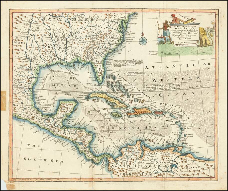
Decorative example of Bowen's map of the Southeastern United States, Florida, Gulf Coast, Texas, Caribbean and Central America. The map is embellished by an elaborate native American scene, along with a depiction of a lion and other indigenous...
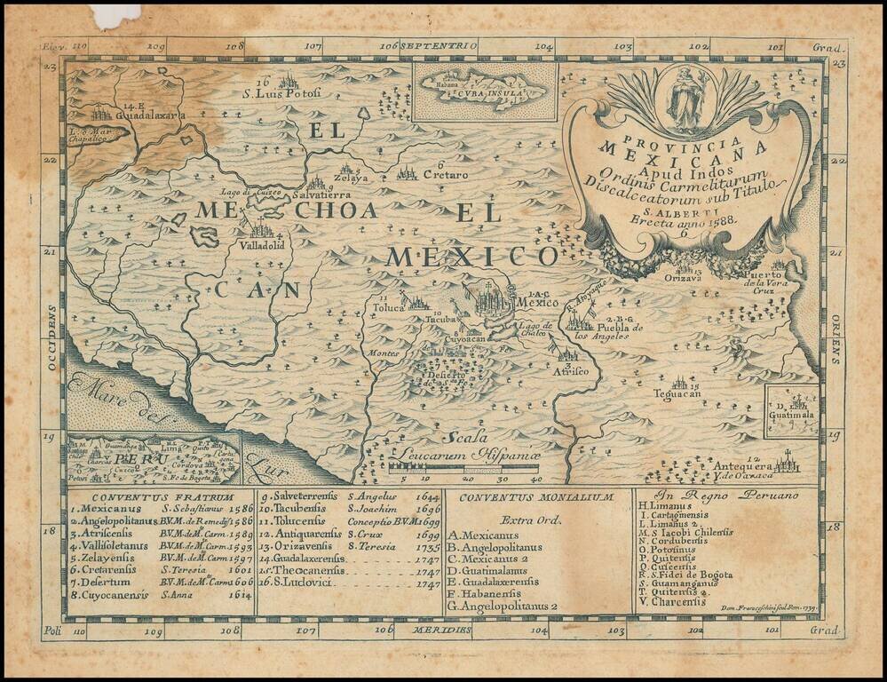
Rare Second State of Carmelite Province of Mexico in Blue Ink This is a very rare map of the central area of Mexico, illustrating the Discalced Carmelite convents of both friars and nuns and engraved by Domenico Franceschini. This is a rare second...
![[Antigua] A New and Accurate Map of the Island of Antigua or Antego taken from Surveys, and adjusted by Astronl. Observations. Containing all the Towns, Parish Churches, Forts . . .](/map/small/68333.jpg)
Decorative and highly detailed map of Antigua. Shows towns, parishes, roads, mountains, islands, forts, plantations, sugar works, castles, etc. Decorative cartouche, compass rose and annotations.
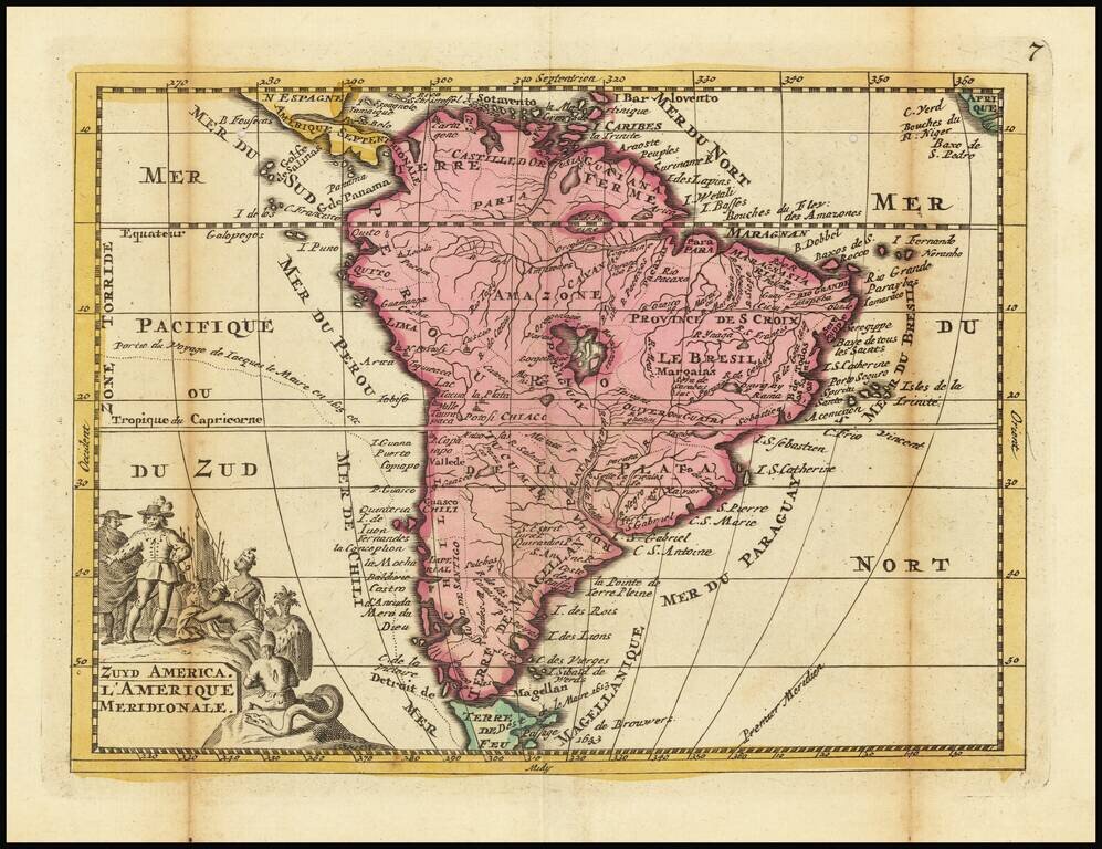
Rare Dutch Map of South America Unusual map of South America Rarity This is the first time we have ever seen the map.
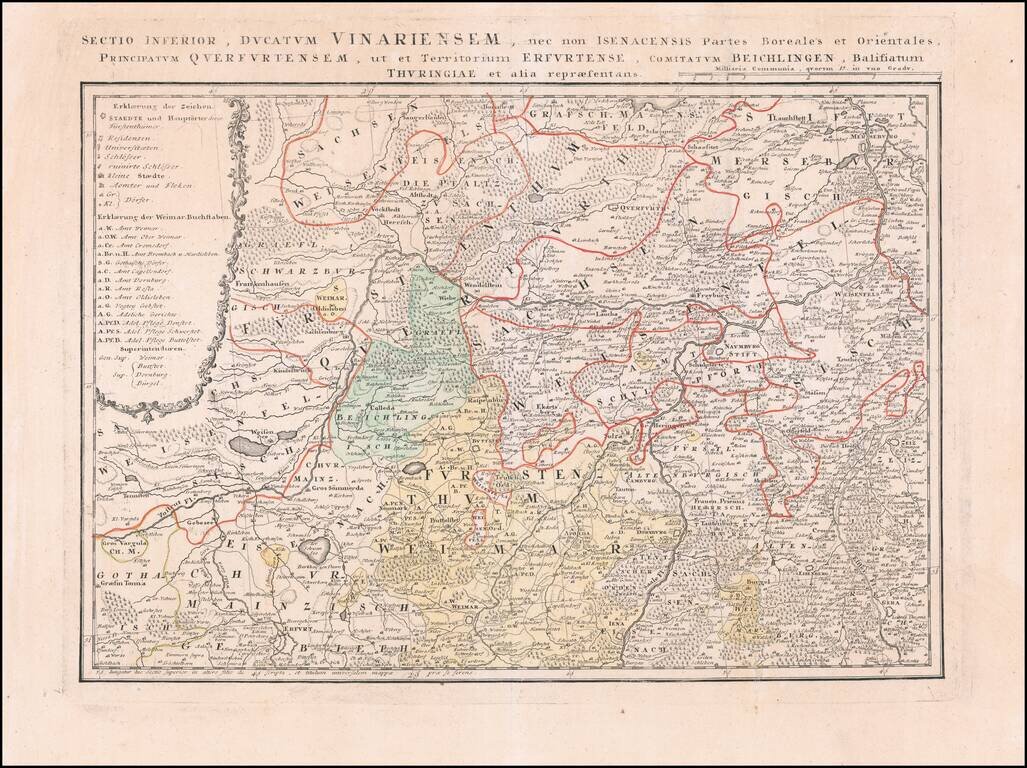
Detailed regional map of a part of the Thuringia region of Eastern Germany.
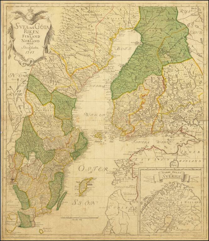
The Most Important Domestically Published Map of Sweden in the 18th Century Highly detailed map of Sweden and Finland, by leading Swedish mapmaker Georg Biurman. A nice example of this landmark map, which saw the rebirth of domestic map publication...
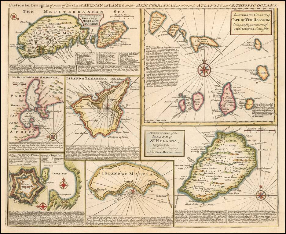
Detailed set of 8 maps, including a large and detailed Malta, the Bay of Agoa de Saldanha, Teneriffe, the Dutch Fortress at the Cape of Good Hope, Table Bay, Madera, St. Helena and the Cape Verde Islands, all with extensive annotations.
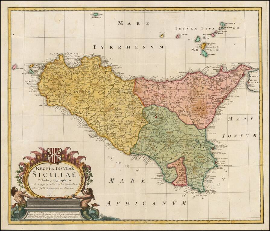
Fine detailed map of Sicily, published in Nuremberg by the heirs of J.B. Homann. Includes a coat of arms and an allegorical cartouche. Excellent detail in the interior of the map.