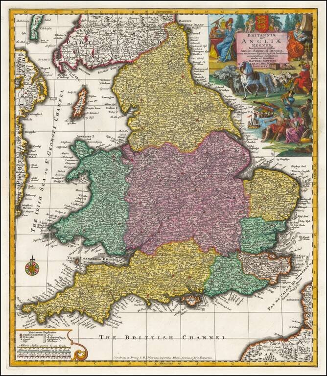
Seutter's decorative engraved map of England. Incudes a coat of arms and an elaborate allegorical vignette.
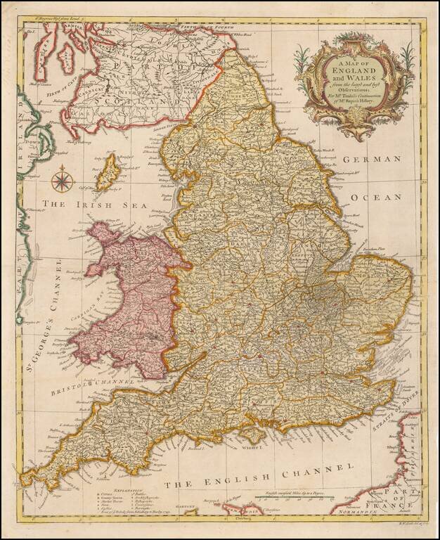
Fine mid-18th century map of England and Wales. The map provides a fine detailed snapshot ot the counties, towns, roads and other features.
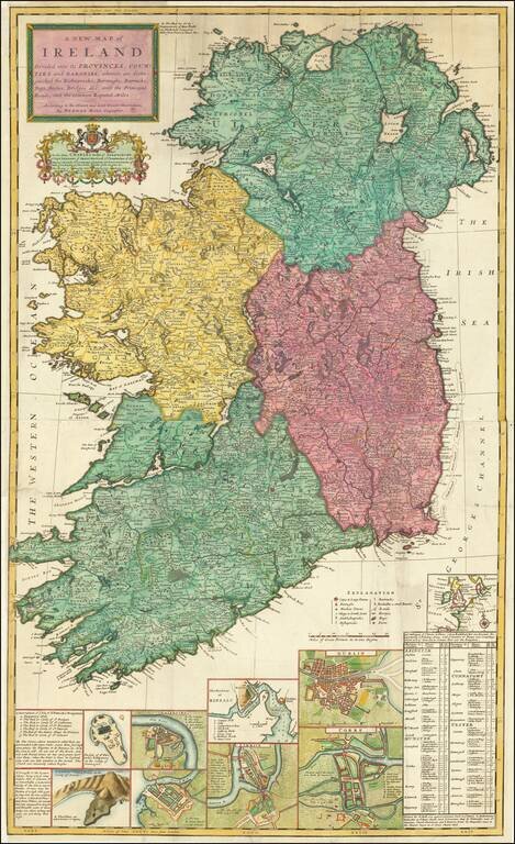
Decorative large map of Ireland, published by Herman Moll. Includes a number of insets including plans of Galloway, Waterford, Limerick, Dublin, and Corke. The map also includes an interesting depiction of the Giants Causeway, with the note "These...
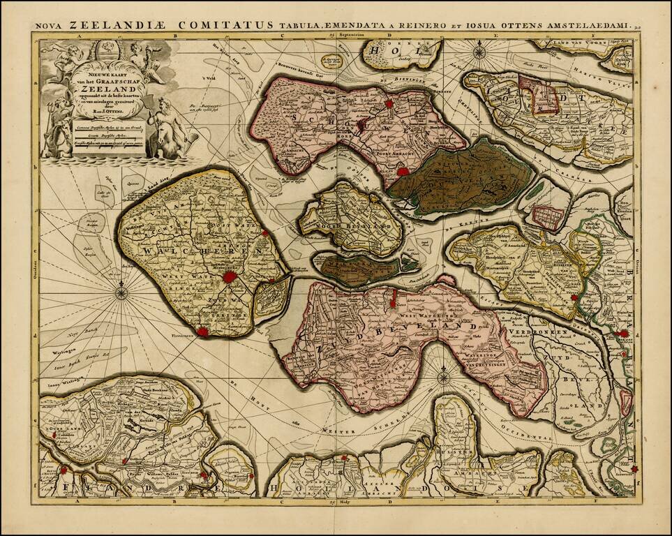
Rare map of the Province of Zeeland, with its many islands and peninsulas. Major cities, small villages, and some of the natural features are named. A nice old color example.
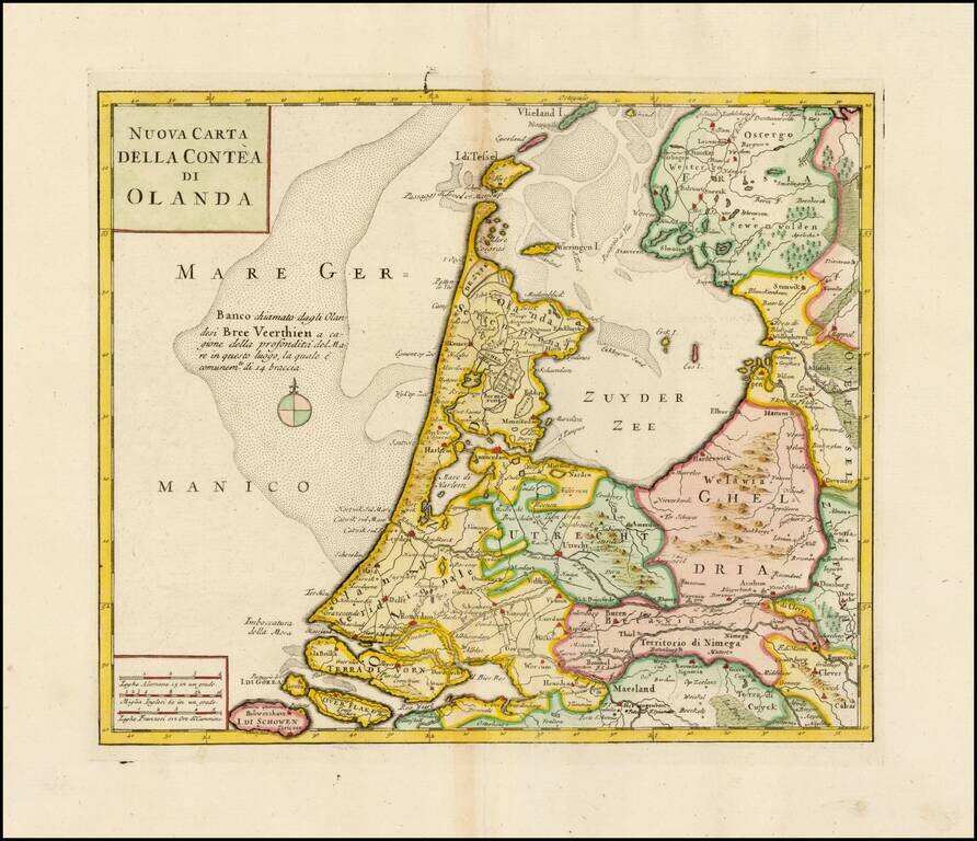
Striking map of Holland, based upon De L'Ise's map. Includes a decorative cartouche and excellent geographical detail. Albrizzi's maps are scarce and beautifully engraved.
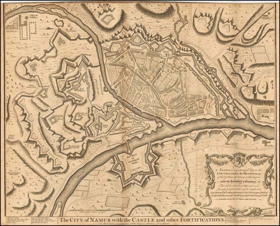
Striking plan of Namur and the Maes and Sambre Rivers, showing the town and fortifications.
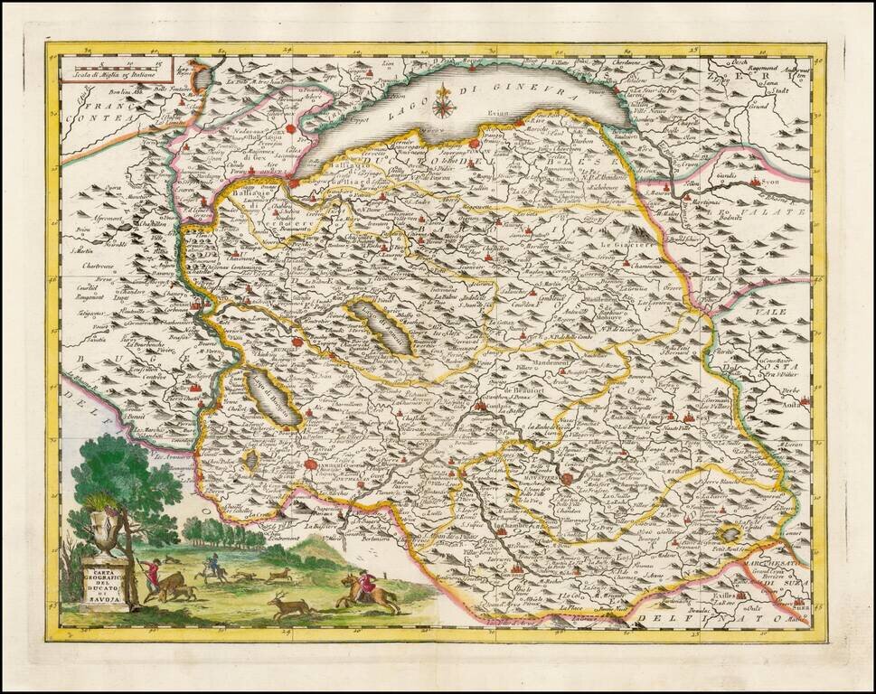
Striking map of the Duchy of Savoye, based upon De L'Ise's map. Includes a decorative cartouche and excellent geographical detail. Includes Lake Geneva. Albrizzi's maps are scarce and beautifully engraved.
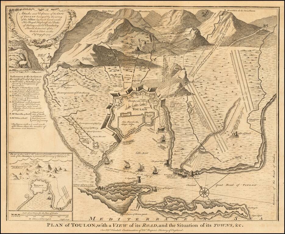
Detailed plan of Toulon, illustrating the fortifications of the town during the War of Spanish Succession. The map shows the action in Toulon the night of August 14, 1707. Siege of Toulon The Battle of Toulon was fought from 2 July 29 to August 21,...
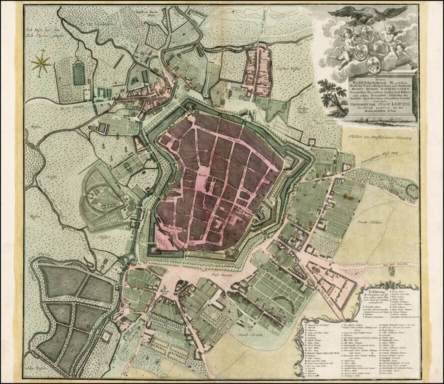
Scarce plan of Leipzig, from one of Germany's leading publishers of the 18th Century. Includes a key locating more than 50 points of interest.
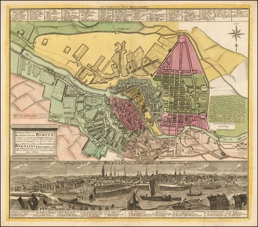
Striking plan of Berlin, with a detailed panoramic view of the city at the bottom, with a key locating 33 landmarks. Homann engraved views of a number of the major European cities during the early 18th century, which were added to his composite atlases.
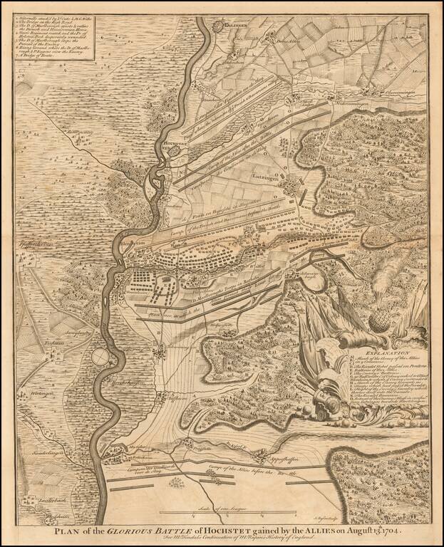
Detailed map of the Battle of Blenheim in 1704. The Battle of Blenheim was a major battle of the War of the Spanish Succession. The overwhelming Allied victory ensured the safety of Vienna from the Franco-Bavarian army, thus preventing the collapse of...
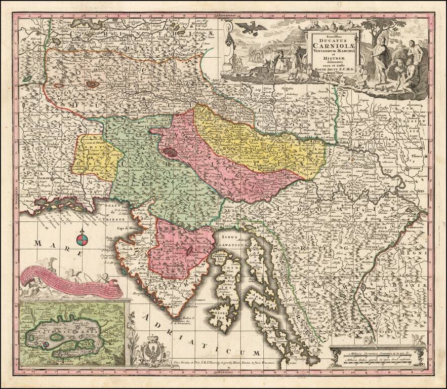
Detailed map of the region from Obercrain and Southern Carinthia in the west to Croatia in the east, centered on Istria, Chres and Krk Islands and the Dalmatian Coastline. Ljubjana (Laybach or Laubach) appears prominently to the north of the Czirnizer...
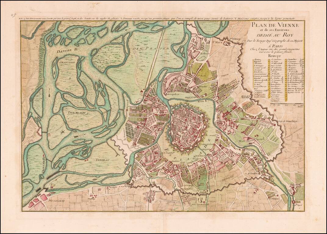
Finely colored plan of Vienna, published in Paris by George Louis Le Rouge and dedicated to the King of France. Shows the fortified walls both in the environs of Vienna, the Esplanade surrounding the old city and the fortified walls of the Old City,...
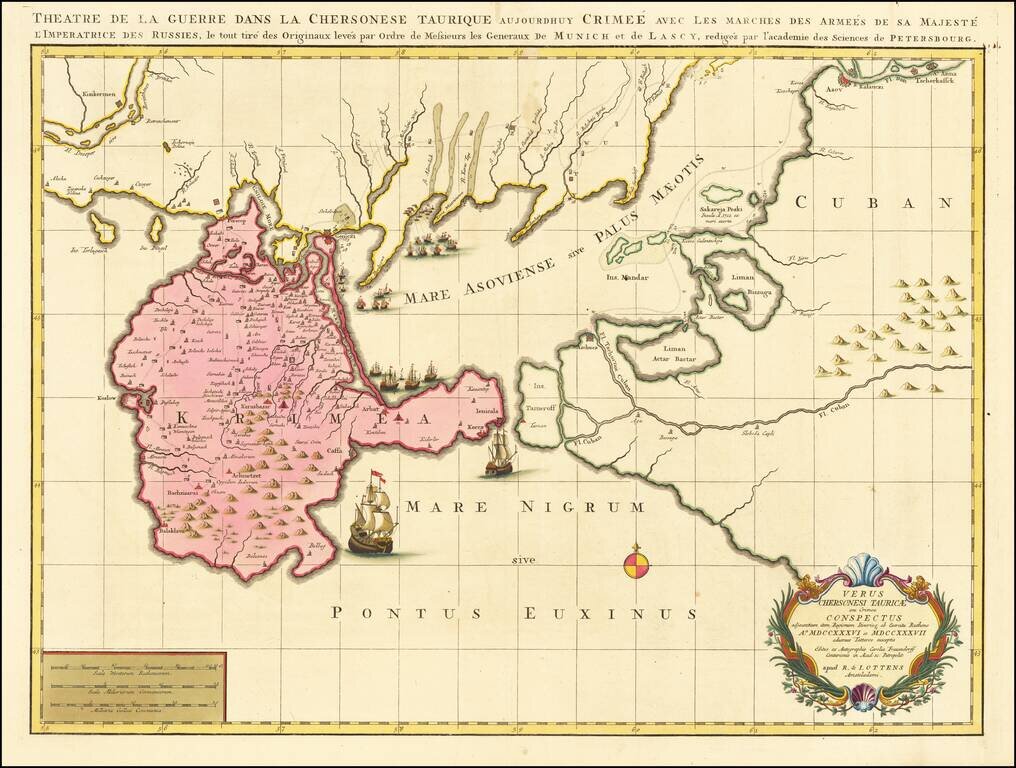
Fine Old Color Example Rare map of part of the Ukraine and the Black Sea region, showing the route of the Russian Army in its expedition against the Tartars in 1736 and 1737. Includes sailing ships, cartouche, compass rose and detailed movements of...
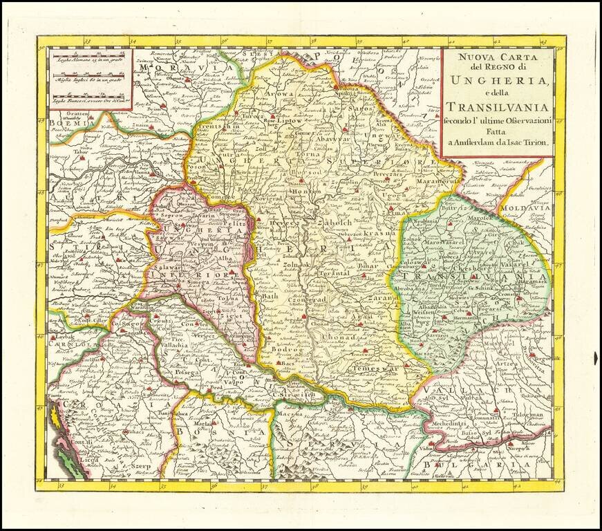
Scare map of Hungary, Slovenia, Transylvania, and parts of Croatia, Bosnia, Serbia, Romania and Bulgaria, from an Italian edition of Thomas Salmon's , Modern History: or, the present state of all Nations. . . entitled Lo Stato Presente... published in...