
Charming double hemisphere map of the World, showing California as an Island and an incomplete Australia and New Zealand. Includes two smaller hemispheres on a polar projection, both of which are largely fanciful. From Bodenehr's Atlas Curieux…...

Rare map of the Western Hemisphere in mirror image format, from a very rare work by Pierre Moullart Sanson, the grandson of Nicolas Sanson the Elder. The map is part of a series of maps intended to depict the various ways of depicting the Globe. The...
![Patriarchatus Antiocheni Geographica Descriptio . . . [shows Cyprus]](/map/small/54177.jpg)
The Cradle of Civilization Rare and highly decorative map of the region bounded by Cyprus and the Holy Land in the west and Sinus Persicus and Susiana in the east. Toward the center is the confluence of the Tigris and Euphrates rivers.
![[Spitzbergen & Wiches Lande]](/map/small/61990.jpg)
Mapping the early whaling voyages of the Muscovy Company Scarce early map of Spitzbergen, flanked by nine scenes of whaling, fishing, processing & bear hunting, and walruses (here called Seamorces), which first appeared in Purchas His Pilgrims...

Scarce map centered on Greeland and focusing on the passage in the North Atlantic from Europe to Hudson's Bay. The map shows the location of where Henry (Jens) Munk wintered in 1619-20. Jens Munk was a Danish explorer. On May 9 1619, he undertook a...
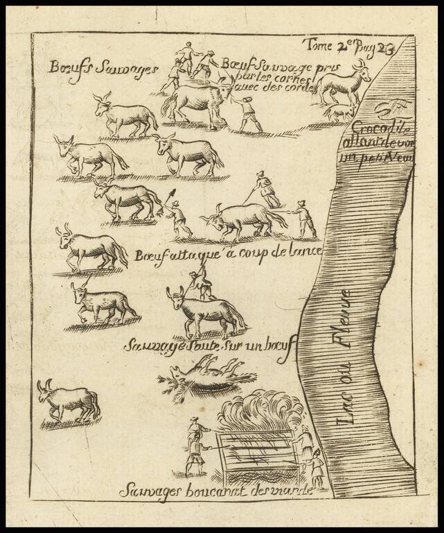
The Crocodile on Baron Lahanton's Longue River This small map was prepared to illustrate a section of Baron Lahontan's imaginary west to east Long River (Riviere Longue), rising in distant western mountains and emptying into the upper Mississippi....
![[Encampment of De La Barre on Lac Frontenac]](/map/small/70174.jpg)
Important Early French Fur Trading Post. Interesting engraving depicting the Encampment of Joseph-Antoine le Fèbvre de La Barre. La Barre (1622-1688) was the Governor of New France from 1682 to 1685. Having replaced the frustrated Comte de...

Detailed map of the 17 provinces of the Low Countries. Includes a decorative cartouche and 17 coats of arms.

De L'Isle's map of the Rhine River and neighboring regions, from Strassbourg in the north to the Swiss Alps.
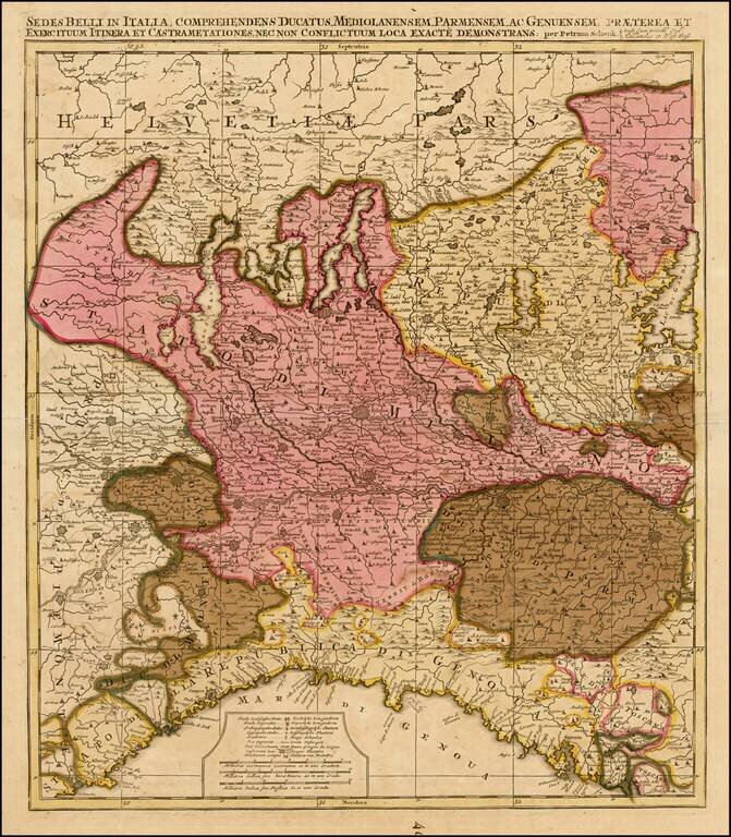
Detailed map of Northern Italy and contiguous parts of Switzerland.
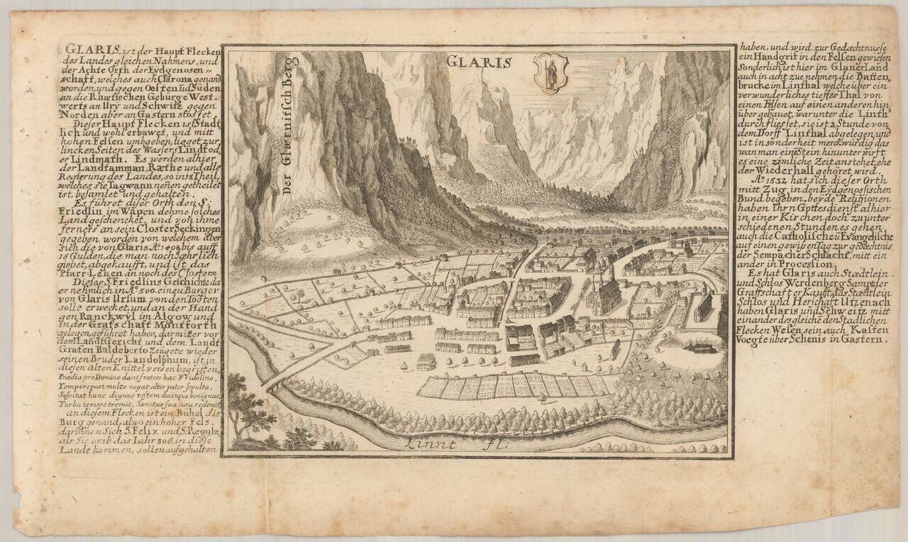
Antique engraved view of Glarus (Glaris), Switzerland, published by Gabriel Bodenehr in his Europeans Macht und Pracht between 1704 and 1720.

Fascinating map tableau, showing the water supply of Rome, including its many aqueducts.
![[Siena] Sienne Ville de la Toscane, Elle est Capitale du Sienois . . .](/map/small/70587.jpg)
One of the Earliest Obtainable Large Plans / Views of Siena Fine early bird's-eye view of Siena, published by Pierre Mortier in his Nouveau Theatre de Toute L'Italie in 1704. Mortier's view shows the a fortified hill town, including the principal...

Rare 2-sheet map of Galicia, Asturias, etc., engraved by T. Rousseau for J.B. Nolin in Paris. The map extends from Santillana del Mar in Cantabria to Galicia. The text inset provides information on Galicia, Asturias and Biscaya. A fine large format...