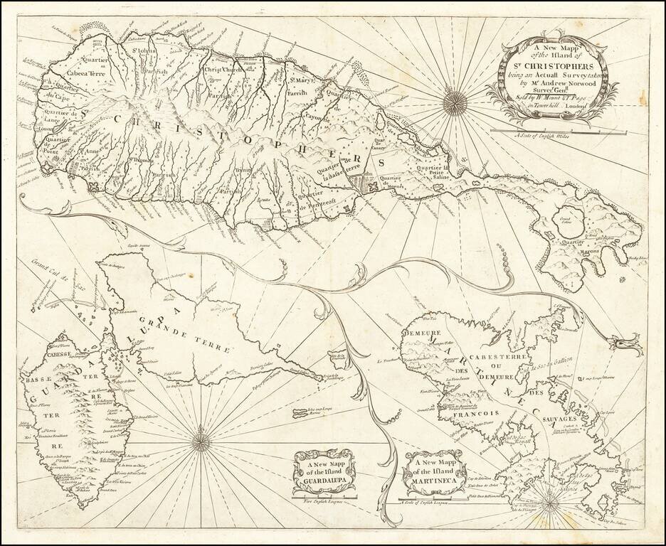
Nice example of John Thornton's sea chart of St. Kitts, Guadalupe and Martinique, which first appeared in the English Pilot, Fourth Book, in about 1706. Includes a fine map of St. Christophers, now known as St. Kitts, showing the parishes, forts,...
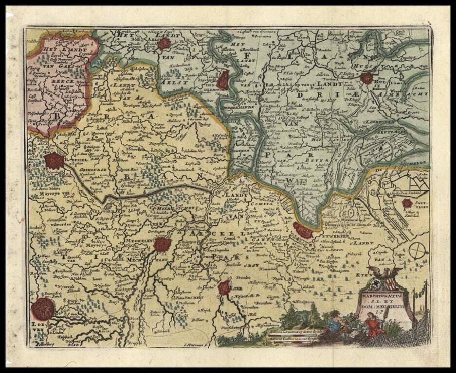
Fine miniature regional map, from an early edition of Afferden's Atlas Abreviado. Includes decorative cartouche, scale of miles and attractive wash coloring.
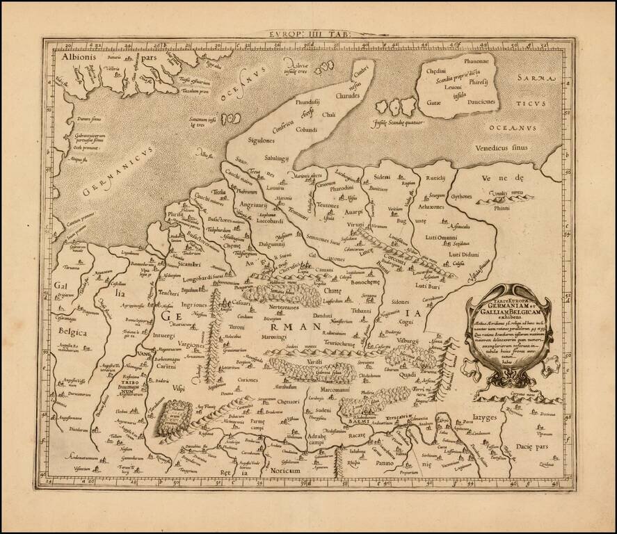
Attractive map of Denmark, Germany, Netherlands and Belgium, on the Ptolemaic model. Mercator originally published this map in his 1578 edition of Ptolemy's great Geography. The present example is the second edition of the map, first issued in 1698....
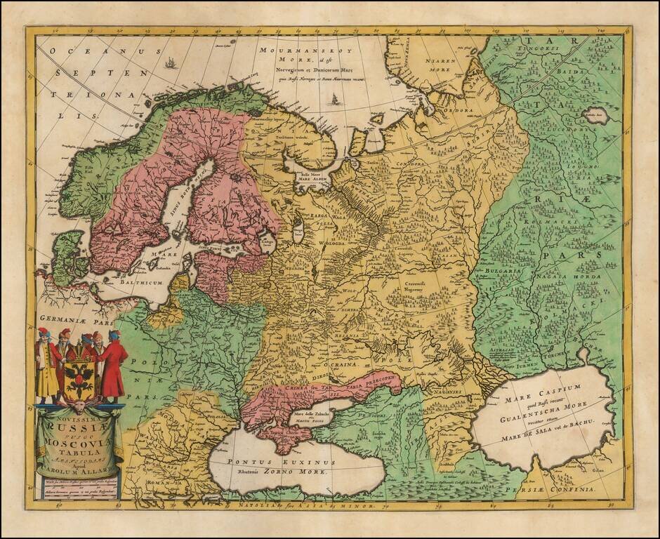
Nice example of Carol Allard's map of Russia and much of Northern Europe. Embellished with a decorative cartouche and coat of arms, plus sailing ships and sea monsters. Based on the cartography of Isaac Massa. The map is an updated version of Hugo...
![[Rhodes and Stanchio, Greece] Rhodus / Stanchio](/map/small/41669.jpg)
Striking view of Rhodes and Stanchio, from De Bruyn's Reizen van Cornelis de Bruyn . . . . The Dutch painter and traveler, Cornelius de Bruyn, traveled to Constantinople and the empire between 1677 and 1684. All the spires, minarets, mosques and...
![[Rhodes] Rhodus](/map/small/41614.jpg)
Striking view of the island of Rhodes, from De Bruyn's Reizen van Cornelis de Bruyn . . . . Finely engraved view of the Greek island of Rhodes, depicting the Old Town with fortifications beside a row of windmills. Numerous ships and boats sail the...
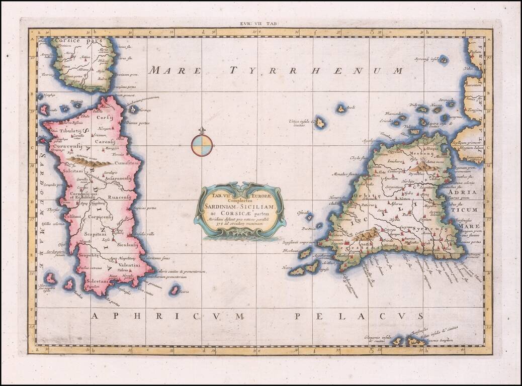
Nice example of Mercator's map of Sicily and Sardinia, from Mercator's edition of Ptolemy's Geographia, first published in 1578 and republished in Amsterdam beginning in 1695. Gerard Mercator published his edition of Ptolemy’s maps as what he...
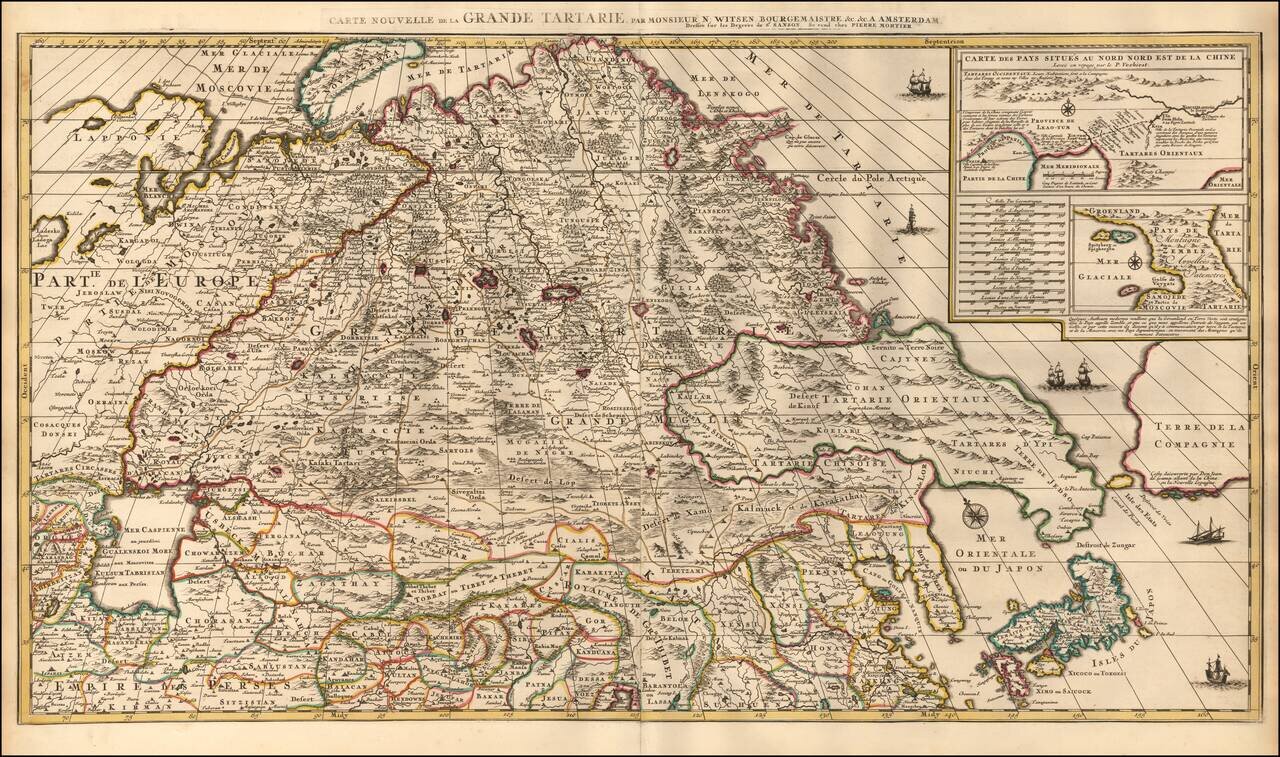
Highly Detailed Map of Tartary by Dutch Statesman and Russian Specialist Nicolaas Witsen with details from the Travels of Verbiest in China and De Vries in the North Pacific Nice example of Pierre Mortier's decorative and detailed map showing Central...
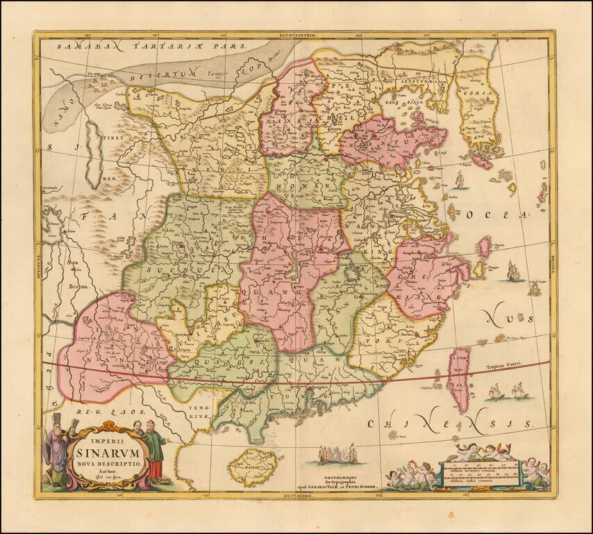
Scarce map of China and Korea, based upon Jansson's map of 1658. China is colored by provinces. Excellent detail throughout the map, which includes the Islands of Formosa and Hainan. The Great Wall of China is shown.
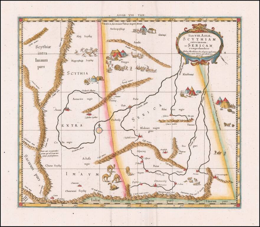
Fine Ptolemaic Map of Central Asia from Mercator’s Geographia Finely engraved map of Central Asia east of the Caspian Sea, encompassing parts of present-day Pakistan, Tajikistan, Kyrgyzstan, and western China. The map is from Mercator’s highly...
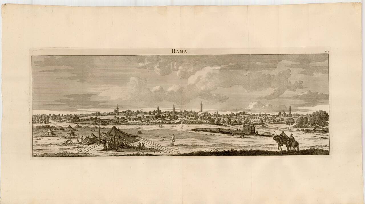
Striking view of the City of Ramallah, from De Bruyn's Reizen van Cornelis de Bruyn . . . .
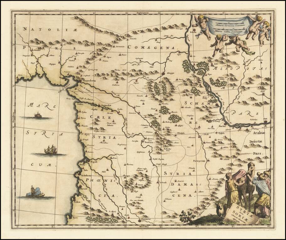
An attractive antique map of Syria, embellished with a decorative cartouche including a camel. The map stretches from Damascus to the Anatolian Peninsula and extends to Mesopotamia in the east, showing the Euphrates. The cities shown include Aleppo,...
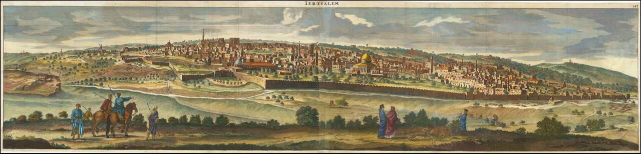
A Fine Panoramic View of Jerusalem Striking view of Jerusalem, from De Bruyn's Reizen van Cornelis de Bruyn . . . . A spectacular panorama of Jerusalem taken from the Mount of Olives. Engraved by Henrik van Krooneveld. Cornelius van Bruyn...