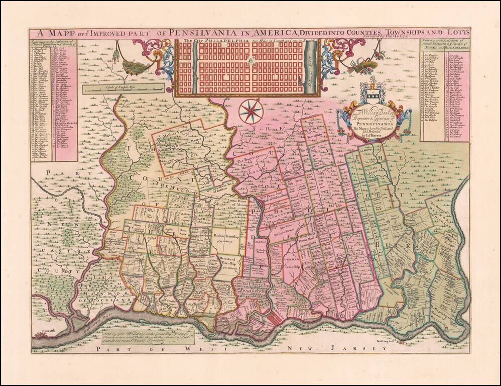
Holme's Map of Philadelphia in Deluxe Contemporary Dutch Color Extraordinary map of the area around Philadelphia, as surveyed by Thomas Holme at the request of William Penn. Offered here in extraordinary original color, quite possibly the finest...
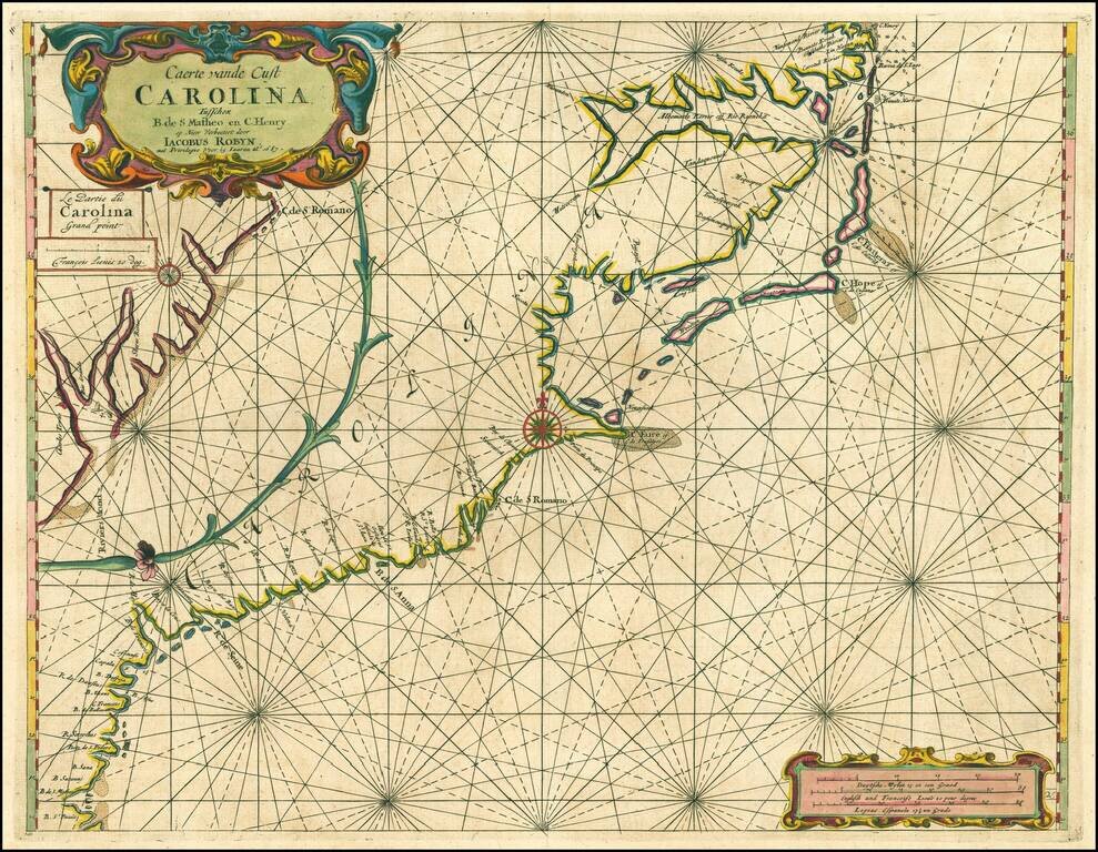
Jacob Robijn edition of this early chart of the Carolina, Georgia & North Florida Coastline, first published by Arent Roggeveen, from his Het Brandende Veen, oriented with south at the top of the map. Roggeveen's chart of the Carolinas, etc. is...
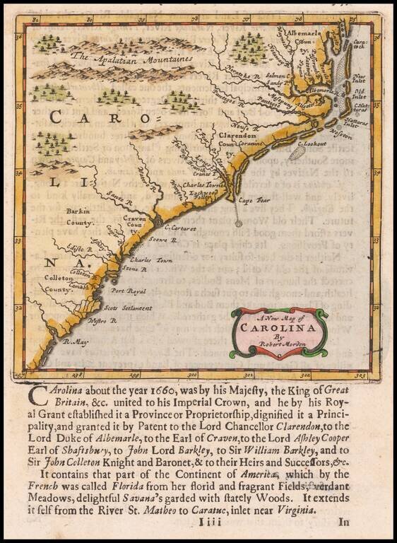
Nice example of Morden's map of the Carolinas, one of the earliest obtainable English maps of the Carolinas. Beginning in the 1670s, the English fortunes in North America took a dramatic turn upward, resulting in a booming interest in the British...
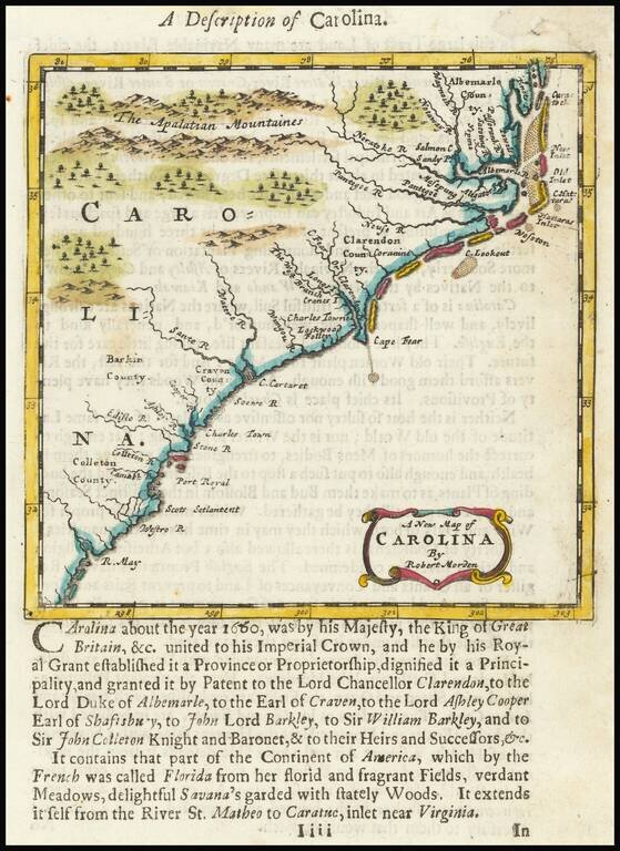
Nice example of Morden's map of the Carolinas, one of the earliest obtainable English maps of the Carolinas. Beginning in the 1670s, the English fortunes in North America took a dramatic turn upward, resulting in a booming interest in the British...
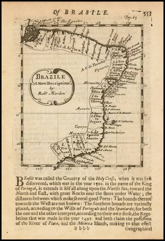
Rare early English map of Brazil, showing remarkable coastal details. The map first appeared in Morden's Atlas Terrestris and is one of the earliest obtainable maps of Brazil published in England.
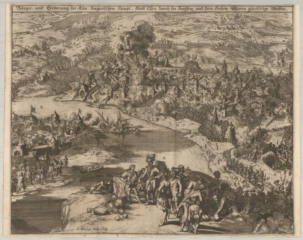
J.C. Haffner's View of the 1686 Siege of Budapest. Finely engraved view of the 1686 Siege of Budapest, engraved by Johann Christoph Haffner in Augsburg in 1687. The view depicts the battle between the Ottoman Turks and the Holy League for control...
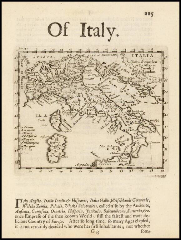
Rare early English map of Italy, in excellent detail, published by Robert Morden. This map first appeared in Modern's rare Atlas Terestris, first published in 1687.
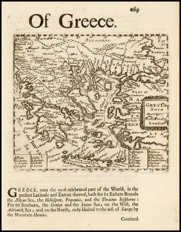
Rare English map of Greece and contiguous islands in the Aegean and Ionian Seas. This map first appeared in Modern's rare Atlas Terestris, first published in 1687.
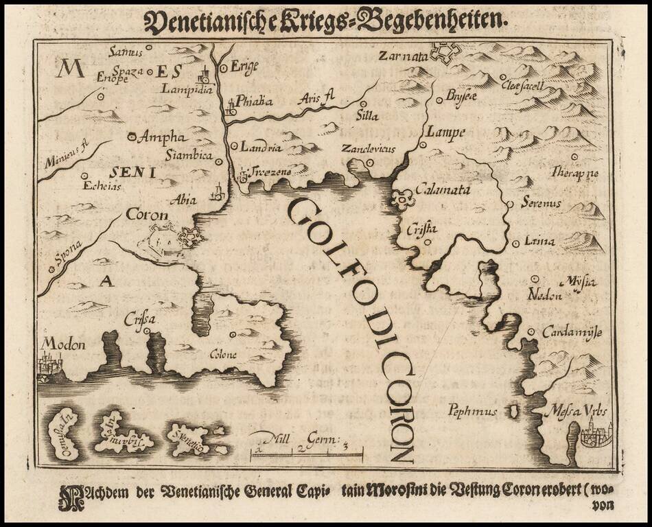
Morosini's Sacking of Koroni in 1685 Scarce map of the coastal region near Kalamata, extending from Methoni and Koroni to Kardamyli and Stoupa. The map illustrates an expedition of Captain General Francesco Morosini against the Ottoman Turks....
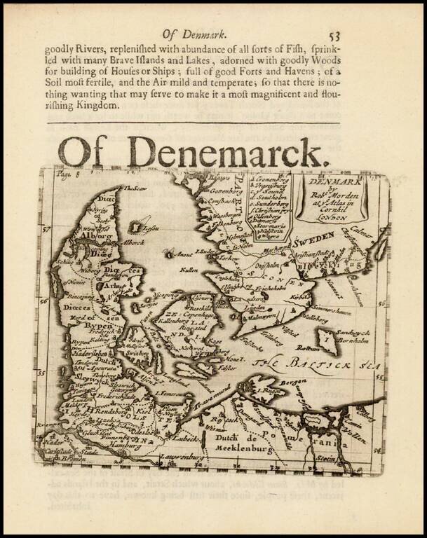
Rare early English map of Denmark and contiguous parts of the Baltic and Sweden. This map appeared in Modern's rare Atlas Terestris, first published in 1687.
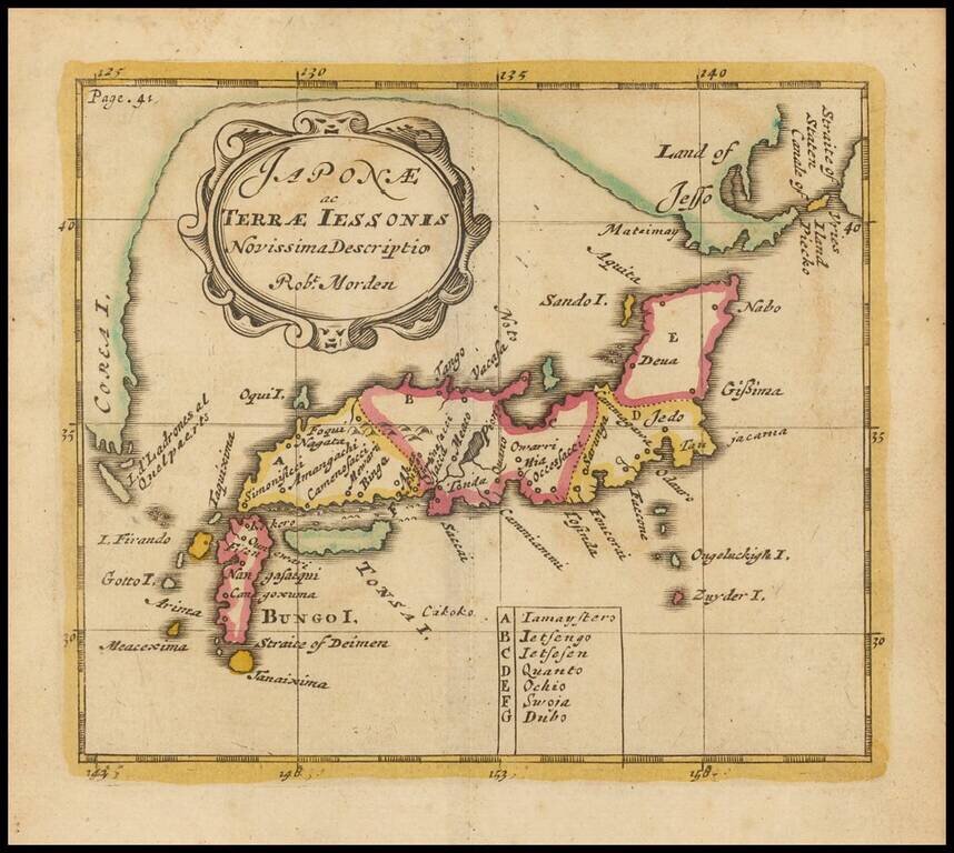
Rare early map of Japan and Korea, which includes some fascinating mythical information. Hokkaido is shown as being connected to Korea. Nice example of this scarce map.
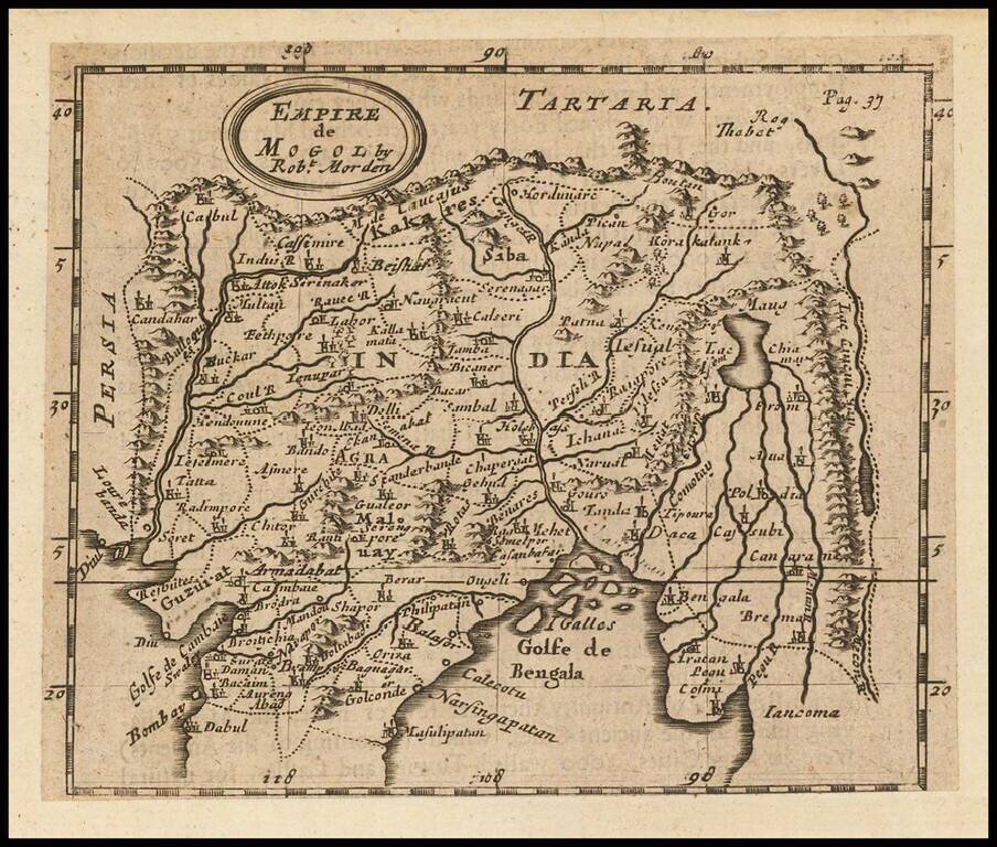
Rare English map, extending from the Gulf of Bengal to the Mecon River. Includes Cabul and Napal in the North and Bombay in the Southwest. One of the earliest obtainable English maps of the region.
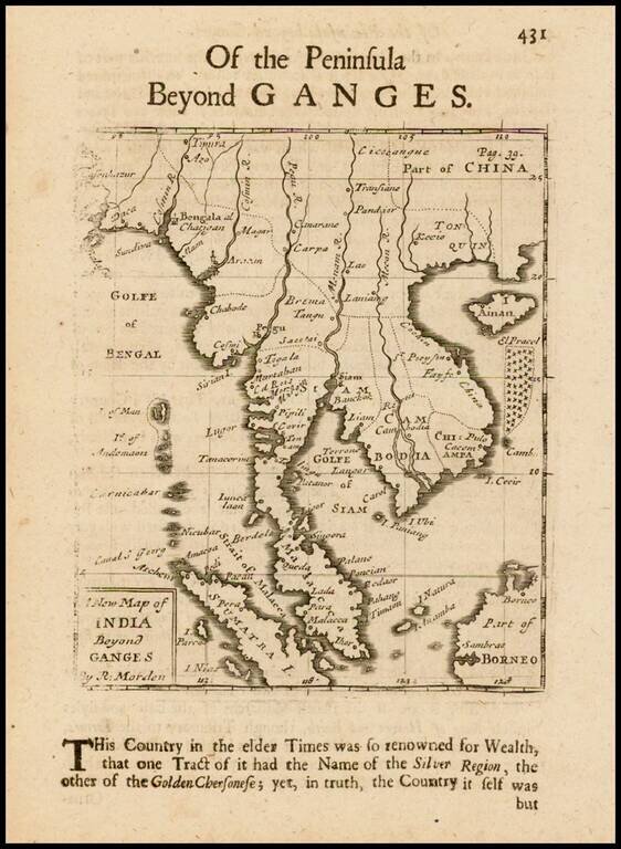
Rare English map of the Malay Peninsula, Cambodia, Vietnam, Thailand, part of China, Borneo, Sumatra and the Gulf of Bengal. One of the earliest obtainable English maps of the region.

Rare early English map of Malacca, Sumatra, Java, Borneo and the tip of Cambodia. One of the earliest obtainable English maps of the region. Centered on Singapore. A fascinating early English map of the region. This map first appeared in Modern's...
![The Molucca Ilands &c. [shows part of Australia]](/map/small/37298.jpg)
Rare early English map of the islands from the Celebes and Nova Guinea to the North Coast of Australia and Timor. A fascinating early English map of the region. This map first appeared in Modern's rare Atlas Terestris, first published in 1687.
![The Turkish Empire in Asia [shows Cyprus]](/map/small/37050.jpg)
Rare early English map of the Turkish Empire in Asia, along with Cyprus and extending to the Caspian Sea and the Tigris and Eurphrates Rivers. This first map appeared in Modern's rare Atlas Terestris, first published in 1687.