Map size in jpg-format: 434130B
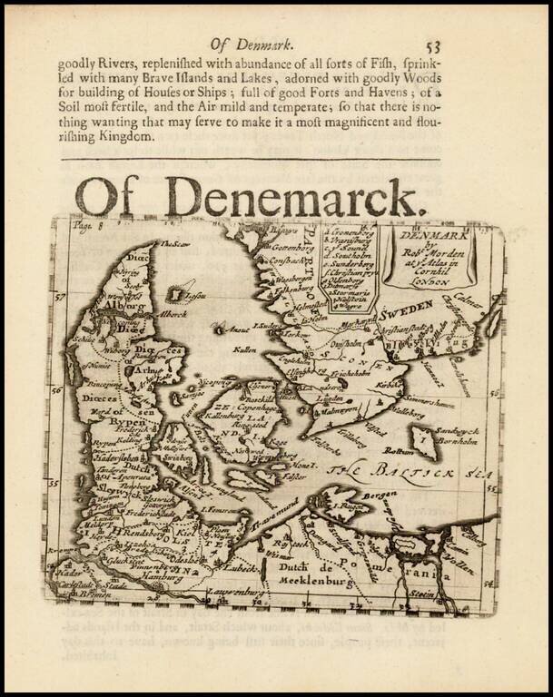
Rare early English map of Denmark and contiguous parts of the Baltic and Sweden.
This map appeared in Modern's rare Atlas Terestris, first published in 1687.
Robert Morden (d. 1703) was a British map and globe maker. Little is known about his early life, although he was most likely apprenticed to Joseph Moxon. By 1671, Morden was working from the sign of the Atlas on Cornhill, the same address out of which Moxon had previously worked. Most famous for his English county maps, his geography texts, and his wall maps, Modern entered into many partnerships during his career, usually to finance larger publishing projects.
If you are a student, write to us in telegram: @antiquemaps and indicate what material you need and for what work you need a map in high detail. We are ready to provide material on special terms. For students only!