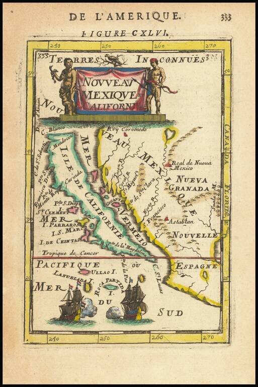
Fine, Distinct Map of the Island of California Striking and exciting map of California as an island, one of the few maps to focus closely on the California region exclusively. First published in Paris in 1683, Mallet’s map is notable because it...
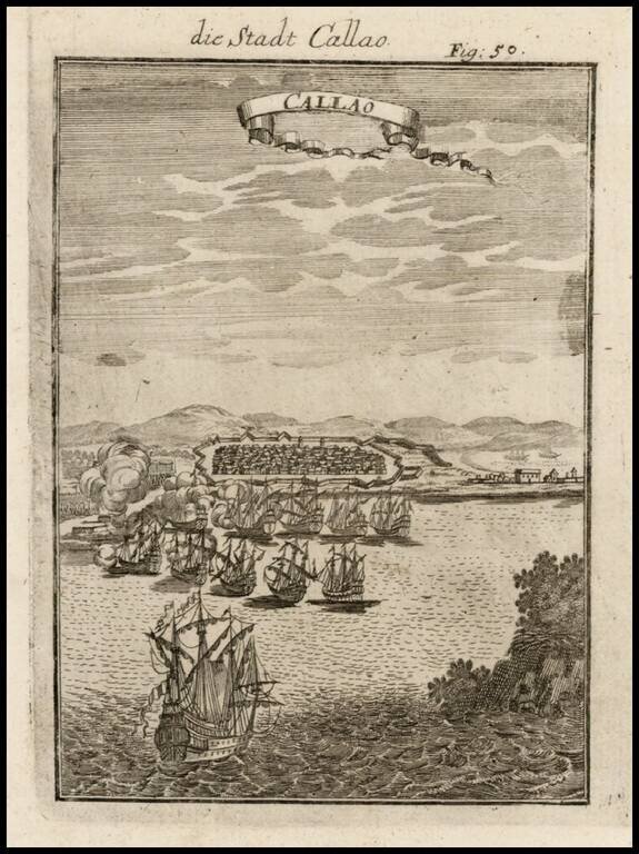
Excellen birdseye view of this Peruvian city from the harbor, featuring sailing ships and fortifications. Mallet's multi-volume work is one of the most famous and comprehensive illustrated works of the 17th Century, which is prized for its excellent...
![(London) Ch.de Withal [Whitehall]](/map/small/16809.jpg)
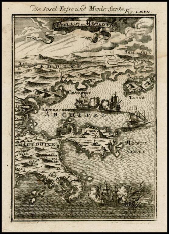
Decorative map of the Macedonian Coastline and contiguous islands, from Mallet's Description de L'Univers, first published in Paris in 1683.

Detailed map of the Balkans, etc, from Mallet's Description de l'Univers.
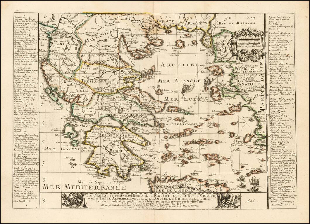
Rare map of the Greek Islands by Pierre Du Val, published in Paris. Du Val's map focuses on the Aegean and the various trade routes through the region and beyond, tracking the routes of ancient and modern Mariners from the Dardenelles, Gallipoli and...

Decorative map of the Greek Islands of Pelagnisi, Saraquino, Prosonissi, Lidrome, Scoglieto, Dromo and contiguous islands, from Mallet's Description de L'Univers, first published in Paris in 1683.
![Asia Minoris Iacobi Cantelli Vineolensis . . . 1686 [Shows Cyprus]](/map/small/37656.jpg)
Rare map of Asia Minor and Cyprus and neighboring regions by Cantelli da Vignola. The map provides a fine depiction of the region. Engraved by Francesco Donia Messis.
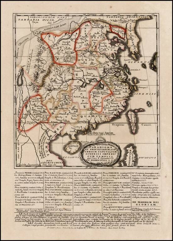
First edition of this rare Jesuit map of China, published by Jean Baptiste Nolin in Paris. The map first appeared in 1686 in the present form, then was reissued without the text at the bottom of the map in Philippe Couplet's Tabula Chronologica...
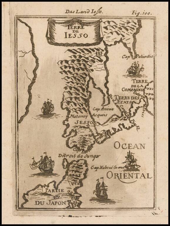
Decorative miniature map of the Land of Eso (Hokkaido) and the north part of Japan, from the first German edition of Mallet's monumental work. Includes sailing ships.
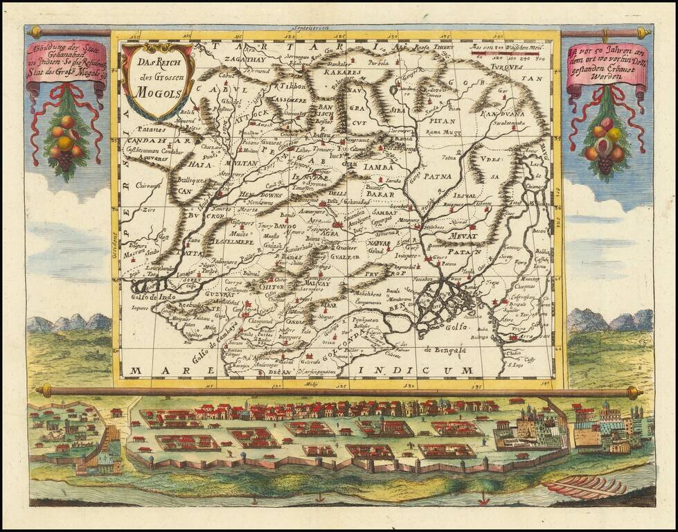
An impressive map of northern India and the surrounding region. The map is superimposed on a scene showing a small city, with a river through the foreground and mountains in the background. Text hangs from the map containing a brief description of the...
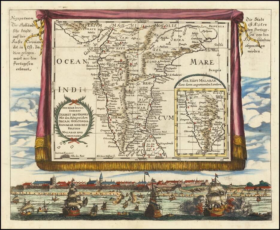
An attractive and rare antique map of southern India, super-imposed on a trompe l'oeil tapestry over a view of Negapatnam (Nagapattinam). The image also includes an inset map of the Malabar coast. The map alludes to the fact that Nageptnam had been a...
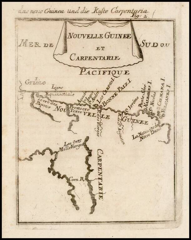
Beautifully engraved hand colored antique map of Cape York Peninsula, the Gulf of Carpenteria and New Guinea. The area is depicted before the Torres Strait was charted. The map was published as part of the 1686 German edition of Alain Manesson Mallet's...
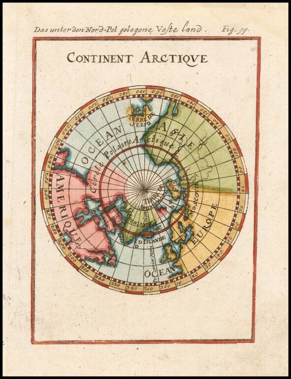
Interesting map of the South Polar Regions, including mythical coastlines and the known coastal regions in New Zealand, Australia, South America and Africa. From Mallet's monumental work.