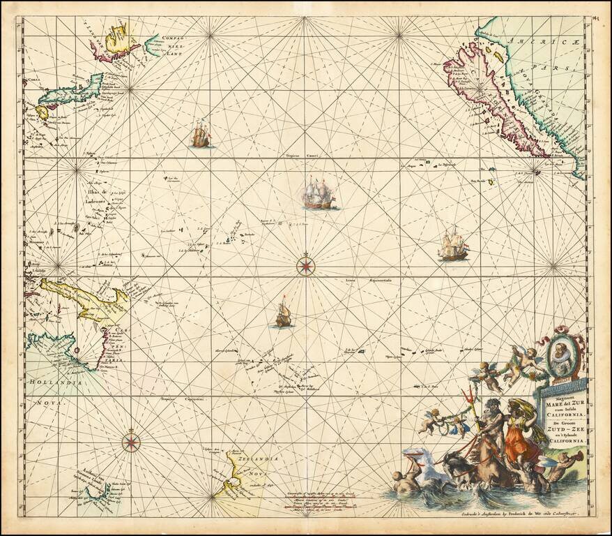
Fine old colored example of first state of De Wit's map of the Pacific Ocean, featuring California as an Island and important early projections of Australia and New Zealand. The finely engraved sea chart was first published in De Wit's Orbis Maritimus...

Rare early allegorical print, published in London. The view has been attributed to Wencaslaus Hollar. A cedar tree representing the traditional episcopal church, inscribed on the trunk 'The Church Catholick', with two smaller shoots from the trunk...
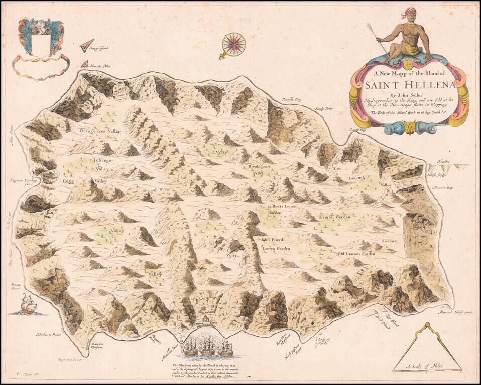
An English Rarity Rare separately published map of the Island of St. Helena, published by John Seller in London. This is the first map of St. Helena to be published in English and initially appeared in Seller's Atlas Maritimus . . . in 1675. The...
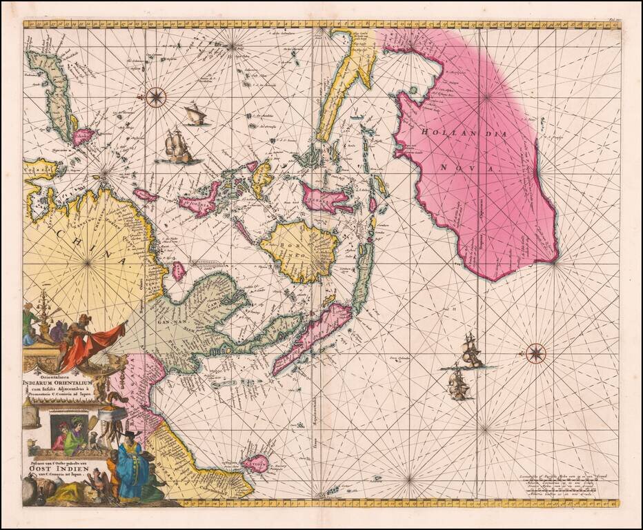
An Important Early Dutch Sea-Chart of Australia, the East Indies and Eastern Part of the Indian Ocean. Stunning original color example of De Wit's map of Australia, Southeast Asia, the Philippines, etc., first issued in 1675. The chart is...
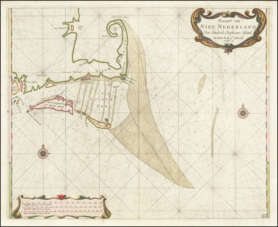
From The English Edition of Roggeveen's American Sea Atlas Nice example of Arent Roggeveen's sea chart of Cape Cod, Martha's Vineyard and Nantucket, etc., offered here in the rare Jacob Robyn edition. The chart is the first detailed mapping of the...
![[Gulf Coast & West Coast of Florida] De Cust van Westindien Van La Desconoscida, tot C. Escondido. . .](/map/small/65741.jpg)
The First Dutch Chart of the Gulf Coast - Texas - West Coast of Florida Roggeveen's chart of the Gulf Coast, etc. is the first sea chart to focus on the region and one of great importance, showing for the first time on a printed Sea Chart the entire...
![[Panama - Silver Trade - Pirates] De Cust van Westindien, Tusschen Punta St. Blaes, en Punta d Naes. . .](/map/small/63779.jpg)
Spanish Silver and Pirates Extremely rare early sea chart by Arent Roggeveen, showing the Panamanian Coastline, between Bahia St. Blaes and and Punta de Naes, centered on Nombre de Dios and Porta Bella. Oriented with south at the top, the map shows...
![[Includes Havana Harbor] Paskaert vande Noord Cust van Cuba Streckende van Bahia de Matancas to Bahia Honda. Beschreven door Roggeveen . . .](/map/small/63760.jpg)
Rare English Edition - North Coast of Cuba Jacob Robyn's edition of this early chart of the north coast of Cuba, first published by Arent Roggeveen, from his Het Brandende Veen, oriented with south at the top of the map. The chart oriented with...
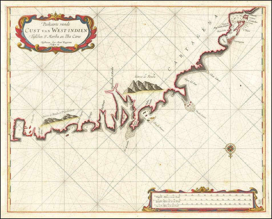
The First Detailed Sea Chart of the Eastern Colombian Coastline Extremely rare early sea chart by Arent Roggeveen, showing the coast of Colombia from Santa Marta to Cartagena, centered on Baranquilla. The chart is oriented with south at the top....
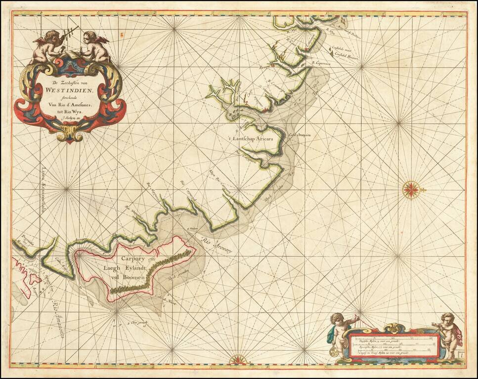
Rare English Edition of the First Sea Chart of the Mouth of the Amazon River and northern coast of Brazil. Important early sea chart of the coast of Northern Brazil, from the mouth of Rio Grande River in the south. The map is oriented with west at...
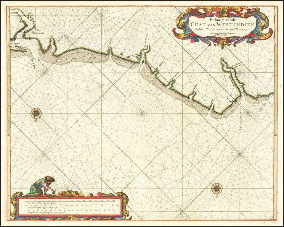
The First Detailed Sea Chart of the Coastline of Surinam Extremely rare early sea chart by Arent Roggeveen, showing the coast Surinam. The chart is oriented with south at the top. Roggeveen's chart is the first detailed sea chart of this region....
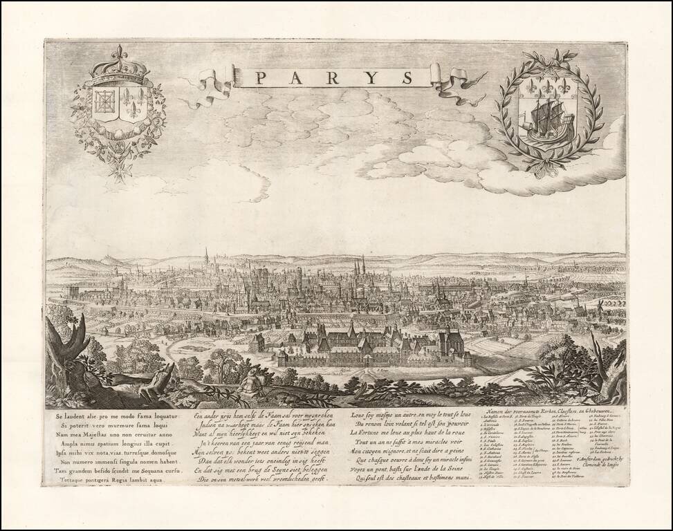
Rare separately published view of Paris by Clement De Jonge. With poem on the beauty of the town in Latin, Dutch and French by A. Montanus. With legend of main churches, monasteries and buildings. Includes the coats of arms of the City of Paris and...
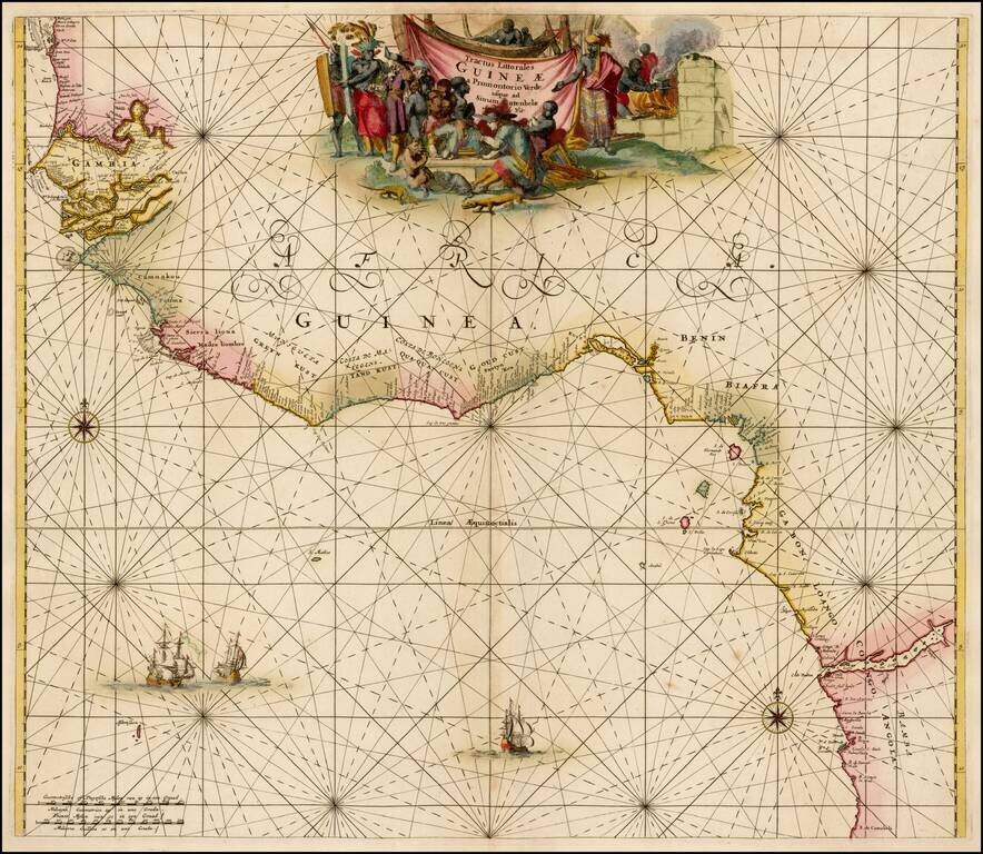
Striking old color example of the first edition of De Wit's sea chart of West Africa, from his Orbis Maritimus ofte Zee Atlas. The map extends from Senegal in the north to Angola in the south, centered on the Bay of Guinea. There is a wealth of...