Map size in jpg-format: 36.4831MiB
Click to open in high resolution (open in new tab).
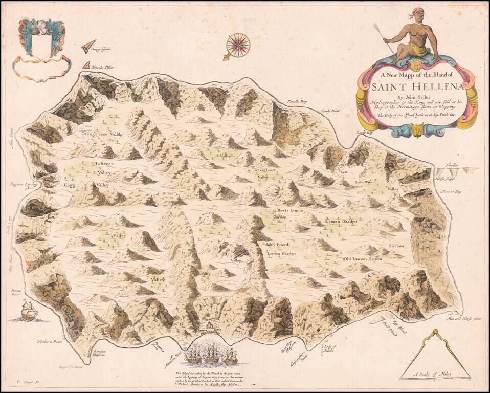
An English Rarity
Rare separately published map of the Island of St. Helena, published by John Seller in London.
This is the first map of St. Helena to be published in English and initially appeared in Seller's Atlas Maritimus . . . in 1675. The map was engraved by John Oliver (Io. Oliver fe). The text in the title cartouche states that "The Body of this Island lyeth in 16 deg. South lat."
Seller's map is the earliest printed map of St. Helena to provide evidence of some of the earliest manmade structures to appear on the island. From early on in the English occupation, attempts were made to fortify the island against attack. The map illustrates the first permanent defenses built in Jamestown in 1660 and along with Banckes Platford, Bearkleys Platforme and Munden's Point.
As noted on the map, the Dutch successfully took the island in 1672, followed by a British retaking of the island, under the command of Sr. Richard Munden in the HMS Assistance in 1673.
Copies of Seller's atlases typically were made to individual order and the contents consequently vary widely between copies. In fact, later editions of the Atlas Maritimus have a smaller plate of Seller's St. Helena map, a 1682 edition having a plate titled The Island of Saint Hellena by Iohn Seller (plate 14, 145 × 110 mm).
In about 1703, the map was completely re-engraved by Samuel Thornton, an inset map of Trinidad is added and the title and title cartouche are substantially altered. The large coat of arms in the top left corner was also removed by Thornton. The topographical details and style in the interior are also significantly different.
Rarity
Seller's map is very rare on the market. We note only a single copy at auction (Sothebys) and no examples in dealers catalogs in the past 30 years.
If you are a student, write to us in telegram: @antiquemaps and indicate what material you need and for what work you need a map in high detail. We are ready to provide material on special terms. For students only!


