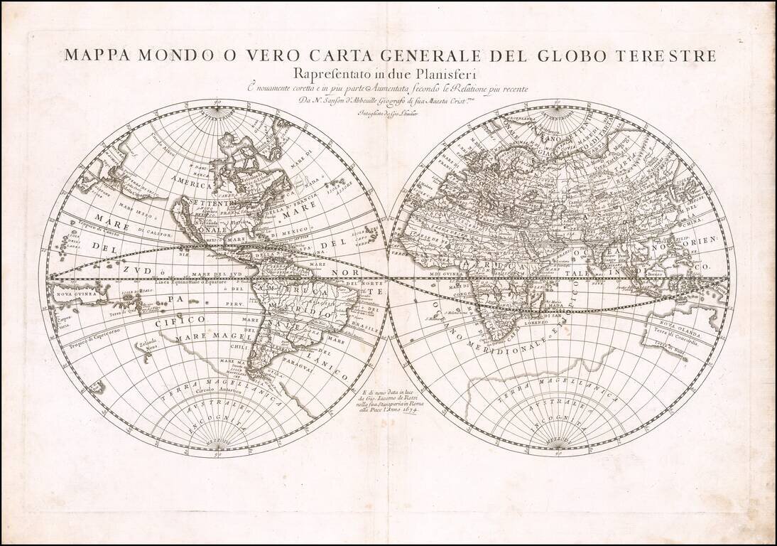
First state of Rossi's double hemisphere map of the world, based upon the work of Nicolas Sanson, the single most important French mapmaker of the 17th Century. His modernistic approach to cartography would redefine commercial cartography over the next...
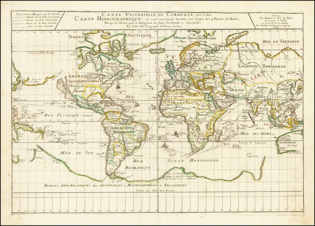
Illustrating the Major Commercial Sea Routes of the 17th Century First state of Pierre Du Val's scarce 17th Century map of the World, illustrating the most important world trade routes during the middle of the 17th Century. Du Val's map is...
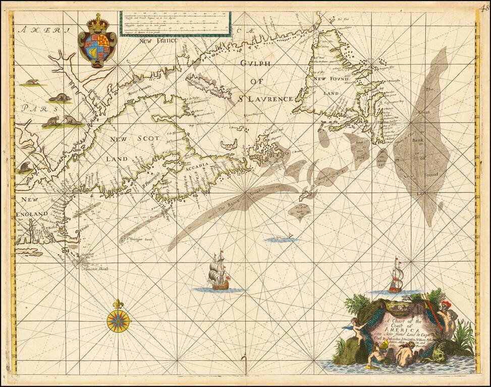
"The first sea chart of [New England and] the Maritimes published in England." - Burden II (#444) Rare English sea chart of the coast of North America from Long Island in the south to Newfoundland in the north, published at about the same time of the...
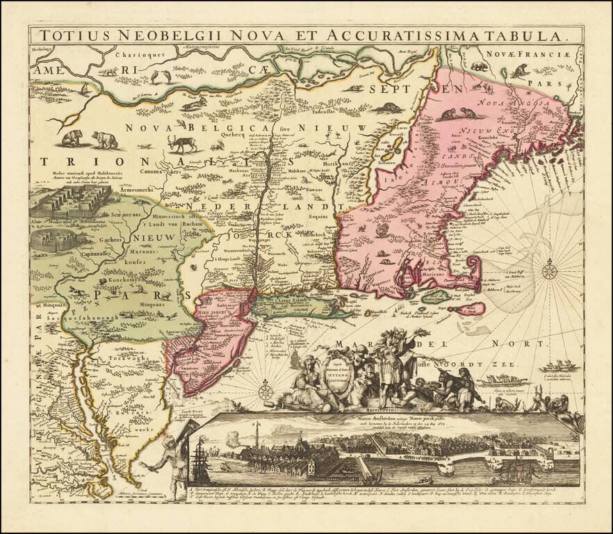
Striking example of Reiner & Josua Ottens edition of Hugo Allard's rare map of New England and the Northeastern United States, including the so-called "Resitutio View" of Manhattan. Ottens map faithfully follows the cartographic details of the...
![[Battle of Seneffe] Beschreibung der Schlact so den i. ii. Augusti 1674 zwischen den Kayerlichen Spaniern und Hollanddern bey Seness mid den Frantzosen gehalten worden](/map/small/59028.jpg)
The Battle of Seneffe Broadside With An Extensive Account Rare separately published broadside illustrating the Spanish, Dutch and French troops on the battlefield in Hainaut, August 11, 1674, with a lengthy account of the battle in German pasted to...
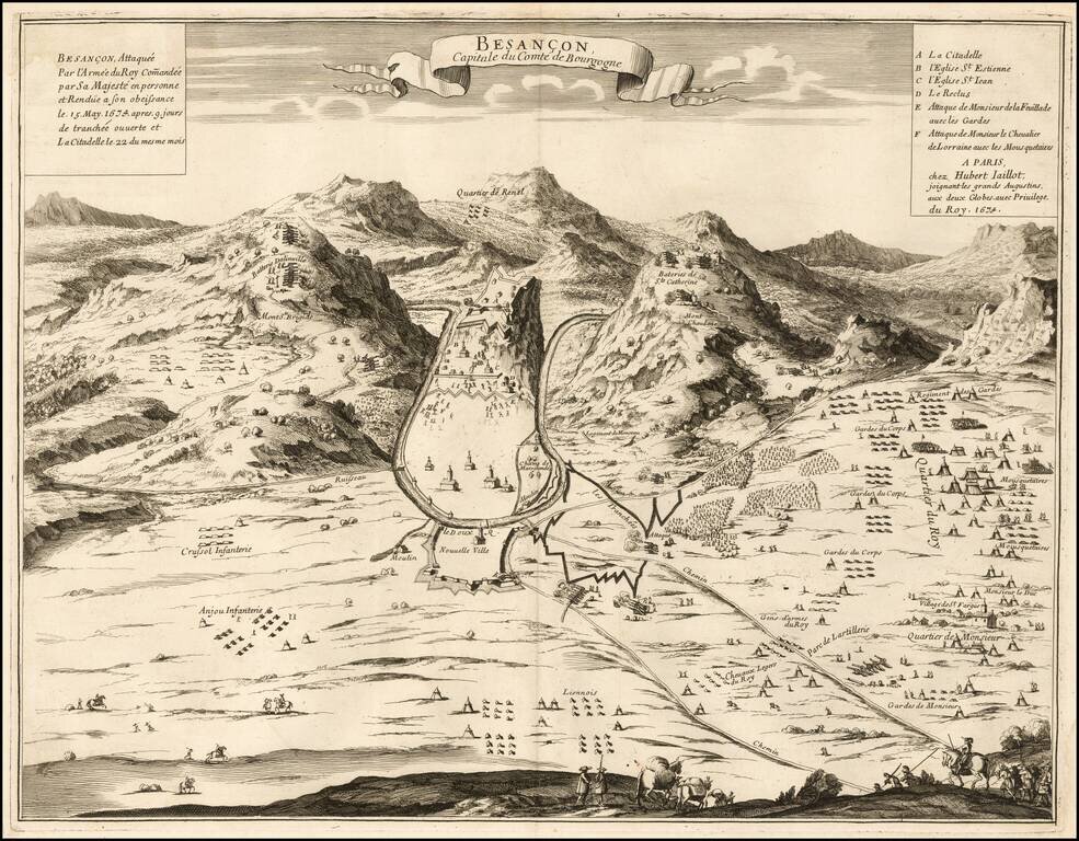
Rare separately published view of Bensancon, issued by Hubert Jaillot in Paris. The second title is: Besançon, Attaquée par l'Armée du Roy Com[m]andée par Sa Majesté en personne et Rendue à son obeissance le 15 May 1674 après 9 jours de...