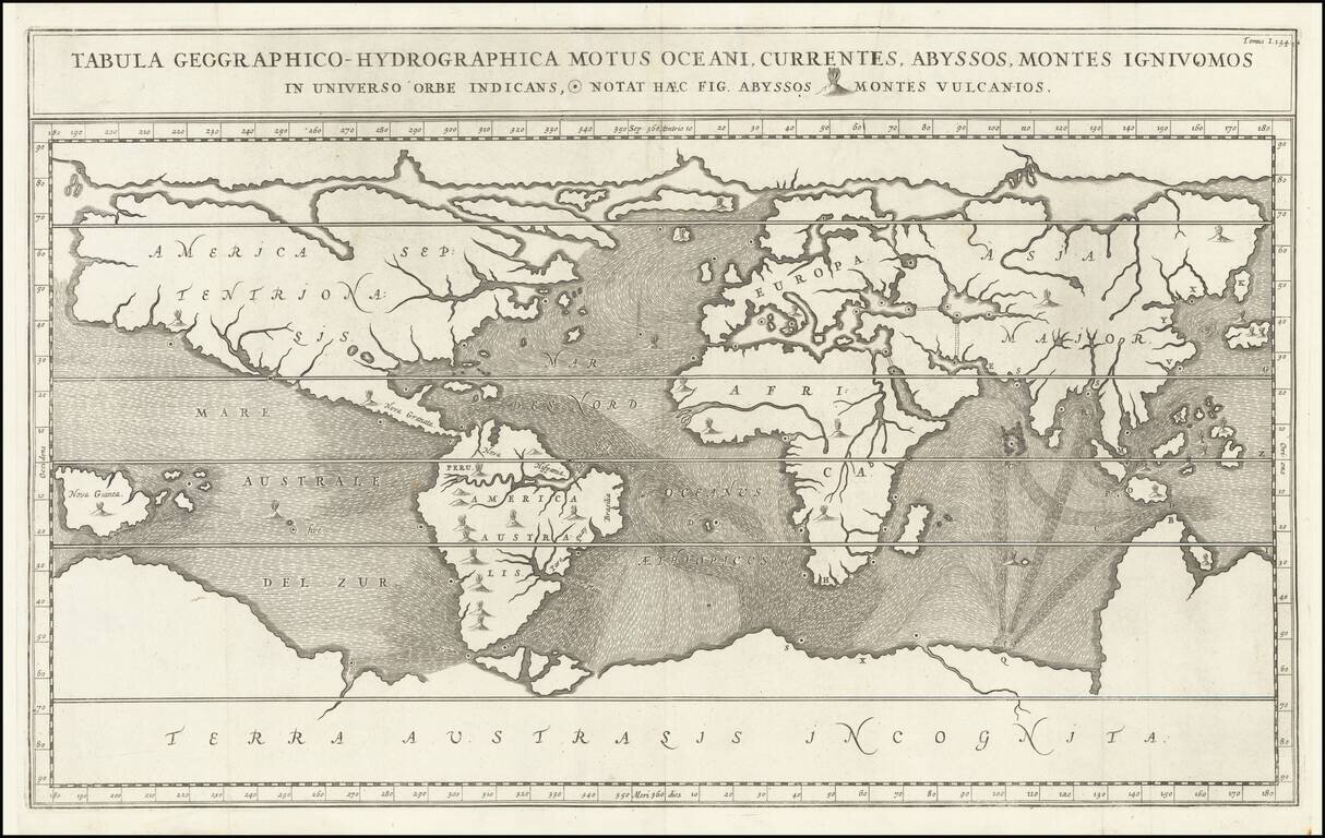
Fascinating World Map Showing Entrances to a Subterranean Realm Striking seventeenth-century map of the world, prepared to illustrate Athanasius Kircher's fascinating work on the underground passages and subterranean networks of the globe....
![De Zee Custen van Ruslant, Laplant, Finmarcken, Spitsbergen en Nova Zemla [Heightened in Gold]](/map/small/54892.jpg)
Detailed sea chart of the coasts of Russia, Finland, and Spitsbegen in old color. Includes an inset map of "De Reviere Dwina opte Reviere van Archangel". The chart includes a detailed plan of the coastlines, soundings, anchorages, coastal details,...
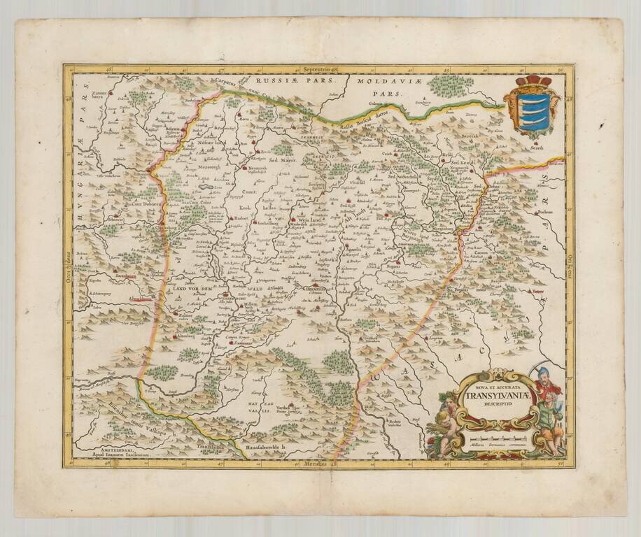
Finely executed map of Transylvania, published in 1665 for Jansson's Atlas Maior. One of the earliest separately published maps of Transylvania.

Map illustrating the route between Belgrade and Ragusa taken by Sieur Quiclet during his travels to and from Constantinople in 1657 and 1658. The map shows the itinerary described by Quiclet between Belgrade and Ragusa on the Adriatic, by way of Bsona...
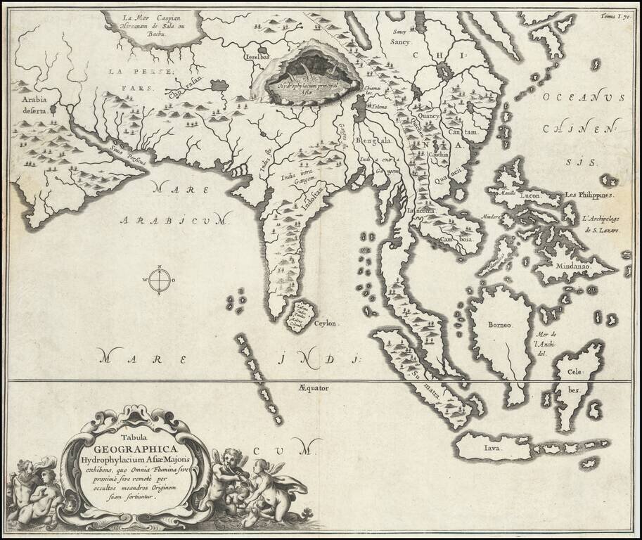
Fine, Distinctive Map of Asia by Polymath Athanasius Kircher Fascinating map of Asia, illustrating the theories of the Jesuit scholar Athanasius Kircher, from his Mundus Subterraneus. It was one of the earliest thematic maps. This very unusual map...
![Reys-Kaerte Vande Ambassade Der Nederlantse Oost Indise Compagnie door China aen den Grooten Tartersen Cham der Johan Nieuhoff . . . [title repeated in French, Latin & German]](/map/small/58896.jpg)
An Early Dutch Map of China From VOC Sources Important early map of China, which accompanied Johann Nieuhoff's important account of his travels in China, one of the earliest non-Jesuit accounts of the region. Johann Nieuhoff was the official...
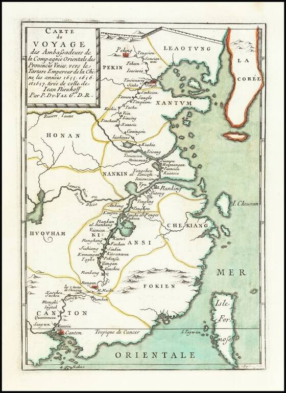
Scarce map of China, extending from Beijing, Korea and the Great Wall of China in the north to Canton, Macao and Formosa. The map illustrates the Dutch expedition to China led by Johan Nieuhof in 1655-57. In the first half of the 17th century, the...
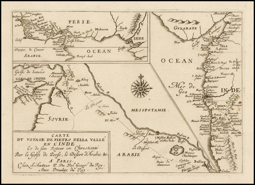
Rare Pierre Du Val antique engraved map featuring three small maps related to the travels of Italian writer Pietro della Valle's travel through the Middle East to the western coast of India in the early 17th century. Dell Valle's route is shown going...
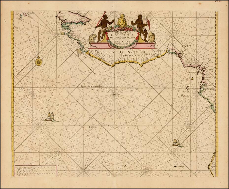
Finely colored example of Doncker's sea chart of West Africa, which appeared in his De Zee-Atlas of Water-Waerelt, published in Amsterdam, circa 1665. The map extends from the Cape Verde Islands, Dakar and the area just north of the Gambia River in...

Cassini's Mapping of the Comet of 1664-65 Finely engraved image of the comet which passed through the European skies between December 1664 and January 1665, which appeared Giovanni Domenico Cassini's rare Theoria Motus Cometae Anni MDCLXIV . . ....
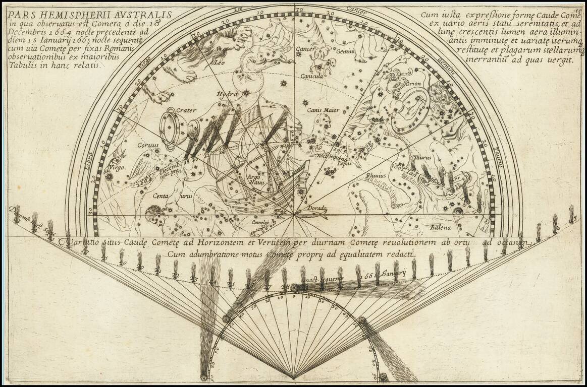
Cassini's Mapping of the Comet of 1664-65 Finely engraved image of the comet which passed through the European skies between December 18, 1664 and January 15, 1665, which appeared Giovanni Domenico Cassini's rare Theoria Motus Cometae Anni MDCLXIV . ....