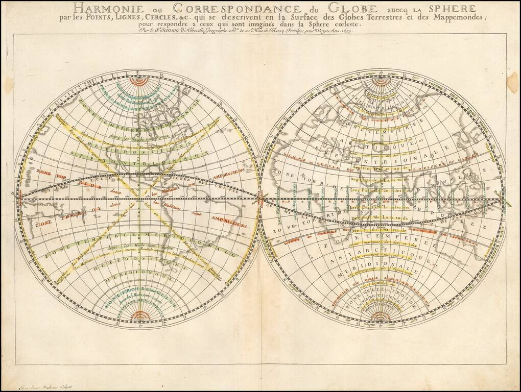
Nicolas Sanson's 1659 double-page engraved map of the world, featuring particular emphasis on latitudes, zones (e.g., "Zone Toride"), and meridians. While the main focus of the map is not detailed topography or toponyms, it includes some noteworthy...
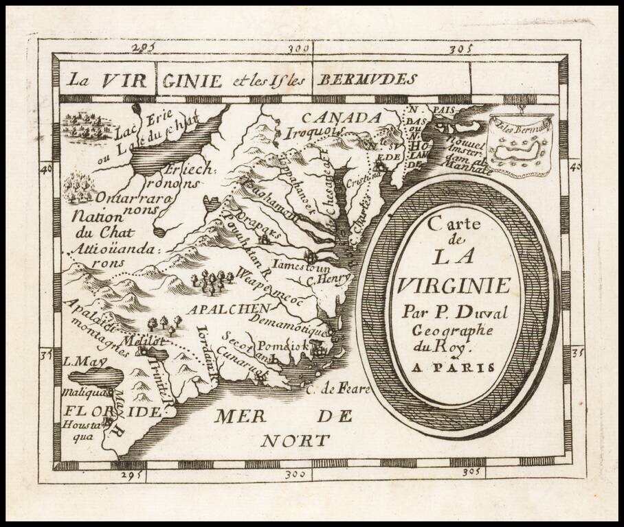
Early regional map from Duval's Le Monde Terrestre, first published in 1659, although no copy located pre-dates 1660. Includes an early depiction of the Chesapeake region, the mythical Lake May above Floride, Jamestown, Cape Henry, Secot, Pomeiok, an...
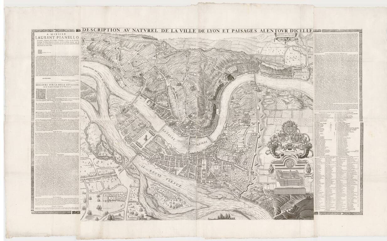
Remarkable large format plan of Lyon, first published in 1659 by Simon Maupin. The first edition of the map included a different coat of arms, which was modified in 1694. The present example has been reissued following the death of Louis XIV, in order...
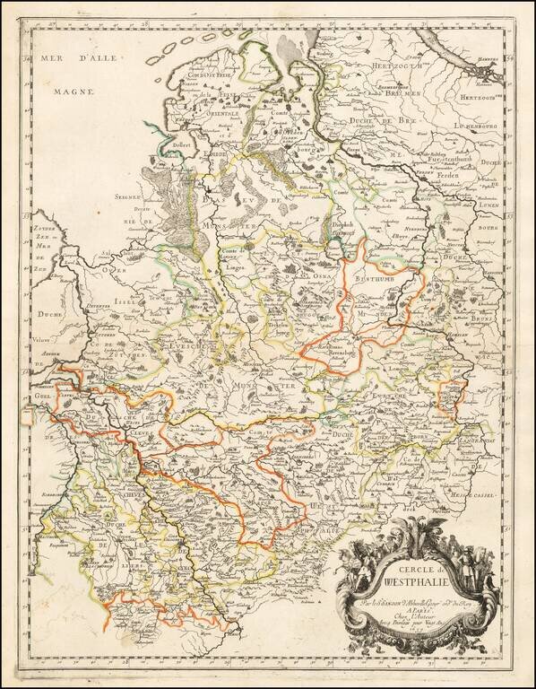
Nicolas Sanson's engraved map of the Circle of Westphalia, in present-day Germany. The map was published in Paris in 1659.
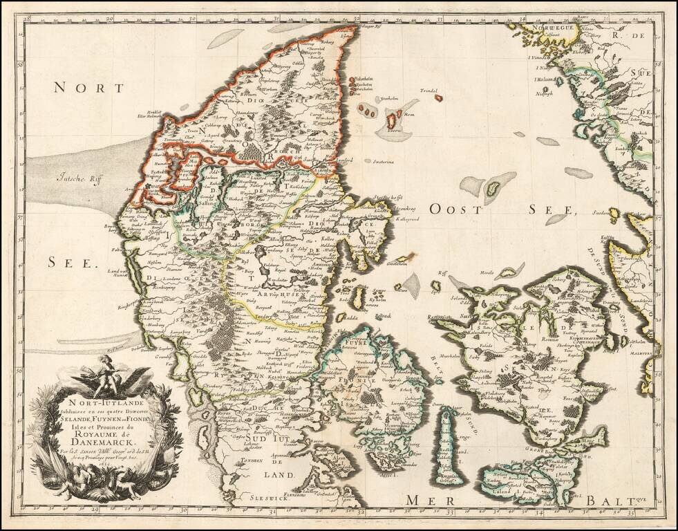
Sanson's 1659 double-page engraved map of Denmark. The map includes a very elaborate cartouche in the lower left corner and is in old outline hand color. Nicolas Sanson (1600-1667) sometimes called Nicolas Sanson d'Abbeville or Sanson d'Abbeville, was...
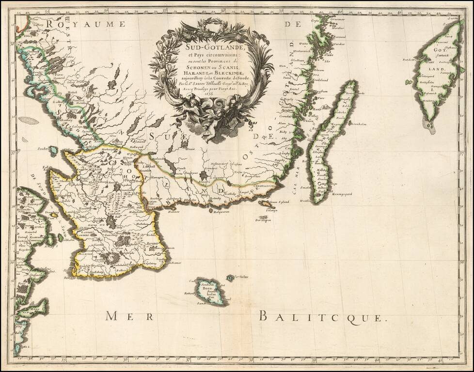
Very nice example of Sanson's 1659 double-page engraved map of southern Sweden. Nicolas Sanson (1600-1667) sometimes called Nicolas Sanson d'Abbeville or Sanson d'Abbeville, was the most important French cartographer of the 17th century. Tooley called...
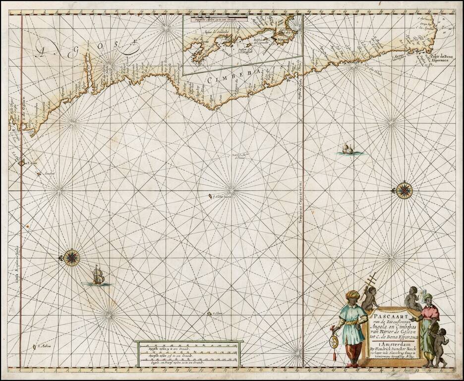
Early edition of Doncker's sea chart of the West Coast of Africa, from Angola to the Cape of Good Hope, with a larger inset map of the area from St. Martin's Bay to the Cape of Good Hope. Hendrik Doncker was a famous bookseller in Amsterdam, who...