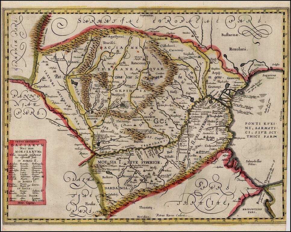
Extremely rare proof state of Jan Jansson's map of Romania, pre-dating the addition of the putti and decorations around the title box. The proof state is known in only a few examples and was mentioned by Peter Van der Krogt in the new edition of...
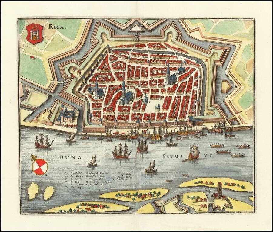
Striking view of the town and harbor of Riga, including a coat of arms. Matthaus Merian (1593-1650) was a Swiss engraver and one of the most prolific engraver's of town views in the 17th Century. Merian learned the art of copperplate engraving in...
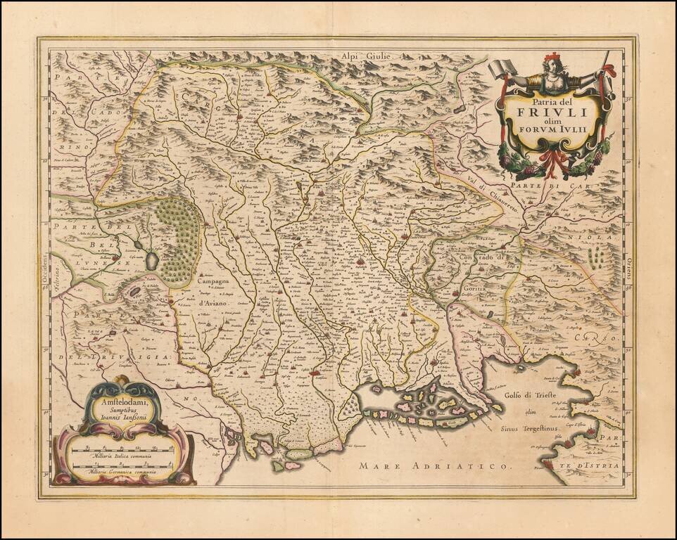
Nice old color example of Jansson's maps of Friuli and the Gulf of Trieste. Includes a decorative cartouche and sailing ships.
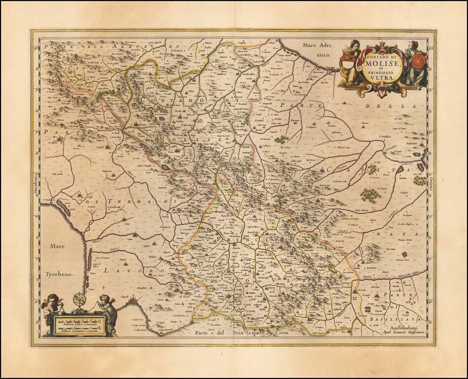
Decorative regional map of Italy, engraved by Jan Jansson. Larger cities include Benevento, Ariano, Avellino, Conza, Troia and Lucera. Napoli appears at the far southwest corner of the map.
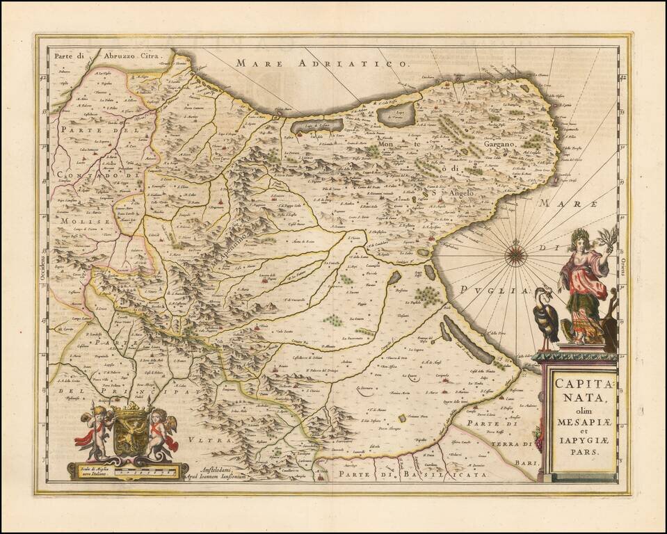
A nice example of Jan Janssonius's circa 1650 double-page engraved map of the Province of Foggia, Italy. Johannes Janssonius Johannes Janssonius (1588, Arnhem - buried July 11, 1664, Amsterdam) (born Jan Janszoon, often called Jan Jansson) was a...
![[Venice] Venetia](/map/small/42498.jpg)
Late example of Stefano Scolari's map of Venice, first published in 1597. The map is based upon the Bernardo Salvioni (1597) plan of Venice. This gorgeous bird's-eye view of Venice gives a taste of how this city existed during the seventeenth century....

Rare map of Catalonia, published in Paris by Pierre Mariette. The map is finely engraved, illustrating topographical features, towns, islands, etc. Includes a decorative coat of arms.
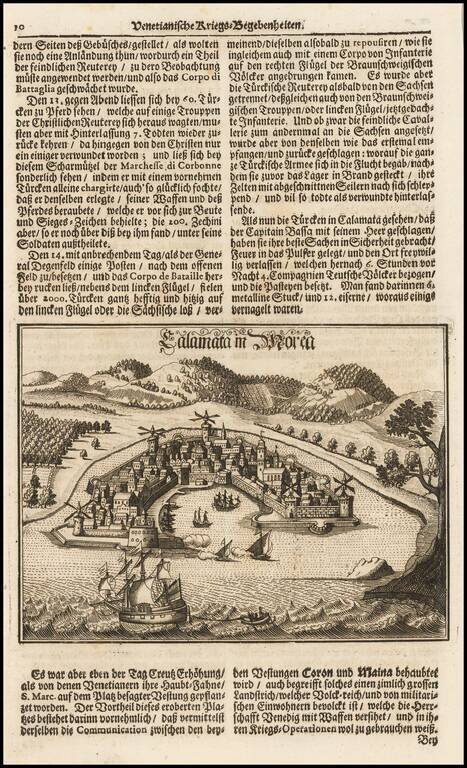
Fine view of the town and harbor of Kalmata, shown during the Venetian Wars.
![Les Estats de L'Empire des Turqs en Asie . . . . [Includes Cyprus]](/map/small/50415.jpg)
Nicolas Sanson's circa 1650 double-page engraved map of the Ottoman Empire. The map provides a detailed look at the Turkish Empire in the middle of the 17th Century, extending to cover the Eastern Mediterranean and the western part of the Persian...
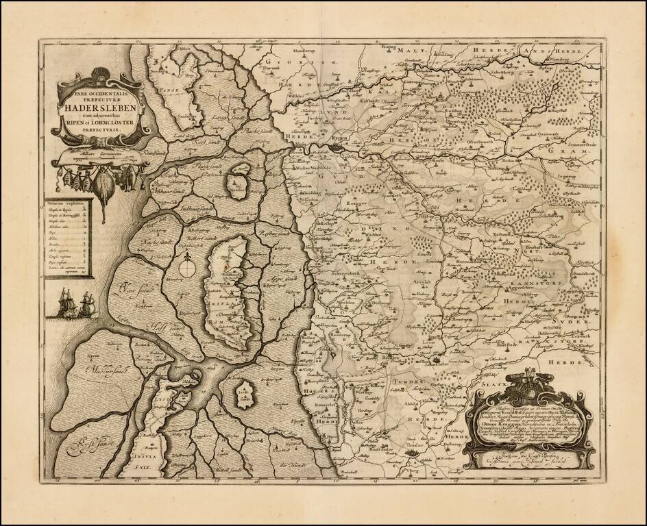
Detailed map of western Denmark, extending from Fano Island in the north, to Sylt Island in the south, showing what was then the western part of the Prefecture of Haderslev. The map includes an elaborate dedication cartouche.
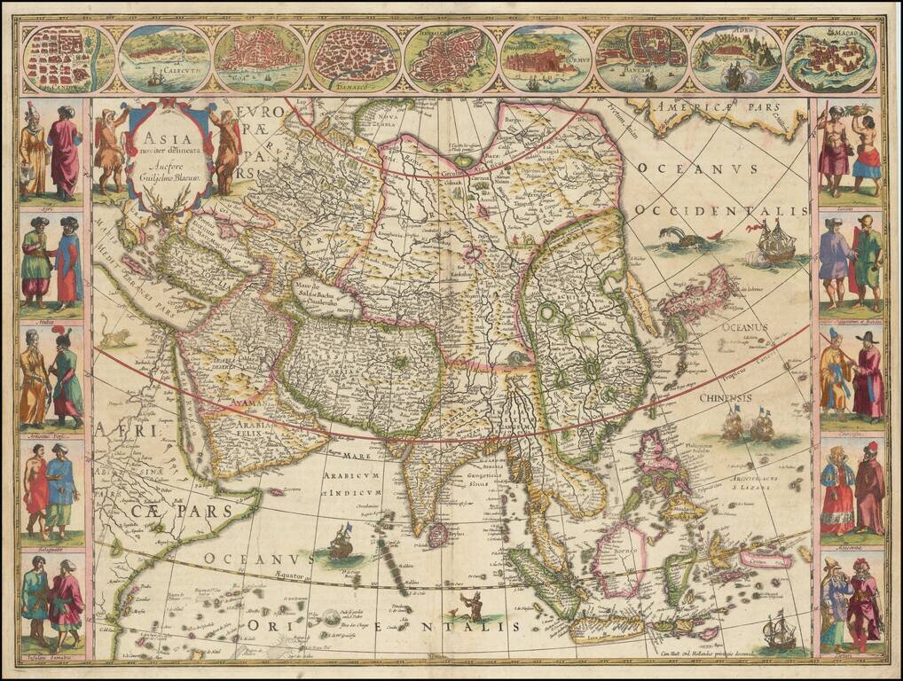
Blaeu’s Iconic Map of the Continent of Asia with Decorative Vignettes Fine example of Blaeu's highly-stylized map of the continent of Asia, one of the most recognizable representations of the continent from the seventeenth century. The map is framed...
![[Sri Lanka] Insula Zeilan olim Taprobana nunc incolis Tenarisim](/map/small/59295.jpg)
Decorative map of Sri Lanka, published in the later editions of Jansson's atlas. A striking image, with a decorative title cartouche and scale of miles held aloft by mer-cherubs.
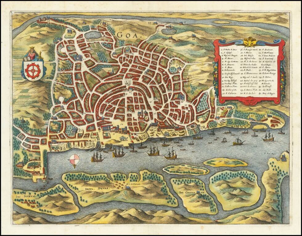
A detailed birdseye view plan of Goa, showing the various streets and buildings of the city, the city's riverine harbor, and the fields surrounding the city. Several decorative features are added. The view includes a key naming forty-three points of...
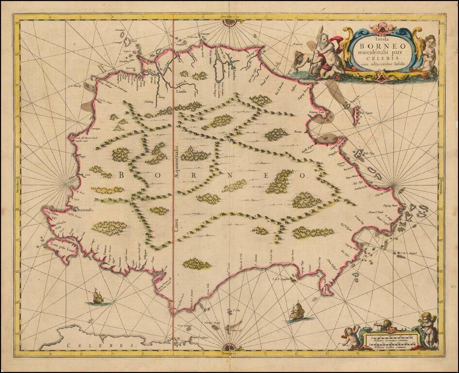
Nice example of Jansson's chart of Borneo, the earliest large format map to focus on the Island.
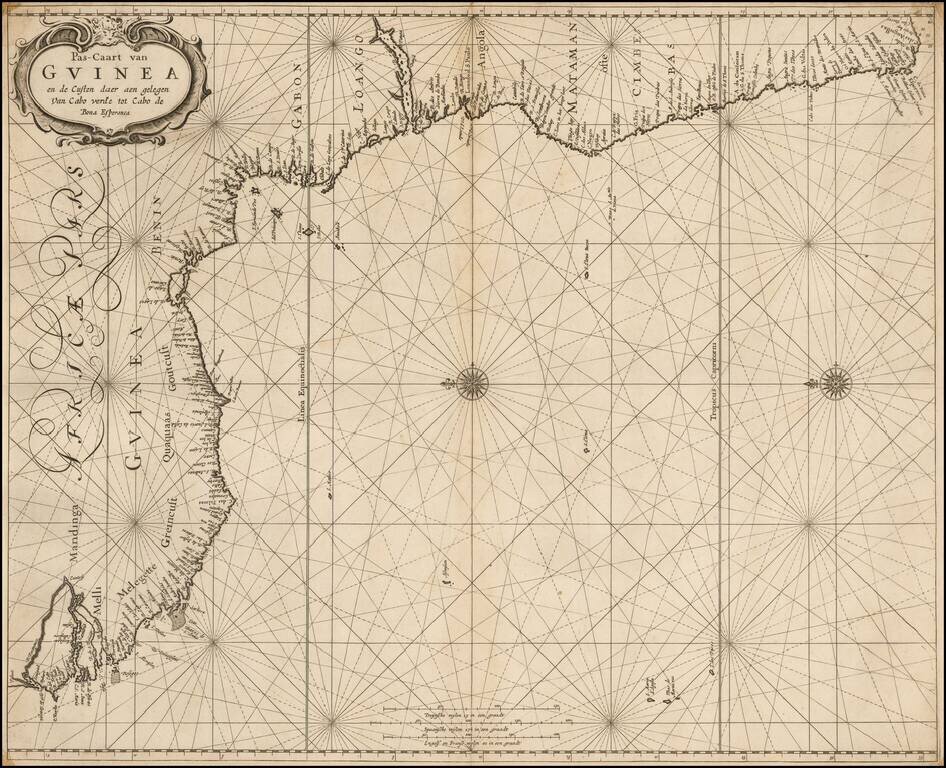
A rare sea chart from one of the great nautical atlases of the Dutch Golden Age of cartography: De Zee-Atlas Ofte Water-Weereld. The map captures the west African coast from the Gambia River in the north (here called R. Portugues) to roughly Cape St....
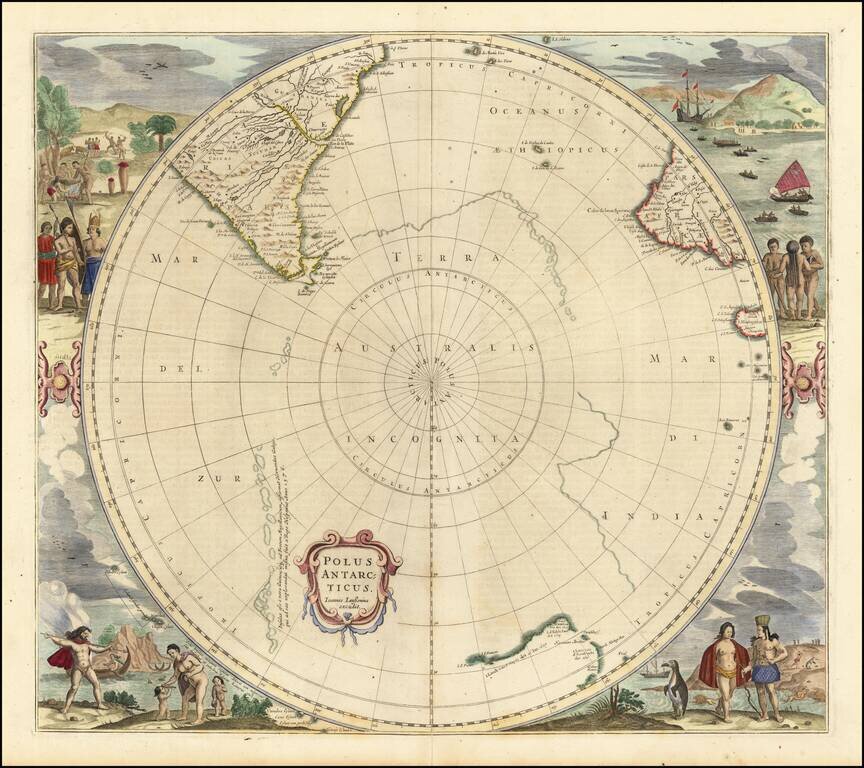
Third state of Hondius' decorative map of the South Polar region, with the name Joannes Janssonius appearing for the first time. The present state predates the first appearance of New Zealand and Van Dieman's Land. The map includes significant...