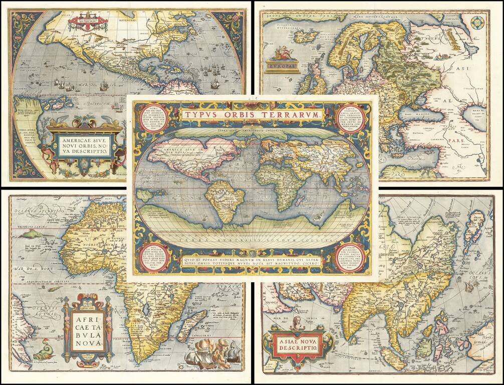
The World & 4 Continents From the First Modern Atlas Early matching set of maps of the World and Continents, from Abraham Ortelius' Theatrum Orbis Terrarum, the first modern World Atlas. Ortelius' Theatrum was perhaps the single most influential...
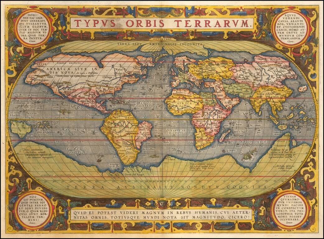
Striking Example of Ortelius' Landmark World Map One of the most famous world maps ever made, Ortelius’s “Typus Orbis Terrarum” featured in the world’s first modern atlas. This is the third edition of the map, which first appeared in 1589 and...
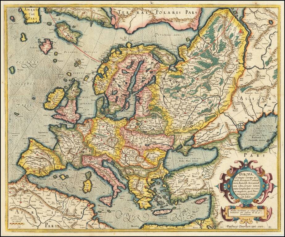
Gorgeous early example of Mercator's map of Europe from his Atlas Sive Cosmographia, first published in 1595. Includes an ornate cartouche. The map was updated and the cartouche etc. changed in 1606.
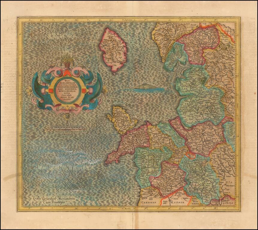
Decorative regional map of Northwestern England, the Isle of Man, Angelsey and part of Wales. From Mercator's Atlas Sive Cosmographia . . .
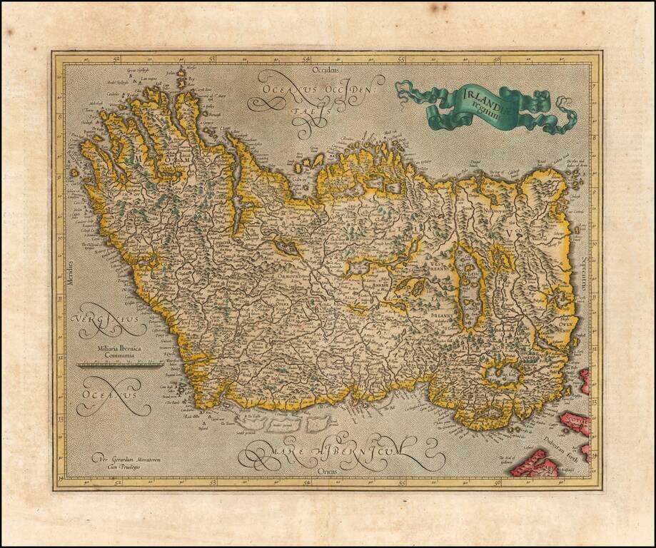
Old color example of Mercator's map of Ireland, which first appeared in the 1595 edition of Mercator's Atlas. A striking old color example.
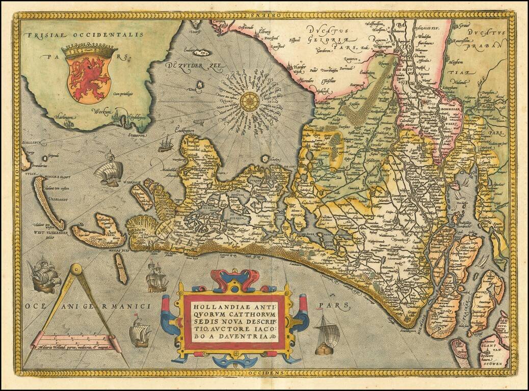
A nice full color example of Ortelius' map of Holland, drawn from Jacaob van Deventer's maps. The map is oriented with east at the top of the map. Elaborately embellished with a compass rose, sailing ships, coat of arms, etc. Nice dark impression and...
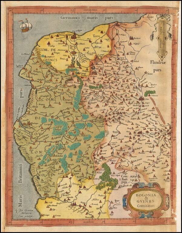
Old color example of Gerard Mercator's map of Northwestern France. The map extends from Calais and Dunkirk in the North, to La Canche River in the south.

Rare first edition of Mercator's detailed regional map of Germany, originally published in the first edition (1595) of Mercator's atlas. Shows the Waldeck Region in central Germany.
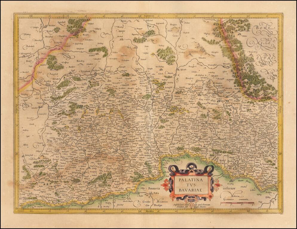
Nice example of the Mercator-Hondius map of the Bavarian Palatinate in Germany. The map follows the course of the Danube River across the bottom (centered on Regensburg). Nuremberg appears toward the upper left. Ingoldstadt is shown at the bottom...
![Turingiae Noviss Descript. Per Iohannem Mellinger Halens [with] Misniae et Lustaiae Tabula Descripta a. M Bartholomeao Sculteto Gorlit.](/map/small/61448.jpg)
Nice old color example of Ortelius' regional maps of Germany. The first map shows the regions of the Sala, Hel and Werra Rivers, from Hall, Merburg and Naumburg to Cruetzberg and Saltzungen, centered on Erfundt. The second shows the region centered...
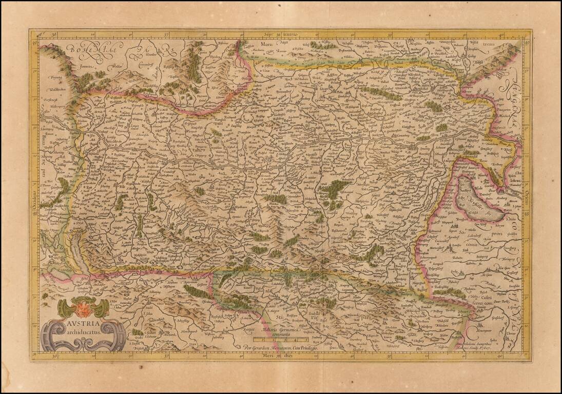
Old color example of the Mercator's map of Austria from his Atlas Sive Cosmographia. The map is centered on the Danube River from the Bavarian border to Pressburg.
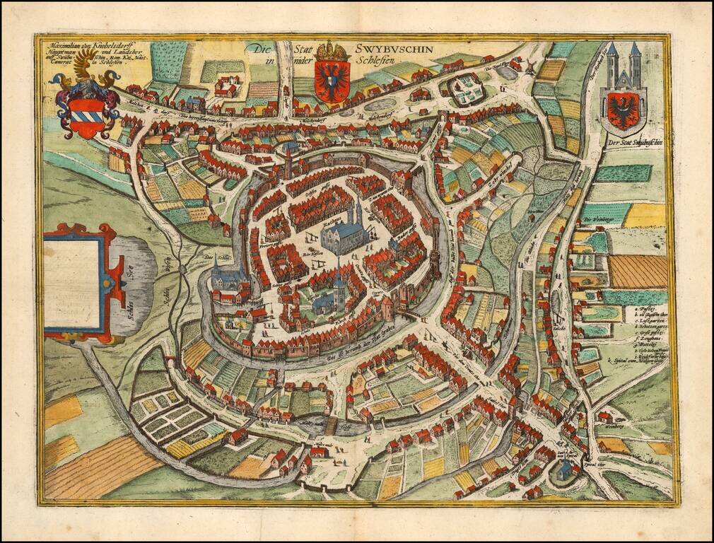
Fine example of Braun & Hogenberg's map of Swiebodzin. The earliest historical records mentioning Swiebodzin dates to the beginning of the fourteenth century. The town grew around the confluence of old trade routes linking Silesia with Pomerania...
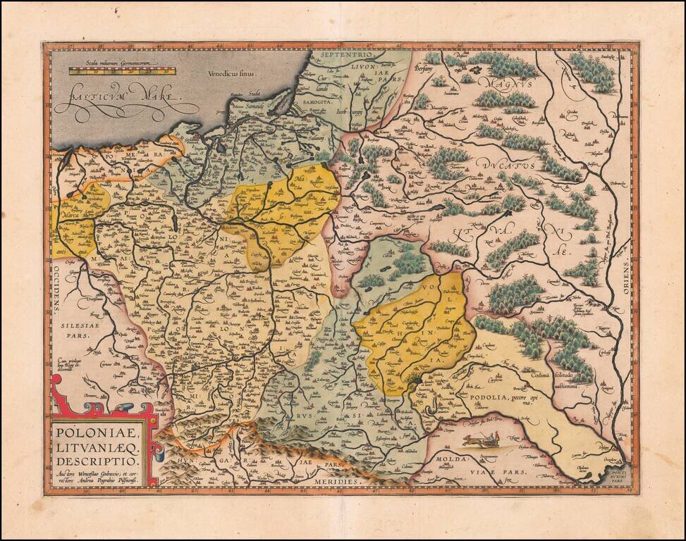
Nice example of Ortelius' second map of Poland and Lithuania which first appeared in the 1595 Latin edition of Ortelius' Theatrum. The map extends from the Dniepr River in the east to the Oder in the west and includes all of Poland, as well as...
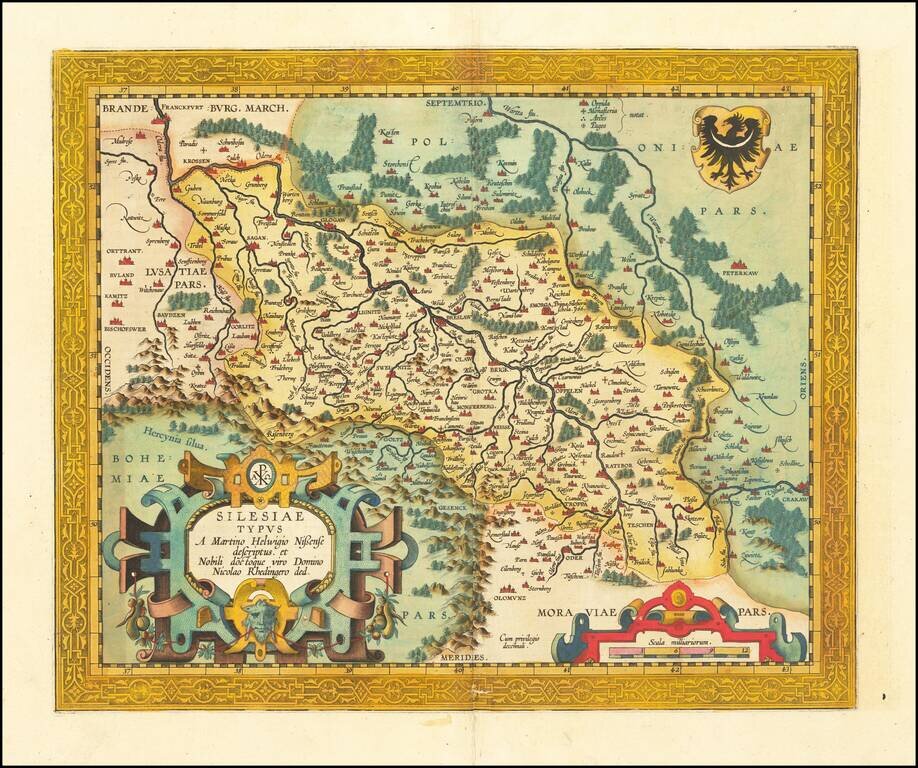
Fine old color example of the second of Ortelius' map of Silesia, which has been enlarged and embellished with a much more elaborate cartouche and military scale. Centered on Brelaw. The map is based upon the work of Martin Helwig. From Ortelius'...
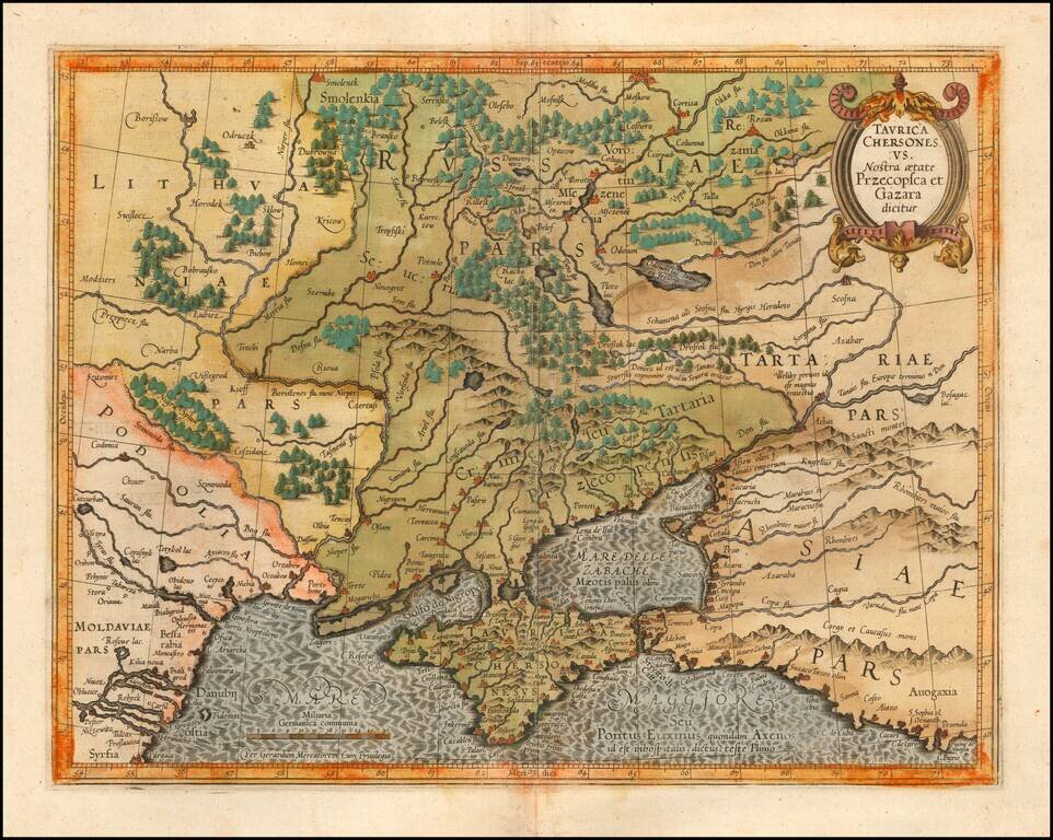
Detailed map of Southern Ukraine, Crimea and surrounding regions between the northern coast of the Black Sea and Moscow. Shows ports, fortified cities and the mouths of the Danube. Minor splitting along the towns, rivers, mountains, etc. Decorative...
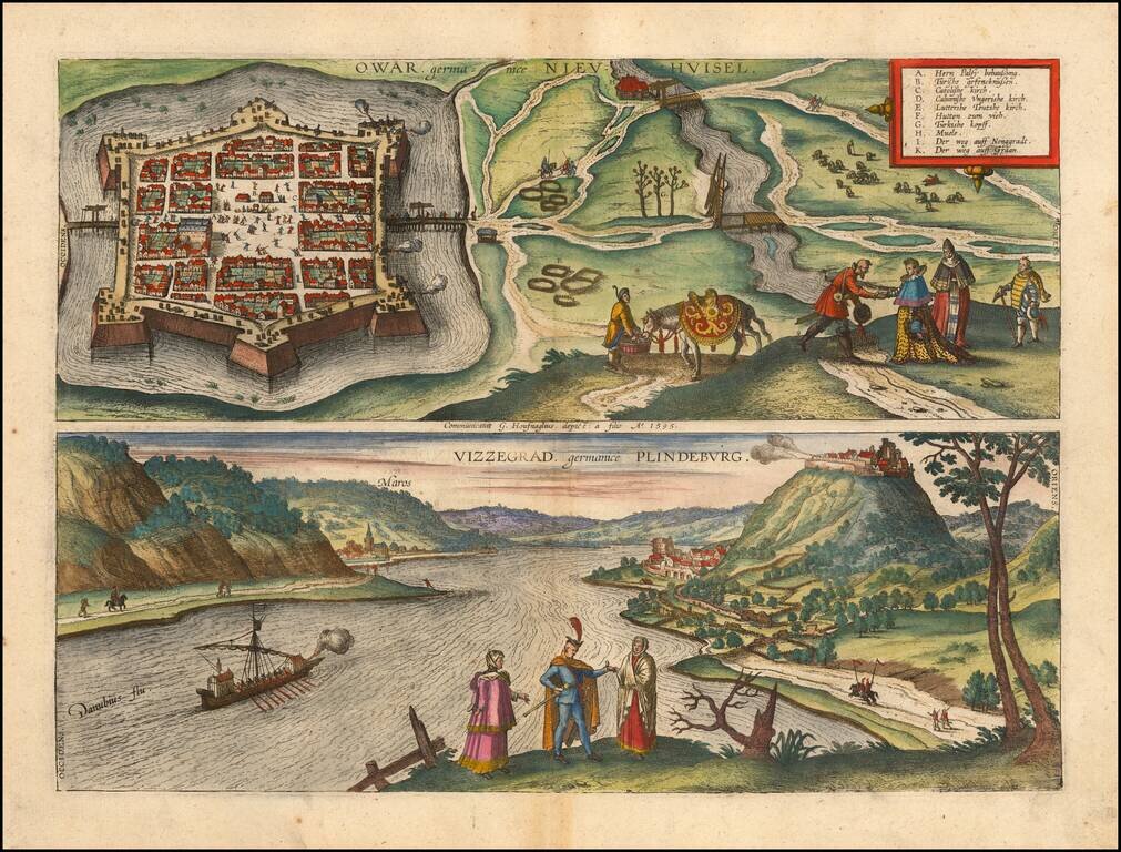
Fine pair of views of the cities of Nové Zámky, Slovakia and Visegrád, Hungary, from Braun & Hogenberg's Civitas Orbis Terrarum. These are among the earliest printed views of each of the two cities.