
Ortelius' Map of the North Atlantic Old color example of Abraham Ortelius's important early map of the North Atlantic, extending from Scandinavia and the Polar regions in the East, to the mythical Islands of the North Atlantic, Greenland, Iceland and...
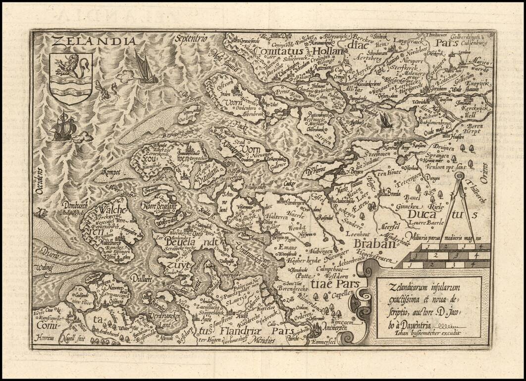
Nice example of this scarce map of Zeland in the Netherlands, published in Cologne. The present map was produced by two of the primary Cologne School mapmakers, Johann Bussemacher and Matthias Quad. The Cologne School of cartography, was perhaps the...
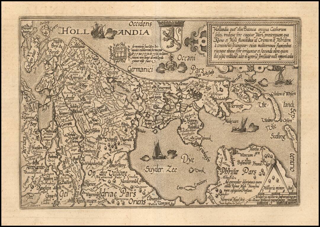
Nice example of this scarce map of Holland, oriented with west at the top, published in Cologne. The map was engraved by Henreich Nagel. The present map was produced by two of the primary Cologne School mapmakers, Johann Bussemacher and Matthias...
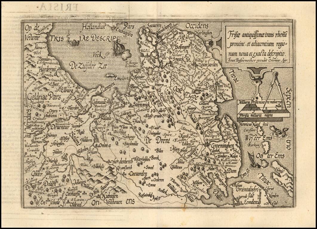
Nice example of this scarce map of Friesland, published in Cologne. The map is oriented with west at the top and extends to Drenth, Groeningen and part of Gelderland The present map was produced by two of the primary Cologne School mapmakers,...
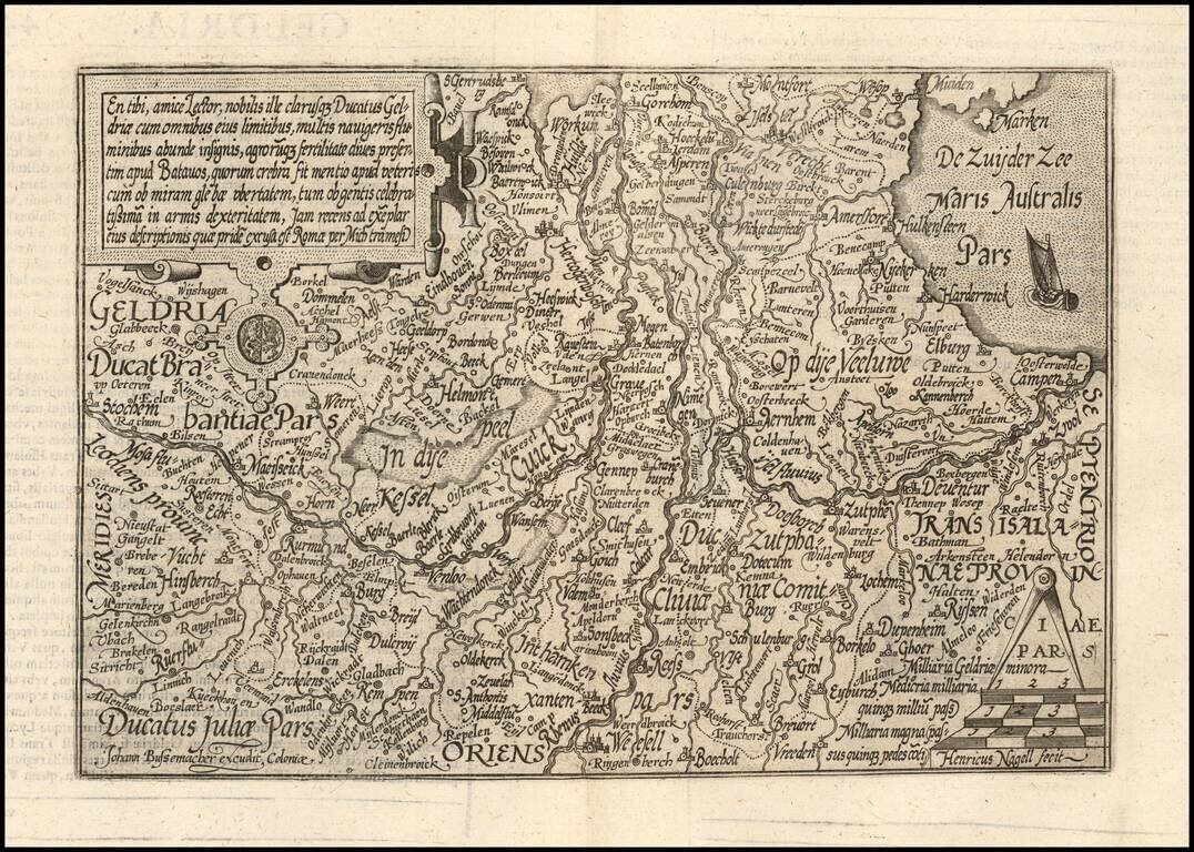
Nice example of this scarce map of Geldria, published in Cologne. The map is oriented with west at the top. The present map was produced by two of the primary Cologne School mapmakers, Johann Bussemacher and Matthias Quad. The Cologne School of...
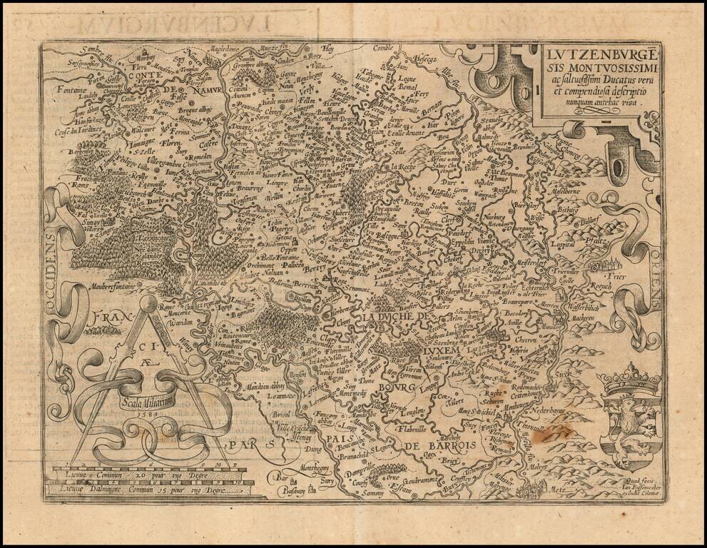
Nice example of this scarce map of Luxembourg. The present map was produced by two of the primary Cologne School mapmakers, Johann Bussemacher and Matthias Quad. The Cologne School of cartography, was perhaps the only group of mapmakers competing with...
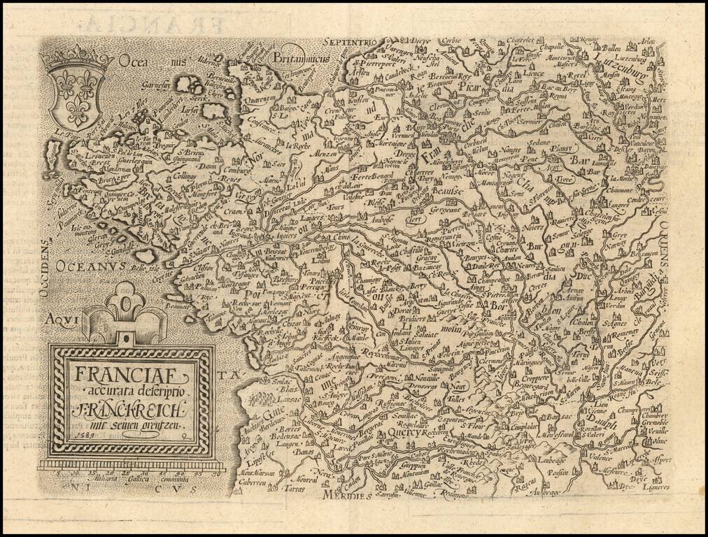
Scarce 16th Century modern map of France, published in Cologne. Matthaus Quad was a German cartographer based in Cologne. The map was engraved by Johannes Bussemacher and appeared in several Geographical works published by Quad and Bussemacher at the...
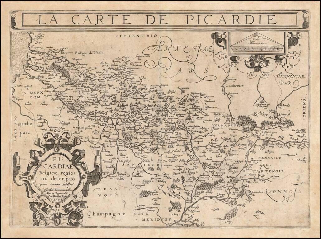
An Important Early Map of Picardy Rare example of Francois Bougereau's map of Picardy region of France, published in Tours, from his Le Theater Francoys. The map is centered on the Somme River, extending from its source near Vermandois to the sea....
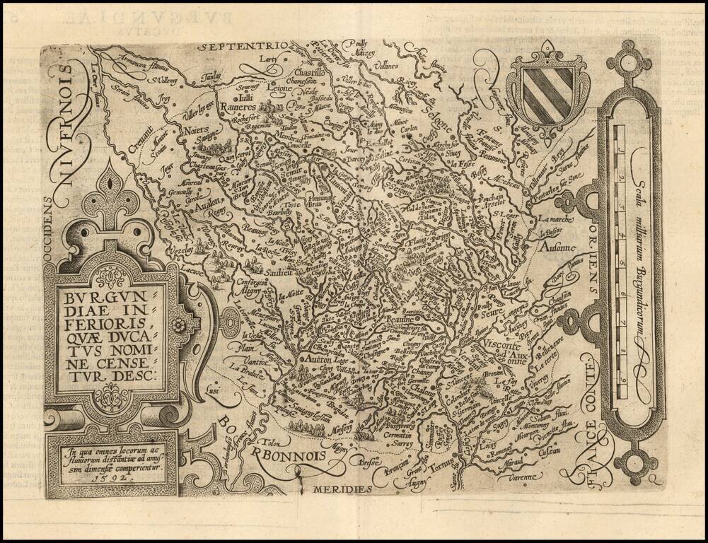
Scarce early map of the Burgundiae Inferioris region of France. Matthaus Quad was a German cartographer based in Cologne. The map was engraved by Johannes Bussemacher and appeared in several Geographical works published by Quad and Bussemacher at the...
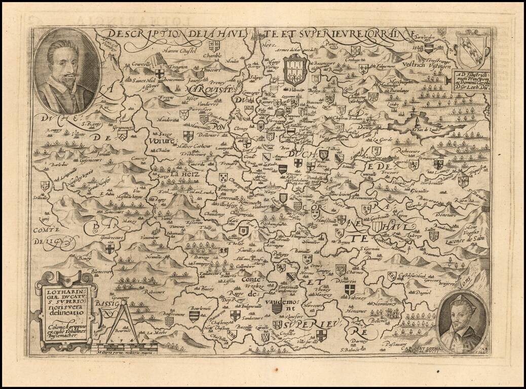
Scarce early map of the Lotharingau Inferioris region of France. Includes two portraits and a number of coats of arms of various towns. Matthaus Quad was a German cartographer based in Cologne. The map was engraved by Johannes Bussemacher and...
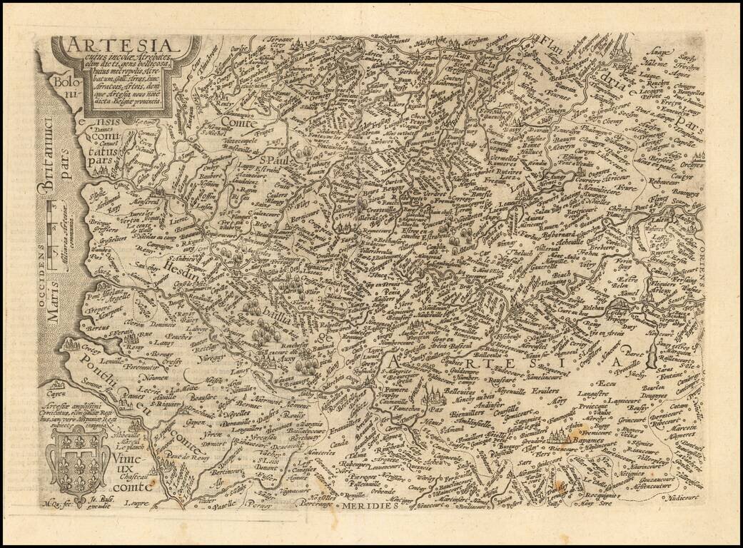
Scarce early map of the Arras region of France. Matthaus Quad was a German cartographer based in Cologne. The map was engraved by Johannes Bussemacher and appeared in several Geographical works published by Quad and Bussemacher at the end of the 16th...
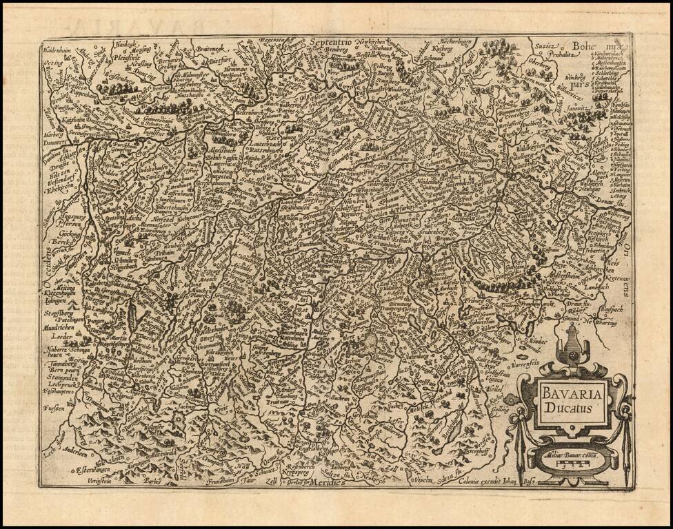
Nice example of this scarce map of the Duchy of Bavaria, published in Cologne. Cities shown include Munich, Passau, Ingolstat, Augsburg, etc. The present map was produced by two of the primary Cologne School mapmakers, Johann Bussemacher and...

Detailed map of Franconia, oriented with south at the top, published in Cologne. Cities shown include Bamberg, Nuremberg, Fulda, Frankfurt, Includes a portrait of Julius of Würzburg and heraldic shield in the lower corners. The present map was...
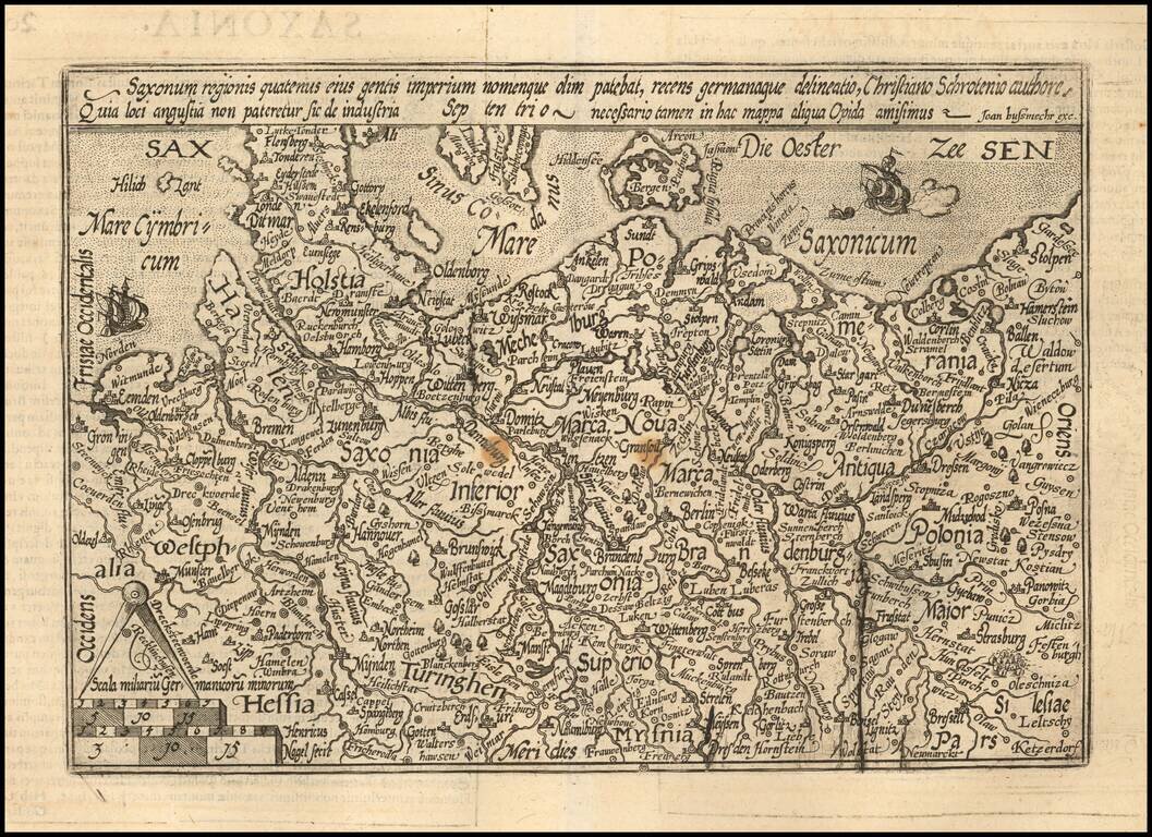
Detailed map of the north part of Germany from Westfalia to Poland. The map is centered on Saxonia Superior. Evidence of an old plate break. The present map was produced by two of the primary Cologne School mapmakers, Johann Bussemacher and...

Detailed map of the area centered on Meissen. Includes Dresden, Leipzig, Erfurt, and extending south to Prague. The present map was produced by two of the primary Cologne School mapmakers, Johann Bussemacher and Matthias Quad. The Cologne School of...

Detailed map of the north part of Germany, incluiding Brandenburg and Pomerania. Includes a portrait of Johan Georg of Brandenburg (1525 – 1598) Prince-elector of the Margraviate of Brandenburg (1571–1598) and a Duke of Prussia. The present map...