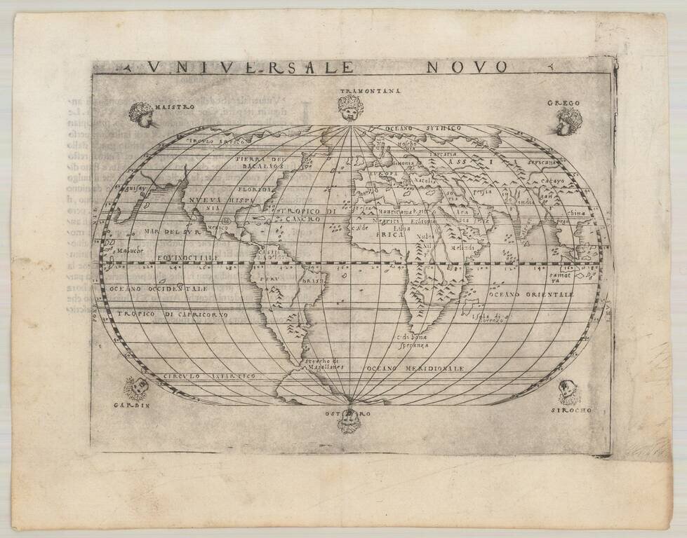
Earliest Obtainable Italian World Map to Show the Continent of America by Italy's Premier Sixteenth-Century Mapmaker This is a fine example of Giacomo Gastaldi's map of the world, published in Venice in 1548. It is a reduced version of his first...
![[Modern World] Das Erst General / inhaltend die beschreibung . . .](/map/small/70265.jpg)
Münster's 1548 Modern Map of the World, an Iconic Image of the Globe Fine example of the second edition of Münster's map of the world, one of the most recognized and influential world maps of the sixteenth century. Munster's map is considered one...
![Tabula Asiae XII [Sri Lanka]](/map/small/59207.jpg)
Striking example of Gastaldi's important map of Sri Lanka, based upon Ptolemy. Giacomo Gastaldi's Atlas of 1548 has been called the most comprehensive atlas produced between Martin Waldseemüller's Geographiae of 1513, and the Abraham Ortelius...
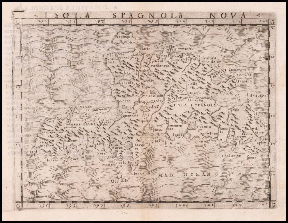
One of the earliest separately published maps of Hispaniola, which first appeared in the 1548 edition of Gastaldi's edition of Ptolemy's Geografia. The map is one of the "modern" maps to appear in Giacomo Gastaldi's La Geografia. Gastaldi was the most...

One of the earliest obtainable modern maps of the British Isles. Fine example of Gastaldi's important early map of British Isles. Giacomo Gastaldi was one of the most important Italian mapmakers of the early 16th Century. His set of maps for the...
![[France] Europae Tabula III](/map/small/60010.jpg)
Fine example of Gastaldi's map of France, based upon Ptolemy. Giacomo Gastaldi is considered as the foremost Italian cartographer of the 16th century along with Paolo Forlani. From Piedmont, Gastaldi established his reputation in Venice and was...
![[Modern France] Gallia Nova Tabula](/map/small/60252.jpg)
Nice example of Gastaldi's modern map of France, one of the earliest reasonably obtainable maps of modern France available to collectors. Giacomo Gastaldi is considered as the foremost Italian cartographer of the 16th century along with Paolo Forlani....
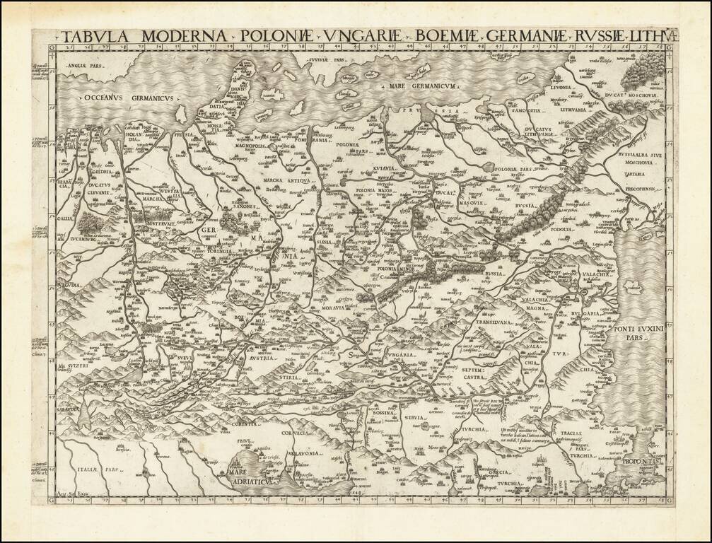
First State of one of the Earliest Modern Maps of Central and Eastern Europe A fine example of this rare and important map of Central and Eastern Europe, published by Antonio Salamanca in Rome. The map is derived from the iconic manuscript map of...
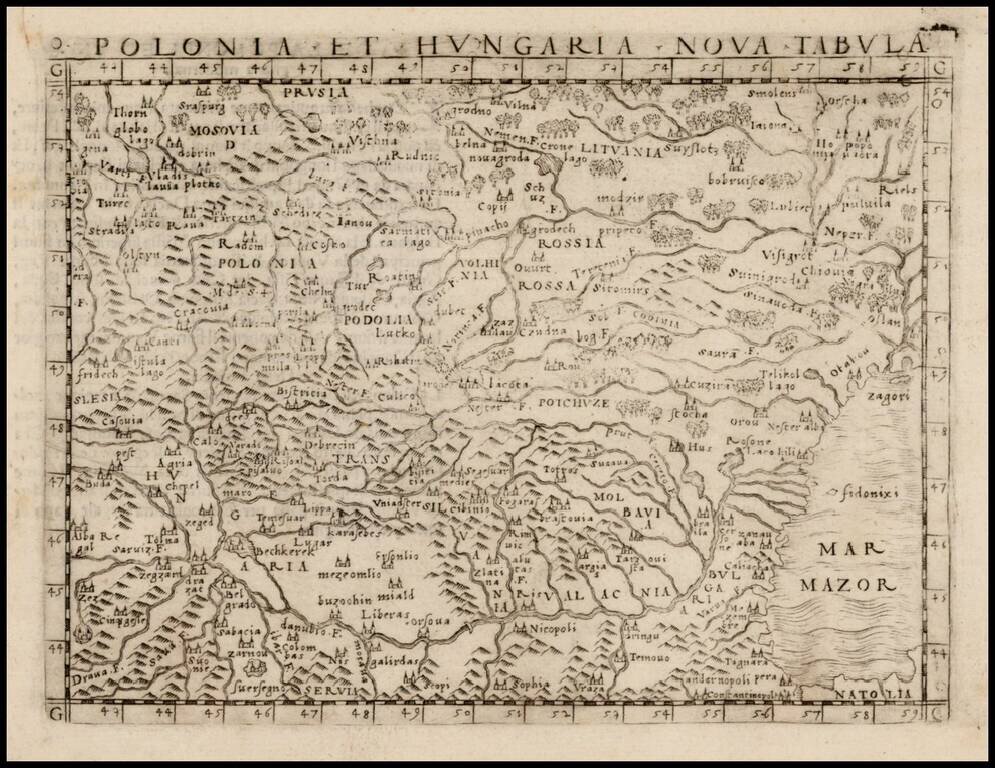
Nice example of one of the earliest obtainable modern maps of Poland, Lithuania and Hungary, published in Venice by Gastaldi. Gastaldi's maps are considered important early maps for regional collectors. Giacomo Gastaldi was one of the most important...
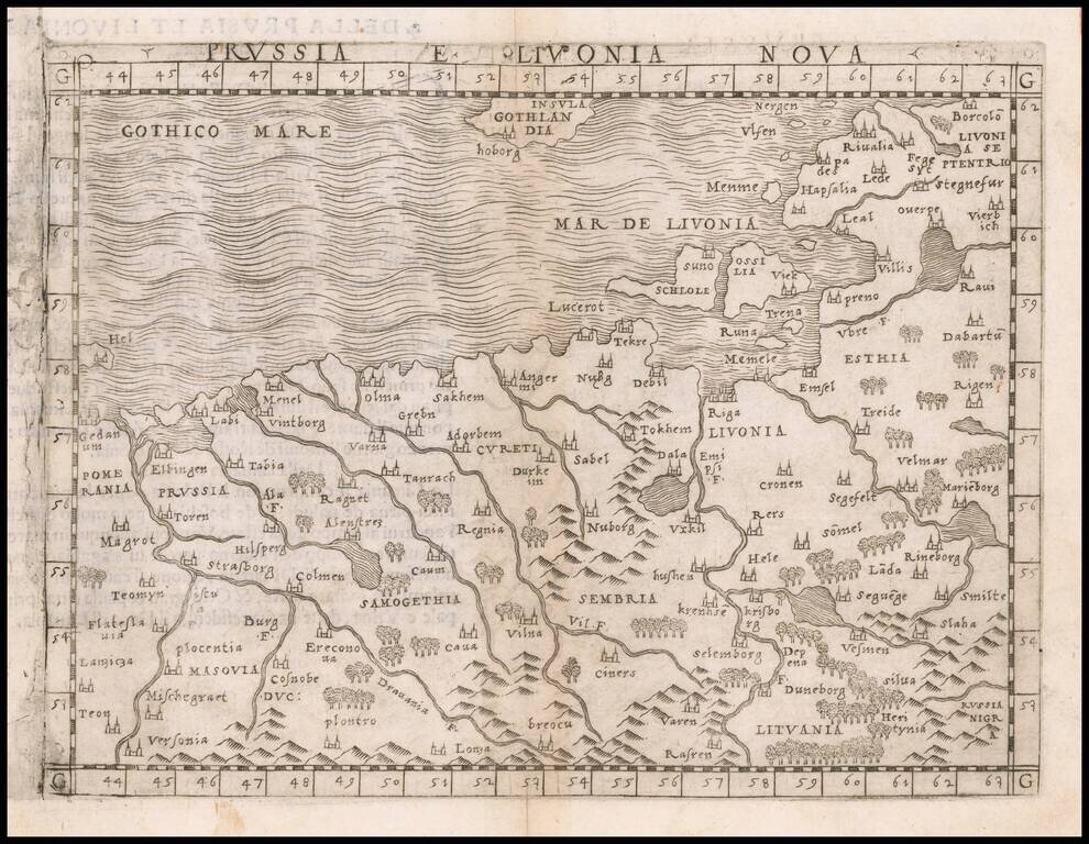
One of the Earliest Obtainable Modern Maps of the Baltic Region Nice example of Gastaldi's map of the region bounded by the Vistula River and Prussia in the west, Livonia in the east, and Lithuania in the southeast. The map is centered on Riga and...
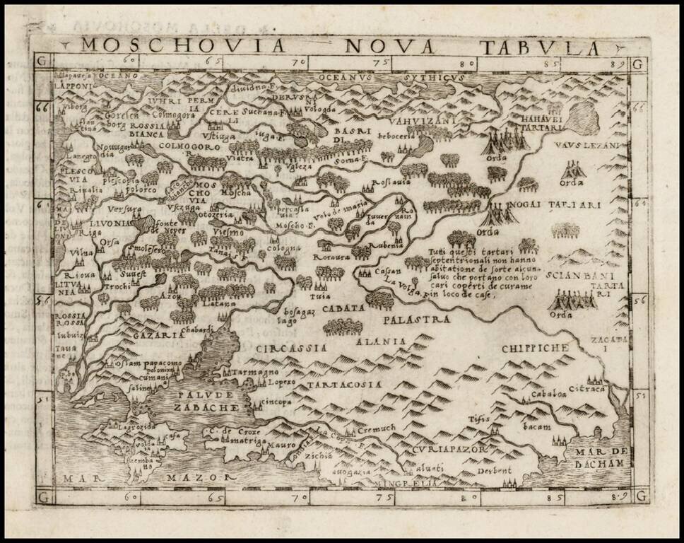
Fine unfolded example of Gastaldi's modern map of Russia, including Poland, Lithuania, Estonia and Ukraine. Gastaldi's map is among the earliest modern maps of the region. Based upon the 1546 map of Sigmund Herberstein, it extends further to the north...
![Europae Tabula VIII [Russia, Ukraine, Baltic, Scandinavia]](/map/small/44610.jpg)
Nice example of Gastaldi's map of the region bounded by the Baltic in the North and the Black Sea in the south, based upon Ptolemy. Giacomo Gastaldi is considered as the foremost Italian cartographer of the 16th century along with Paolo Forlani. From...
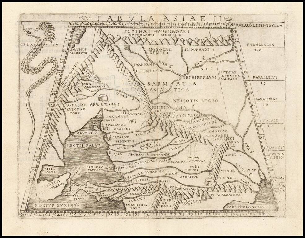
Fine example of Gastaldi's map of Ukraine, Russia, Georgia, Armenia and neighboring regions, based upon the work of Claudius Ptolemy. Giacomo Gastaldi's Atlas of 1548 has been called the most comprehensive atlas produced between Martin...
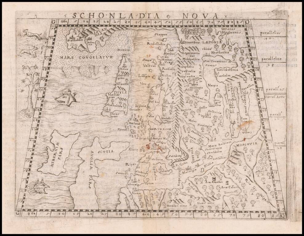
Important early modern map of Scandinavia, Iceland, and the Baltic, published in Venice by Giacomo Gastaldi. Gastaldi's modern map of Scandinavia and environs "built upon previous publications, in particular, the representation was based on the map of...
![Tabula Europae IX [Greece & Turkey]](/map/small/45661.jpg)
Interesting map of the region including Greece and Turkey, along with part of Dalmatia, extending east to Istanbul and the Bosphorus, from the 1548 edition of Ptolemy's Geographia. Gastaldi's maps are considered important early maps for regional...
![[Balkans / Adriatic / Italy] Tabula Europae V](/map/small/59530.jpg)
Nice example of Gastaldi's map of Italy and the Balkans, based on Ptolemy. Giacomo Gastaldi's Atlas of 1548 has been called the most comprehensive atlas produced between Martin Waldseemüller's Geographiae of 1513, and the Abraham Ortelius Theatrum of...