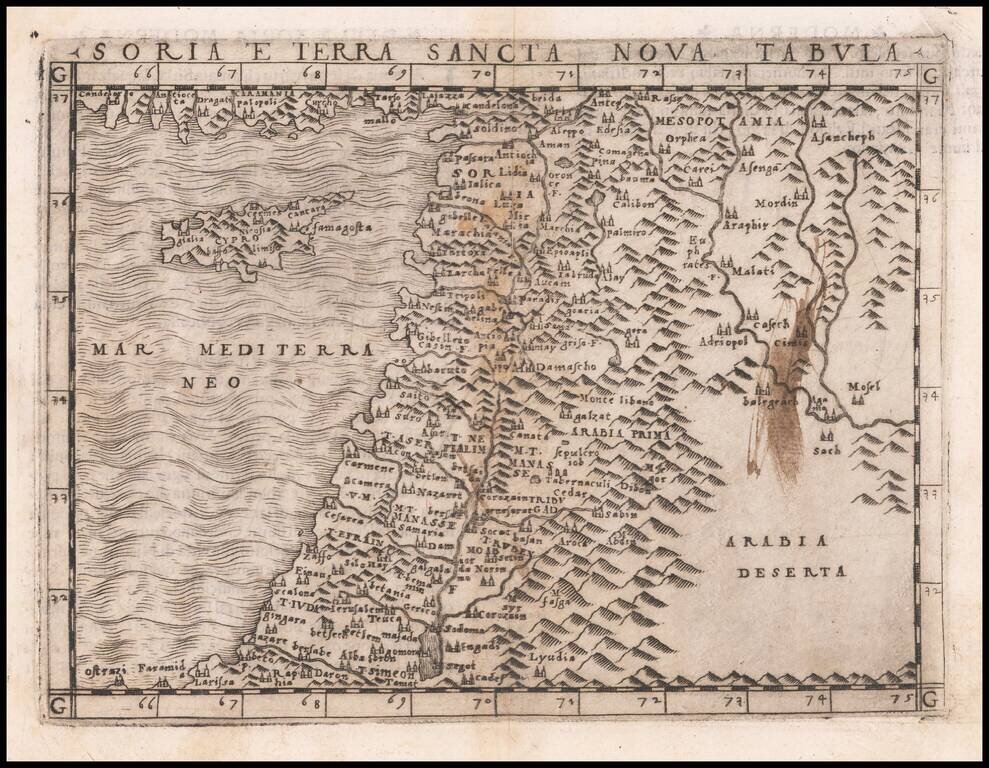
One of the earliest obtainable modern maps of the Holy Land and Cyprus, published by Giacomo Gastaldi in Venice. Gastaldi's maps are considered important early maps for regional collectors. The map show the Arabian Peninsula, Persian Gulf, Red Sea,...
![[Arabia] Tabula Asiae VI](/map/small/62056.jpg)
Early Map of the Middle East Fine example of Gastaldi's map of Arabia, the Red Sea and the Gulf, based upon Claudius Ptolemy. Includes a mermaid at the lower right corner. Giacomo Gastaldi's Atlas of 1548 has been called the most comprehensive atlas...
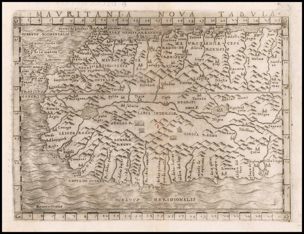
Fine example of Gastaldi's regional map of Northwest Africa, from Tangiers and Cueta to Villa Longa, the Atlas Mountains and Algeria. Giacomo Gastaldi is considered as the foremost Italian cartographer of the 16th century along with Paolo Forlani....
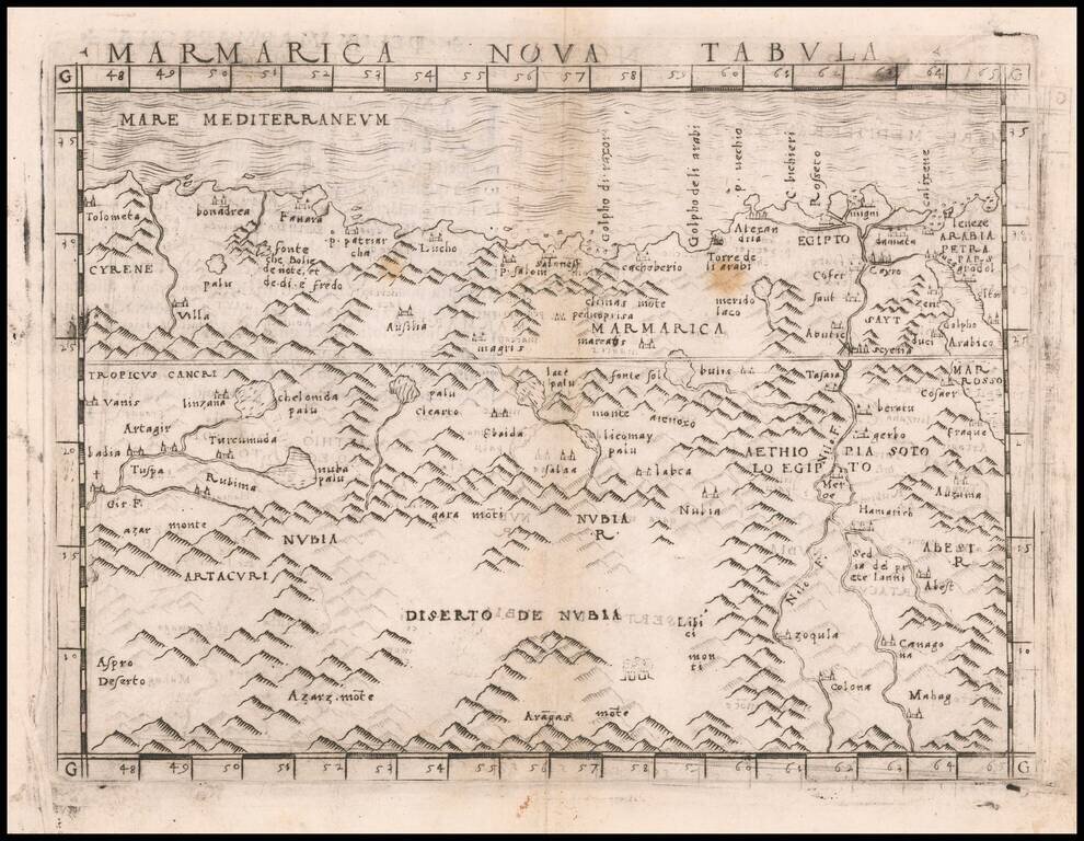
Nice example of Gastaldi's map of a portion of North Africa, centered on the Nubia Desert and showing Egypt, the Nile, etc. Giacomo Gastaldi is considered as the foremost Italian cartographer of the 16th century along with Paolo Forlani. From...
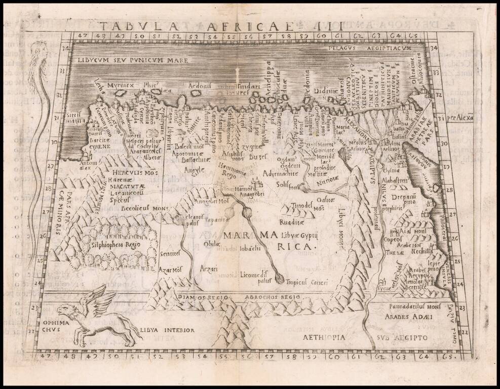
Nice example of Gastaldi's map of the northeastern portion of Africa, based on Ptolemy. The map extends east to Egypt and the Red Sea and south to Libya Interior. Snake with a human head and Ophimchus (winged creature) are shown. appear on the map....