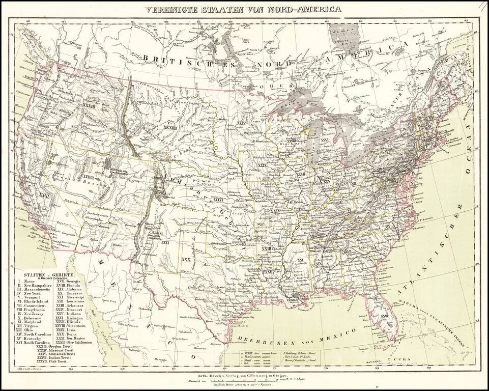
Nice example of Flemming's map of the United States, exhibiting in fabulous detail the early US territorial borders, Indian Districts, Forts, early routes of the Transmississippi explorers and other details. any Indian tribes, forts, missions, roads,...
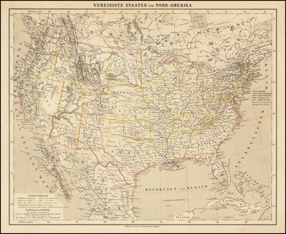
Detailed map of the United States, shortly after the conclusion of the American Civil War. Montana, Wyoming and Idaho are now clearly and accurately delineated as counties, with only Dakota Territory not yet in its final configuration. The map...
![Mexico, Mittel-America, Texas [Republic of Texas]](/map/small/64181.jpg)
Nice example of Carl Flemming's detailed map of Texas and the Southwest, published shortly after Texas was annexed by the United States in 1845. The map was issued immediately after the annexation of Texas and prior to the creation of Utah and New...
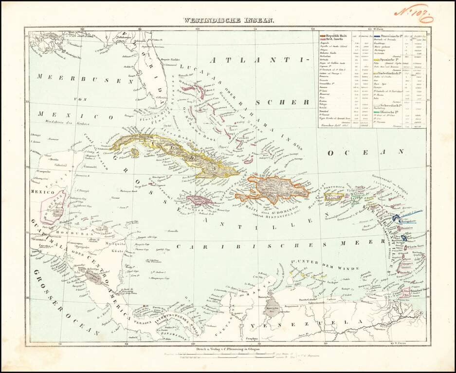
Detailed map of the Caribbean, from Florida to the cCoast of Venezuela and the Yucatan. Includes a key identifying populations, sizes and colonial possessions.
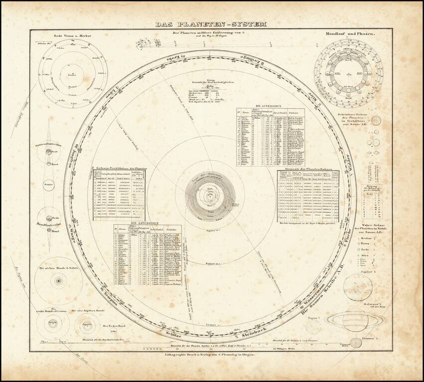
Interesting set of models of the solar system, including orbits of the planets and several comets. Surrounded by models of the various planets and other information.