Didier Robert de Vaugondy (ca. 1723-1786) was the son of prominent geographer Gilles Robert de Vaugondy and Didier carried on his father’s impressive work. Together, they published their best-known work, the Atlas Universel (1757). The atlas took fifteen years to create and was released in a folio and ¾ folio edition; both are rare and highly sought-after today. Together and individually, father and son were known for their exactitude and depth of research.
Like his father, Didier served as geographer to King Louis XV. He was especially recognized for his skills in globe making; for example, a pair of his globes made for the Marquise de Pompadour are today in the collection of the Municipal Museum of Chartres. Didier was also the geographer to the Duke of Lorraine. In 1773, he was appointed royal censor in charge of monitoring the information published in geography texts, navigational tracts, and travel accounts.
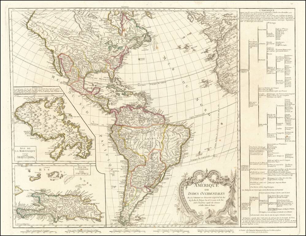
The Great River of the West and Lahontan's Longue River Scarce second state of De Vaugondy's map of America, pre-dating information from any of the Cook Voyages. The Northwest Coast of America is shown wildly distorted to the west, with a number of...
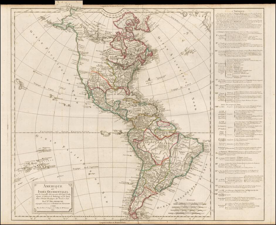
Scarce third state of De Vaugondy's map of America, updated to include the details of all three of Cook's voyages. The Northwest Coast of America is still mapped with part information and part conjecture. The Spanish contacts with the region are...
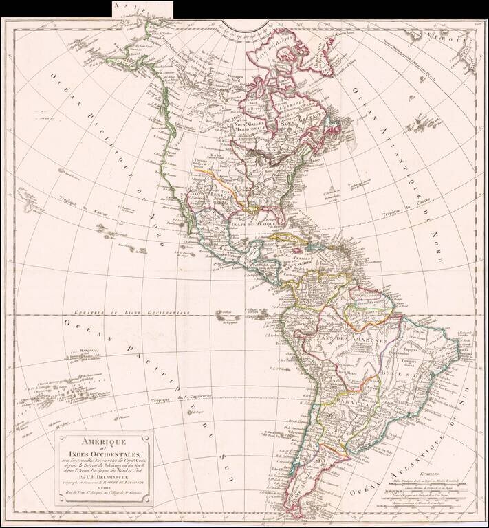
Rare late state of De Vaugondy's map of America, updated to include the details of all three of Cook's voyages. The Northwest Coast of America has again been heavily revised to include the discoveries up to 1800, with the earliest hint of the course...
![Carte des parties Nord et Est de L'Asie qui comprend Les Costes De Russie Asiatique Le Kamschatka, Le Iesso et Les Isles Japon…[insets of Alaska, West, AZ and Conibas]](/map/small/70673rd.jpg)
Marvelous depiction of the Northeast Passage, from Norway and Spitsberg Island to the Straits of Anian and Cape Schalaginskoy north of Kamschatka, covering the NE Coast of Asia to south of Japan and Korea. The primary focus of the map is Asiatic...
![[Title Page] Atlas Portatif . . . 1748](/map/small/70389.jpg)
Decorative title page from De Vaugondy's Atlas Portatif.
![Partie De L'Amerique Septent? Qui comprend La Nouvelle France ou Le Canada . . . [Large Great Lakes Inset]](/map/small/57758.jpg)
Decorative and highly detailed map of New England and Part of Canada, extending east to Newfoundland, with a large inset map of the Great Lakes. The large inset of the Great Lakes is based upon Bellin's map, and provides one of the best large format...

Detailed map of the Ohio Valley and regions to the East Nice example of Robert de Vaugondy's map of the Northern British Colonies, French interests to the North of the Great Lakes, and contested "Back Settlements," including a fine detailed treatment...
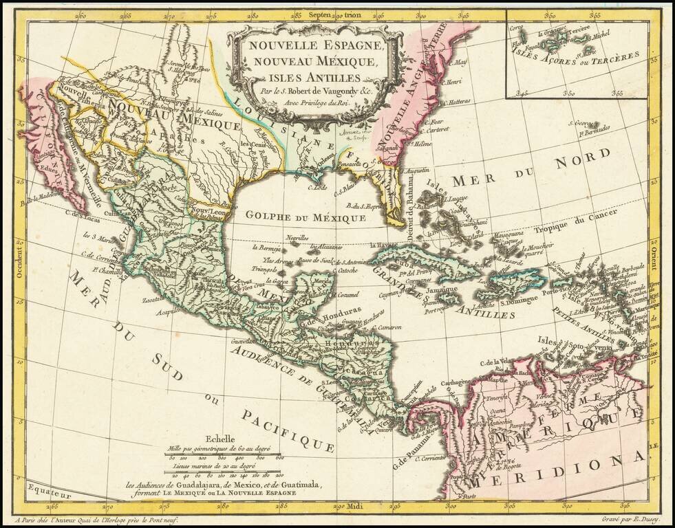
Antique Map of Texas, Mexico and the American Southwest, Florida and the Caribbean Scarce map of the Southwest, Caribbean and Gulf Coast, from De Vaugondy's Nouvel Atlas Portatif. Includes a marvelous contemporary cartographic representation of the...
![[The 5 Californias] Carte De La Californie Suivant 1. La Carte manuscrite de l'Americque de Mathieu Neron Pecci olen dressee a Florence en 1604, 2. Sanson 1656 . . .](/map/small/67157.jpg)
Survey of the Fine Early Maps of California A historically important depiction of the 5 most influential cartographic depictions of California, showing the evolution of how California was mapped between 1604 and 1767. The earliest map is (upper...
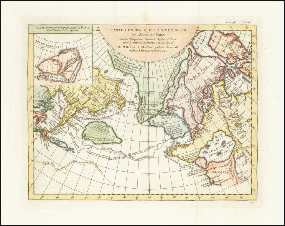
A fascinating map of the Northwest Coast, showing De L'Isle's conjectural northwest coast, based upon De Font and Russian Discoverers, including the Bay of the West. The map is part of the great mid-18th Century debate, spurred by the reports of...
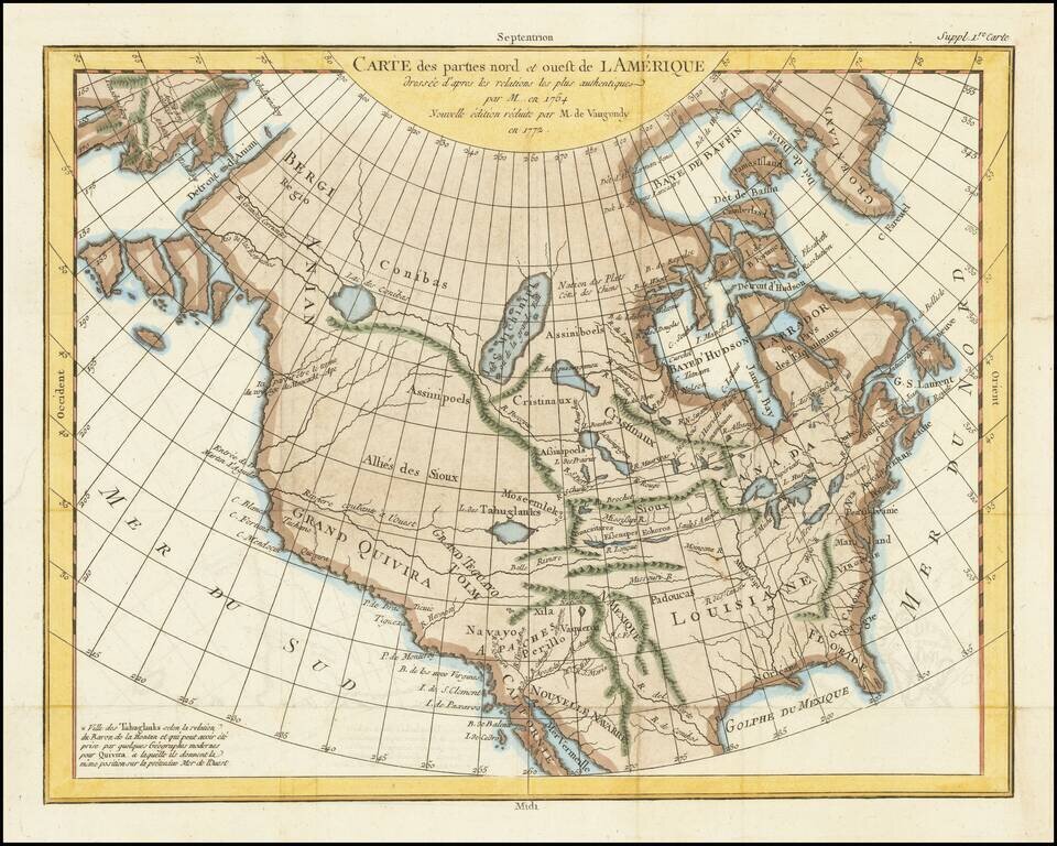
A fascinating map of North America, based upon a map by Thomas Engel. Engel's map of North America was issued in his Memoires Observations Geographiques in 1765, and provides a fascinating look at the watercourses across North America, with no less...
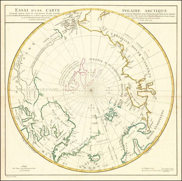
A Cartographic Landmark -- De Vaugondy's Presentation to the French Royal Academy on the Most Practicable Sailing Routes to the Pacific via the North Polar Regions Extremely rare polar map produced to illustrate a presentation made by Didier Robert...
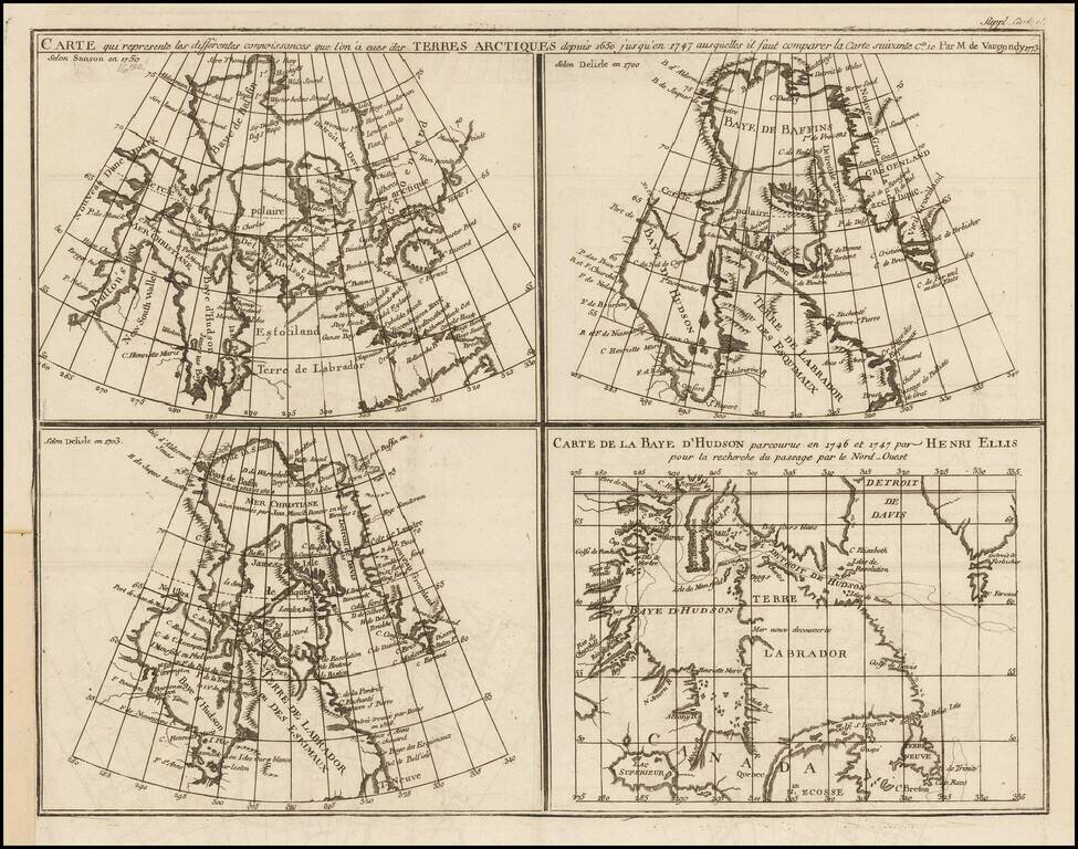
Marvelous set of four maps of the Hudson, Button and Baffin Bay regions, Davis Straits, and the Coast Labrador, as developed and explored between 1650 and 1750. This map was one of ten maps in Diderot's important 10 volume encyclopedia, one of the...
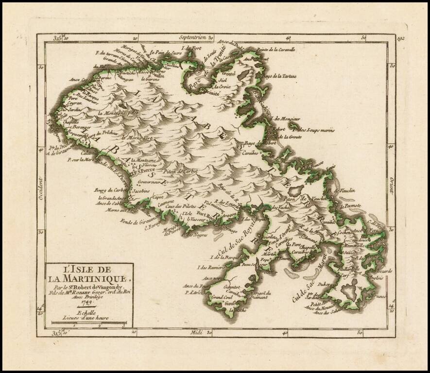
Striking example of De Vaugondy's map of Martinique, from his Atlas Portatif, Universel et Militaire. . . , first published in Paris, in 1748. The map provides a marvelous look at the topography of the island.
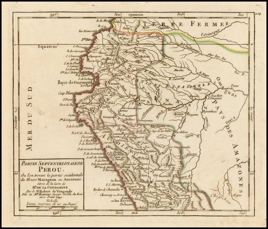
Striking example of De Vaugondy's map of the northern part of Peru from his Atlas Portatif, Universel et Militaire. . . , first published in Paris in 1748.
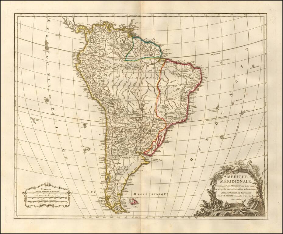
Detailed map of South America, published by one of Europe's leading map publishers of the second half of the 18th Century. The map illustrates South America at the height of its Colonial period and at a time when the interior of the Continent was...