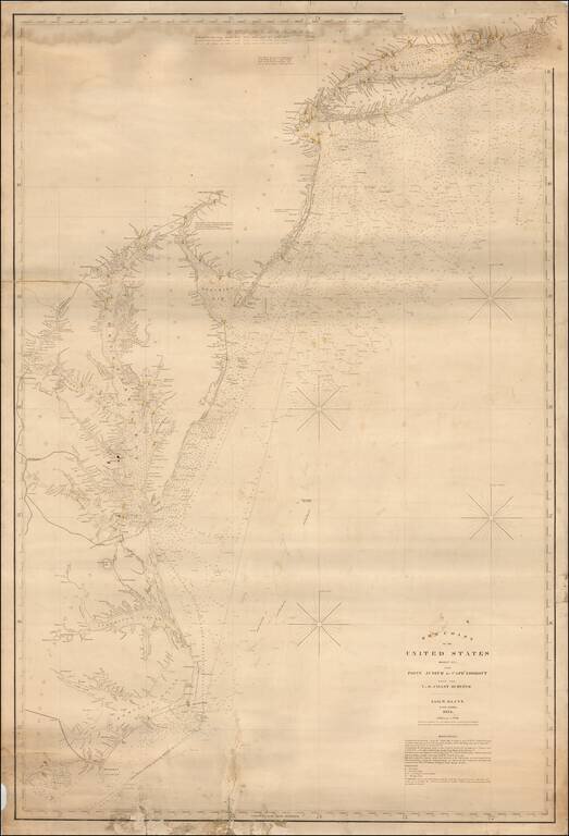
Fine large format sea chart of the coastline from Long Island Sound to the Outer Banks of North Carolina, published by Blunt in New York City, the most famous of American Chart makers of the period. The map shows light houses, light ships and channel...
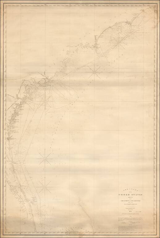
Fine large format sea chart of the coastline from the Outer Banks of North Carolina to central Florida, published by Blunt in New York City, the most famous of American Chart makers of the period. Includes an early pencil annotation near Savannah,...
![[Untitled Coast chart of North Carolina, South Carolina, Georgia, and Florida, with insets of the harbor of Charleston, S.C. and the entrance of the Saint Johns River]](/map/small/50156.jpg)
Scarce single sheet map of the the region from Cape Fear, North Carolina to St. Augustine Florida, one of a series of maps covering the east coast of North America, engraved by William Hooker and published by E & G.W. Blunt of New York. Blunt's...
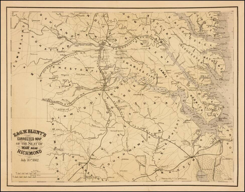
Rare separately issued map of the area around Richmond, Virginia, published by E & GW Blunt in July, 1862. The map shows Richmond and the railroad lines, canal, roads and rivers that feed into the City, including the Richmond & Danville...
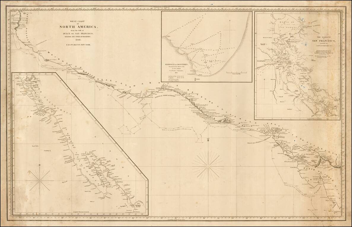
Rare sea chart of California, Mexico and Central American coastline, showing the southern sea route to San Francisco printed on the eve of the California Gold Rush. This fine chart depicts the length of the Pacific Coast of North and Central America,...
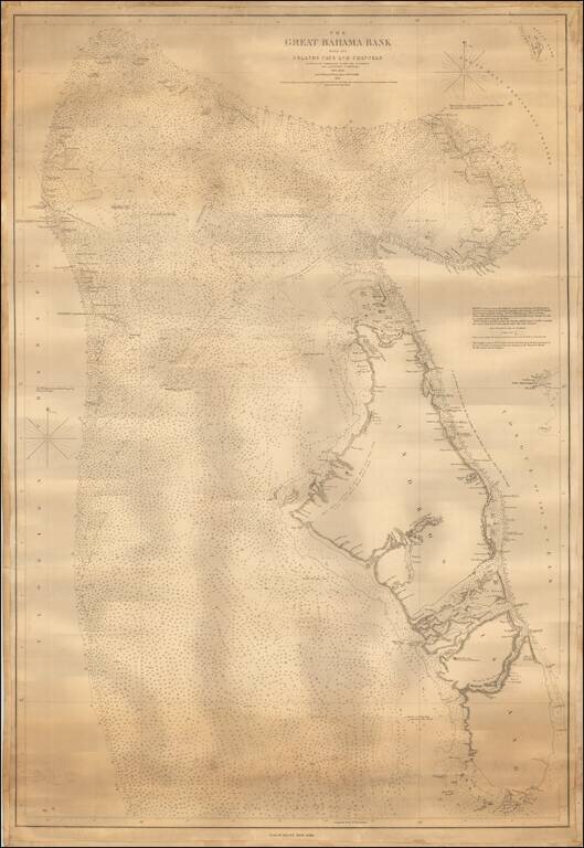
One of the Earliest Modern Sea Charts of the Central Section of the Great Bahama Banks. Fine chart of the Bahama Banks, focusing on Andros Island and the neighboring islands, etc., published by Blunt. The map reaches east to New Providence Island...
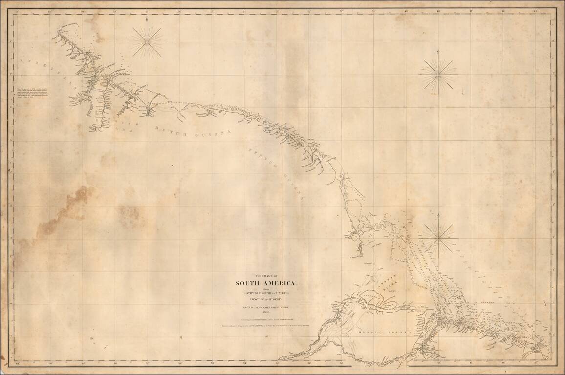
Rare separately published American Sea chart of the Northeastern coastline of South America, drawn by Charles Copley and published by Blunt. The map extends from the Orinoco River, Essequibo River and Demarara River in Venezula to Ilha Marajo, Belem...