Laurie & Whittle refers to the partnership of Robert Laurie (1755?-1836) and James Whittle (1757-1818), engravers and map publishers. Both men were employed by Robert Sayer (ca. 1724-1794), one of the most prominent British publishers and map sellers of the eighteenth century. Sayer died in 1794 and his business was taken over by his assistants. The two worked together as Laurie & Whittle until 1812, when Laurie retired. They were especially known for publishing sea charts and maritime atlases. From 1812-1818, when he died, Whittle worked with Laurie’s son, Richard Holmes Laurie, as Whittle & Laurie. After 1818, the firm was known as R. H. Laurie, even though Richard died in 1858. Later, the firm was managed by Laurie’s draughtsman, Alexander George Findlay, and, later, Daniel and William Kettle.
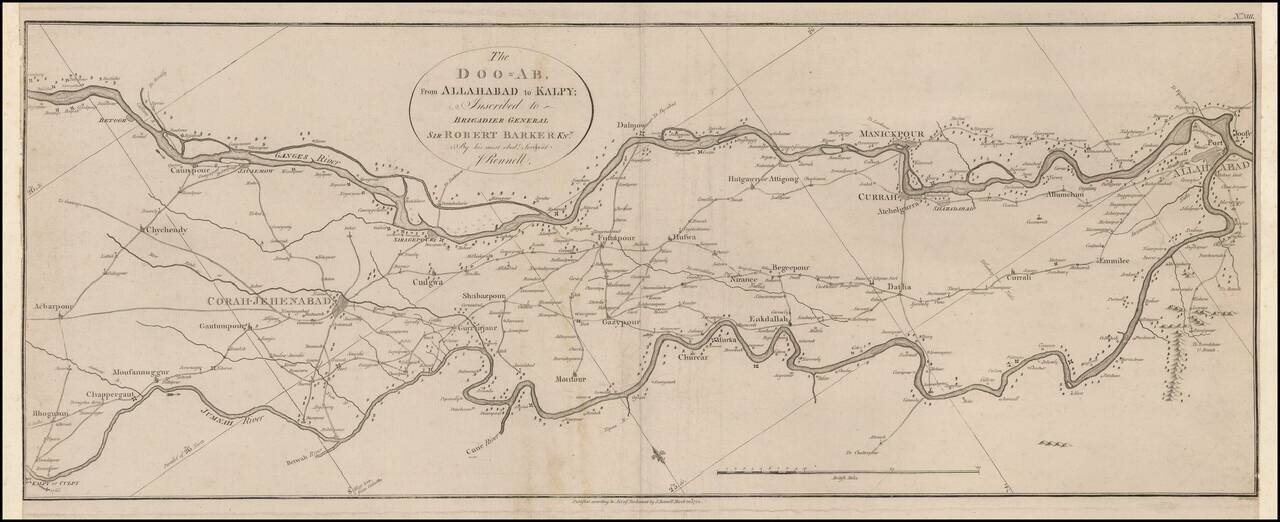
Scarce map of a charting of a section of the Ganges and Jumnah Rivers. The Ganges is shown flowing from the Betoor area from Culpy on the Jumnah. James Rennell (1742-1830) , Often referred to as "The Father of Indian Surveying," Rennell was a...
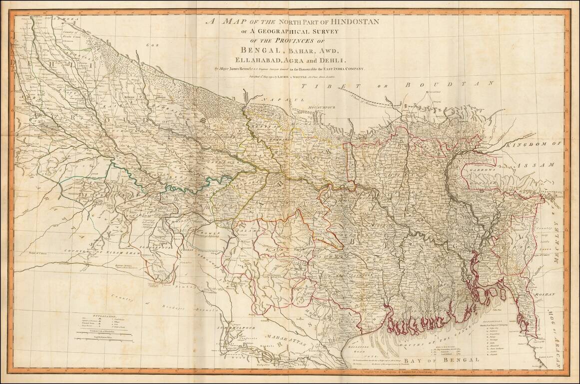
Fine example of James Rennell's highly detailed map of northern India, based upon his survey work while Surveyor General of the East Indian Company. The map is exceptionally detailed and includes roads, towns, mountains, rivers and a host of other...
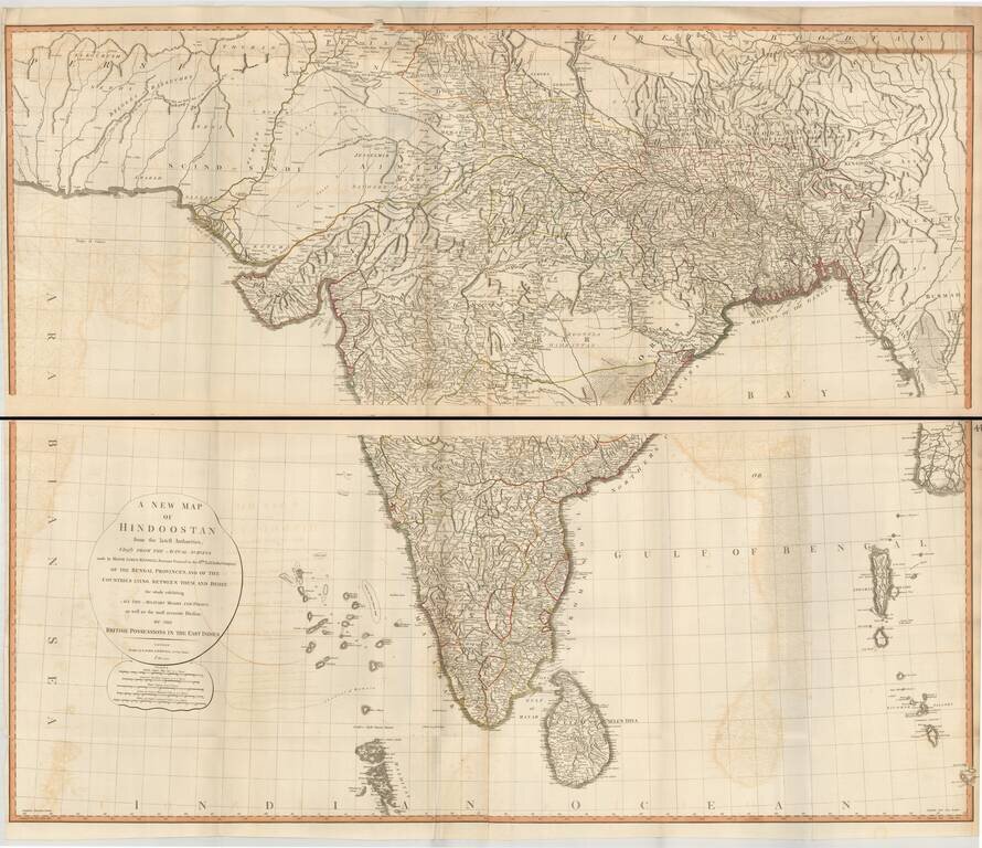
Superb large format map of India and Sri Lanka, based on the surveys of James Rennell, and published by Laurie & Whittle. The map is exceptionally detailed and includes roads, towns, mountains, rivers and a host of other details. It was one of the...