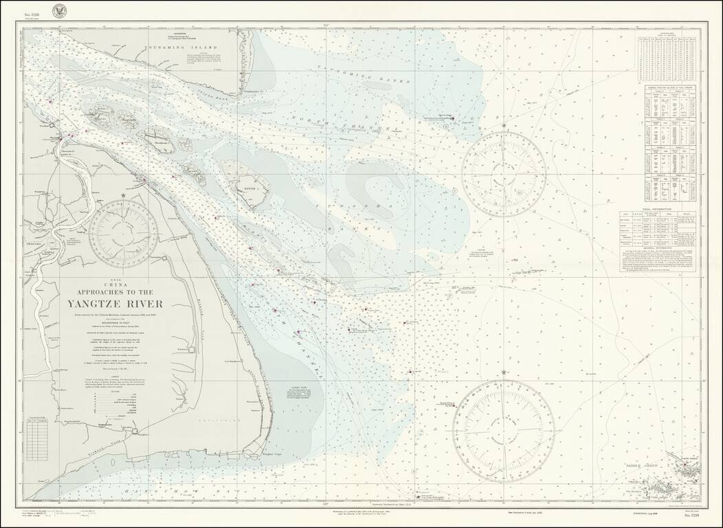
World War II-era hydrographical chart of the entrance to the Yangtze River and the Shanghai Region. Shanghai is shown at the left of the map, with details such as the railroads and their stations, the International Settlements, and local hamlets and...
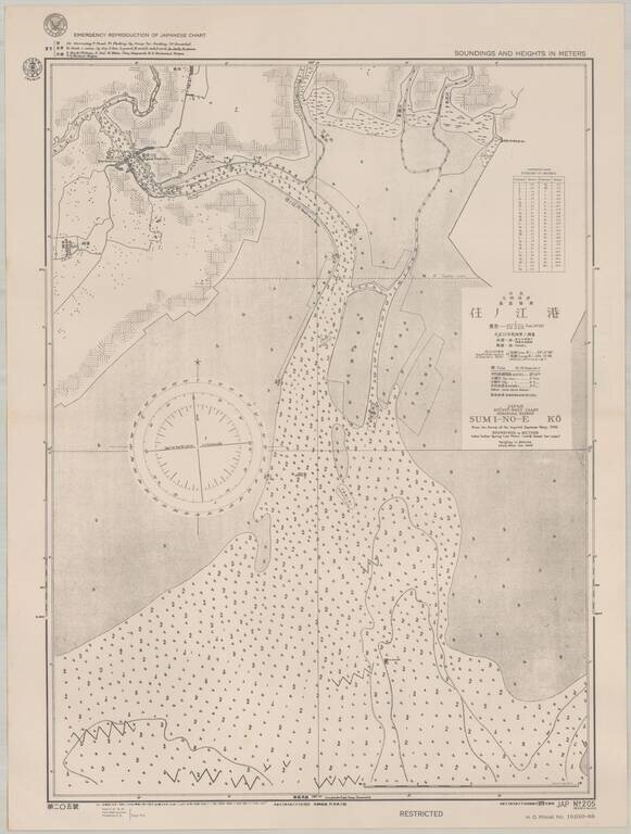
Scarce sea chart of part of the west coast of Kyushu, providing a fascinating insight into U.S. efforts to produce maps of Japan during World War II. The map, which was published by the Navy in September 1944, shows an area on the west coast of Kyushu,...