
Detailed road map of the Great Lakes Region, constructed by Canada's Department of the Interior. Includes Provincial Routes, Federal Routes and State Routes.
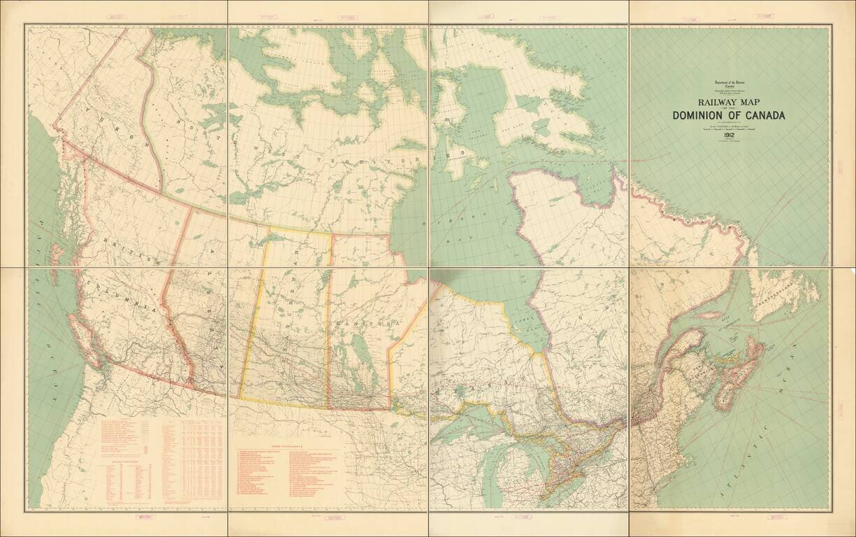
Fine example of this exceptional map of Canada, published by the Department of the Interior. The map focuses on the Railway system in Canada and related statistical information. Tables include: Legend showing Grand Trunk Railway, Canadian Pacific...
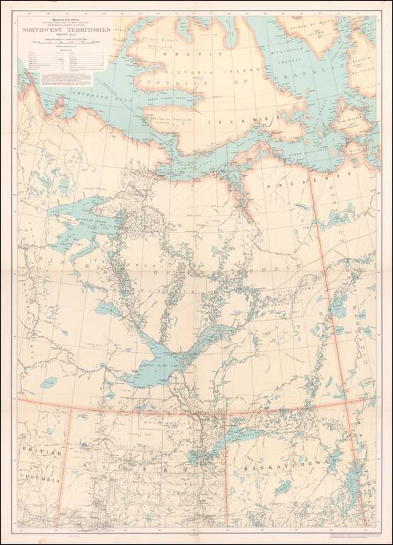
![[Route of the 1938 Westward Northwest Passage Cover] Map of the Northwest Territories 1929](/map/small/60046.jpg)
Illustrating Canadian Postal History -- A Cover's Travel Through the Northwest Passage in 1939 Fine large format map of the Northwest Territories of Canada, published by the Department of the Interior. The map identifies: Royal Canadian Mounted...
Detailed map of a portion of the Northwest Territories, published by the Department of the Interior in 1932. The map illustrates: Main, Wagon and Winter Roads Falls and Rapids Ranger Cabins Royal Candian Mounted PoliceStations Sea Plane...