Henricus Hondius (1597-1651) was a Dutch engraver and mapmaker, a member of a prominent cartographic family. His father, Jodocus Hondius, was also an engraver and geographer. While working with his father, Henricus was instrumental in the expansion and republishing of Mercator’s atlas, first published in 1595 and republished by Hondius in 1606.
Upon his father’s death in 1612, Henricus and his brother, Jodocus the Younger, took over the business. He set up his own shop in 1621, where he continued to release new editions of the Mercator atlas. Later, he partnered with his brother-in-law, Jan Janssonius, in continuing to expand and publish Mercator’s atlas, which would become known as the Mercator-Hondius-Janssonius atlas. Born and based in Amsterdam, he died there in 1651.
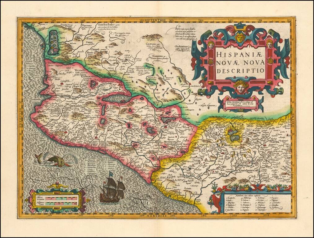
Mercator-Hondius Map of Mexico, a Foundational Map of New Spain Attractive map of Mexico from the Mercator-Hondius Atlas Sive Cosmographicae. This map and Ortelius' map of 1579 were foundational maps for all regional maps of Mexico to follow. The...
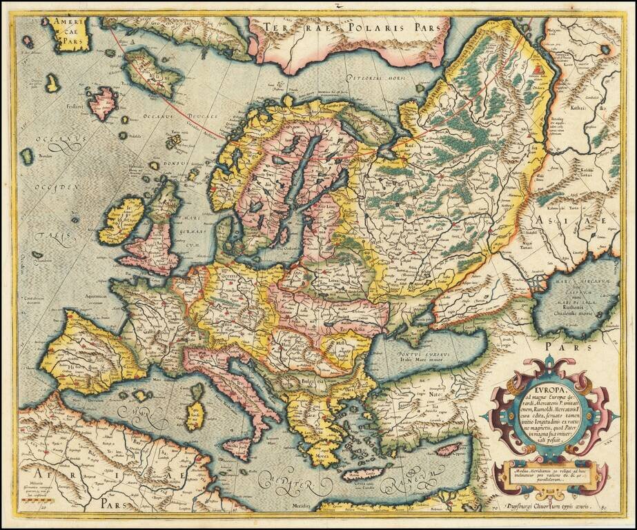
Gorgeous early example of Mercator's map of Europe from his Atlas Sive Cosmographia, first published in 1595. Includes an ornate cartouche. The map was updated and the cartouche etc. changed in 1606.
![[Southwestern England] Cornubia, Devonia, Somersetus, Dorcestria, Wiltonia, Glocestria, Monumetha, Glamorgan, Caermarden, Penbrok, Cardigan, Radnor, Breknoke et Herfordia](/map/small/60735.jpg)
Decorative regional map of the Southwestern part of England from Mercator's Atlas Sive Cosmographia . . . Includes the counties of Cornwall, Devon, Sommerset, Dorset, Wilton, Glouchester, Glamorgan, Caermarden, Penbroke, Cardigan, Radnor Breknoke,...
Decorative regional map of Germany. Includes decorative cartouche. From an English Edition of the Mercator-Hondius Atlas. Nice full color example.
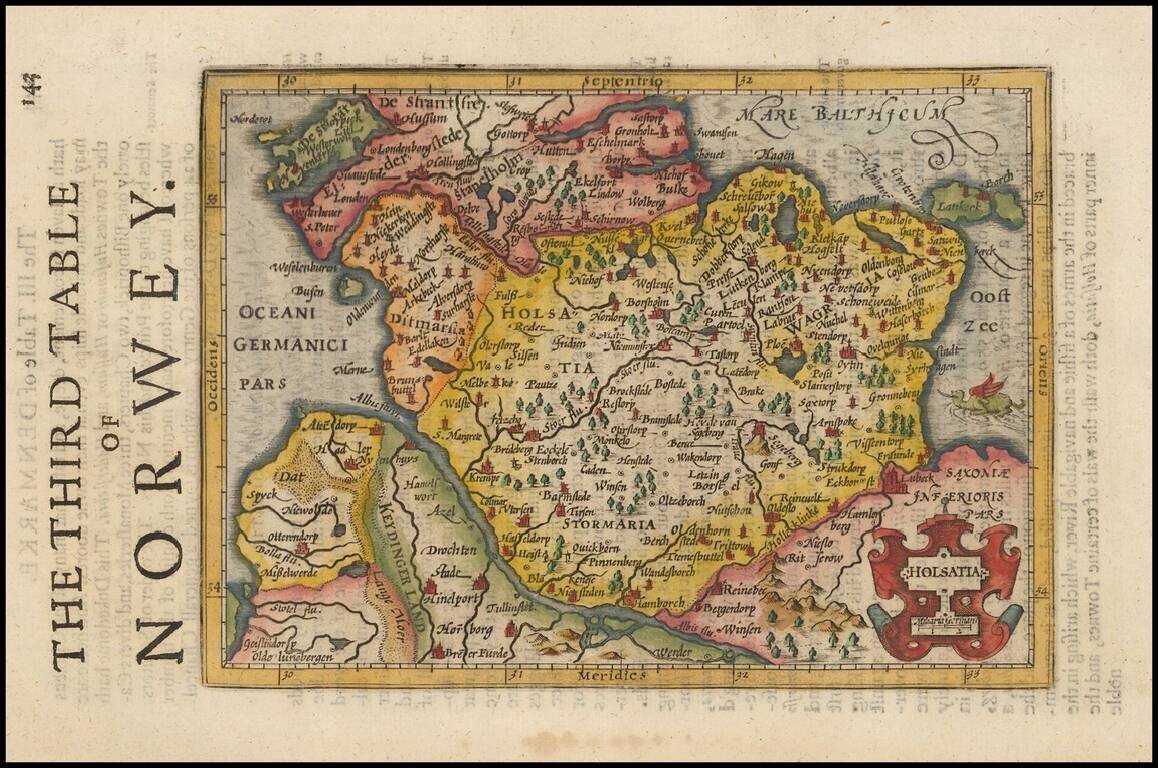
Decorative regional map of Northern Germany and part of Denmark (then Norway), showing Hamburg, Lubeck, etc. Decorative cartouche and a sea monster in the Baltic. From an English Edition of the Mercator-Hondius Atlas.
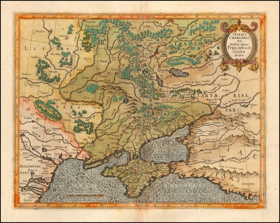
Detailed map of Southern Ukraine, Crimea and surrounding regions between the northern coast of the Black Sea and Moscow. Shows ports, fortified cities and the mouths of the Danube. Minor splitting along the towns, rivers, mountains, etc. Decorative...
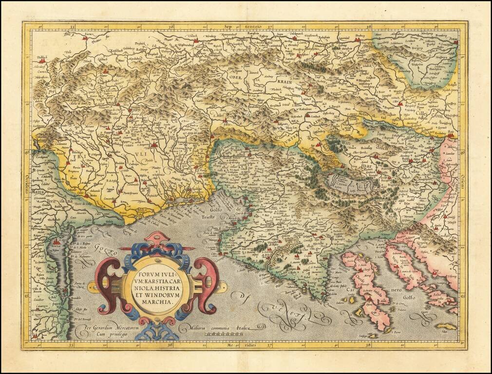
Detailed regional map of the Gulf of Venice and Gulf of Trieste regions, including Friuli and Istria. Includes Slovenia, northwestern Croatia and parts of Italy and Austria.
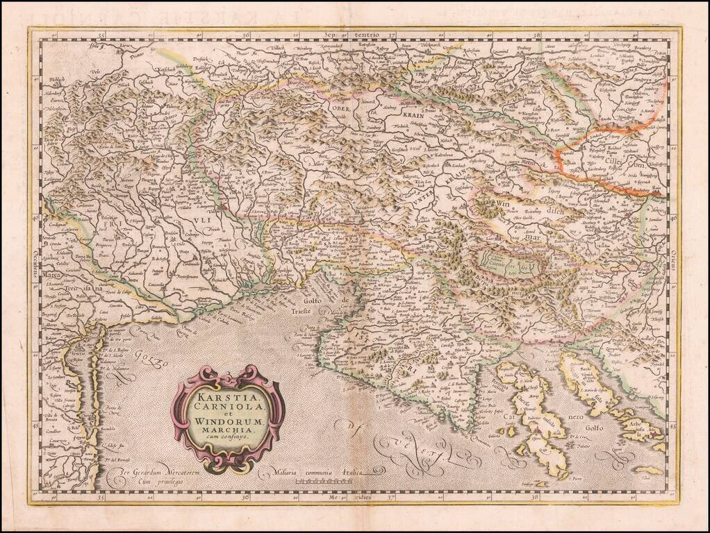
Detailed regional map of the Gulf of Venice and Gulf of Trieste regions, including Friuli and Istria. Includes Slovenia, northwestern Croatia and parts of Italy and Austria.
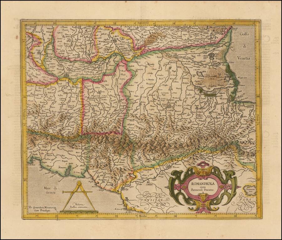
Striking regional map of Italy, published by Gerhard Mercator. Some of the major towns located include Parma, Bologna, Ravenna, Florence, Cremona, Mantova, Brescia, Piacenza, Pisa and Ferrara.
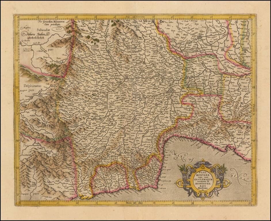
Striking regional map of Italy, centered on the Pedemont region of Italy and Genoa, published by Gerard Mercator and later by Hondius in the Atlas Sive Cosmographia. The map extends to the Milan region in the northeast, Cinque Terre in the southeast,...
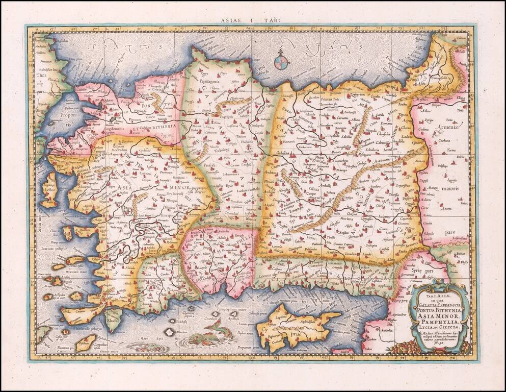
Nice example of Mercator's map of Asia, Minor and Cyprus, from Mercator's edition of Ptolemy's Geographia, first published in 1578 and republished in Amsterdam beginning in 1695. Includes a Sea Monster, cartouche and a detailed treatment of the...
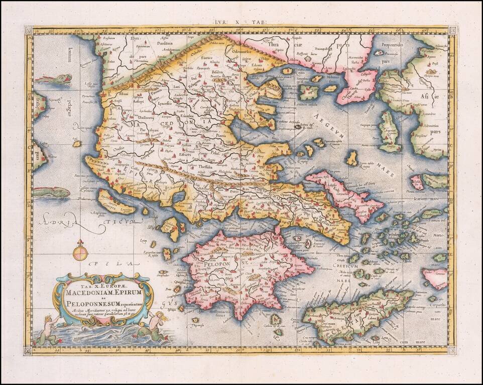
Nice example of Mercator's map of Greece from Mercator's edition of Ptolemy's Geographia, first published in 1578 and republished in Amsterdam beginning in 1695. Includes a Sea Monster, cartouche and a detailed treatment of the region. Gerard...
![Tab. IV. Asiae in qua Mesopotamia, Syria, Arabia Petrea ac Deserta . . . [Shows Cyprus]](/map/small/58766.jpg)
Nice wide margined example of Mercator's Ptolemaic map of Cyprus, the Holy Land, Syria, Chaldea, Mesopotamia, Armenia, etc. Nice example of Mercator's map of the region, from Mercator's edition of Ptolemy's Geographia, first published in 1578 and...
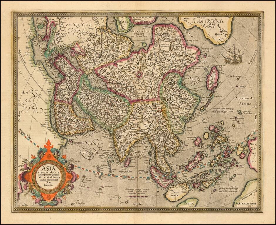
Nice old color example of Mercator's map of Asia. Includes an ornate cartouche and sailing ship. The map was updated and the cartouche etc. changed in 1606. The map is based upon Mercator's World Map of 1569.