![Pascaart vertoonende de zeecusten van Chili, Peru, Hispania Nova, Nova Granada, en California…. [Early New Zealand Inset]](/map/small/65168.jpg)
Fine Golden Age Dutch Chart with the Island of California and an Early Mapping of New Zealand Scarce early sea chart by Doncker, showing the West Coast of the Pacific Ocean, which extends from the island of California to Chile, with noteworthy insets...
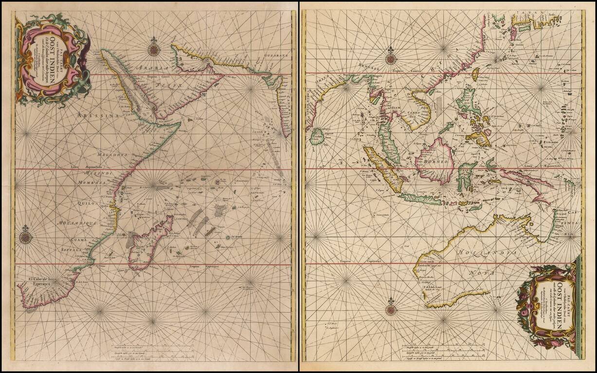
Rare Sea Chart of Australia, Southeast Asia, and the Indian Ocean from the Dutch Golden Age of Cartography Early pair of sea charts of the Indian Ocean and contiguous regions. Australia is remarkably delineated for this early date and reflects recent...
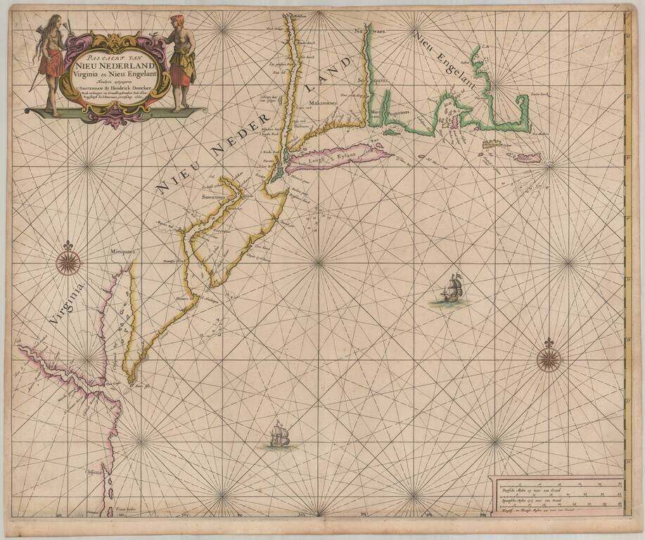
One of the earliest obtainable Sea Charts of the Atlantic Coast of North America. Important early Dutch sea chart of the coast of North America from Trinity Harbor, North Carolina to Cape St. Ann, Massachusetts, from Doncker's Zee-atlas ofte...
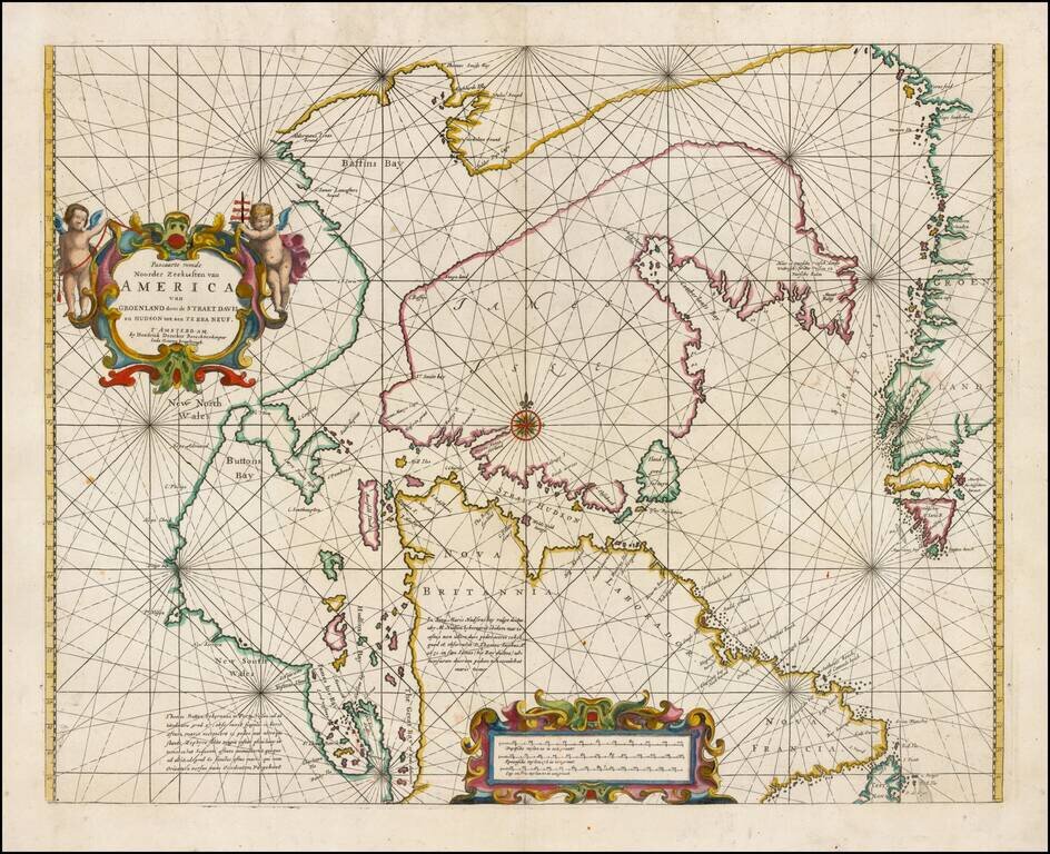
Fine example of Doncker's rare early map of the Northern part of America, including Hudson Bay, Davis Straits, Button Bay and the west coast of Greenland. Doncker's chart is one of the earliest obtainable charts to show this configuration and much of...
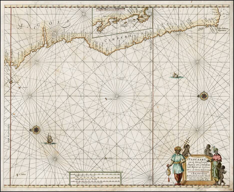
Early edition of Doncker's sea chart of the West Coast of Africa, from Angola to the Cape of Good Hope, with a larger inset map of the area from St. Martin's Bay to the Cape of Good Hope. Hendrik Doncker was a famous bookseller in Amsterdam, who...
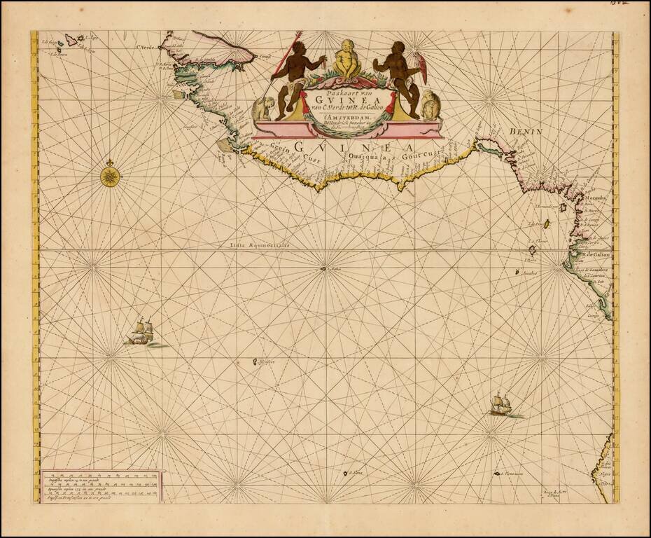
Finely colored example of Doncker's sea chart of West Africa, which appeared in his De Zee-Atlas of Water-Waerelt, published in Amsterdam, circa 1665. The map extends from the Cape Verde Islands, Dakar and the area just north of the Gambia River in...