John Ogilby (1600-1676) was an English geographer and publisher, one of the most prominent of the seventeenth century. Little is known of his early life but by 1619 he was apprenticed to John Draper, a dancing-master in London. He worked as a dancing-master, courtier, and theater owner form 1620-1641. From 1649 he worked as a poet, translator, and publisher of classical texts. It is only in the last decade of his life that he entered into geography.
In 1649, Ogilby published his first translation, of Virgil, and continued to put out translations in the 1650s and 1660s. In March 1661 he was reconfirmed as master of revels in Ireland and appointed master of the king’s imprimeries, or king’s printer. From 1662 to 1665 he was in Ireland, where he most likely met Robert Boyle. He returned to London only to lose much of his printing stock in the Great Fire of 1666. Post-fire, he became assistant surveyor to the city, where he met Robert Hooke and Christopher Wren.
In 1669, Ogilby published Embassy to China. At the same time, he planned to release atlases that would cover the entire world. These atlases would be funded via subscriptions, advertisements, and lotteries—all common practice at the time, especially for expensive multi-volume works. He released Africa and Atlas Japannensis in 1670, America in 1671 and Atlas Chinensis in 1671, and Asia in 1673. Ogilby compiled the works based on materials produced by others and they reflect a growing interest in the wider world within England.
In 1671, while producing the atlases, Ogilby secured another royal title, that of his Majesty’s cosmographer. He used this title when publishing Britannia in 1675, his best-known work. The Britannia is best described as a road atlas; it shows 2519 miles of road in 100 strip maps. This technique would be widely adopted in the subsequent century. His method of measuring with a waywiser, a large wheel, also helped to standardize the distance of the English mile at 1760 yards. The Britannia was a major achievement in early English cartography and was republished in 1698, 1719, and 1720.
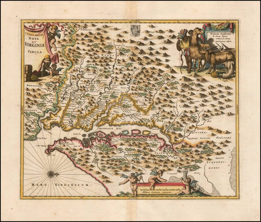
Nice example of Ogilby's edition of Smith's map of the Virginia & Chesapeake region. The map is based upon the earlier maps by Hondius and Blaeu, a bit smaller, but with 3 large cartouches, one of which includes fascinating indigenous animals,...
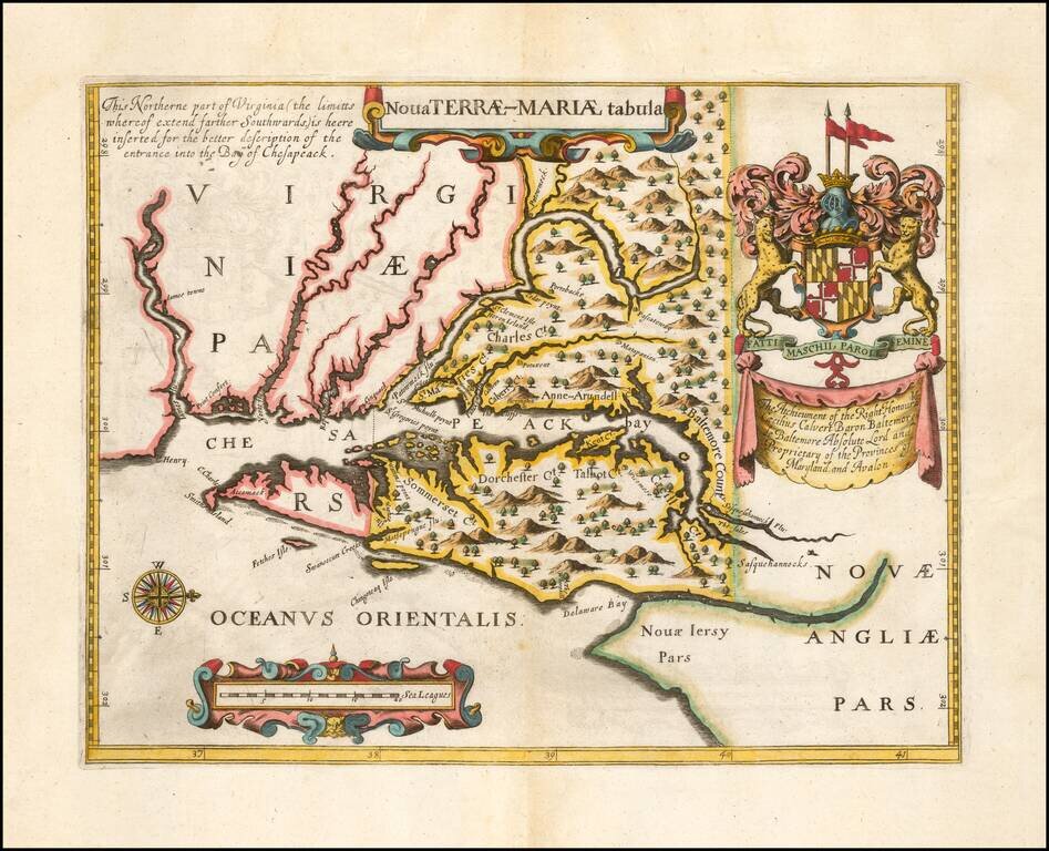
Second Edition of the First Map of the Province of Maryland -- Prepared To Promote The Newly Created Province Fine example of John Ogilby's rare Lord Baltimore Map, the second edition of the first printed map of Maryland and the first to show the...
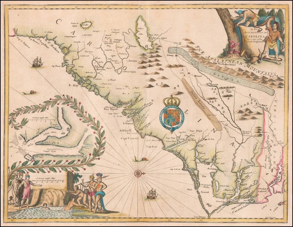
Rare and important early promotional map of the Carolinas, from the coast of the Appalachians, prepared by James Moxon to promote the newly established Carolina Colony. This map is the first large format map of the newly settled Carolina Colony,...
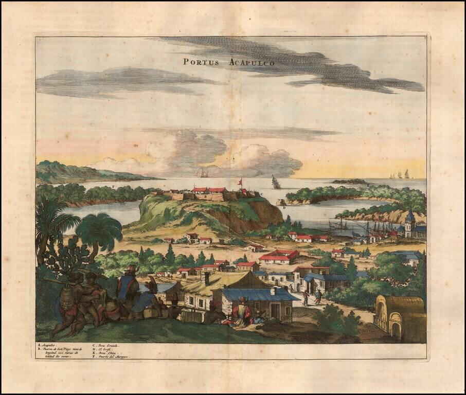
Attractive view of the Spanish stonghold of Acapulco, showing fortifications, outlying buildings, ships in the harbor, costumed locals, etc. Acapulco was one of the most important ports on the Pacific Coast of Mexico and major port in the Manilla...
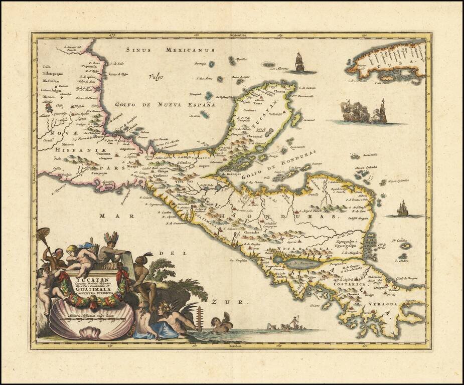
An Early Decorative Map of the Yucatan and Central America Striking full color example of Ogilby's regional map, centered on the Yucatan, Guatimala and Honduras, and extending south to Costa Rica and Panama City and North to Mexico City (and showing...
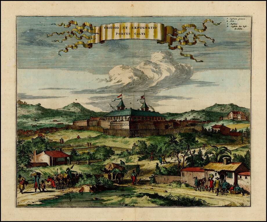
Early view of the Portuguese fort of Porto Calvo in Brazil. Porto Calvo in the Alagoas region, controlled the passage of the Manguaba River, and was at the frontline of Portuguese-Dutch hostilities in the early 1630's. Shown here as a simple wooden...
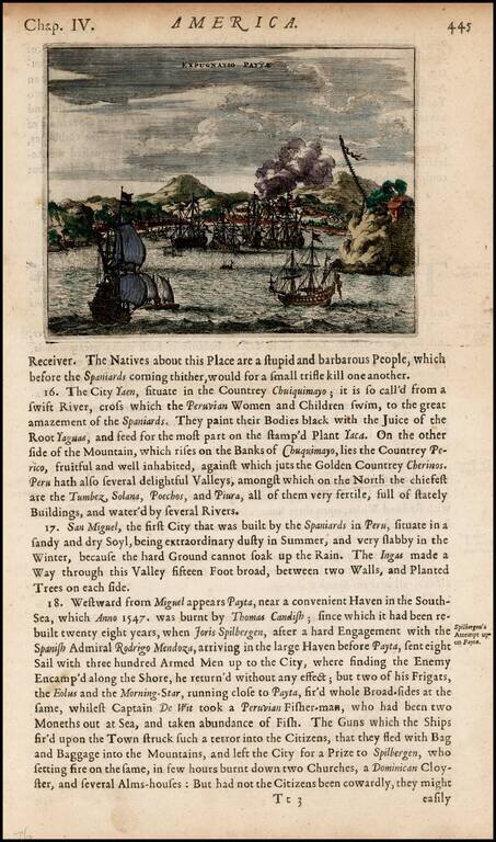
Detailed view of the harbor and town of Payta, burned by Thomas Cavendish in 1547 and visited by Joris Spilbergen in 1575.
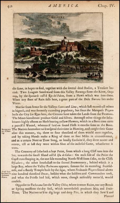
View of the fortifications at Guarme, or present-day Huarmey, Peru, from Ogilby's Complete History of America. Includes men landing goods and barrels from boats and a settlement with a church in a distance.
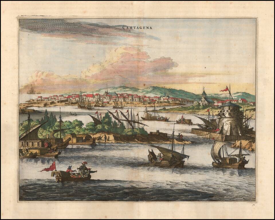
Striking view of the fortified town of Cartagena, Colombia showing sailing vessels, fortifications etc. The map illustrates an idealized harbor, walled city and European style buildings. Very active commercial scene shown in the foreground. This view...
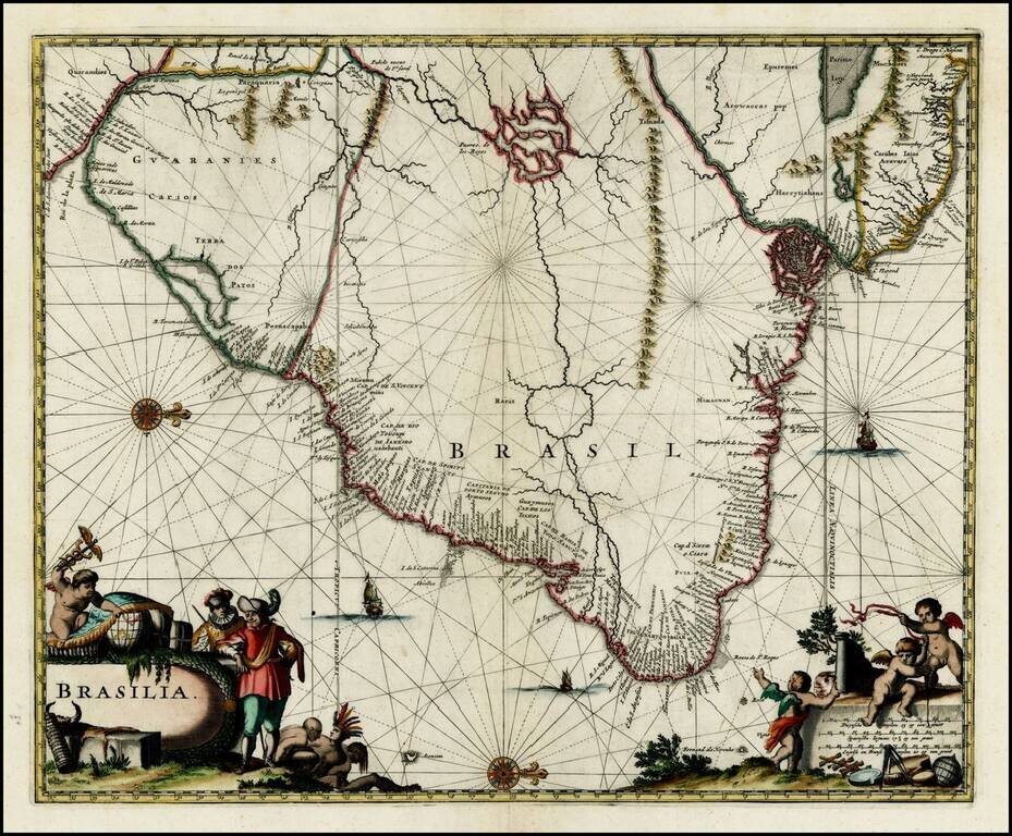
Striking full color example of the map of Brazil from Ogilby's English translation of De Nieuwe en Onbekende Wereld published by Arnold Montanus, which was used by John Ogilby as the basis of his Complete History of America. The cartography of the...
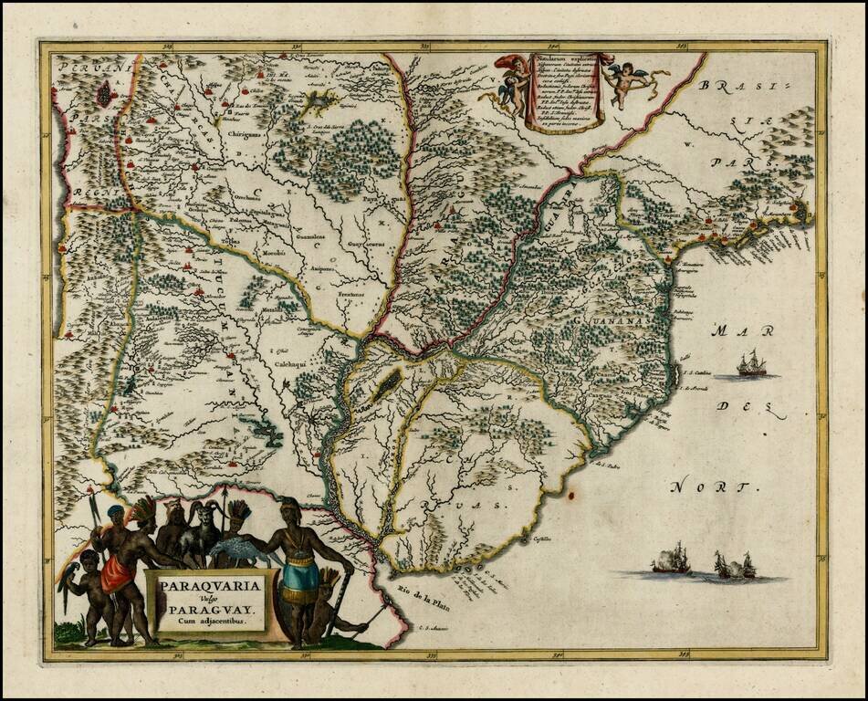
Nice full color example of this regional map, extending from the mouth of the Rio De La Plata to San Sebastian and Marambaya in Brazil, and centered on the course of the Rio De La Plata. Embellished with 2 decorative cartouches and sailing ships.
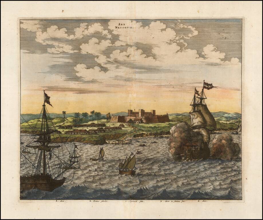
An attractive early view of Fort Nassau. This fine early view depicts the scene of a battle off the coast of Pernambuco on the east coast of Brazil, during the Dutch & Portuguese struggle to retain ownership of the area. Fort Nassau (Arx Nassovii)...
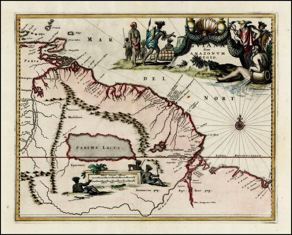
Striking full color example of the map of the coast between the Orinoco River and the Amazon, centered on Parime Lacus, from Ogilby's Complete History of America. Very large decorative cartouche, compass rose and large second cartouche showing...