
Geological map which accompanied William H. Emory's Report on the United States and Mexican Boundary Survey, one of the classic maps of Texas and Western history. "On August 15, 1854," notes William Goetzmann, "Major William H. Emory was ordered by...
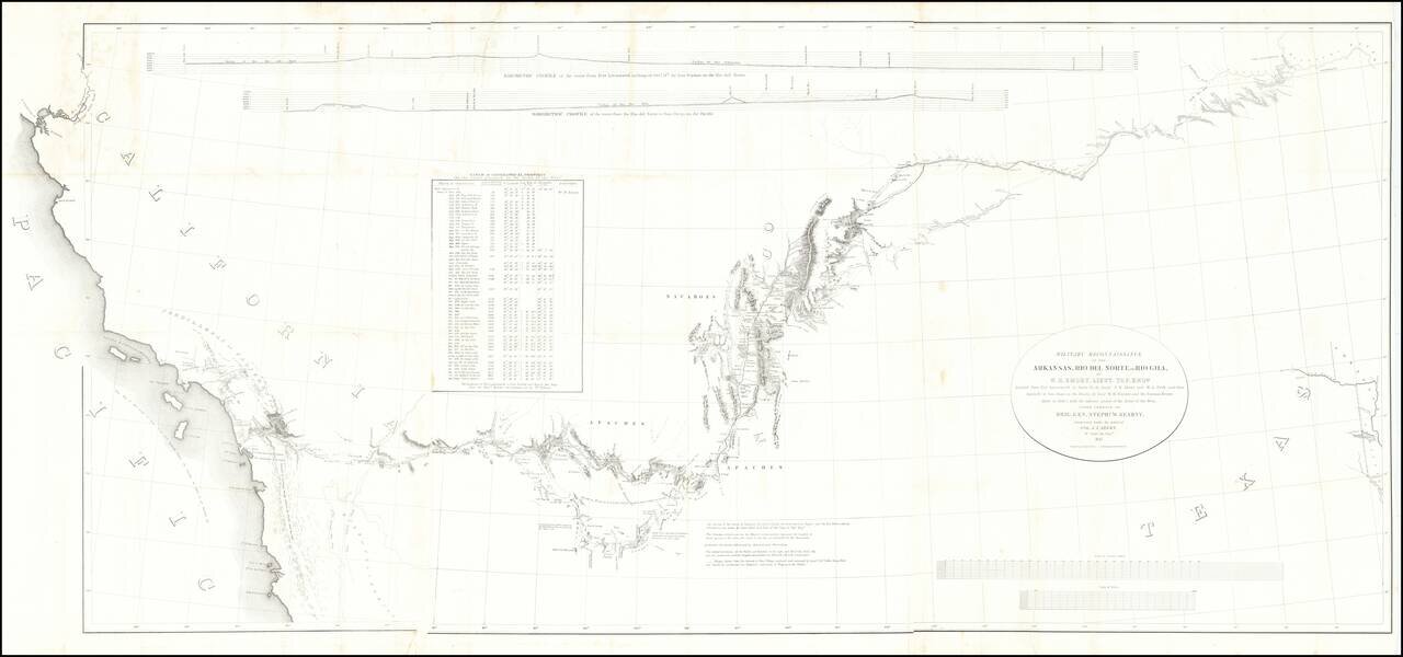
Fine example of the William Emory's milestone mapping of the Southwestern United State, from Ft. Leavenworth to the West Coast, from Emory's Notes of a Military Reconnaissance, from Fort Leavenworth, in Missouri, to San Diego, in California . . ., one...
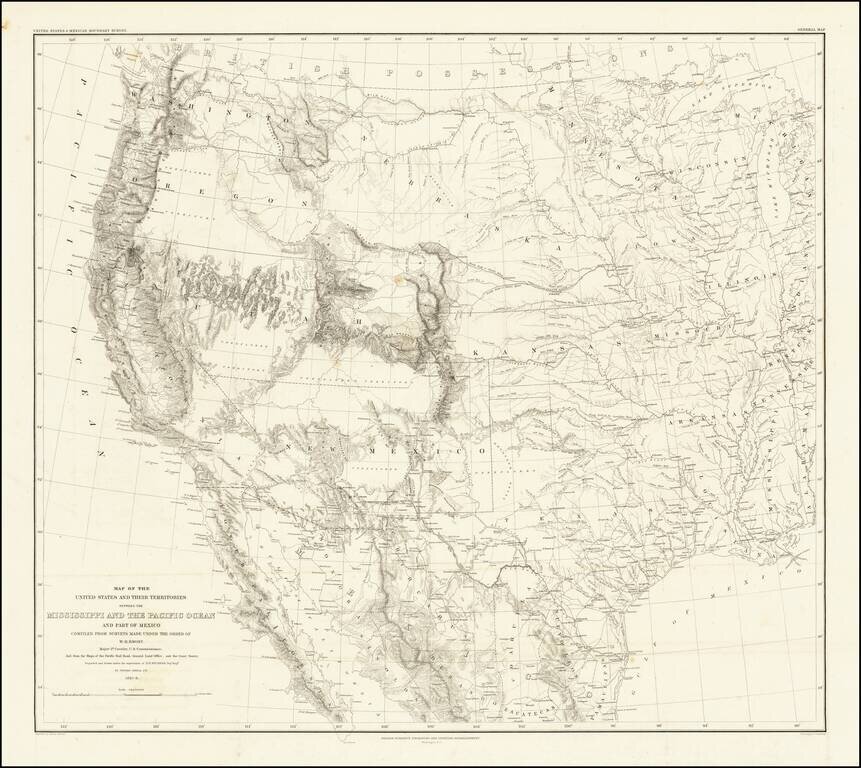
Emory's Map of the Transmississippi West. Marvelously detailed map of the Western Territorial US, published by W.H. Emory in his Report of the United States and Mexican Boundary Survey. The map is one of the fundamental post-Gadsden Purchase maps of...
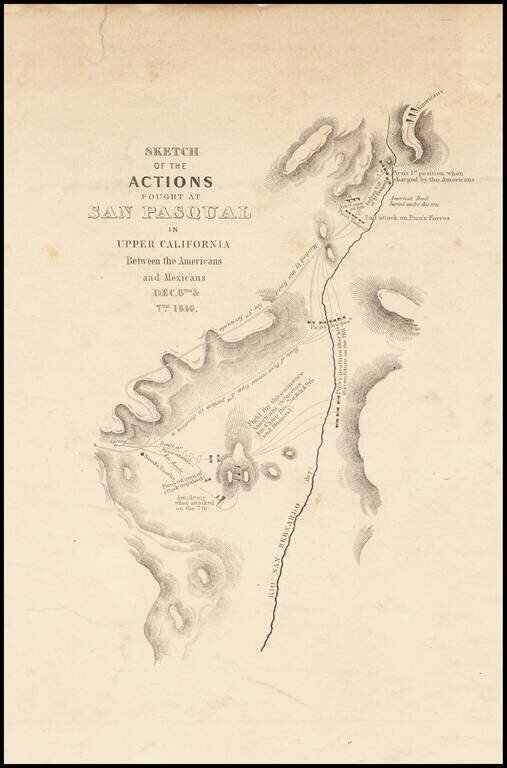
Nice example of Emory's map of the Battle of San Pasqual, in North San Diego County, one of the earliest military battles fought in Upper California. The Battle of San was fought during the Mexican-American War in what is now the San Pasqual of San...