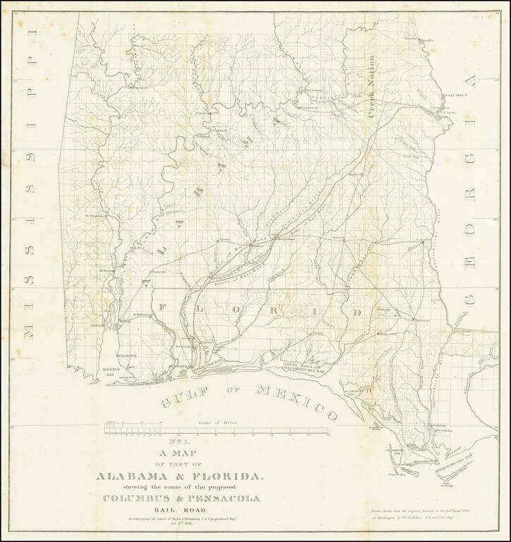
Detailed map of Alabama and western Florida, showing the route of the proposed Columbus & Pensacola Railroad, which accompanied the report of Major J.D. Graham, February 6, 1836. An early and important railroad map of parts of southern Alabama and...
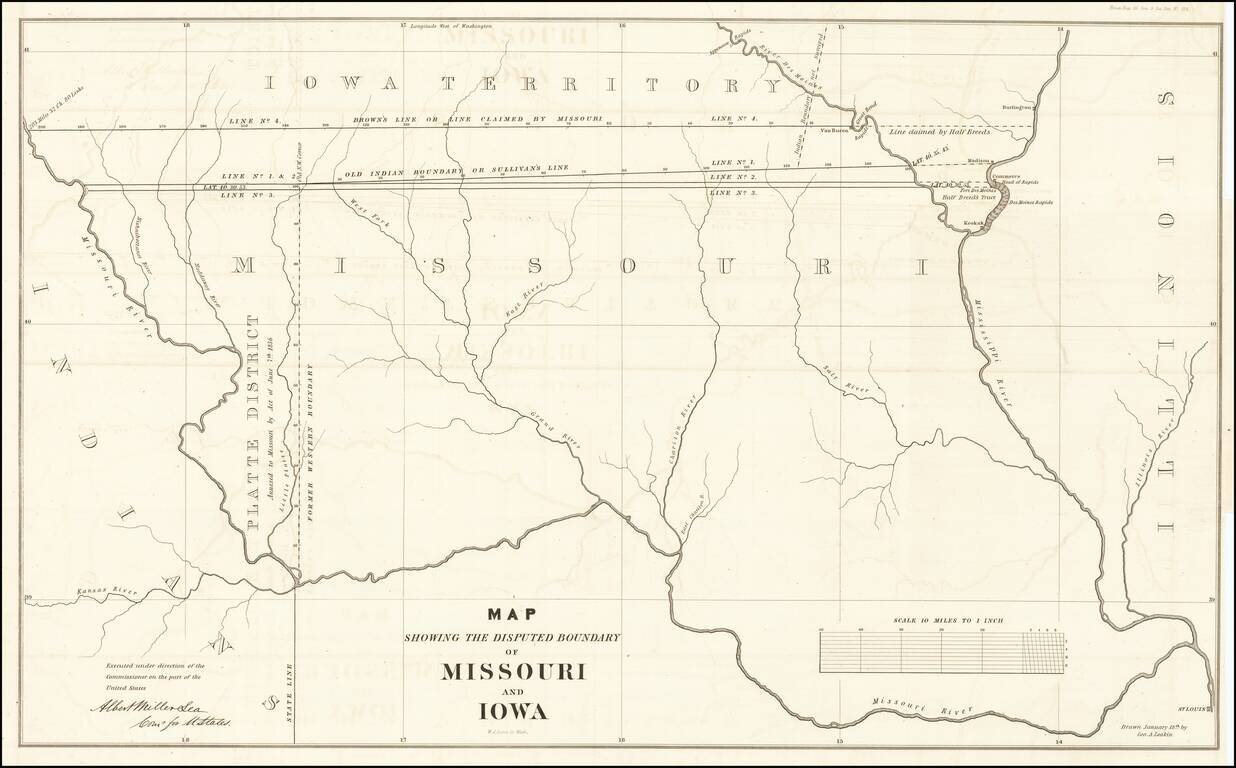
The Iowa-Missouri Boundary Dispute Detailed map illustrating the boundary dispute between Missouri and Iowa, drawn by George A. Leakin, accompanied by the report to the House of Representatives dated December 31, 1842, regarding the Northern Boundary...
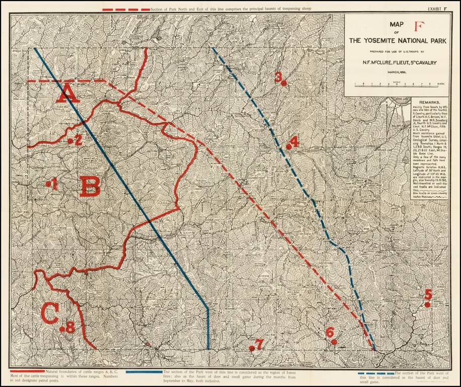
Highly detailed map of Yosemite National Park, prepared by N.F. McClure, during the period when the Park was controlled by the U.S. Army. Includes outlines in Red and Blue, showiing natural boundaries of cattle ranges, section of the park susceptible...