Thomas Kitchin (1719–1784) was a British cartographer and engraver. Born in Southwark, England, Kitchin was the eldest of several children. He was apprenticed to the map engraver Emanuel Bowen from 1732 to 1739, and he married Bowen’s daughter, Sarah, in December 1739. By 1741 Kitchin was working independently and in 1746 he began taking on apprentices at his firm. His son Thomas Bowen Kitchin was apprenticed to him starting in 1754. By 1755 Kitchin was established in Holborn Hill, where his firm produced all kinds of engraving material, including portraits and caricatures. He married his second wife, Jane, in 1762. Beginning in 1773 Kitchin was referred to as Hydrographer to the King, a position his son also later held. He retired to St. Albans and continued making maps up to the end of his life.
A prolific engraver known for his technical facility, clean lettering, and impressive etched decoration, Kitchin produced several important works throughout his career. He produced John Elphinstone’s map of Scotland in 1746, and the first pocket atlas of Scotland, Geographia Scotiae, in 1748/1749. He co-published The Small English Atlas in 1749 with another of Bowen’s apprentices, Thomas Jefferys. He produced The Large English Atlas serially with Emanuel Bowen from 1749 to 1760. This latter was the most important county atlas since the Elizabethan era, and the first real attempt to cover the whole country at a large scale. In 1755 Kitchin engraved the important John Mitchell map of North America, which was used at the peace treaties of Paris and Versailles. In 1770 he produced the twelve-sheet road map England and Wales, and in 1769–70 he produced Bernhard Ratzer’s plans of New York. In 1783 he published The Traveller’s Guide through England and Wales.
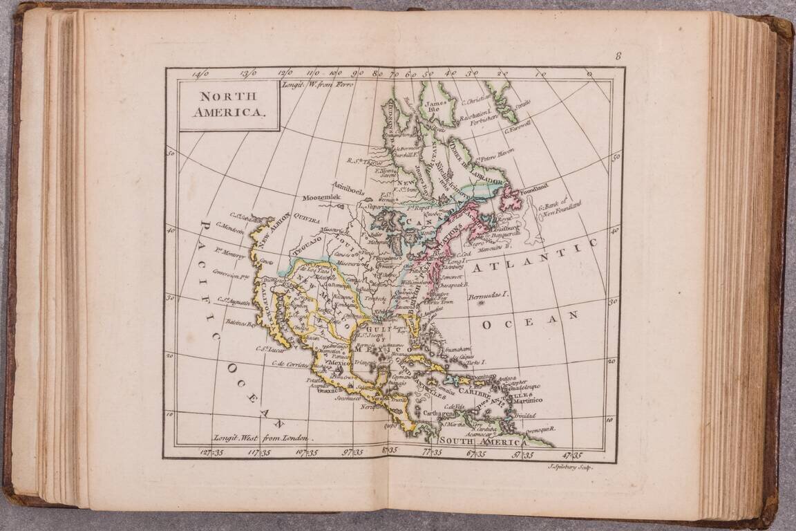
A little gem of an 18th-century English atlas, being the 1761 edition of Dury's New General and Universal Atlas. Rumsey (3004) says that the map of Canada is double-page in the 1763 edition but not in the 1761. The 1763 having been changed to reflect...
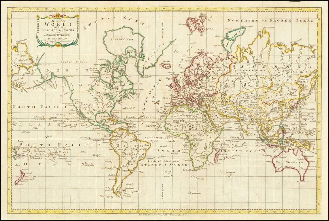
A World Map Immediately Following The Discovery of Hawaii Finely executed map of the World, focusing on the recent discoveries of Captain James Cook in his 3 Voyages of exploration which spanned the preceding decades. This map presents an interesting...
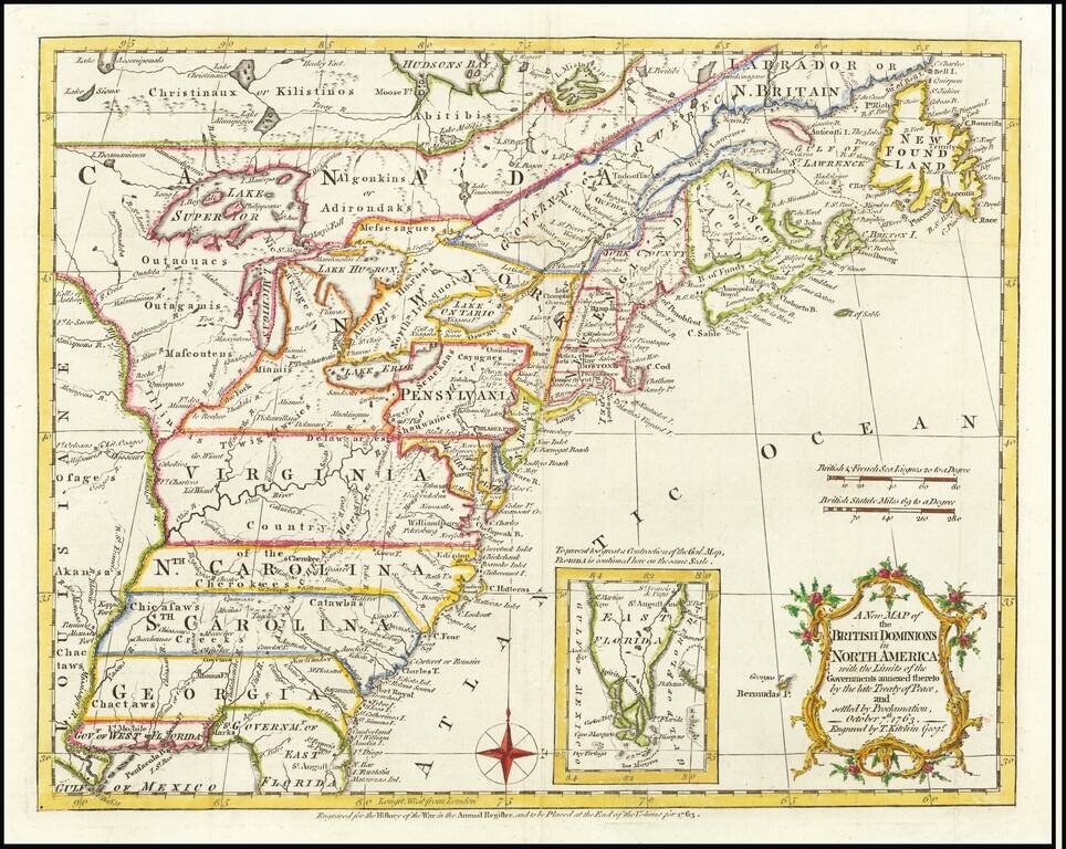
Interesting map of the US and Canada at the end of the French & Indian War, based upon John Mitchell's seminal map of 1755. The map shows the many French and English Forts in the Mississippi and Ohio Valleys, along with numerous Indian Tribes on...
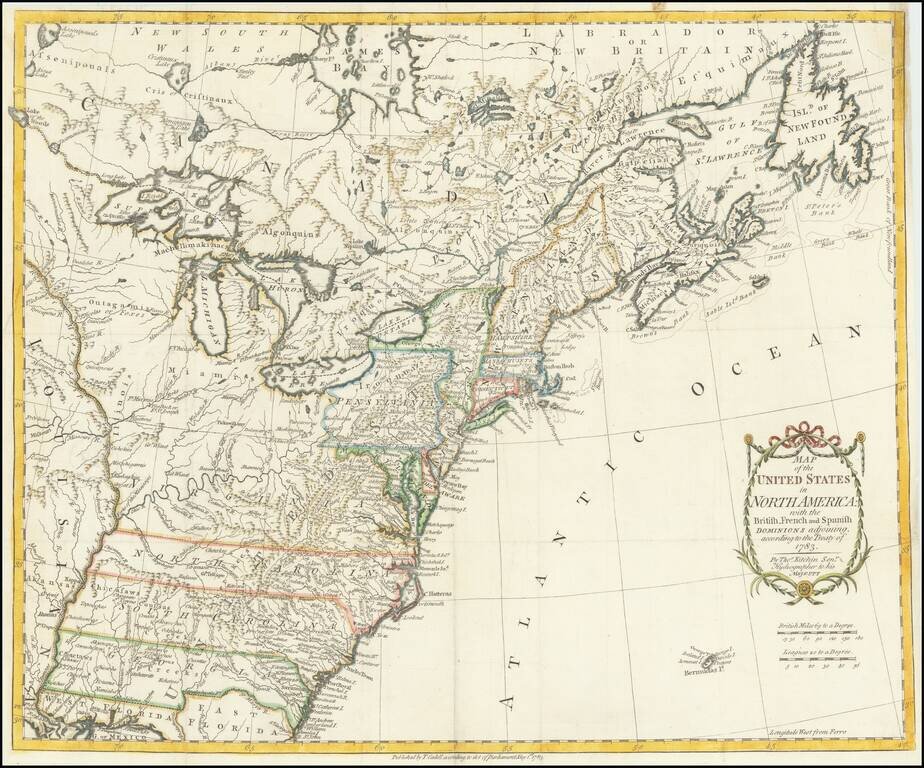
One of the earliest obtainable English Maps to name (and recognize) the newly independent United States of America. The map shows the United States extending to the Mississippi River, with the former colonial claims now Independent States. The states...
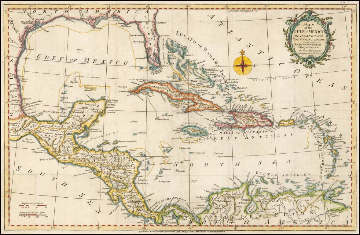
Detailed map of the Caribbean and Southeastern US, extending to Texas, Mexico, Central America and South America. Numerous annotations throughout.
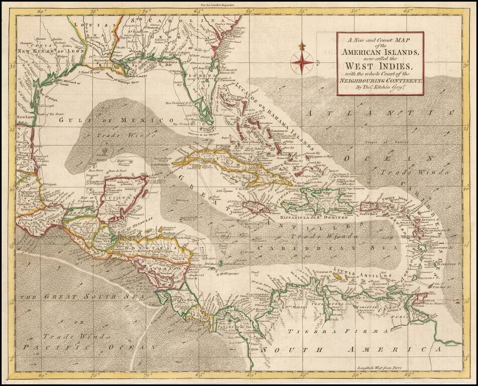
Striking map of the West Indies, Gulf Coast, Florida, etc. Florida shown as an archipelago. Includes a compass rose and decorative cartouche.
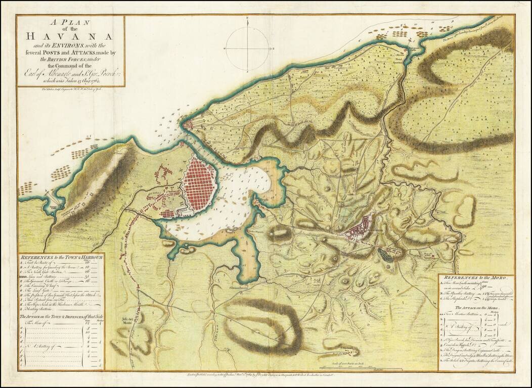
Perhaps the First Separate Map of the 1762 Siege of Havana. Extremely rare separately issued map of showing the British Siege of Havana, at the tail end of the French & Indian War. This map, published November 1, 1762, by John Boydell and R....

A Rare Separately Published Example From A Storied English Country Mansion. Striking two-sheet, engraved map of South America below the Rio de La Plata, produced by Thomas Kitchin in London in 1772. Attractively-engraved by Kitchin, the map features...
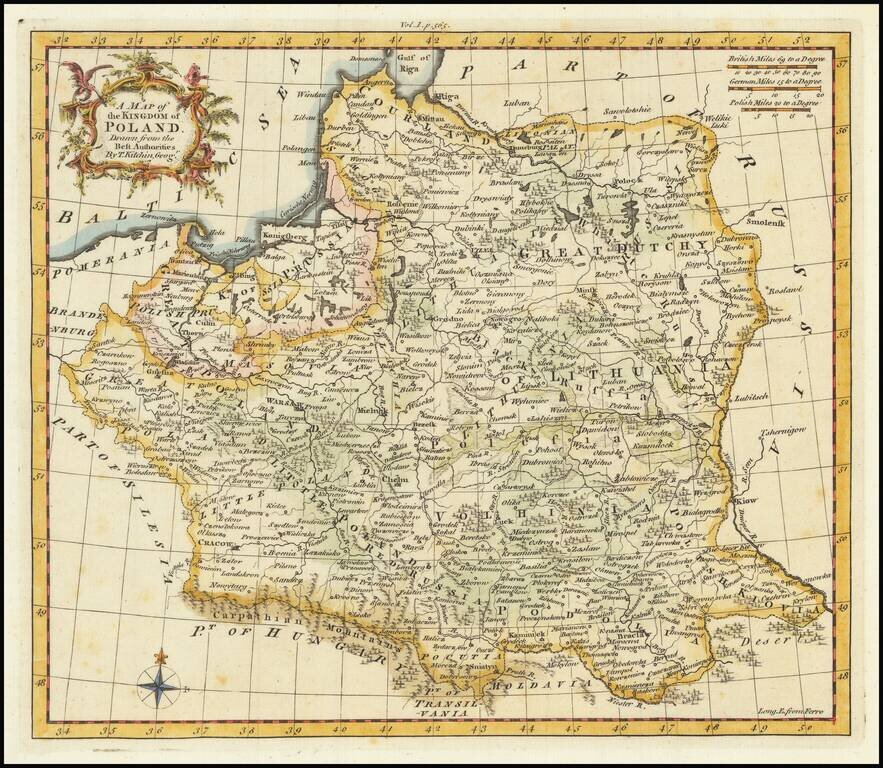
Scarce English map of the Kingdom of Poland (and Lithuania) on the eve of its initial dismemberment. The map appeared in Busching's A new system of geography: in which is given, a general account of the situation and limits... of the several kingdoms...
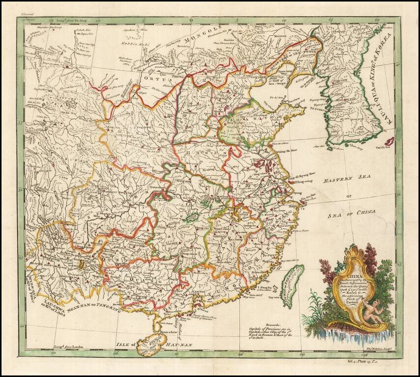
Based on a Jesuit Map of China Finely executed map of China and Korea, originally drawn from Jesuit Sources. The Qing Emperor Kangxi commissioned a ground of Jesuit surveyors to map China from 1708 to 1716. The resulting maps were published as the...
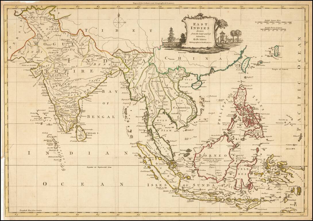
Decorative map of China, Korea, Southeast Asia, the Philippines, and India, published in Guthrie's New Geographical Grammar.
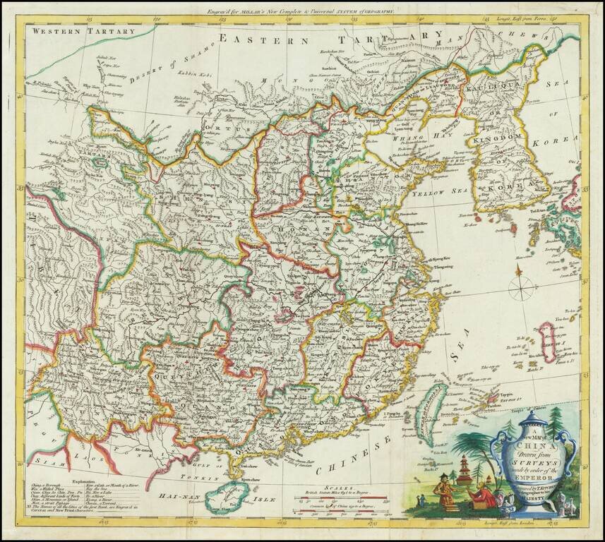
Attractive engraved map of China, produced by Thomas Kitchin for George Henry Millar's New Complete & Universal System of Geography. The map was published in London circa 1782. The cartouche is particularly attractive on this map, featuring a...
![[Fort Gingee & The Great Mountain of Gingee]](/map/small/58792.jpg)
Detailed plan of "The Great Mountain of Gingee" and the small fort atop it, published by Thomas Kitchin. The explanatory note continues that 10 men were sufficient to defend the fort against assaults. The key locates a total of 12 places on the map....
![A Map of the Coast of Coromandel from the River Gadevari, to Cape Comorin [Sri Lanka]](/map/small/62976.jpg)
Detailed regional map of Southwestern India and Sri Lanka, published by Kitchin. The map is drawn primarily from D'Anville's map, as augmented by Kitchin using English sources, including: "The Route from Tritchinapoly to Tinevelley; as ascertained...
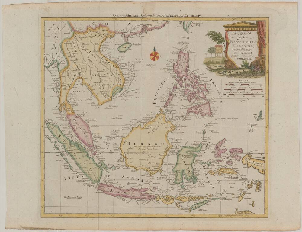
Scarce map of the Philippines and Southeast Asia, published for Millar's New Complete & Universal System of Geography. The map is centered on the Philippines and Brunei, and includes a decorative cartouche.
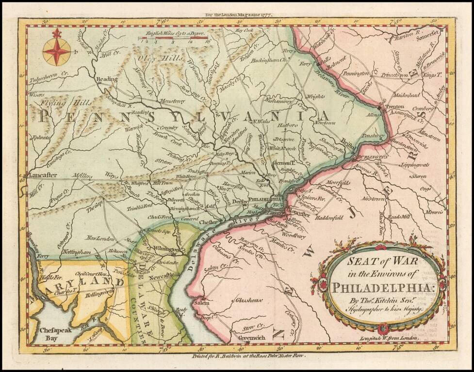
Fine early map showing the Seat of the American Revolutionary War around the Delaware River and Philadelphia, which appeared in the London Magazine in 1777. The map includes the area from Trenton to Lancaster. The road network is shown in detail. It...