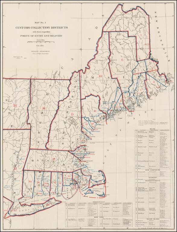
Rare Treasury Department Map of the New England and Northeast Region, identifying the customs port of entry. The following are annotated: Ports of Entry (red) Ports of Delivery (blue) The table identifies dozens of ports districts. A...
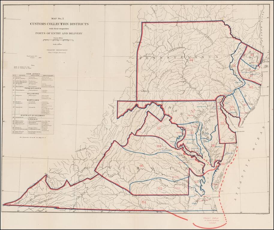
Rare Treasury Department Map of the Mid-Atlantic Region, identifying the customs port of entry. The following are annotated: Ports of Entry (red) Ports of Delivery (blue) The table identifies about 40 different ports districts. A fascinating...
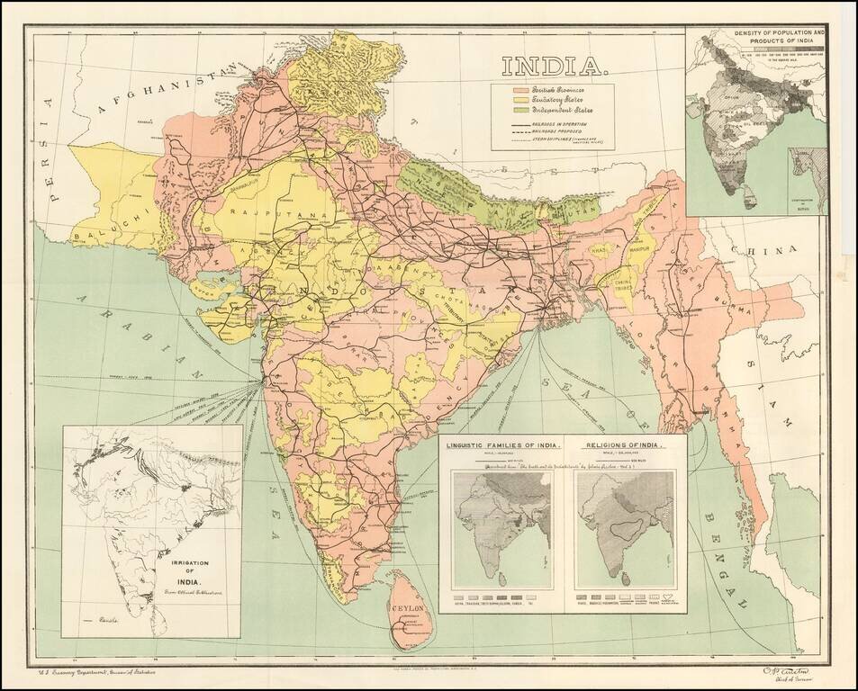
Detailed map of India, showing density of population, lingusitic information, religion, etc. The map is color coded to show British Provinces, Fendatory Provinces and Independent Provinces.