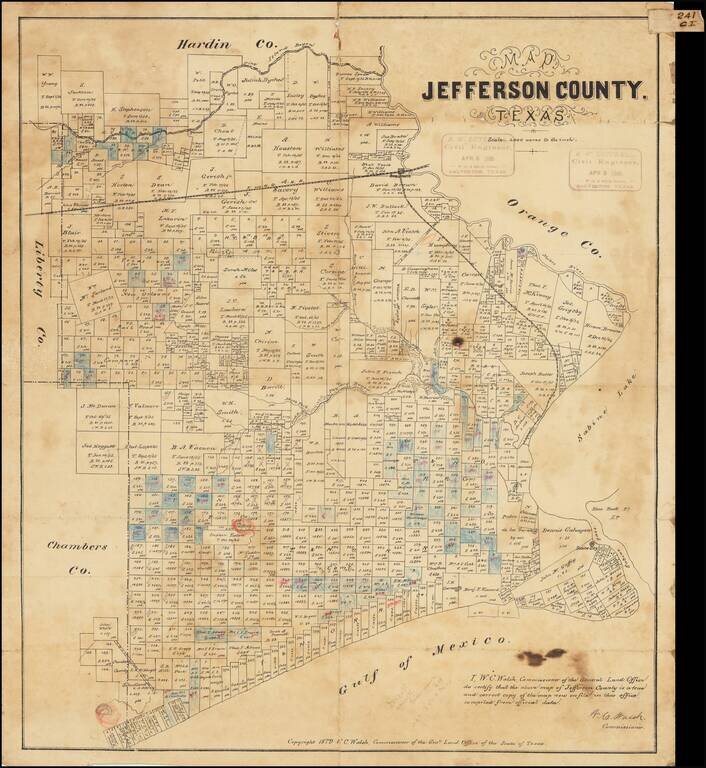
Antique Texas General Land Office map of Jefferson County, Texas. The map was prepared in 1879 by W.C. Walsh, Commissioner of the Genl. Land Office. This example of the map has manuscript annotations related to land sales and the oil industry. Three...
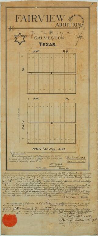
19th-century Manuscript Map of Part of Galveston Texas. Unique antique manuscript map of the "Fairview Addition" to Galveston, Texas, produced by one of Galveston's most important early surveyors, R.W. Luttrell. The map covers two blocks of plots,...
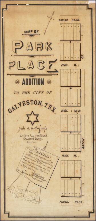
Manuscript 19th-century Galveston Survey Map. Unique manuscript map of an early addition to Galveston, Texas, produced by a Galveston-based surveyor circa 1895. The addition probably occurred (or was to occur) on the west side of the City of...
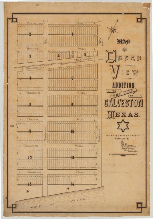
Attractive manuscript plan for an early subdivision in Galveston, Texas, drawn by Galveston-based surveyor R.W. Luttrell. The map shows a Gulf of Mexico-adjacent 15-block addition called the "Ocean View Addition". The addition is centered around the...
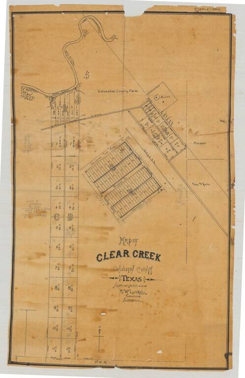
Original manuscript plat map of "Clear Creek", now League City, in Galveston County, Texas, drawn by Galveston-based surveyor R.W. Luttrell probably around 1900. The map shows a series of plots and roads just south of Clear Creek, which enters Clear...