Jean Lattré (fl. 1743-1793) was a Parisian bookseller and engraver who published many maps, plans, globes, and atlases. He worked closely with other important French cartographers, including Janvier, Bonne, and Delamarche, as well as other European mapmakers, such as William Faden, Santini, and Zannoni. Lattré is also interesting due to his propensity to bring suits against those who copied his work; plagiarism was common practice in eighteenth-century cartography and mapmakers struggled to maintain proprietary maps and information.
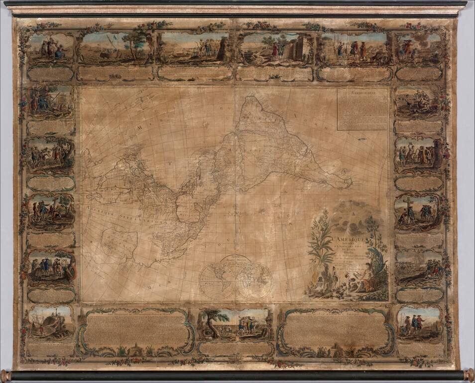
Important 18th Century wall map of America, one of the earliest obtainable printed maps to show the Sea or Bay of the West and the earliest wall map of America to show this configuration. The map is oriented with east at the top, one of only a few...
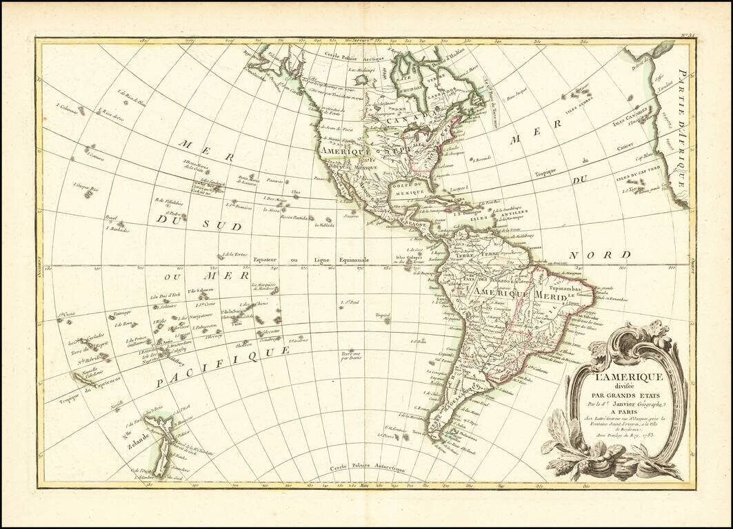
Fascinating Alaska Configuration 1783 edition of Janvier's map of America, issued in the same year that the United States was formally granted its independence from England. The mythical Sea of the West is no longer shown, replaced by a curious...
![L'Amerique divisee en ses principaux Etats . . . 1790. Augmentee du voyage de Cook en 1782 [Sea of the West]](/map/small/29459.jpg)
Rare 1790 Janvier/Lattre map of America, which contains not only the mythical Sea of the West, but also an equally mythical reference to a 1782 Voyage of Cook. The present map is one of the most fascinating (and lazy) examples of the use of a recycled...
![Sphere De Ptolemee [with] Rose De Boussole…](/map/small/63929.jpg)
Decorative chart, showing a compass rose, Ptolomaic Sphere and various other 18th Century spheres, from Janvier's Atlas.
![Карта Шара Земнаго Солиненная по Астрономическимъ Наблю-денїямъ. Жанверомъ. [Globular Map of the Earth Compiled from Astronomical Observations. Janvier]](/map/small/65900.jpg)
Rare 1793 Russian-language edition of Jean Janvier's double hemispheric world map "Mappe-Monde ou Description Du Globe Terrestre", originally published in 1762. The map appeared in the Saint Petersburg-published atlas: Новый атлас, или...
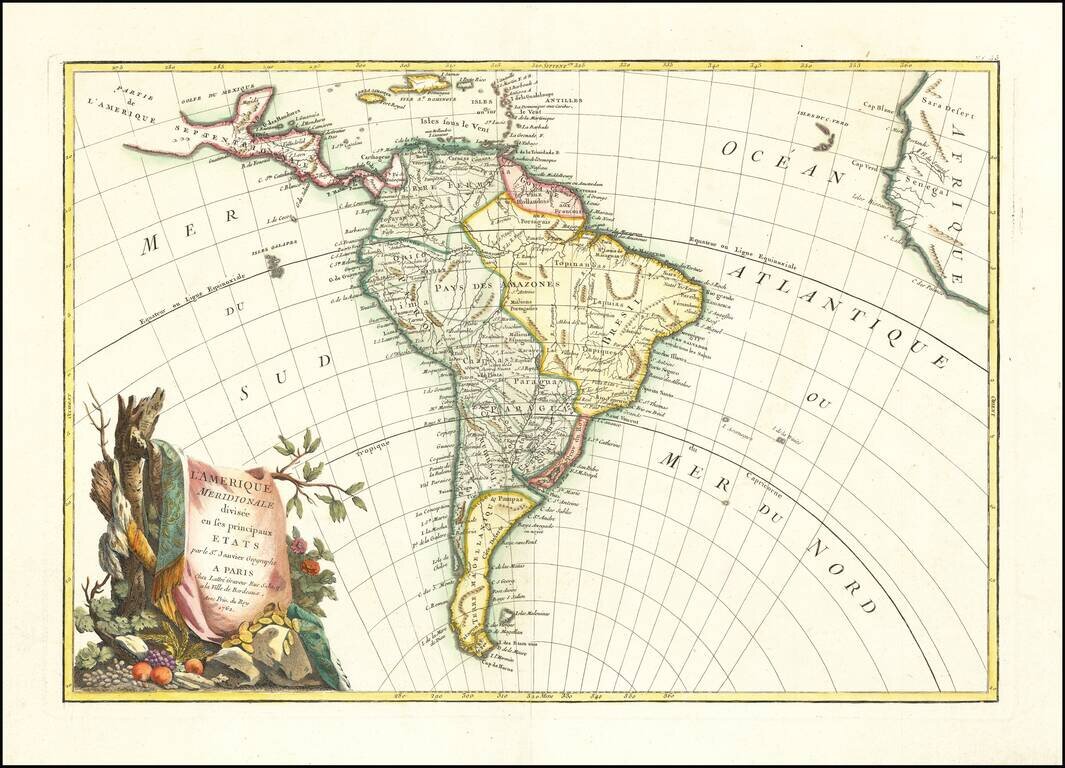
Decorative map of South America, published in Paris by Jean Janvier. A classic example of the French unwillingness to enhance maps with speculative cartography. Large decorative cartouche.
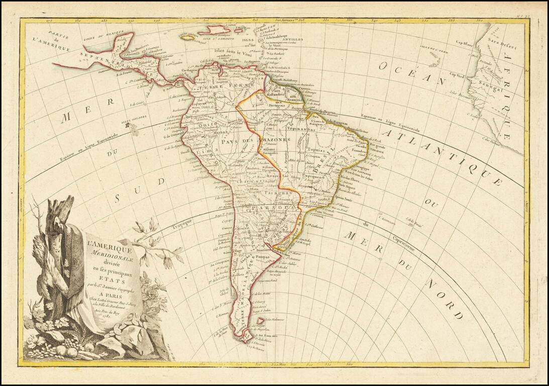
Decorative map of South America, published in Paris by Jean Janvier. A classic example of the French unwillingness to enhance maps with speculative cartography. Large decorative cartouche.
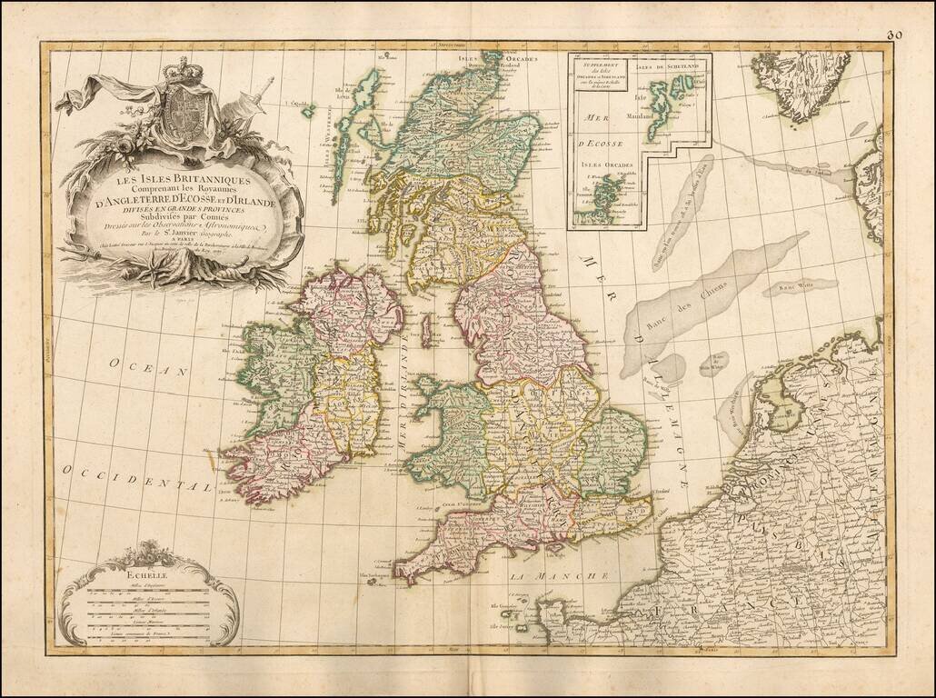
Fine large format map of the British Isles, with a large inset of the Orkades and Shetlands. The map includes a fine ornate cartouche and coat of arms, with the various countries colored by regions and counties. This large format Janvier map is quite...
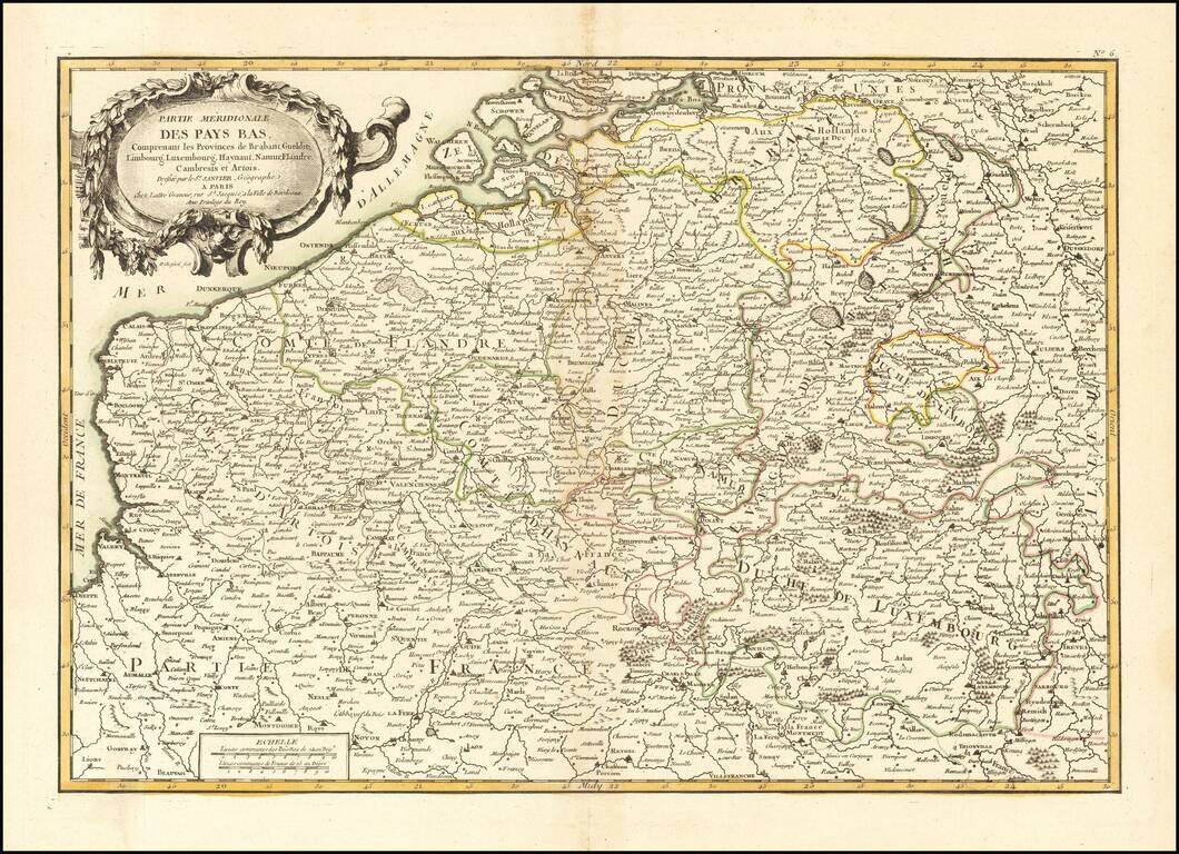
Decorative map of the Southern part of the Low Countries, published in Paris.
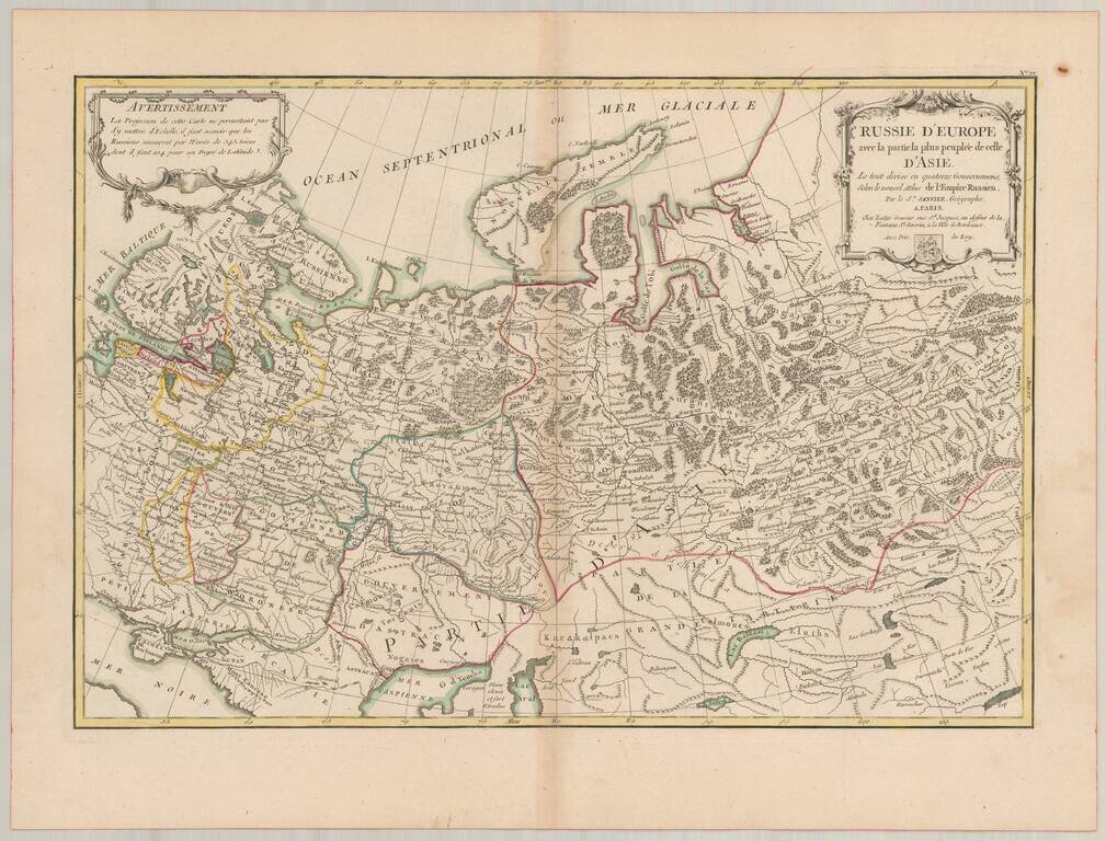
Detailed map of Russia, extending from Scandinavia and Baltics to nearly the Pacific. Shows forests, rivers, towns, mtns, lakes, etc. 2 decorative cartouches. The map is based upon the rescently completely Atlas of Russia, for which the famous French...
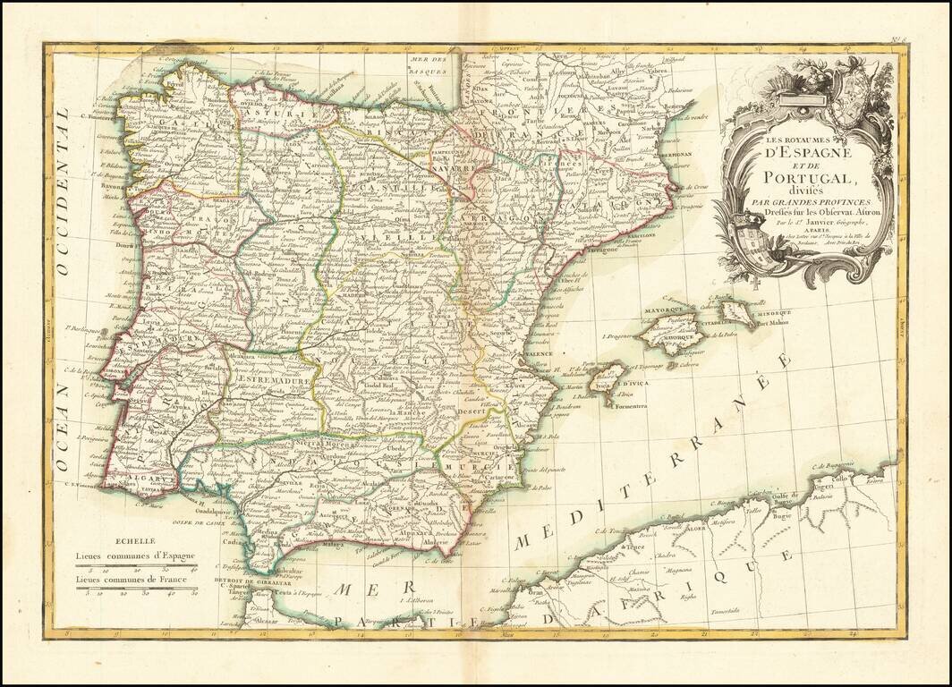
Attractive map of the Iberian Peninsula, colored by province in outline color. Includes the Balearic Islands. Shows towns, rivers, lakes, islands, mountains, etc. Large decorative cartouche.
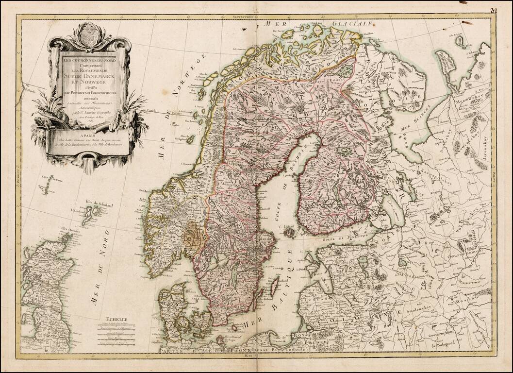
Scarce large format map of Scandinavia, by Janvier, published in Paris.