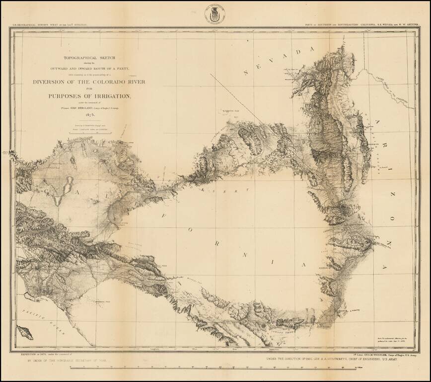
Highly detailed US Geographical Survey Map, tracing the expedition route from Ehrenberg and the Willow Spring area to Los Angeles, via the Coachella Valley and San Bernardino, the North into the Mojave Desert and on toward modern day Las Vegas. The...
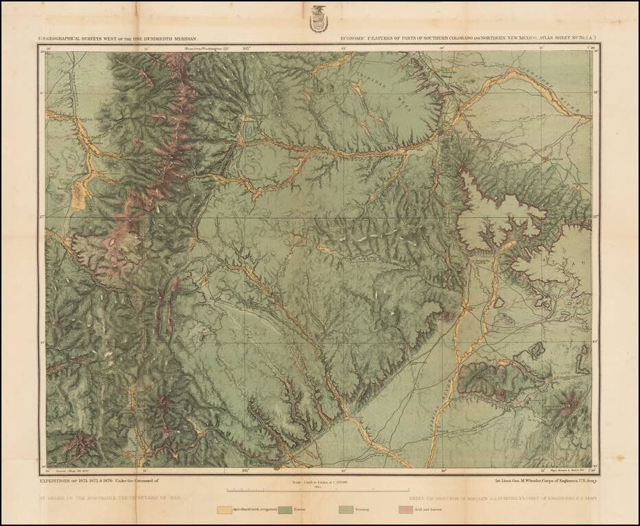
Detailed topographical map showing the region bounded by the Taos, New Mexico area in the southwest, San Luis, Colorado and Trinchera Peak in the northwest, Purgatory River and Trinidad Colorado in the Northeast and the area just south of Laughlin Peak...
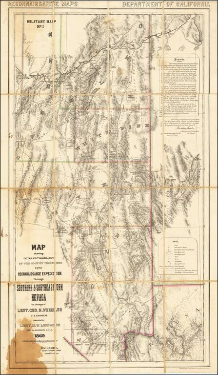
A Nevada & Grand Canyon Rarity -- The Foundation Map for Southern Nevada A remarkable map of the Eastern Half of Nevada, including Las Vegas, the Grand Canyon, Great Salt Lake and Sevier Lake (then called Preuss Lake), being the first scientific...
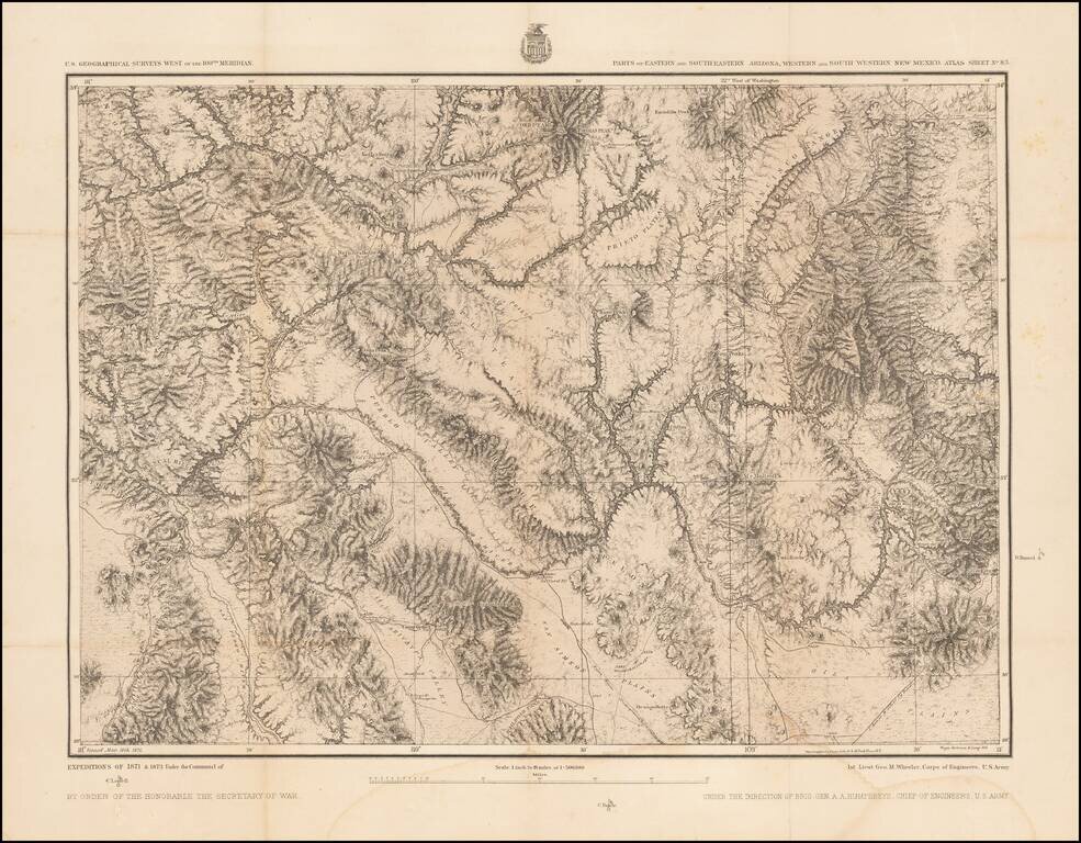
Detailed topographical map showing southwestern New Mexico and southeastern Arizona. Shows towns, roads, mountains, rivers, lakes, hydrographical details, etc. The map was generated during the Wheeler Survey. The Wheeler Survey was a survey of a...
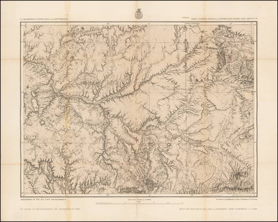
Includes the Phoenix Area Detailed topographical map showing eastern Arizona and western New Mexico. The map extends from the Phoenix area in the southwest (Pleasant Valley) to the Flagstaff area in the northwest, to the Fort Wingate / Gallup, New...
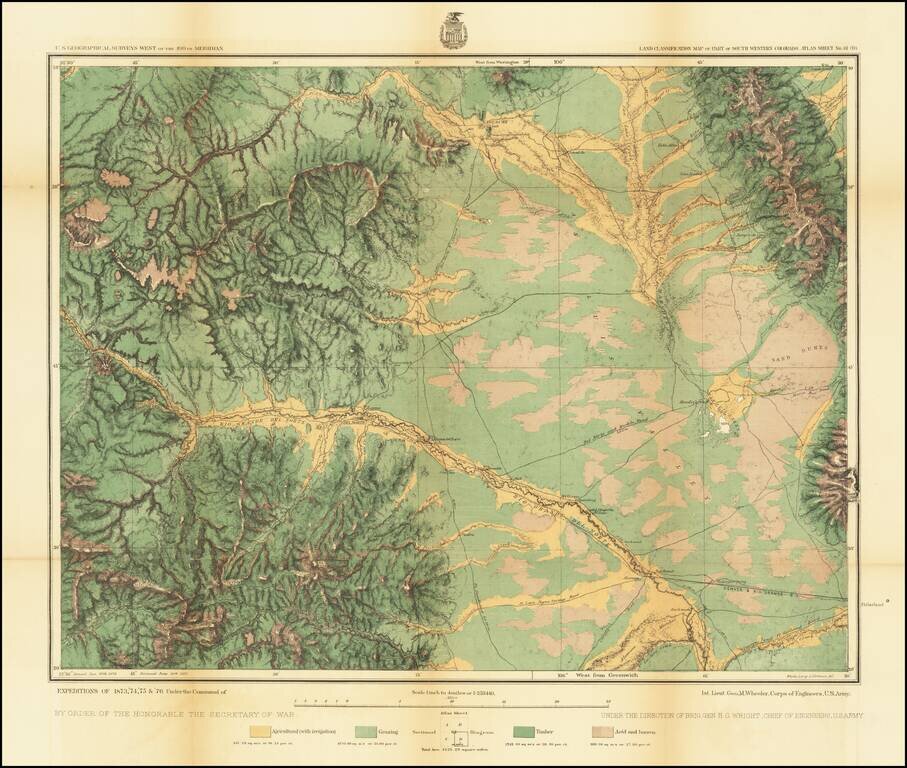
Detailed topographical map showing the region centered on Saguache County, Colorado. Shows towns, roads, mountains, rivers, lakes, hydrographical details, etc. The map was generated during the Wheeler Survey. The Wheeler Survey was a survey of a...
![[Nevada and parts of California, Utah and Arizona] Explorations and Surveys South of Central Pacific R.R. . . . Preliminary Topographical Map Map Embracing in Skeleton a Portion Only of the Notes from Surveys . . . 1871 (with original text)](/map/small/68848.jpg)
Detailed map of the Southwest, prepared at the outset of the Surveys West of the100th Meridian. The map is one of the few maps executed by Louis Nell during this time working for the War Department Topographical Engineers. Nell would later settle in...
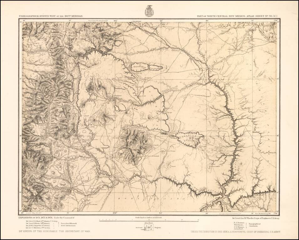
Detailed topographical map showing north central New Mexico, with the Taos Mountains at the upper left and Fort Union toward the center. Shows towns, roads, mountains, rivers, lakes, hydrographical details, etc. The map was generated during the...
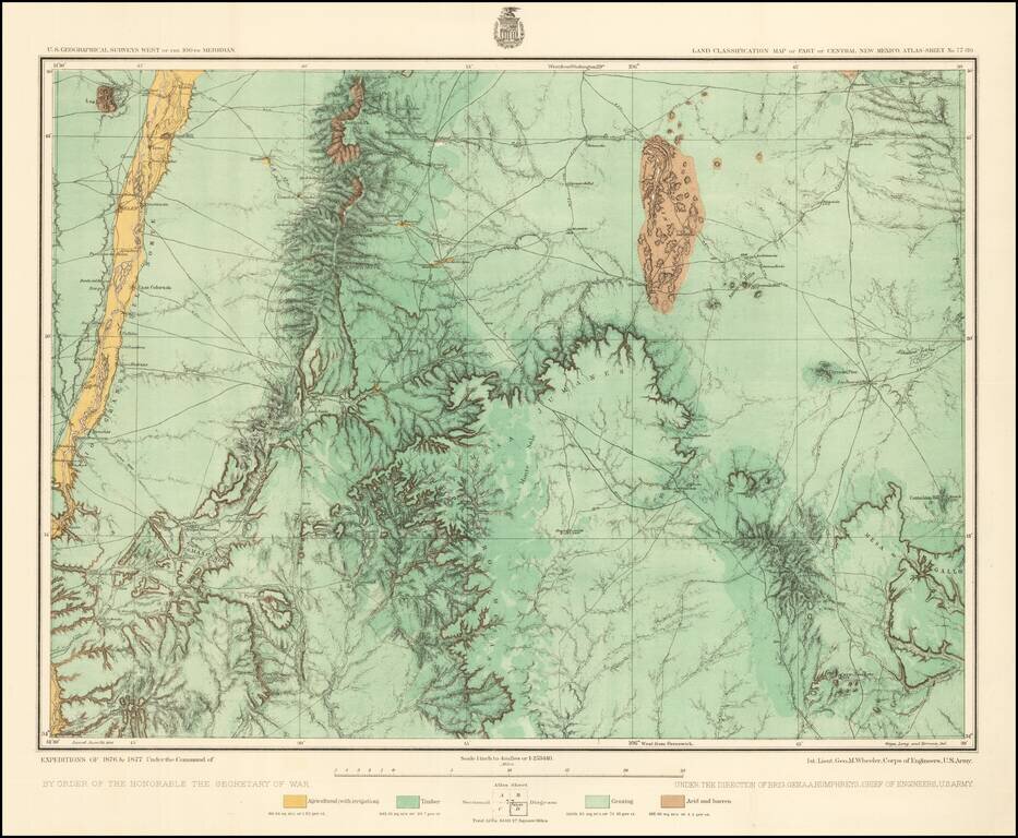
Detailed topographical map of central New Mexico, showing the area immediately southwest of Albuquerque. Shows towns, roads, mountains, rivers, lakes, hydrographical details, etc. The map was generated during the Wheeler Survey. The Wheeler Survey...
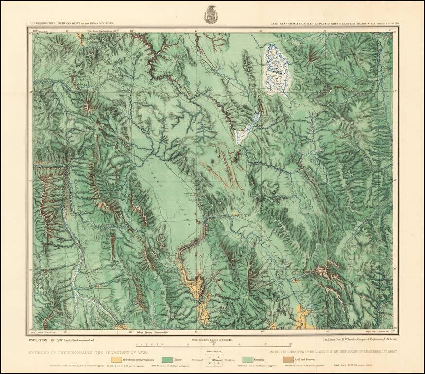
Fine regional map of Southeastern Idaho, based upon reconnaissance done in the Wheeler Survey Expedition of 1877, "Atlas sheet No. 32 (D) U.S. Geological surveys west of the 100th Meridian. Expedition of 1877 under command of 1st. Lieut. Geo. M....