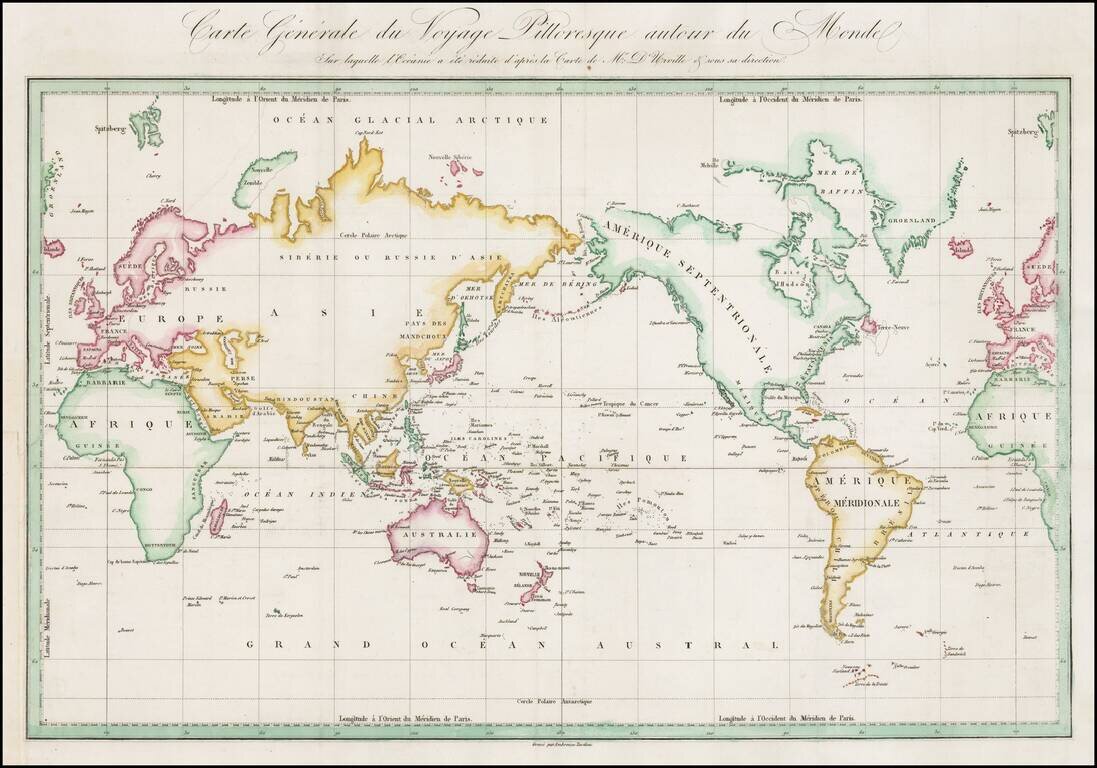
Interesting early map of the world, from D'Urville's Voyage pittoreque autour du Monde. The map is one of the earliest printed maps to include the name Hawaii in its modern English spelling.
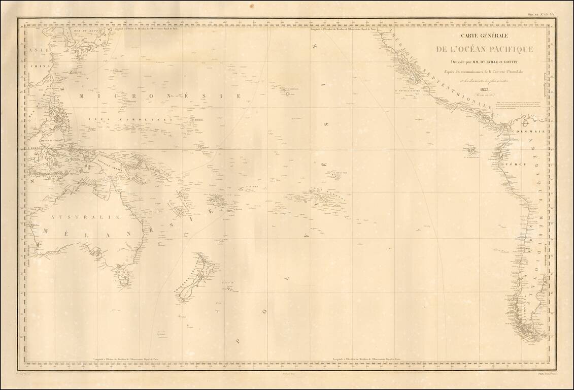
Fine separately published example of Dumont D'Urville's fine map of the Pacific, based upon his explorations. The map details the regions explored by the Astrolabe, under Dumont D'Urville's command. Rear Admiral Jules Sébastien César Dumont...
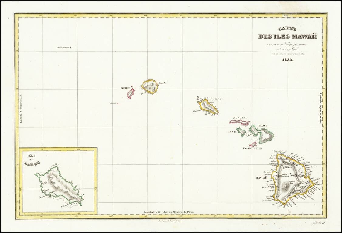
Interesting early map of Hawaii from D'Urville's Voyage pittoreque autour du Monde, one of the earliest printed maps to include the name Hawaii in its modern English spelling. The map is engraved by Ambrose Tardieu, and shows Nihau, Tauai, Oahou,...
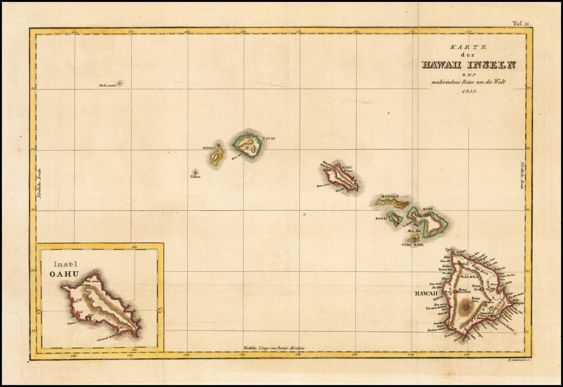
Rare German edition of this early map of Hawaii from D'Urville's Voyage pittoreque autour du Monde, one of the earliest printed maps to include the name Hawaii in its modern English spelling. The map is engraved by Ambrose Tardieu, and shows Nihau,...
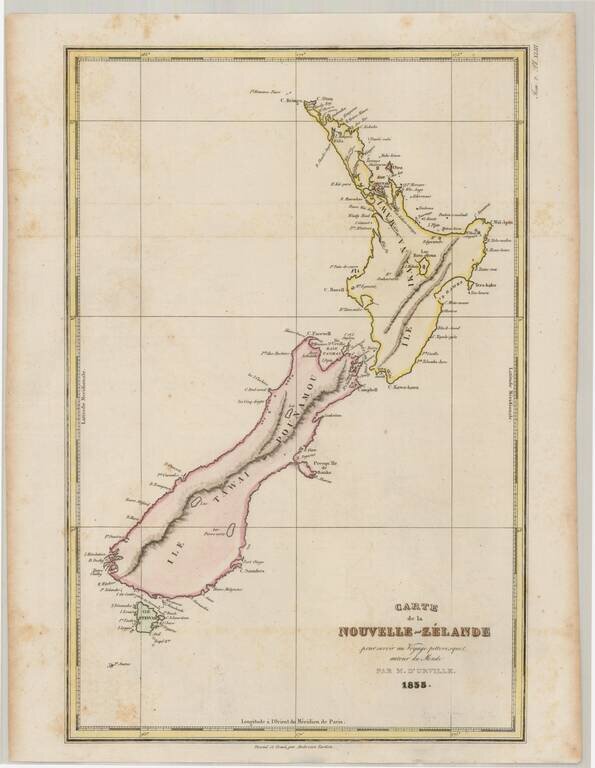
Detailed early map of New Zealand, including a separate Stewart Island. Rear Admiral Jules Sébastien César Dumont d'Urville (1790-1842) was a French explorer and naval officer, who explored the south and western Pacific, Australia, New Zealand, and...
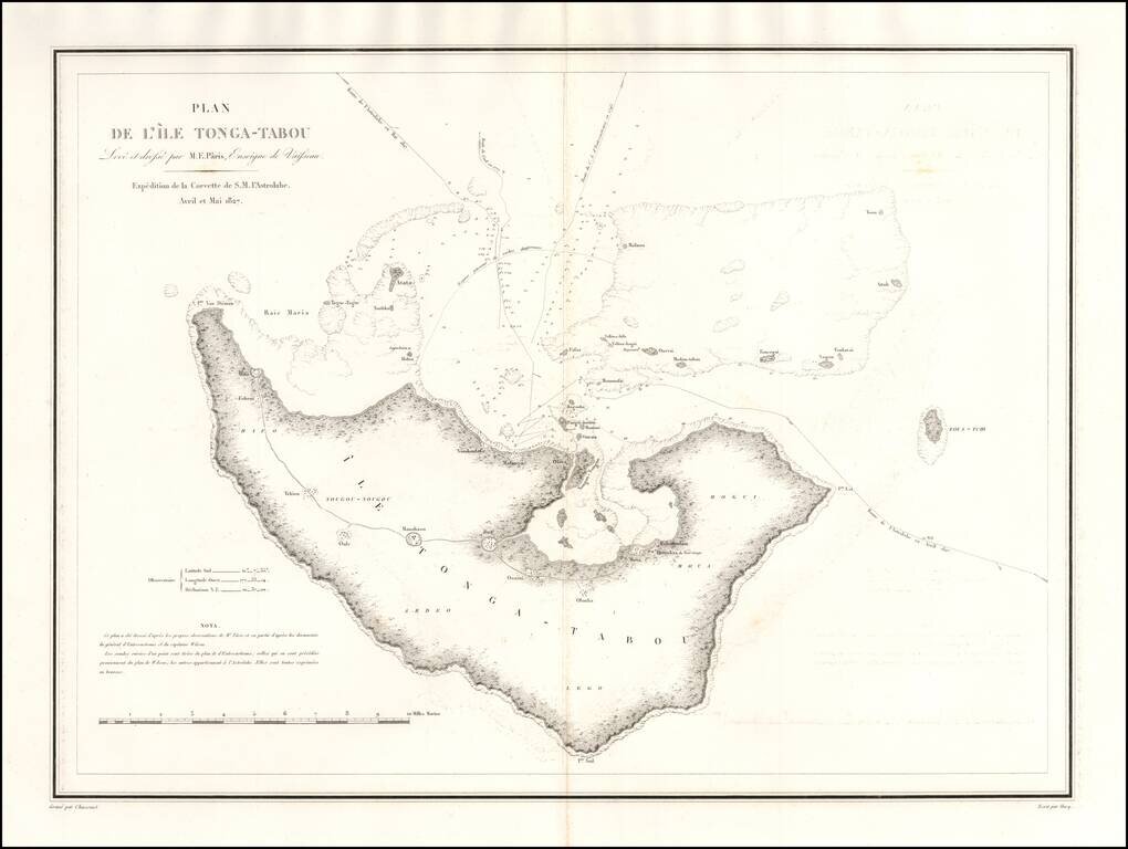
One of the earliest obtainable maps of Tonga. Rear Admiral Jules Sébastien César Dumont d'Urville (1790-1842) was a French explorer and naval officer, who explored the south and western Pacific, Australia, New Zealand, and Antarctica. Dumont...