Isaak Tirion was a prominent Dutch publisher based in Amsterdam in the eighteenth century. He is best known for historical works that included prints showing scenes from around the world. He also produced maps, such as those in the Nieuwe Hand-Atlas of 1744.
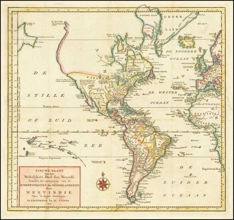
Fascinating map of America, featuring an unusual northwest coast of America, which includes Martin d'Aguilar's strait which provides for a Northwest Passage via the Great Lakes, via what would likely be the so-called River of the West. The rest of the...
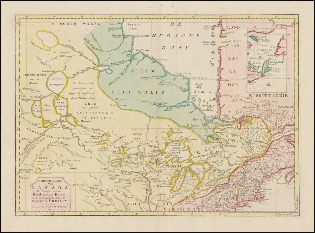
Interesting map of Canada and the Upper Midwest, centered on the Great Lakes and Hudson's Bay, published by Issak Tirion. The map shows the region shortly after the conclusion of the French and Indian War. Included are the Hudson Bay Company forts and...
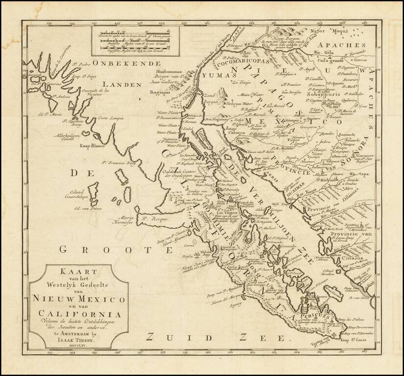
One of the Earliest Obtainable Maps of Southern California and Baja California Fine old color example of this early map of Baja California and parts of Alta California, Arizona and Sonora. Isaac Tirion's map of Baja California is one of the best...

Terrific map of the North Polar region, which shows the Northeast Passage, but no definite Northwest Passage. California is shown as an Island, along with the River systems of North America. Nice detail in the Polar regions, especially New Denmark and...
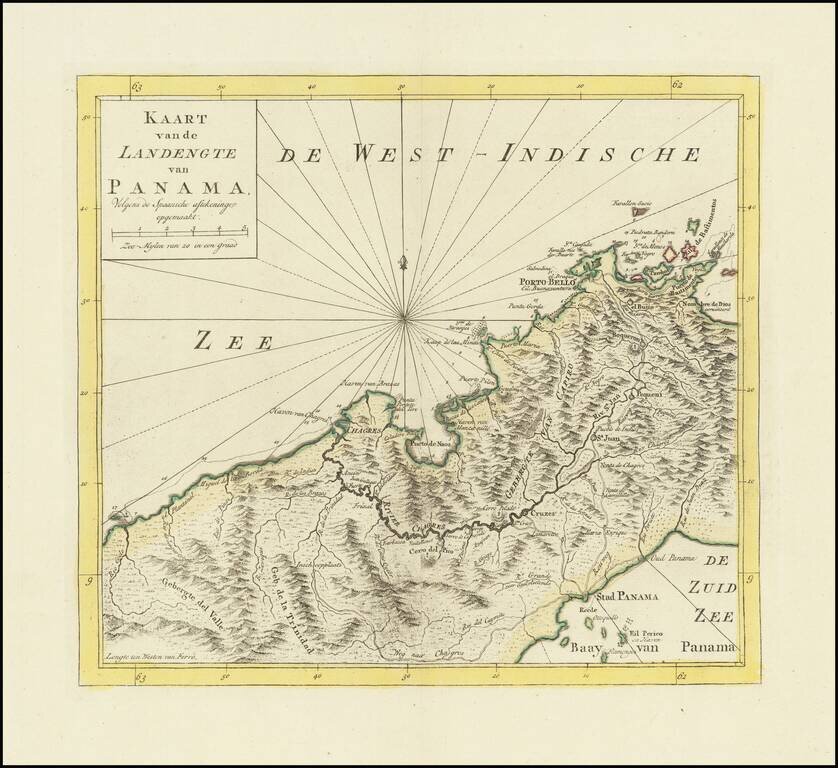
Detailed map of Panama, published in Amsterdam by Isaak Tirion. Extends from Panama City at the southeast, Chagres at the northwest and Porto-Bello at the northeast. Several missions are also located. Roads and the Chagres River connect them all.
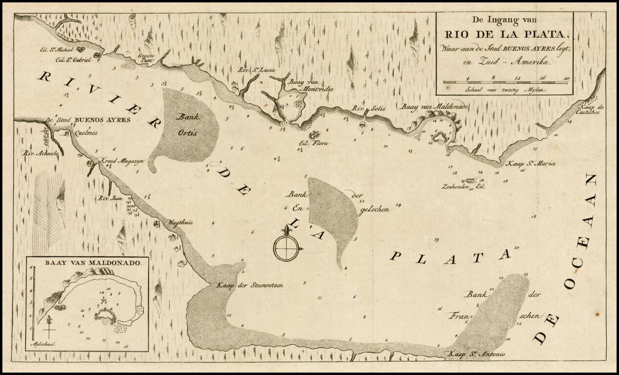
Detailed plan of of the mouth of the Rio de la Plata, including cities, soundings and other details. Inset of the Bay of Maldonado. From Tirion's Hedendaagsch Historie of Tegenwordige Staat van Amerika.
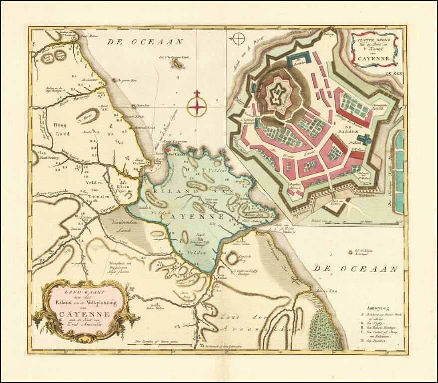
Fine old color example of Tirion's map of French Guiana, with a large inset map of Cayenne. Includes a meticulous depiction of the Plantations in the region.
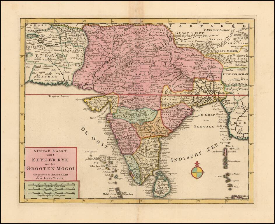
Highly detailed map of India, extending to Tibet, published by Isaak Tirion in Amsterdam. The map extends from the Candahar region and Lake Zara to Tibet, and south to Ceylon.