
Rare map of the Kingdom of Prester John, which appeared in Picart's Tresor des carte Geographiques, published in Paris. Picart's map is based upon Jansson's map, published in his Atlas Minor in 1628. The first French version of the map was published...
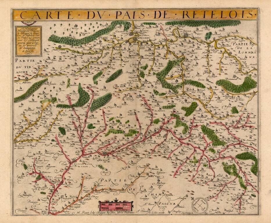
Rare map of Retelois, from Jean Le Clerc's very rare atlas of France. A credit is given at the bottom to the French surveyor Jean Jubrien (1569-1641).
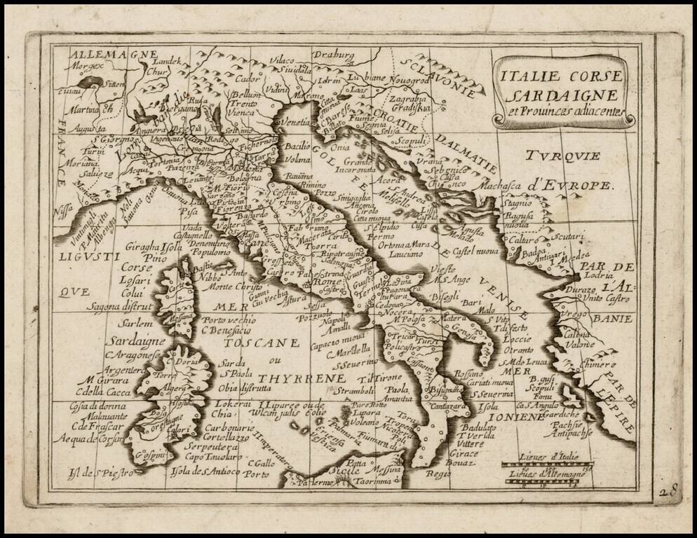
Rare map of Italy, Corsica and Sardinia, which appeared in Picart's Tresor des carte Geographiques, published in Paris. Picart's map is based upon Jansson's map of the same region, published in his Atlas Minor in 1628. The first French version of the...
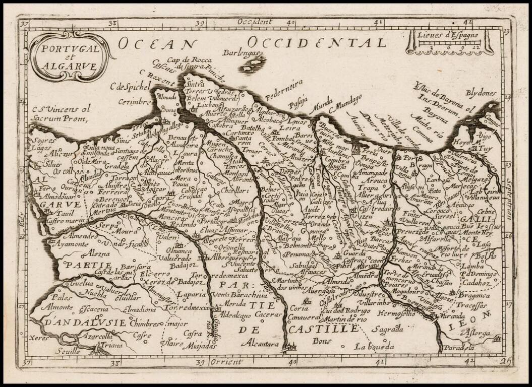
Rare map of the Portugal, which appeared in Picart's Tresor des carte Geographiques, published in Paris. Picart's map is based upon Jansson's map, published in his Atlas Minor in 1628. The first French version of the map was published by Jean Boisseau...
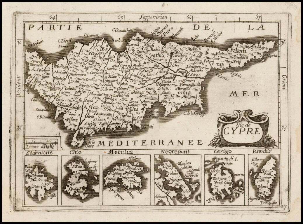
Detailed map of Cyprus, with 6 smaller inset maps below, most likely published by Antoine de Fer in his Cartes de Geographiques, although it may be by a different publisher, as the map is apparently unrecorded. Burden suggests that the 1657 De Fer...
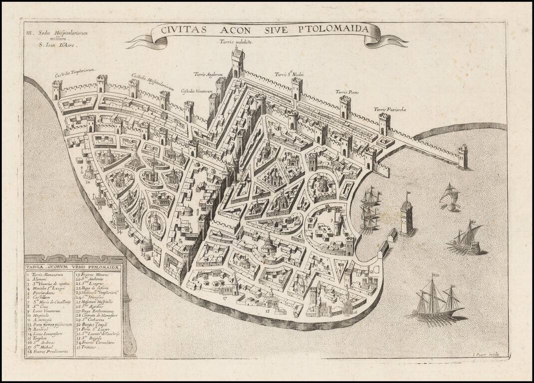
Extremely rare plan of Acre, based upon the Vesconte-Sanuto plan, intended to illustrate a period when the town was under the control of the Knights of St. John. Shows extensive fortifcations, town plan, buildings and a key identifying significant...
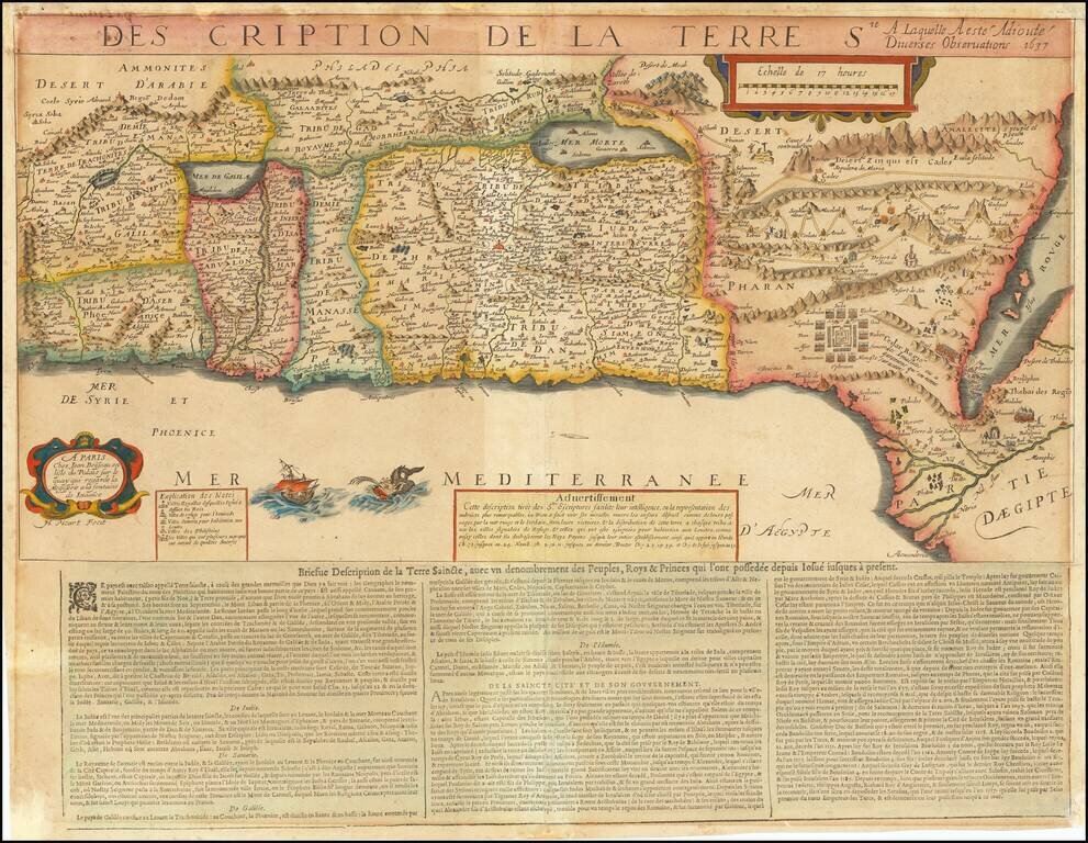
Extremely rare map of the Holy Land based upon the writings in the Old Testament, published by Jean Boisseau and engraved by Jean Picart in Paris. The map includes descriptive text at the bottom entitled: Briefue Description de la Terre Saincte. The...
Rare map of part of North Africa, which appeared in Picart's Tresor des carte Geographiques, published in Paris. Picart's map is based upon Jansson's map, published in his Atlas Minor in 1628. The first French version of the map was published by...