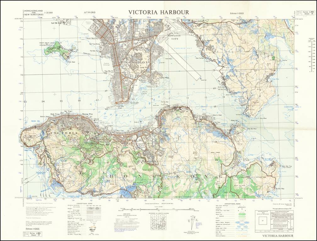
Detailed map of Victoria Harbour produced by D Survey, War Office and Air Ministry in 1957. There is a diversity of information communicated by the map including built-up areas, villages, "temporary native quarters", and isolated buildings in some...
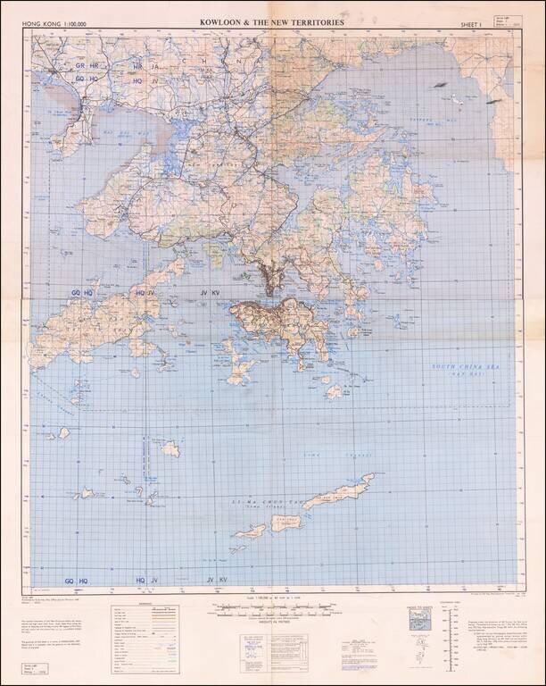
Detailed War Office and Air Ministry Two-Sheet Chart of Hong Kong. Detailed British military mapping of Hong Kong, published in two sheets (here joined as one), in 1958. The sheets are labeled first editions and have as their sources RAF Air Survey...
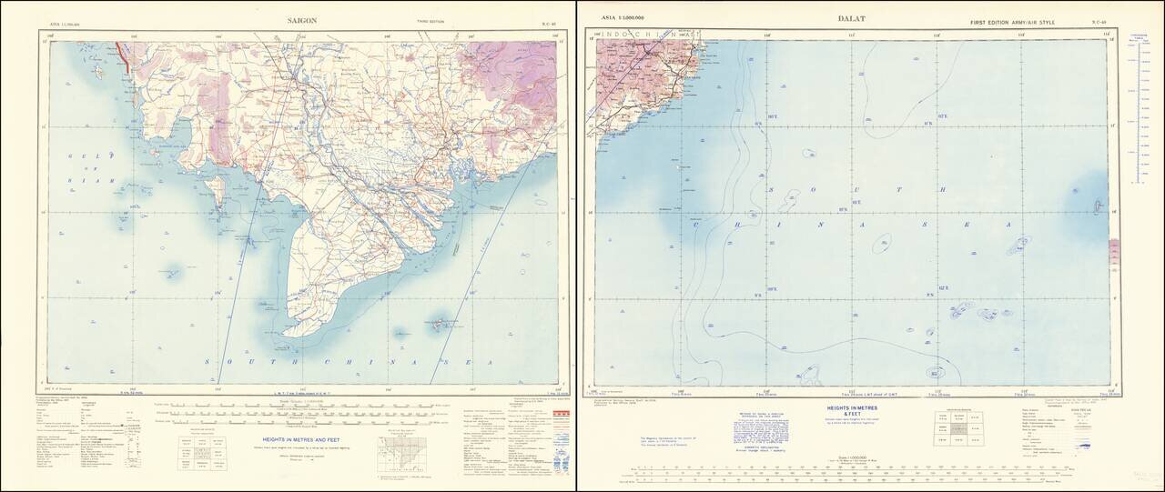
Southern Vietnam at the beginning of the First Indochina War. Scarce World War Two-era map of southern Vietnam, the Saigon region, the Mekong River delta, and adjacent parts of the South China Sea. The Saigon sheet credits the Survey of India 1944...
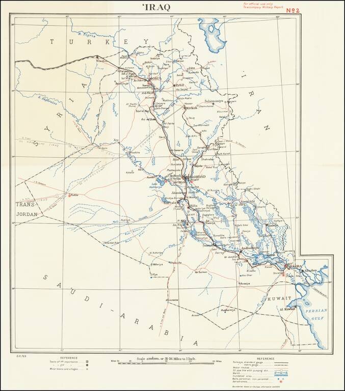
For official use only To accompany Military Report This is a simple and attractive military map of Iraq dating to the mid-twentieth century. The map is detailed, showing roads, cities, rivers, pipelines, cables, and more. Detail extends slightly into...
![Bandar Abbas [U.A.E. and Strait of Hormuz]](/map/small/67305.jpg)
Detailed Second World War-era map of the Strait of Hormuz and what is now the United Arab Emirates. This is the third edition of the map, published in 1945. This is one of the most detailed maps available from this era. It includes oil wells and oil...
![Horuf | Restricted [Qatar and Bahrain] [on verso:] Bandar Abbas [U.A.E. and Strait of Hormuz]](/map/small/66777.jpg)
Detailed silk airman's map of Qatar and Bahrain and on the reverse and map of the present-day United Arab Emirates and Strait of Hormuz. The map has the U.K. Ministry of Defense Secrecy Rating "RESTRICTED". This is one of the most detailed maps...
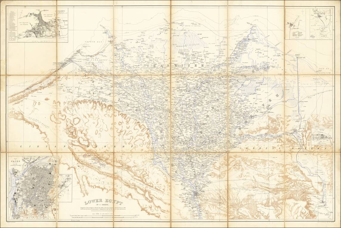
Egypt During the Anglo-Egyptian War Detailed military reconnaissance map of the Lower Nile Delta, published by the British War Department. The map extends from Cairo in the South, to Alexandria and Port Said in the north, and includes significant...
![[Northern Nigeria Protectorate]](/map/small/70705.jpg)
A Map Prepared for the British Conquest of Northern Nigeria. Detailed map of Nigeria and vicinity, published by W. and A.K. Johnston for the Intelligence Division, of the War Office (UK). The map is framed by the Niger River, Benue River, and Lake...