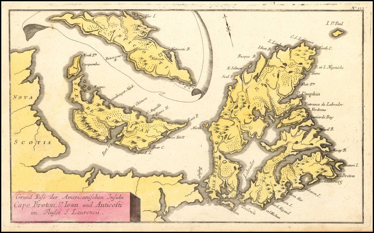
French & Indian War Map of NE Canada Detailed map of Northeastern Canada, including the eastern part of Nova Scotia, namely Cape Breton and Prince Edward Islands, published by Raspe in Nuremberg. The map includes an inset map of Anticosti Island...
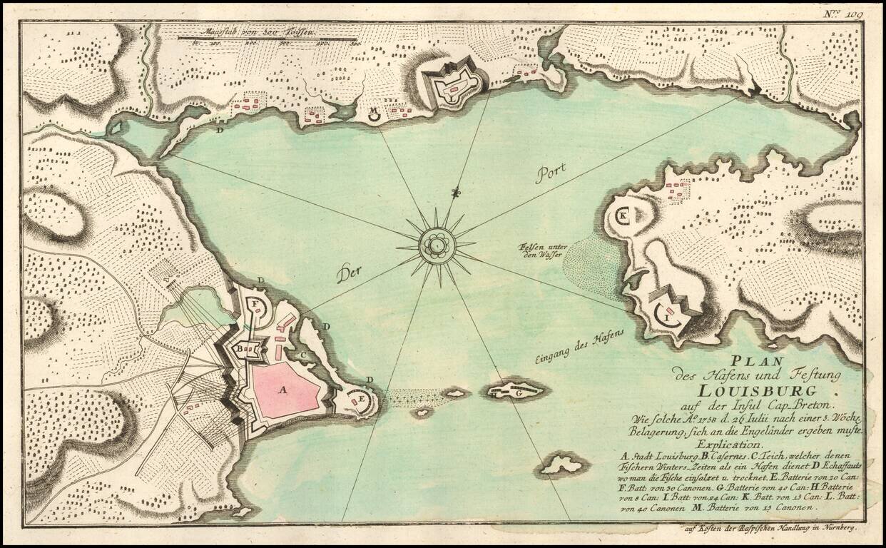
Scarce French & Indian War Plan of the area around Louisbourg, from Raspe's Schauplatz des Gegenwaertigen Kriegs . . . Shows fortifications, batteries, Cannon, and other details. A rare French and Indian War Battle plan.
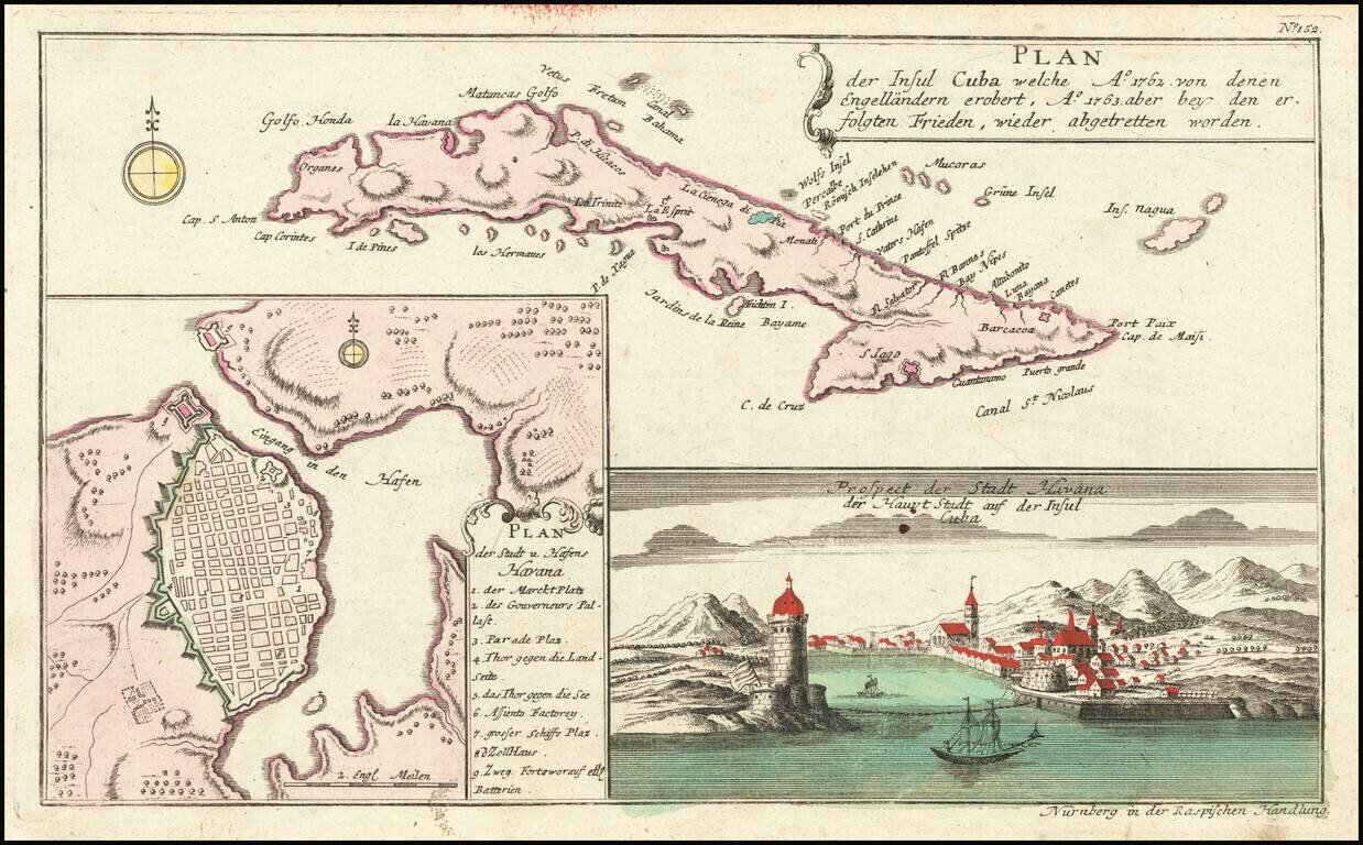
Striking map of Cuba, along with a detailed plan of Havana, and a view of the city and the entrance to its harbor, which appeared in Raspe's Shauplatz des gegenwaertigen Krieg. The plan is highly detailed with a numbered key to the city's major...
![[Belfast and Carickfergus Lough] Plan der Gegend von Irrland, wo Ao. 1760 dens 18 Febr der See Avanturier u Capt. Thurot bey A gelandet und Carickfergus eingenomen auch bis Bellast vorge drungen, den 27 Febr: aber von den Engellandischen See Capitain Ell](/map/small/54174.jpg)
Fine old color example of Raspe's Plan of the area round Belfast and Carrickfergus Lough, from his Schauplatz des Gegenwaertigen Kriegs . . . This scarce map of Belfast Lough and view of Carrickfergus Castle illustrates the attack of the French...
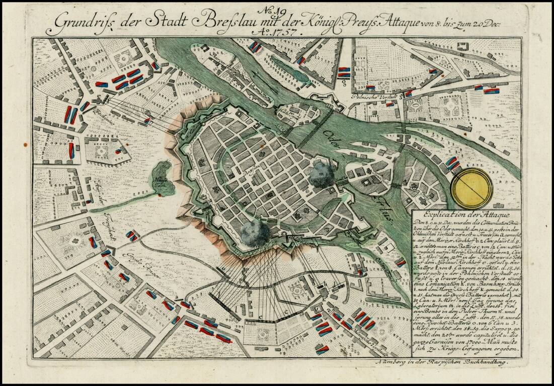
Detailed view of the Battle fought at Breslau during the 7 years war. The city fell to Austria in November 1757, before being retaken by PRussian forces the following month.
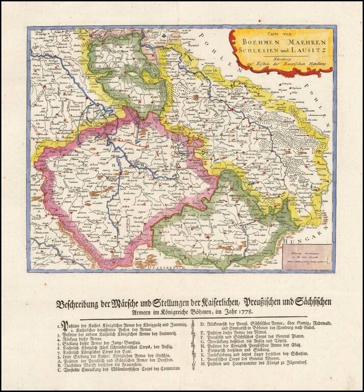
Rare separately published map showing a description of Marche and the position of the imperial Prussian and Sachis armies in Bohemia in 1778.
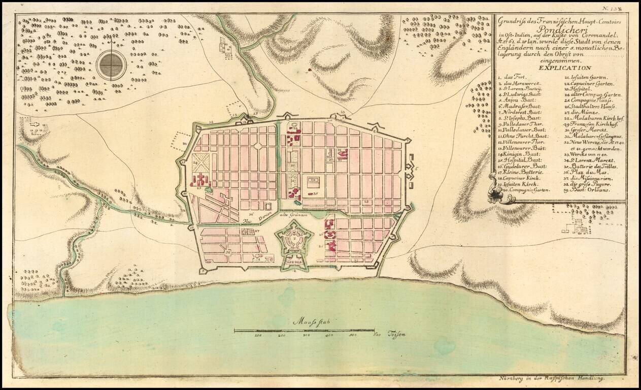
Puducherry at the time of its Capture by the English in 1761 Scarce early plan of the area around Puducherry, from Raspe's Schauplatz des Gegenwaertigen Kriegs... Shows fortifications, the Hospitals, Jesuit Church, Capuchine Church, English Church,...