
A True Cartographic Rarity -- Europe, Persia and Middle East Map Section, Likely From A Lost 16th Century Wall Map of the World Exceptionally rare separately published map of Europe, the Middle East, Persian Empire and the Tartar Regions of Russia,...
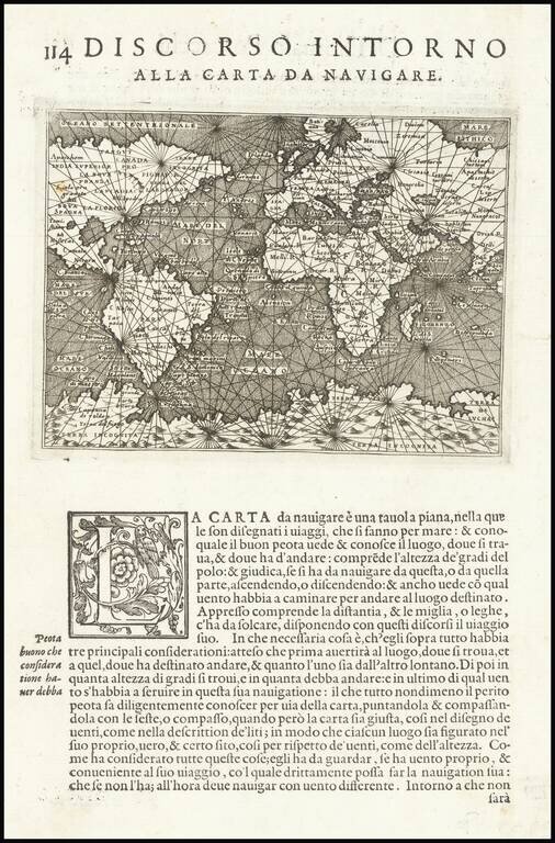
Fine, Early World Map from Porcacchi’s Popular Books of Islands Nice example of Porcacchi's early chart of the world, from his bestselling isolario, L'Isole Piu Famose Del Mondo. The map is modeled on a sea chart and is criss-crossed with rhumb...
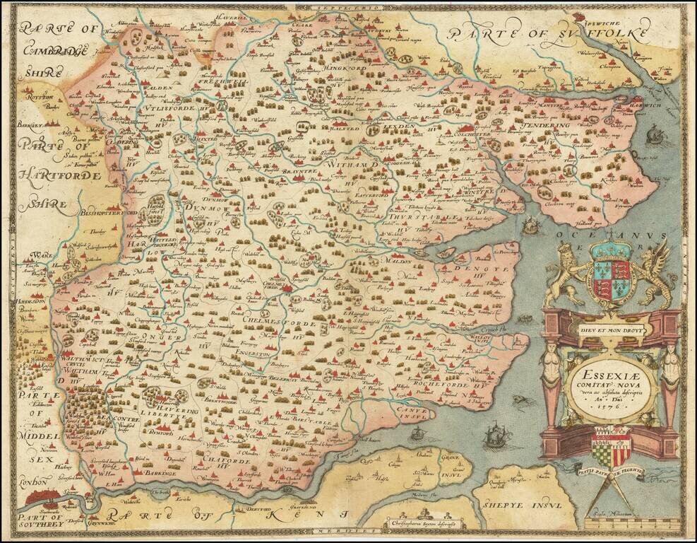
The First Printed Map of Essex A fabulous Saxton map of Essex, showing the county at a time when it nearly reached the City of London. The detail on the map is fabulous, with many cities and townships displayed. Parts of adjacent counties, including...
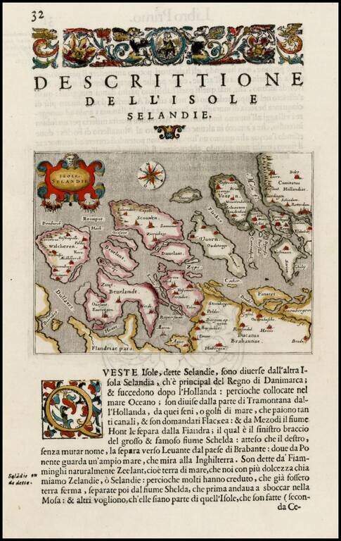
Fine early map of Zeeland, from Porcacchi's L'Isole Piu Famose Del Mondo… Map of islands of southern Dutch coast before dykes were built and land reclaimed.
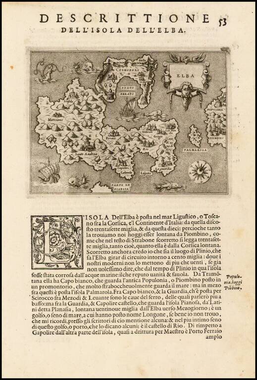
Fine early map of the Island of Elba and contiguous Tuscan Coastline, from Porcacchi's L'Isole Piu Famose Del Mondo… Finely engraved, with compass rose and decorative cartouche.
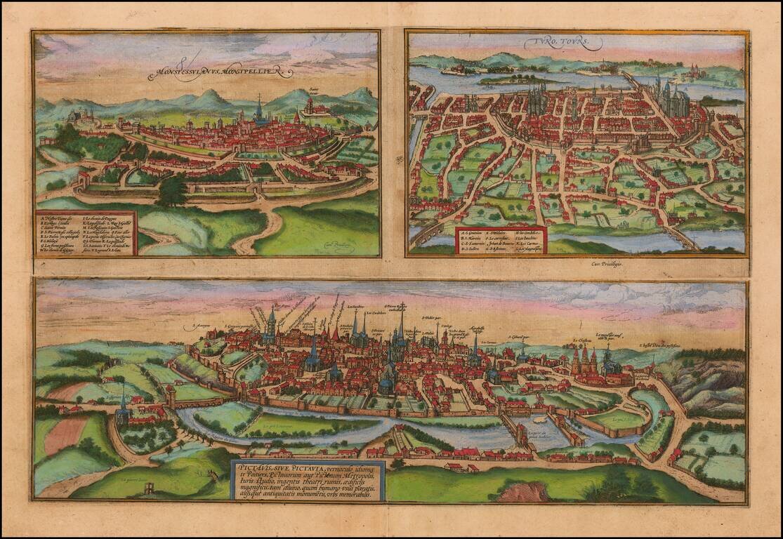
Detailled plan of the towns of Poitiers, Montpellier and Tours, from Braun & Hogenberg's Civitatus Orbis Terrarum, the most important book of town plans and views published in the 16th Century. Beautiful old colored plan of the three cities,...
![[France]](/map/small/71049.jpg)
Rare map of France, likely engraved by Joost Amman in Frankfurt. The map illustrates Charlemagne in the foreground, holding a globe aloft, with a map of France and neighboring regions as a background. The map apparently appeared in a 1576 publication...
![[Munich, Regensburg, Ingolstadt, Nordlinga etc.] Monacum, Nominatissima Bavariae Civita (with) Ingolstadium (with) Nordlinga (with) Frisingensis (with) Ratispona (with) Straubinga](/map/small/58558mp2.jpg)
Nice set of 6 views of Southern German Cities, including Munich, Regensburg, Ingolstadt, Nordlinga, Frisinga, and Strauburg, etc. Includes manuscript notes in a contemporary hand.
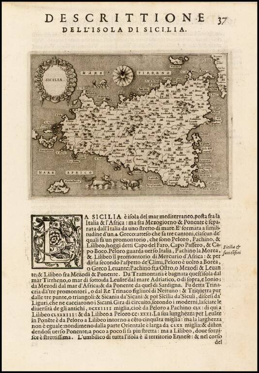
Fine early map of the Island of Sicily, from Porcacchi's L'Isole Piu Famose Del Mondo… Finely engraved, with compass rose and decorative cartouche.