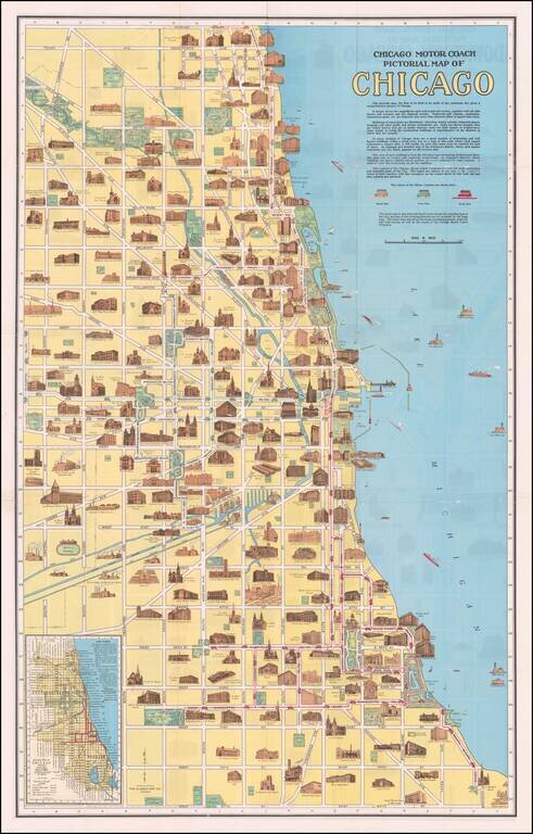
Fine promotional map of Downtown Chicago, showing profile elevations for Chicago's major landmark buildings. Second map on the verso. Offered with original covers.
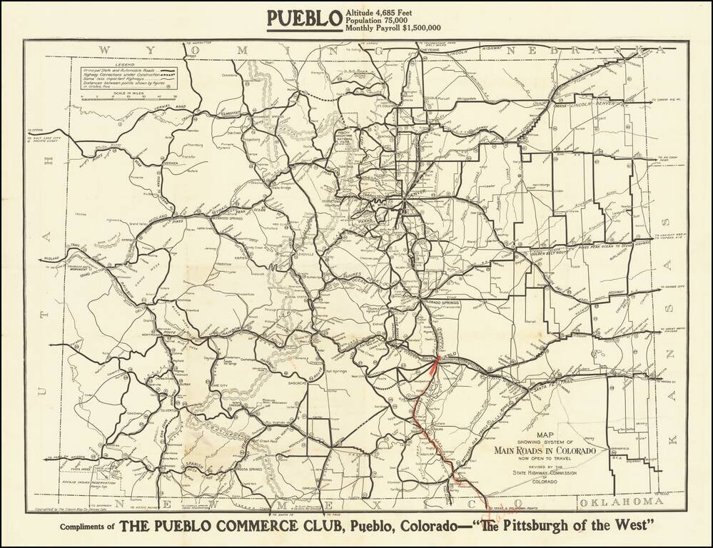
The Pittsburgh of the West Fine early road map of Colorado, published by the Colorado Highway Commission. The map differentiates different types of roads, including: Principal state and automobile roads (fat black line) Highway Connections under...
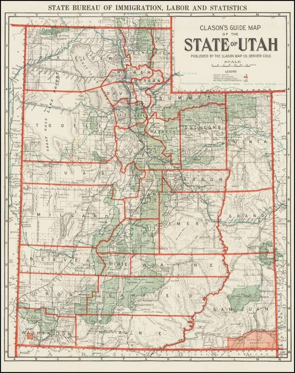
Rare Early Automobile Road Map of Utah Scarce map of the state of Utah, published by Clason for the Utah Bureau of Immigration, Labor and Statistics. The map shows County Seats, County Boundaries, Townships Unsubdivided and National Forest...
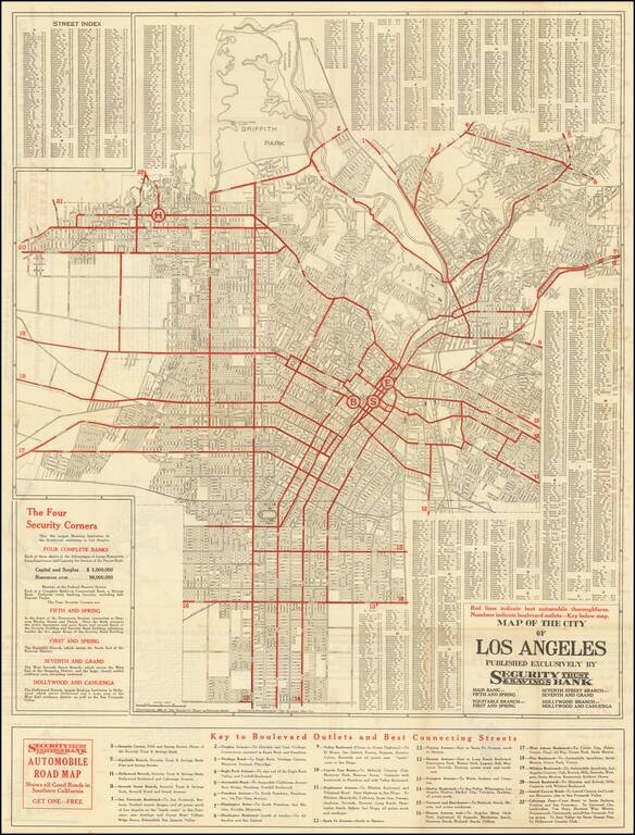
Detailed vintage street map of the City of Los Angeles, prepared by The Clason Map Company for the Security Trust & Savings Bank, and published in Los Angeles in 1921. The primary map covers the City of Los Angeles north of Manchester and the...
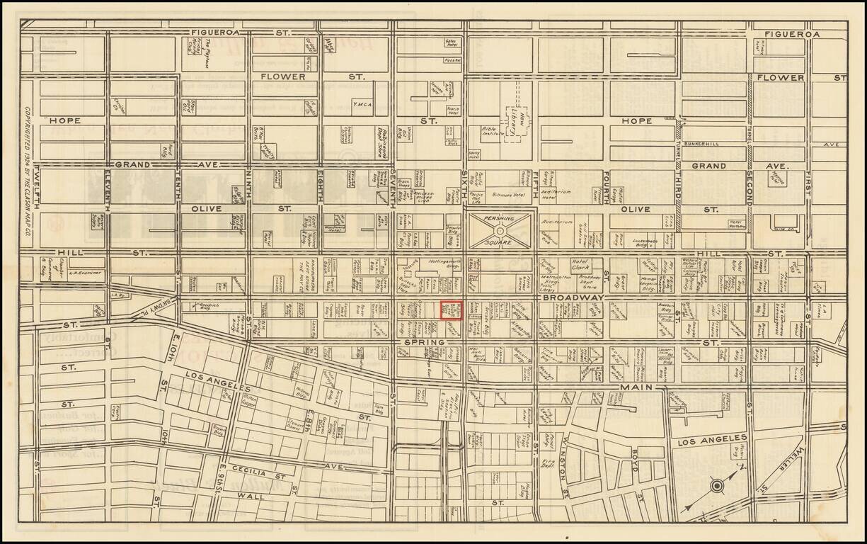
Detailed map of downtown Los Angeles in 1924, featuring building-level detail and an extensive enumeration of businesses in the area. The map is roughly bounded by Figueroa on the west, Wall Street on the east, First Street in the north, and Twelfth...