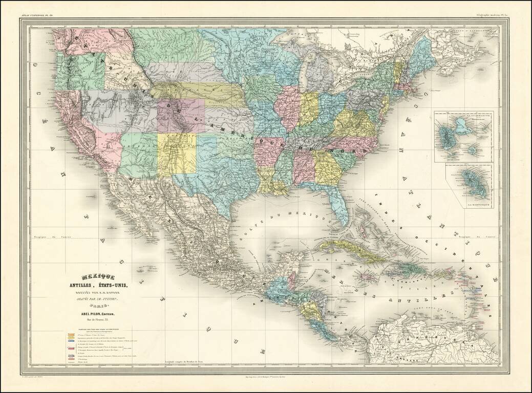
A Fascinating French convolute of Shoshone, Idaho & Montana Territories. Finely colored large format map of the United States, depicting the evolution of the Western Territories, as they were created in the 1860s. Includes marvelous ephemeral...
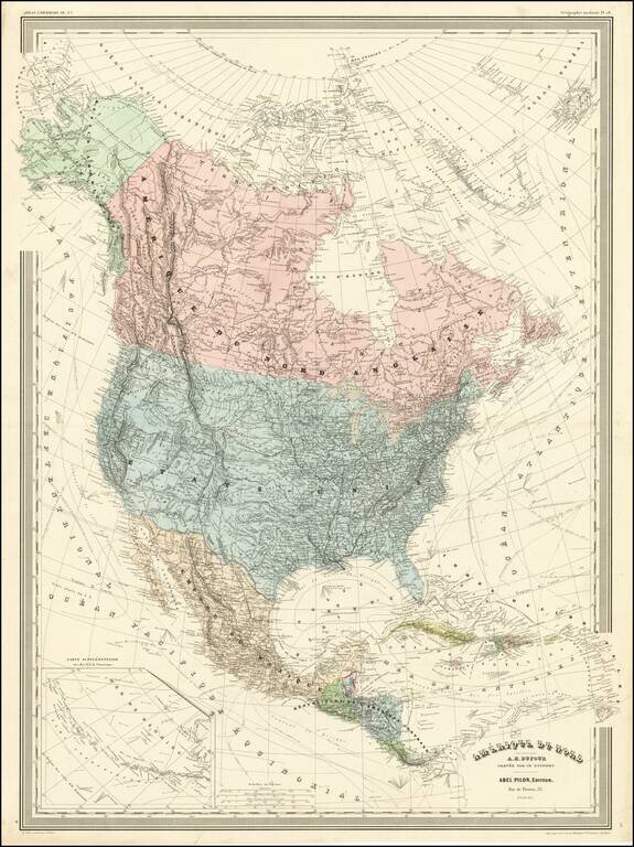
Detailed wall map of North America, published by A.H. Dufour. Arizona is below New Mexico (the Baylor Line), a vestige of the attempt to create a slave and non-slave territory prior to the Civil War. Colorado is named (the map shows Colona in the...
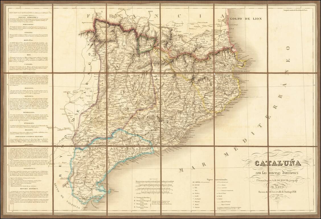
Finely executed map of Cataluña, published in Paris by A.H Dufour. The map is exceptionally detailed, showing roads, towns, rivers, mountains, forts, and a host of church related places and many other details. The location of battles, combat and...