
Fine example of this decorative map of the World on a Cassini projection, published by Jan Elwe. This is the second edition of the map, which was first published by Louis Renard circa 1715. The second edition can be identified by the removal of the...
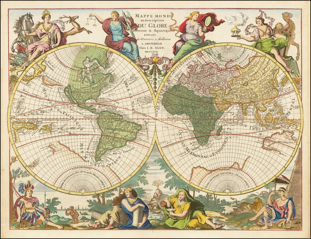
Hubert Jaillot's World Map Re-Issued At the End of the 18th Century Scarce Dutch decorative double hemisphere map of the World one of the most unique and decorative world maps of the period. By the end of the 17th Century, Paris was supplanting...
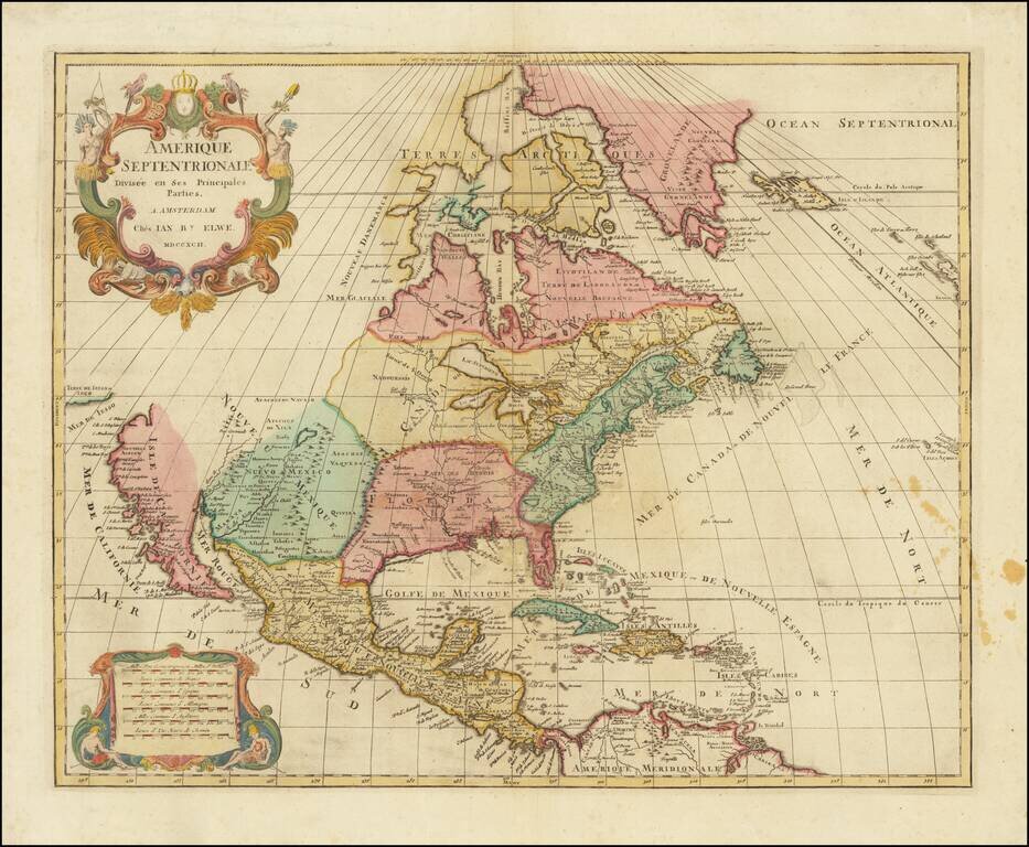
Interesting map of North America by Jan Elwe, printed in Amsterdam. The map is a scarce derivative of Sanson's 1656 and Jaillot's 1676 maps. California is now a peninsula. The Great Lakes are closed at the western ends, unlike the earlier versions of...
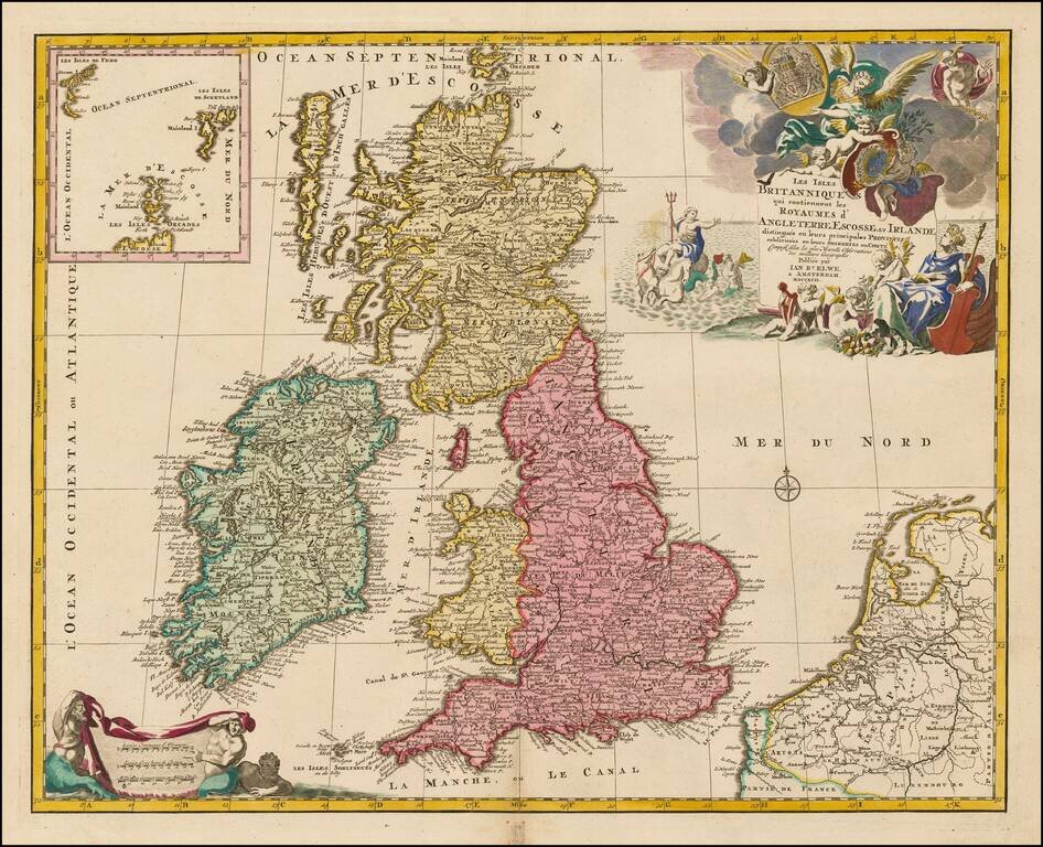
Scarce map of the British Isles, embellished with a large cartouche and coat of arms.
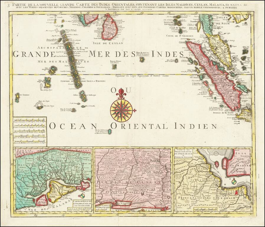
Finely detailed regional map depicting Singapore, Ceylon, the Maldive Islands, Sumatra, Southern Malaysia, etc. Remarkably detailed this map is highly decorative as well.
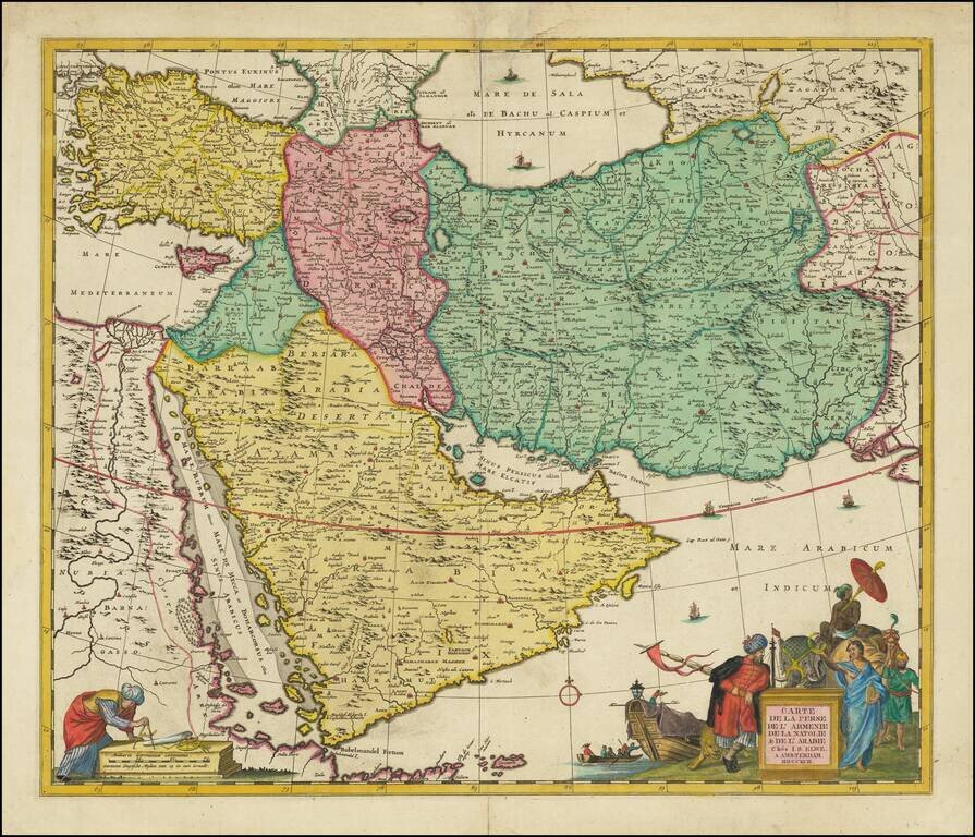
Scarce decorative map of the region bounded by the Saudi Peninsula, Red Sea, Nile River, Cyprus, Asia Minor, the Gulf of Aden, Indian Ocean, Armenia, the Caspian Sea, Afghanistan and the Indian Ocean, centered on the Persian Gulf. Includes two...
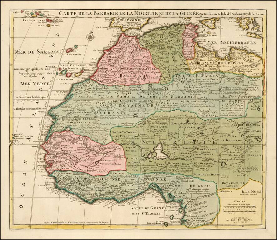
Detailed map of North and West Africa, by Jan Elwe, based upon the earlier maps of De L'Isle. Richly annotated throughout and with excellent regional detail.